The Status of the Weather Radar Cliff Mass
advertisement
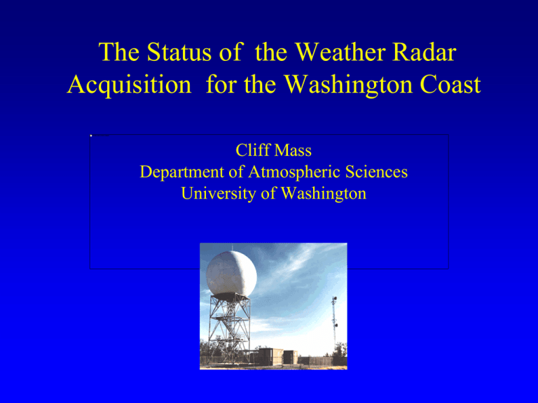
The Status of the Weather Radar Acquisition for the Washington Coast Cliff Mass Department of Atmospheric Sciences University of Washington During the early 90s, the NWS installed a network of powerful Doppler Weather radars, aka NEXRAD WSR88D NWS Radar Sites But there was a major problem in the Pacific Northwest... The two NW radars (Camano Island, WA and Portland, OR) were placed east of the Olympics and Coastal Mountains and thus the radar beams were generally blocked before they reached the coast. Radar coverage for the lowest beam (.5 degree elevation angle) for the current network. Red areas indicate no coverage below 8000 m (25,000 ft). Radar coverage calculations by Ken Westrick The right diagram indicates the effective coverage of the Weather Service radars for all elevation angles at 10,000 ft above mean sea level, with hatching indicating substantial blockage. Northwest Coastal Radar Problem • The Pacific Northwest has the worst coastal radar coverage of any region of the lower 48states. • There is virtually no radar coverage for the lower atmosphere over the coastal zone and the near-shore waters. • Such poor coverage exists for a region of often intense storms AND a great deal of military, shipping, fishing and other marine traffic. Years in the Wilderness • For roughly ten years a number of local meteorologists called for the acquisition of coastal weather radars, with one positioned on the central Washington Coast. • This went nowhere fast until two things happened in 2007 and 2008. The First: The Big Storm of December 2-4, 2007 Dec. 2-3, 2007 20 inches in two days over coastal terrain of SW Washington Pictures courtesy of WSDOT The results: massive landslides and river flooding Hurricane-Force Gusts for Nearly 24h The Second: Senator Maria Cantwell Senator Cantwell Not Only Appreciated the Importance of a Coastal Radar But Secured the Funding • 2 million dollars of stimulus funding • 7 million dollars in the 2009-2010 budget Current Status • The National Weather Service is now committed to installing the radar. • It will be a power S-band (10-cm wavelength) radar like the current NEXRAD units. • It will be a be a dual-polarized radar, which the current radars are not. • (Dual-pol radars Other Implications of Poor Coastal Radar Coverage Northwest forecasters often have a poor idea of the structure of weather systems approaching the area. – The ability to provide short-term forecasts over western Oregon and Washington is greatly lessened. The Implications of Poor Coastal Radar Coverage • With no low level Doppler wind and reflectivity from radar, critical warnings and weather guidance over the coastal zone are degraded. No assistance for emergency situations, pollutant spills, and the like. When the New Carrisa grounded Near Coos Bay, Oregon, there was no radar coverage to help manage salvage operations. The Implications of Poor Coastal Radar Coverage • There is no radar coverage of the heavy orographic precipitation on the western and southern sides of the Olympics and coastal mountains….thus, degrading flood and river forecasting. Input from Larry Schick, Lead Forecaster, U.S. Army Corps of Engineers • “An additional one or two radar sites on the NW coast is imperative for managing risk and for confident flood control operations” • “No doubt coastal radar would have helped in detecting precipitation and real time management of the floods in December.” • “Coastal radar would help greatly in all our flood operations , not just the coastal areas, as we often need to know the timing of the end of the rain or increase in the Cascade projects as well. Coastal radar coverage would help us with that too and understanding near offshore precipitation conditions.” The Implications of Poor Coastal Radar Coverage • There is a distinct lack of high resolution weather data offshore for initializing weather prediction models. A coastal radar could provide such data. Without such radars, future short-term forecast skill of weather features approaching our coast will be limited. • Weather radar information is invaluable for research, allowing the understanding of important local weather features. The Solution: Acquisition of Additional Coastal Radars Coverage for Lowest Elevation Angle (.5 degrees) Now With Two New Radars Acquisition of Additional Coastal Radars • Ideally two radars would be acquired with one positioned on the central WA coast (e.g., Westport to Pacific Beach) and the other on the central Oregon coast (e.g.,Florence) • If we could secure only one, a central WA coast radar should be the priority…since it provides coverage of entrances to the Columbia River and the Strait entrances, Gray’s Harbor, precipitation on the wet side of the Olympics, and is upstream of the densely populated Puget Sound region. We have an idea of the advantages of such a radar, because one was in place for a research experiment…IMPROVE I, in January-February 2001. Westport S-Pol Radar (January-February 2001) Reflectivity from S-Pol radar at Westport 0031 UTC 2 Feb 2001 at 0.5 degree elevation dBZ National Weather Service Forecasters Found the Coastal Radar Highly Useful During Those Two Months in 2001 AREA FORECAST DISCUSSION NATIONAL WEATHER SERVICE SEATTLE WA 325 PM PST THU JAN 4 2001 SATELLITE IMAGERY SHOWS COLD FRONT OFFSHORE NOW NEAR 133W...STILL WEST OF BUOY 5. WARM ADVECTION PRECIPITATION BEGAN ALONG THE COAST AROUND 18Z AND OVER THE INTERIOR AROUND 21Z. S-POL RADAR AT WESTPORT HAS SW WIND AT 40 KT BEGINNING AROUND 1500FEET. THIS COMBINED WITH JUICY AMS ASSOCIATED WITH THE FRONT WILL MAKE FOR HEAVY RAINFALL OVER THE OLYMPICS TONIGHT. THE WESTPORT RADAR IS ALREADY SHOWING MODERATE ECHOES JUST OFFSHORE. WILL CONTINUE FLOOD WATCH FOR THE SKOKOMISH RIVER. MODELS PRETTY CONSISTENT WITH THE NATIONAL WEATHER SERVICE SEATTLE WA 223 PM PST TUE JAN 23 2001 UPR LVL LOW IS SETTLING IN W OF THE OREGON CST NR 45N/133W AND PER 12Z PROGS...WL HANG AROUND THRU WED NIGHT...BEFORE BEING ABSORBED ON THU BY A 2ND UPR LVL LOW THAT DIGS SE TWD CA. AVN IS MDL OF CHOICE. WK FNTL BAND DRAPED NW-SE ACRS NW OREGON WL MOV SLOWLY NWD INTO W WA TNGT WITH AREAS LGT RAIN BUT LOW ACCUMULATION. CONFIDENCE IN A LITTLE LGT RAIN TNGT IS GOOD GIVEN S-POL RESEARCH RADAR AT KHQM SHOWG LGT ECHOES EXTENDING NNW ALG FNT TO ABT 35NM W QUILLAYUTE. The Coastal Radar Helped During a Flooding Event NATIONAL WEATHER SERVICE SEATTLE WA 930 AM PST THU JAN 4 2001 SATELLITE IMAGERY SHOWS COLD FRONT OFFSHORE NOW NEAR 134W. SSMI IMAGERY OLD BUT IMAGERY FROM YESTERDAY SHOWED PW VALUES OVER 2 INCHES AND MAX RAINFALL RATES AROUND A HALF INCH AND HOUR ASSOCIATED WITH THE FRONT. GIVEN THE CONNECTION TO THE TYPHOON IN THE WESTERN PACIFIC THIS IS NOT UNREASONABLE. 12Z MODEL RUNS CONSISTENT IN BRING FRONT THROUGH WESTERN WASHINGTON 12Z-18Z FRIDAY. SOUTHWESTERLY 850 MB WINDS OF 40 KNOTS AHEAD OF THE FRONT MAKES FOR STRONG OROGRAPHICS ALONG THE SOUTHERN SLOPES OF THE OLYMPICS TONIGHT BETWEEN 00Z-12Z. WILL KEEP WATCH FOR THE SKOKOMISH GOING. S-POL RADAR AT WESTPORT SHOWS LEADING EDGE OF THE PRECIPITATION OUT AHEAD OF THE FRONT JUST WEST OF KHQM AT 16Z. CURRENT TIMING BRINGS THIS PRECIPITATION INTO THE INTERIOR MID TO LATE AFTERNOON. MORE COOL AIR BEHIND THIS FRONT THEN THE FRONTS THAT WENT THROUGH THE PAST WEEK FOR SCATTERED SHOWERS FRIDAY AFTERNOON BUT MOST OF THE PRECIP WILL BE IN THE MOUNTAINS. SATURDAY STILL LOOKS DRY WITH UPPER LEVEL RIDGE MOVING OVER THE AREA AND OFFSHORE SURFACE PRESSURE GRADIENTS. LITTLE CHANGE TO CURRENT PACKAGE. FELTON Weather Radar Greatly Improves Daily Lives • Able to plan recreational activities or even bicycle commuting. • Assists weather sensitive businesses from fishing and crabbing to construction, painting and forestry. • Why should the coastal portion of Washington be denied these advantages? Maritime Interests • The coastal waters of Washington heavily traveled by both civilian and military vessels. • Important fisheries offshore and alongshore. • Knowing weather is needed for safety. Radar Costs • The radar, with polarization option, would cost approximately four million dollars (including installation). • Costs of land, site surveys, bringing in utilities, and spare parts are additional. Growing Support for the Coastal Radar • • • • • • • • Northwest Weather Modeling Consortium Friends of Gray’s Harbor Crab Industry, Fishers, and Oystermen Audubon Society Port Blakely Tree Farms Cities and Counties Puget Sound Clean Air Agency Editorials in major local papers For More Information Check the Web Site http://www.atmos.washington.edu/~cliff/coastalradar.html Analysis of Four Sites from SRI Report • Information provided by Socorro Medina, Cliff Mass, and Bob Houze, University of Washington Topography around possible radar locations Exact location of sites (for Saddle and Langley hills these are slightly different from our previous North Central Park calculations) (site 6): 46.985111 N, 123.724917 W Langley Hill (site 12): 47.116139 N, 124.113639 W Scar Hill (site 19): 46.858500 N, 123.698361 W Saddle Hill (site 23): 47.062472 W, 124.112111 W Terrain and 50 km range rings around radar locations (~1 km resolution terrain) N. Central Park Site 6 Scar Hill – Site 19 Langley Hill – Site 12 Saddle Hill – Site 23 Beam-blockage simulations The following slides present calculations of terrain beam-blockage (described in Lang et al. 2009) for low-level elevation angles. They were conducted with ~ 1 km resolution terrain and assuming a 30 m tower. The figures show 50 km rings. Beam blockage at 0.0° elevation angle for different radar locations (using ~1 km resolution terrain and a 30 m tower) N. Central Park Site 6 Scar Hill – Site 19 Langley Hill – Site 12 Saddle Hill – Site 23 Beam blockage at 0.5° elevation angle for different radar locations (using ~1 km resolution terrain and a 30 m tower) N. Central Park Site 6 Scar Hill – Site 19 Langley Hill – Site 12 Saddle Hill – Site 23 Beam blockage at 1.0° elevation angle for different radar locations (using ~1 km resolution terrain and a 30 m tower) N. Central Park Site 6 Scar Hill – Site 19 Langley Hill – Site 12 Saddle Hill – Site 23 Beam blockage at 1.5° elevation angle for different radar locations (using ~1 km resolution terrain and a 30 m tower) N. Central Park Site 6 Scar Hill – Site 19 Langley Hill – Site 12 Saddle Hill – Site 23 Beam blockage at 2.0° elevation angle for different radar locations (using ~1 km resolution terrain and a 30 m tower) N. Central Park Site 6 Scar Hill – Site 19 Langley Hill – Site 12 Saddle Hill – Site 23 Some Conclusions • Of these four sites, North Central Park and Scar Hill are clearly inferior, with far greater blockage than the other two. • Langley Hill and Saddle Hill are both very similar and promising, and the SRI report suggests both have accessible utilities. Each has its own positives and negatives. – Langley Hill has more blocking towards Puget Sound and is forested. It is closer to the Olympics and affords better close-in radar coverage. Farther from SW Washington mountains. – Saddle Hill has far few trees and less blocking towards Puget Sound. There is a cell tower there. Comments • Pacific Beach is perhaps the third choice. Certainly as good as Scar Hill and is closer to the Olympics (potentially better dual-pol coverage). However, it is further from the mountains of SW Washington—a negative. We don’t believe sea clutter will be a serious issue. The END
