Analyst, Spatial Modeling
advertisement

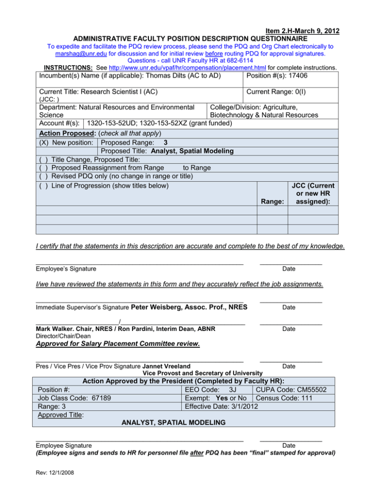
Item 2.H-March 9, 2012 ADMINISTRATIVE FACULTY POSITION DESCRIPTION QUESTIONNAIRE To expedite and facilitate the PDQ review process, please send the PDQ and Org Chart electronically to marshag@unr.edu for discussion and for initial review before routing PDQ for approval signatures. Questions - call UNR Faculty HR at 682-6114 INSTRUCTIONS: See http://www.unr.edu/vpaf/hr/compensation/placement.html for complete instructions. Incumbent(s) Name (if applicable): Thomas Dilts (AC to AD) Position #(s): 17406 Current Title: Research Scientist I (AC) Current Range: 0(I) (JCC: ) Department: Natural Resources and Environmental College/Division: Agriculture, Science Biotechnology & Natural Resources Account #(s): 1320-153-52UD; 1320-153-52XZ (grant funded) Action Proposed: (check all that apply) (X) New position: Proposed Range: 3 Proposed Title: Analyst, Spatial Modeling ( ) Title Change, Proposed Title: ( ) Proposed Reassignment from Range to Range ( ) Revised PDQ only (no change in range or title) JCC (Current ( ) Line of Progression (show titles below) or new HR Range: assigned): I certify that the statements in this description are accurate and complete to the best of my knowledge. ____________________________________________________________ Employee’s Signature __________________ Date I/we have reviewed the statements in this form and they accurately reflect the job assignments. ____________________________________________________________ Immediate Supervisor’s Signature Peter Weisberg, Assoc. Prof., NRES __________________ Date ________________________/____________________________________ Mark Walker. Chair, NRES / Ron Pardini, Interim Dean, ABNR Director/Chair/Dean __________________ Date Approved for Salary Placement Committee review. ____________________________________________________________ __________________ Pres / Vice Pres / Vice Prov Signature Jannet Vreeland Date Vice Provost and Secretary of University Action Approved by the President (Completed by Faculty HR): Position #: EEO Code: 3J CUPA Code: CM55502 Exempt: Yes or No Census Code: 111 Job Class Code: 67189 Range: 3 Effective Date: 3/1/2012 Approved Title: ANALYST, SPATIAL MODELING ____________________________________________________________ __________________ Employee Signature Date (Employee signs and sends to HR for personnel file after PDQ has been “final” stamped for approval) Rev: 12/1/2008 Position Description – Analyst, Spatial Modeling Page 2 1. Summary Statement: State the major function(s) of the position and its role in the university. Attach an organizational chart with positions, ranges, and names for the division which reflects the position in it as well as those supervised in the department. (This section is used for advertisement of the position.) The Analyst, Spatial Modeling, has primary responsibility for providing geographic information system (GIS), remote sensing, and spatial modeling support for research within the Department of Natural Resources and Environmental Science (NRES) and the University of Nevada, Reno (UNR). The individual provides technical, operational, and staff supervisory support for grant funded projects and reports to the Principal Investigator (PI) of the project(s). 2. List the major responsibilities, including percentage of time devoted to each. Provide enough detail to enable a person outside the department to understand the job (percentage first with heading and then bulleted information). 65% - Spatial Modeling and Development Spatially model soils and vegetation variables (e.g., soil erosivity, salinization potential, soil temperature, net primary production) across the study area Develop spatial GIS databases for soils and vegetation characteristics and genetic sampling using existing data sources and data collected by project collaborators Conduct remote sensing analyses using aerial photography, multispectral satellite imagery and Light Imaging Detection and Ranging LIDAR data sets Develop the technical components of research plans for new projects including the methodologies and software to be used, in consultation with the PI Develop new GIS tools to advance the technical GIS discipline and make them available for download on the web Model species distributions and abiotic processes Create decision support tools for use by funding agencies Use genetic sampling data collected in the field and scale up to the landscape level 25% - Lab Coordination and Research Support Supervise, advise, and train students and temporary staff on technical aspects of data collection in the field Advise graduate students on technical aspects of GIS, remote sensing and spatial modeling Assist with sampling of plant community, soil characteristics, groundwater characteristics, growth rates of riparian trees and shrubs, water quality, and mice populations to analyze consequences of human impact on ecological corridors Prepare publications and poster and oral presentations; provide text and professional quality maps and other graphics Assist PI in writing grants for continuous funding of research projects Assist other project personnel (PI, students, faculty) with GIS and remote sensing applications and analysis for various research projects Research competitive products and pricing for software and equipment; ensure software licenses are current 10% - Publications and Research Take a lead on publication, including first authorship Assist in the preparation of research proposals Position Description – Analyst, Spatial Modeling Page 3 3. Describe the level of freedom to take action and make decisions with or without supervision and how the results of the work performed impact the department, division and/or the university as a whole. Level of Freedom: The incumbent acts independently on identifying options and technical implementation of projects, operation of the lab, training of students and temporary staff, establishing research procedures and lab system, software, and hardware recommendations. The Analyst is expected to take initiative to identify opportunities and create new tools. Moderate direction is provided by the supervisor in the areas of success/failure feedback for methodologies, undergraduate technicians, and decisions on purchases. The position is expected to discuss, develop and recommend new models for projects in collaboration with the PI. Impact: The decisions and judgments of the Analyst primarily impact the success of the NRES research projects. The effects on the Department, College, and University are through the reputation and prestige that the research brings to these organizations. Inaccurate information or failure to meet deadlines impacts funding of existing and future projects. Students involved in these projects will have an opportunity to learn and advance their careers in the field. 4. Describe the knowledge, skills (to include cognitive requirement and verbal and written communication), and abilities (to include task complexity, problem solving, creativity and innovation) essential to successful performance of this job (in bullet format). Knowledge of: GIS database development and ArcGIS software/databases Remote sensing science and image processing methodology Statistical and geostatistical methodologies for spatial modeling Soils science and/or vegetation ecology Research methodologies – research design and data collection and analysis – both qualitative and quantitative Publication and presentation of scientific research Skills: Supervisory and training Strong verbal and written communication Computer programming skills (VB/VBA, C++, C#) Relational databases and software (MS-Access, ArcSDE, Python, R) Analytical and decision-making skills (critical thinking) Ability to: Develop databases for a variety of research purposes Design and implement spatial models Provide technical support Work collaboratively with other scientists and staff towards utilizing spatial data for research projects Work independently and creatively Present information to diverse audiences Position Description – Analyst, Spatial Modeling Page 4 5. Describe the type of personal contacts encountered in performing the duties of the job. Explain the nature and purpose of these contacts: i.e., to provide services, to resolve problems, to negotiate. Internal Principal and Co-Principal Investigators Other investigators and scientists, postdoctoral and graduate researchers Undergraduate assistants External Funding agencies Reason for Contact To coordinate research projects and provide technical services and resolve problems relating to GIS, remote sensing and spatial modeling To coordinate research activities To assist with collection of field data and assist with laboratory and computer analyses Reason for Contact To coordinate projects, submit reports, and seek funding opportunities 6. Indicate the minimum qualifications which are necessary in filling this position should it become vacant. Please keep in mind the duties/responsibilities of the position rather than the qualifications of the incumbent. a. Minimum educational level, including appropriate field, if any. Master’s Degree from a regionally accredited institution with major in Natural Resources, Environmental Science, Geography or related field b. Minimum type and amount of work experience, in addition to the above required education necessary for a person entering this position. Master’s Degree and two years of experience in geodatabase development, GIS modeling and analysis, and image processing and analysis Preferred Licenses or Certifications: None c. Indicate any license or certificate required for this position. None


