City of Columbia
advertisement
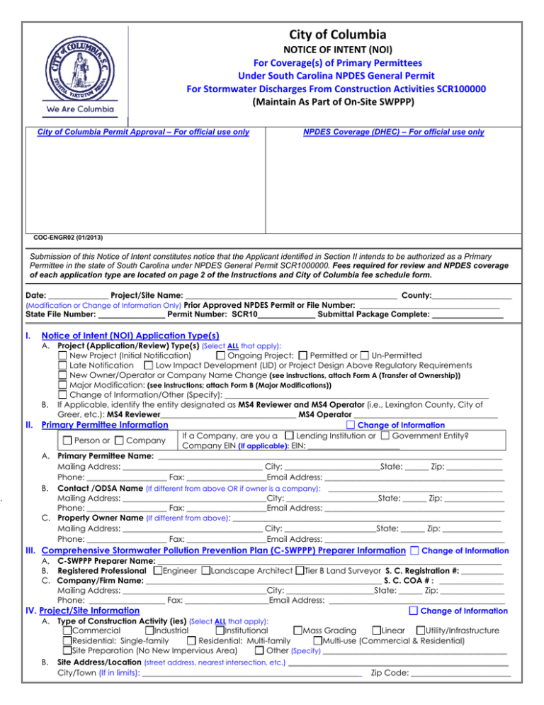
City of Columbia NOTICE OF INTENT (NOI) For Coverage(s) of Primary Permittees Under South Carolina NPDES General Permit For Stormwater Discharges From Construction Activities SCR100000 (Maintain As Part of On‐Site SWPPP) City of Columbia Permit Approval – For official use only NPDES Coverage (DHEC) – For official use only COC-ENGR02 (01/2013) Submission of this Notice of Intent constitutes notice that the Applicant identified in Section II intends to be authorized as a Primary Permittee in the state of South Carolina under NPDES General Permit SCR1000000. Fees required for review and NPDES coverage of each application type are located on page 2 of the Instructions and City of Columbia fee schedule form. Date: _______________ Project/Site Name: _____________________________________________________ County:____________________ (Modification or Change of Information Only) Prior Approved NPDES Permit or File Number: ___________________________________ State File Number: _______________ Permit Number: SCR10_____________ Submittal Package Complete: ________________ I. . Notice of Intent (NOI) Application Type(s) A. Project (Application/Review) Type(s) (Select ALL that apply): New Project (Initial Notification) Ongoing Project: Permitted or Un-Permitted Late Notification Low Impact Development (LID) or Project Design Above Regulatory Requirements New Owner/Operator or Company Name Change (see instructions, attach Form A (Transfer of Ownership)) Major Modification: (see instructions; attach Form B (Major Modifications)) Change of Information/Other (Specify): __________________________________________________________________ B. If Applicable, identify the entity designated as MS4 Reviewer and MS4 Operator (i.e., Lexington County, City of Greer, etc.): MS4 Reviewer__________________________________ MS4 Operator ____________________________________ II. Primary Permittee Information Change of Information Lending Institution or Government Entity? If a Company, are you a Person or Company Company EIN (If applicable): EIN: _______________________ A. Primary Permittee Name: ______________________________________________________________________________________ Mailing Address: ___________________________________ City: ________________________State: ______ Zip: ______________ Phone: ____________________ Fax: ____________________Email Address: _____________________________________________ B. Contact /ODSA Name (If different from above OR if owner is a company): _________________________________________________ Mailing Address: ____________________________________City: _______________________State: ______ Zip: _______________ Phone: ____________________ Fax: ____________________Email Address: _____________________________________________ C. Property Owner Name (If different from above): ___________________________________________________________________ Mailing Address: ___________________________________ City: _______________________State: ______ Zip: _______________ Phone: ____________________ Fax: ____________________Email Address: _____________________________________________ III. Comprehensive Stormwater Pollution Prevention Plan (C-SWPPP) Preparer Information Change of Information A, C-SWPPP Preparer Name: ______________________________________________________________________________________ Engineer Landscape Architect Tier B Land Surveyor S. C. Registration #: ____________ B. Registered Professional C. Company/Firm Name: ___________________________________________________________ S. C. COA # : __________________ Mailing Address: ____________________________________City: ______________________State: ______ Zip: ________________ Phone: ___________________ Fax: _____________________Email Address: ____________________________________________ IV. Project/Site Information Change of Information A. Type of Construction Activity (ies) (Select ALL that apply): Commercial Industrial Institutional Mass Grading Linear Utility/Infrastructure Residential: Single-family Residential: Multi-family Multi-use (Commercial & Residential) Site Preparation (No New Impervious Area) Other (Specify) ______________________________________________ B. Site Address/Location (street address, nearest intersection, etc.) _____________________________________________ City/Town (If in limits): _______________________________________________________ Zip Code: _________________________ Latitude: ________’____” N Longitude: - ________’____” W (Source): GPS Web Site: _______________________________ Tax Map Number (s) (List all): ______________________________________________________________________________________ Yes No B. Is this site located on Indian Land? Proposed Completion Date:_______________________________ C. Proposed Start Date: ______________________________ E. Disturbed Area (nearest tenth of an acre): ________________ Total Area (acres): __________________ F. Total New Impervious Surface After Development: ___________________________________________ G. Job Value of Grading & Site Work: __________________________________________________________ H. Modification Only:(nearest tenth of an acre): Disturbed Area: Current (Approved) Area: _______________ Disturbed Area Change (Increase Only): __________________ Total Disturbed Area (After Change): _________________ Yes No I. Is this project part of a Larger Common Plan for Development or Sale (LCP)? LCP/ Overall Development Name: ____________________________________ Check here if this is the First Phase. Previous State Permit/File Number: ____________________ Previous NPDES Coverage Number: SCR10 ______________ Yes No (If yes, provide detailed description of flooding problems and applicable floodway/flood zone information in the C-SWPPP). H. Any Flooding Problems exist downstream of or adjacent to this site? I. J. Active City Warning Notice, Notice to Comply or Notice of Violation for this site or LCP? Yes No List Relevant State and Federal Environmental Permits or Approvals applied for or obtained for this site (e.g., RCRA, USACOE, Nationwide, etc.). If None, list None. _______________________________________________________________________ Any Waiver(s)/Variances/Exceptions Requested for this Project? (If yes, identify below and include Waiver Request and K. Justifications in the C-SWPPP for each proposed request). 1. Small Construction Activity Waiver(s) From NPDES permitting (Section 1.4 & Appendix B)? Yes No If yes, Identify requested waiver: Rainfall Erosivity Waiver TMDL Waiver Equivalent Analysis Waiver V. Waterbody Information (Attach additional sheet(s) as needed) Change of Information A. Receiving Waterbody(s) (RWB) Information (List the nearest and next nearest receiving waterbodies to which the sites stormwater discharges will drain. If stormwater discharges drain to multiple waterbodies, list all such waterbodies). 2. Distance to 3. Classification of 1. Name of Receiving Waterbodies (RWB) RWB (feet) RWB a. Nearest: _______________________________________ b. Next Nearest: __________________________________ d. Other Waterbodies: _____________________________ B. Waters of the U.S. / State Information (Attach additional sheet(s) as needed) Waters of the U.S./ State 1. On the site? 2. Delineated/ Identified? Yes No a. Jurisdictional wetlands Yes No b. Non-jurisdictional wetlands Yes No Yes c. Other Water(s): _________________________ Yes No Yes 3. Impacts? 4. Amount of impacts Yes No _____ Ac No Yes No _____ Ac No Yes No _____ Ac ______ Feet 5. If yes for impacts in B.3, describe each impact and activity, and list all permits (e.g., USACOE Nationwide Permit, DHEC General Permit) and certifications that have been applied for or obtained for each impact: _____________________________________________________________________________________________________________________ C. S.C. Navigable Waters (SCNW) Information (Section 2.6.5) The Department will address any issues related to State Navigable Waters’ Program under SC Regulation 19-450 during the review of the C-SWPPP for activities that will NOT require a 404 permit or a 401 certification. (Attach additional sheet(s) as needed). 1. Are S. C. Navigable Waters (SCNW) on the site: Yes No a. If no, do not complete this question. Proceed to Section D (Impaired Waterbodies). b. If yes, provide the name of S.C. Navigable Waters (SCNW) on the site: ________________________________________ 2. If yes for C.1, will construction activities cross over or occur in, under, or thru the SCNW? Yes No If yes, describe SCNW activities (e.g., road crossing, sub-aqueous utility line, temporary or permanent structures, etc.) and proceed to Section C.3: _______________________________________________________________________________________ 3. Identify permits providing coverage of SCNW activities proposed for your site. If NONE, list none. Permits/Certifications Permit or Certification No. Corresponding Covered SCNW Activity(ies) a. DHEC General/ Other DHEC Permit b. USACOE 404 Permit or 401 Certification All Activities or Some Activities (Describe): c. SCNW Permit If applied for or issued, identify Date applied for or issued: ________________ d. If a SCNW Permit has NOT been applied for provide an additional plan sheet that shows plan and profile views (drawn to scale) of the SCNW and associated activities. Include a description of all proposed activities on this plan. COC-ENGR02 (01/2013) D. Impaired Waterbodies Information (Attach additional sheet(s) as needed) 1. 303(d) Listed Impaired Waterbodies a. Name of Nearest DHEC Water Quality Monitoring Stations (WQMS)(s) that receives stormwater from your construction site and/or thru an MS4 and the Name of the Corresponding Waterbody? Nearest DHEC WQMS(s) Corresponding Waterbody b. Is this WQMS(s) listed on the most current 303(d) List? If No, proceed to Section 2 of this table. If Yes, complete items c thru f. Yes No Yes No Yes No c. List the pollutant(s) identified as “CAUSES” of the impairment d. Will any pollutants causing the impairment be present in your site’s construction stormwater discharges? Yes Yes Yes e. If yes for d, list the “USE SUPPORT” impairment(s) affected by the pollutant(s) identified in c. No No No f. If yes for d above, will use of the BMPs proposed for your project ensure the site’s discharges will NOT contribute to or cause further WQS violations for the impairment(s) listed in c? Yes No (NOTE: If no for f, this site is NOT eligible for coverage under the CGP). See Instructions. 2. TMDL Impaired Waterbodies a. Name of Nearest DHEC Water Quality Monitoring Stations (WQMS)(s) that receives stormwater from your construction site and/or thru an MS4? b. Has a TMDL(s) been developed for this WQMS(s)? If No, identify as such below and proceed to Section VI. If Yes, complete items c thru f of this table. Yes No Yes No Yes No c. If yes for b, what pollutants are listed as “CAUSES” or causing the impairment? d. If yes for b, has the standard been “ATTAINED” or “ Fully Supported” for the impairment(s)? Yes Yes Yes No No No e. If no for d (Not Attained), will any pollutants causing the impairment be present in your site’s construction stormwater discharges? Yes Yes Yes f. If yes for e above, are your discharges consistent with the assumptions and requirements of the TMDL(s)? No No No Yes No (NOTE: If no for f, this site is NOT eligible for coverage under the CGP). See Instructions. VI. Signatures and Certifications DO NOT SIGN IN BLACK INK! Read the Certifications below (in entirety). Provide date, printed name, and signatures below. If you are a New Owner/Operator, as Primary Permittee you must also sign and date the applicable Comprehensive SWPPP Acceptance & Compliance Agreement below. C-SWPPP PREPARER: “One copy of the C-SWPPP, all specifications and supporting calculations, forms, and reports are herewith submitted and made a part of this application. I have placed my signature and seal on the design documents submitted signifying that I accept responsibility for the design of the system. Further, I certify to the best of my knowledge and belief that the design is consistent with the requirements of Title 48, Chapter 14 of the Code of Laws of SC, 1976 as amended, pursuant to Regulation 72-300 et seq. (if applicable), and in accordance with the terms and conditions of SCR100000.” (This should be the person identified in Section III). _________________________________ ____________________________ ______________________________ Printed Name of C-SWPPP Preparer Signature of C-SWPPP Preparer S. C. Registration # PRIMARY PERMITTEE: “I or I (on behalf of my company and its contractors and agents), as the case may be, certify under penalty of law that this document and all attachments were prepared under my direction or supervision in accordance with a system designed to assure that qualified personnel properly gather and evaluate the information submitted. Based on my inquiry of the person or persons who manage the system, or those persons directly responsible for gathering the information, the information submitted is, to the best of my knowledge and belief, true, accurate, and complete. I understand that City of Columbia and/or DHEC enforcement actions may be taken if the terms and conditions of the C-SWPPP are not met and I am aware that there are significant penalties for submitting false information, including the possibility of fine and imprisonment for knowing violations.” “I or I (on behalf of my company and its contractors and agents), as the case may be, also hereby certify that all land-disturbing construction and associated activity pertaining to this site shall be accomplished pursuant to and in keeping with the terms and conditions of the approved plans and SCR100000. I also certify that a responsible person will be assigned to the project for day-to-day control. I hereby grant authorization to the to S. C. Department of Health and Environmental Control (DHEC) and/or the City of Columbia the right of access to the site at all times for the purpose of on site inspections during the course of construction and to perform maintenance inspections following the completion of the land-disturbing activity.” (See Section 122.22 of S.C. Reg. 61-9 for signatory authority information.) Having understood the above information, I am signing this certification as Primary Permittee to the aforementioned NPDES general permit.” ______________________________________ _______________________________________ Printed Name of Primary Permittee Title/Position _________________________________________ __________________________________________ Signature of Primary Permittee Date Signed COC-ENGR02 (01/2013) City of Columbia MS4 Land Disturbance/Grading FEE SCHEDULE ( This schedule should be attached to City of Columbia Notice of Intent (Application) for Stormwater Discharges from Construction Activities. Do not send payment in window envelope. DO NOT MAIL CASH. The City will notify the Project Owner/ Operator if the submitted check or credit card payment cannot be processed. The review clock will start when acceptable payment is received. Total Required Fees (One-time/Flat Fee) Less than 1 acre 1-10 acres Over 10 acres Linear Project Modifications1 $150 $300 $500 $150 $100 Inspections1 $50/month for the life of the project 1 For major modifications that will affect hydrology calculations, a change or addition in point discharge location, and/or the addition of impervious or disturbed area (see full definition in the (Revised) Stormwater City Code of Ordinances)2 3 2$50/month after the 2nd month of construction until issuance of N.O.T. (to be submitted separately from the Plan Review Fees after approval is granted and construction begins) 3 Notice of Termination (N.O.T.) of Coverage under the NPDES General Permit for Stormwater Discharges associated with Construction Activity Total Required Fees Add the values applicable from the table above and enter in the right-hand column. (The City will not review this project until all required fees are received). $ __ __ __ 0. 00 4. Identify the Method of Payment: Payment by Check: Attach a signed and dated check payable to City of Columbia to the front of this Fee Schedule. Please note that all checks must be less than 30 days old and must be for the entire required fees. STAPLE CHECK HERE Payment by Credit Card: (Check here if you wish to pay via credit card) The City will contact you to provide instructions and the invoice number necessary for payment. Please provide an name, e-mail address and phone number in order to be contacted for appropriate payment instructions and invoice: Name: _________________________________ Phone: __________________ Fax: _______________________ Email Address: ______________________________________________________ For official use only: COC-ENGR02 (01/2013) Invoice Number ___________________ Instructions for Completing the Notice or Intent (NOI) All projects within the City of Columbia limits, regardless if it is new or re-development, that disturb 5,000 SF or more, you are required to have the site plan reviewed and approved through City Stormwater Management to be issued a grading permit for work. If you are uncertain whether you need to obtain coverage under the NPDES General Permit for Stormwater Discharges from Construction Activities, SCR100000 (CGP), if you cannot access the websites listed on the NOI and instructions, or if you have any other questions, contact the Stormwater Division for the City of Columbia (SWD) at (803) 545-3400 or DHEC Stormwater Permitting Section for DHEC (SWP) at (803) 898-4300. Please see the City’s Stormwater website at http://www.columbiasc.net/stormwater or Bureau of Water, Stormwater Permitting website (BOW-SPWS): http://www.scdhec.gov/environment/water/swater/ for guidance and additional information regarding MS4 requirements or the CGP, respectively. Who Must File a NOI: • If S.C. Department of Transportation (SCDOT) is the Primary Permittee (Owner/ Operator), this NOI form should not be used. • The Owner/ Operator of a single project or larger common plan for development or sale (LCP—see item IV.G of instructions) that will ultimately disturb 1 acre or more (all counties). Where to File: See the DHEC website for a current list of the areas that are reviewed by Municipal Separate Storm Sewer System (MS4) operators and entities that have delegated review authority. For projects in these areas, the initial submittal should be made to the MS4 operator; if initial submittal is made to DHEC for projects in these areas, the review process may be delayed. Please contact the appropriate entity for additional information and requirements; for example, the MS4 operator may require that a different application form be submitted. If a project crosses jurisdictional boundaries (e.g., sewer line in Greenville County and the city of Mauldin), then submittals to all appropriate MS4 operators, delegated entities, and DHEC must be coordinated. Projects Located in the SCCZ S.C. DHEC—Bureau of Water Coastal Stormwater Permitting Section 1362 McMillan Ave., Suite 400 Charleston, S.C. 29405 All Other Areas S.C.DHEC—Bureau of Water Stormwater Permitting Section 2600 Bull Street Columbia, SC 29201-1708 Submittal Package for SWP and CSWP: • When DHEC performs a full technical review, you must include the original, signed NOI form, appropriate fee schedule (A or B) with required fees, one (1) copy of the Comprehensive Stormwater Pollution Prevention Plan (C-SWPPP), and one (1) copy of all other supporting documentation with the initial submittal. For projects in the non coastal counties disturbing greater than or equal to 1 acre and less than or equal to 2 acres, one (1) copy of the C-SWPPP and one (1) copy of supporting documentation can be submitted with the initial submittal. In the SCCZ, applications for Coastal Zone Consistency certification are to be filed with requests for NPDES construction coverage and will then be routed internally to the Office of Ocean and Coastal Resource Management (OCRM) for review. OCRM submittal requirements can be located at: http://www.scdhec.gov/environment/ocrm/czc.htm • When a regulated MS4 or entity implementing Regulation 72-300 performs the technical review, you must include a copy of the MS4 approved NOI form or MS4 approved application, the $125 NPDES fee, and one (1) copy of the MS4 approval. In the SCCZ,applications for Coastal Zone Consistency certification are to be filed with requests for NPDES construction coverage and will then be routed internally to OCRM for review. • For projects ultimately disturbing more than 1 acres, the checklist must be completed and attached when DHEC reviews your CSWPPP. In the SCCZ, for projects ultimately disturbing more than 0.5 acres and located within ½ mile of a CRW, the checklist must be completed and attached. See BOW-SPWS for the most current version of the checklist. If this project will NOT ultimately disturb more than 0.5 acres (Coastal Counties) or more than 1.0 acre (Non-Coastal Counties) AND is not part of an LCP, your project is automatically covered under this permit and the NPDES coverage fee and review fee are not required. See the BOW-SPWS for “Less Than 1-Acre of Land Disturbance - Coastal Counties AND “Less Than 1-Acre of Land Disturbance – Non-Coastal Counties. • For Modification projects where DHEC performs a technical review, see Section I of the instructions and Form B. Complete the applicable sections of the NOI Form. Complete the Form B Checklist. Submit an original, signed NOI form, appropriate fee schedule (C) with required fees, one (1) copy of SWPPP revisions, and one (1) copy of all other supporting documentation, including necessary engineering calculations. No review clock is required for Modification reviews. Authorization to discharge is granted based on the timeframes specified in the table below. For project sites located in the SCCZ, the timeframes provided below do not commence until a Coastal Zone Consistency determination has been issued for the site. Review Type Allotted Review Time Frame Regulated MS4 or entity implementing Regulation 72-300 7 business days of DHEC receipt of a complete NOI and fee payment. DHEC (when construction site is subject to State CSWPPP reviews) 20 business days of DHEC receipt of a complete NOI and fee payment. Fee Schedules: Make sure to answer all applicable questions on the appropriate Fee Schedule. If you are completing the online fillable version of the NOI, the cursor should automatically move to the next question that needs to be answered until all applicable questions have been answered. Complete Fee Schedule A for Non-Coastal projects; Schedule B for Coastal projects. Attach Form A, as required, for Transfer of Ownership. Attach Form B for major modifications to a prior approved project with Fee Schedule C if DHEC reviews your modification. Office Mechanics and Filing: The original NOI form for projects located outside of MS4 areas and supporting documentation will be kept in the Central Office files (hard copy or digitized copy) in accordance with the Retention Schedule. Date: Enter today’s date. Project/Site Name: The Project/ Site Name should be a unique or distinguishing name (e.g., not Proposed Subdivision). NOTE: DHEC must be notified in writing if the Project/ Site Name changes. County: If the project is in multiple counties, list the county in which the majority of the site is located. If part of the project is in the SCCZ, then list the coastal county in which the majority of the site is located and submit the project to CSWP; see the “Where to File” section. List the other counties in which the site is located in the C-SWPPP. Prior Approved NPDES Permit Number (Major Modification or Change of Information Only): Provide the NPDES permit number (SCR number)or File Number previously assigned to the project or LCP. Expedited Review Program (ERP): For additional information about ERP, see the ERP website http://www.scdhec.gov/environment/water/swater/expeditedReview.htm. DHEC will notify the Project Owner/ Operator if the project is selected for review in the ERP. There are additional required fees for participation in this program; these ERP fees should not be submitted until DHEC has notified the Project Owner/ Operator that the project was selected for participation in the ERP. In the SCCZ, please note that projects impacting Geographic Areas of Particular Concern (GAPCs) and/or wetlands may not eligible for participation. Consult OCRM staff. I. Notice of Intent (NOI) Application Type(s) (See Section 2.4 of CGP for submission deadlines and notification requirements) A. Project (Application) Type - Select ALL applicable application types that best describe your project or application. Section 2 of the Construction General Permit (CGP) may be reviewed for further information on each type of application listed in this section. As an example, if your project is one that is a new startup, then “New Project” should be selected. If your project is a new startup that will be located in Beaufort County, that will also be expedited, then “New Project”, “OCRM Project Review”, and “Expedited Review Program” should each be selected to describe your application. To determine if the project design is considered to be above regulatory requirements or Low Impact Development, see the “Expedited Review Standard Operating Procedures” document. If none of the application types listed in this section apply or clearly define the intent of your project, select “Other” and provide specific details that clearly describe the intent of your NOI application. NOTE: DHEC must be notified in writing within fourteen (14) business days of a new Owner (person, lending institution, government institution, etc.) taking title to or ownership of a prior approved ongoing NPDES construction project/site. A new Property Owner must complete all applicable sections of Form A (Transfer of Ownership) and submit this form to the Department or respective MS4 with the NOI application. Written notification is also required when the Owner or Developer’s company name changes for a prior approved construction permit. NOTE: Major Modifications allowed by the Department are listed in Section 3.1.7 of the CGP. If your project is a major modification, complete Form B, Fee Schedule C, and applicable sections of the NOI per directions identified on Form B. Please note that Section V (Waterbody Information) of the prior approved NOI must be reviewed for changes prior to submitting any modification request to the Department. If changes have occurred, identify as Change of Information on the NOI form and provide the revised information in this section. Attach a detailed Narrative and revised C-SWPPP documents to the major modification request. A. II. MS4 Reviewer and MS4 Operator - If this project is located inside a Municipal Separate Storm Sewer System (MS4) and must be reviewed and approved by a MS4 entity prior to submission to DHEC, then select “MS4 Project Review” as application type in Item A and provide the names of the entities that will perform the review and the MS4 Operator. Urbanized area boundary maps are available at http://cfpub.epa.gov/npdes/stormwater/urbanmapresult.cfm?state=SC. See the following website for information about MS4s: http://www.scdhec.gov/environment/water/swnsms4.htm. Note: Some MS4s have increased their review jurisdiction boundaries beyond the original urbanized area map. Please confirm with the appropriate MS4 regarding review jurisdiction. Primary Permittee Information Identify whether the Primary Permittee is a person or a company. If a company, identify if it is a lending institution or government entity. Provide the Employer Identification Number (EIN) as established by the U.S. Internal Revenue Service for the company. The EIN is commonly referred to as the taxpayer ID. If the company does not have an EIN (e.g., single member LLC, sole proprietorship), DO NOT list a Social Security number A. Primary Permittee Name - Provide the complete, legal name of the person or entity (company) that will be the Primary Permittee (Owner/Operator, O/O) for the project. If a person, provide the Title or Position. If a company, provide the complete, legal name of the company. Do not list the D/B/A (Doing Business As) name. NOTE: If S.C. Department of Transportation (SCDOT) is the O/O, this NOI form should NOT be used. Provide the complete mailing address of the person/company identified in II.A as the Primary Permittee. B. Contact/ODSA Name – Complete if different from II. A or O/O is a company. Provide the complete legal name of the person identified as the Contact or Operator of Daily Site Activities (ODSA) for the project. This can be someone other than the person that has signatory authority for the company. Often the Contact person is also referred to as the ODSA. Provide the complete mailing address for the person, other than the permittee, the Department may contact. This address can be different from the mailing address entered for the O/O. C. Property Owner Name – If different from II.A or B, list the complete, legal name of the current Property Owner(s) of the site. Enter the complete mailing address for the Property Owner. NPDES coverage will be issued to the Primary Permittee identified in Section II.A, not the Property Owner, unless same entity. If there are multiple Property Owners, attach additional sheets with all information requested in Section II.C. III. Comprehensive Stormwater Pollution Prevention Plan (C-SWPPP) Preparer Information A. C-SWPPP Preparer Name – Provide the name of the C-SWPPP Preparer for this project. B. Registered Professional – Identify whether the C-SWPPP Preparer is a Registered South Carolina Professional Engineer, Tier B Surveyor, or Landscape Architect. For projects disturbing more than 2 acres, the C-SWPPP preparer must be one of the listed professionals or federal government employee as described in Title 40, Chapter 22, and as required and allowed by the qualified individual’s respective act and regulations. Company/Firm Name - Provide the complete, legal name of the company and S.C. Certificate of Authorization (S.C. COA number). Enter the complete mailing address. City/DHEC may contact the C-SWPPP Preparer via email. See the following websites for information about COA requirements for Landscape Architecture firms http://www.dnr.sc.gov/land/LandscArch/LAlicense.html and Engineering and Surveying firms http://www.llr.state.sc.us/POL/Engineers/. Enter N/A for S.C. COA if the firm is not required to have a COA. IV. Project/Site Information A. Type of Construction Activity (ies) - Select ALL activity types that best describe the development proposed for the site. “Institutional” includes schools and other publicly owned projects, except linear projects. “Site Preparation” includes clearing, grubbing, and grading only; no new impervious areas should be proposed if this activity type is selected. If none describe the development, then select “Other” and list the activity. B. Site Address/Location - List the site address. If the site address is unknown, list the road name(s) on which the site is located, the nearest intersection, or other detailed description of the site location. List a city/town only if the site is within the city/ town limits. List zip code (if known). Provide the latitude/longitude and tax map numbers. See the following website for assistance in obtaining latitude/ longitude coordinates: http://www.epa.gov/tri/report/siting_tool/index.htm. Latitude (from 32° to 35°) and longitude (-78° to -83°) should be for the center of the site. Minutes (’) and seconds (”) should be from 0 to 59. Identify the lat/long data source. C. Indian Lands – Identify if this site is located on Indian lands. D. Proposed Start Date/Completion Date – Provide proposed project start and completion dates. E. Disturbed Area/Total Area - Enter the disturbed area for the project and the total area for the site. The disturbed areas must be rounded to the nearest tenth of an acre. For subdivisions, if the exact build-out is not known, the disturbed area can be estimated using the following equation: Disturbed area= 2(Maximum Footprint of House)(# of lots) + Road/ Right-of-Way areas + Other easements/ disturbance. NOTE: Provide written notification if the actual disturbed area exceeds the disturbed area on the approved NOI. F. Total New Impervious Area (After Development): Please calculate the total impervious area post-development compared to the pre-development impervious area. While the entire site may be disturbed, there may be an increase OR decrease from pre- to post-development. This is important as it will affect your Stormwater Utility Bill, which is calculated on impervious area. G. Job Value of Grading & Site Work: Please fill out so that the Development Center can accurately determine the fee for Zoning permits. H. Modification Only: Change to Disturbed Area – If your modification to a prior approved project will increase or decrease the disturbed area, complete this section and see Section I of the Instructions. Enter the current approved disturbed area and proposed increase (+) or decrease (-) to the disturbed area. If no change, enter 0.0. Enter the new total disturbed area (after change). Round each entry to the nearest tenth of an acre. I. Larger Common Plan for Development or Sale (LCP) - The plan in LCP is “broadly defined as any announcement or piece of documentation (including a sign, public notice or hearing, sales pitch, advertisement, drawing, permit application, zoning request, computer design, etc.) or physical demarcation (including boundary signs, lot stakes, surveyor markings, etc.) indicating construction activities may occur on a specific plot.” [63 Federal Register No. 128, July 6, Page 6 1998, p. 36491] For example, if master calculations have been prepared and/ or submitted for an entire site, then all phases and parcels at that site would be considered part of an LCP. If the site is part of a subdivision, industrial park, commercial park, etc., then it is considered to be part of an LCP. List a unique, distinguishing LCP/ Overall Development name. This name should not reference a specific phase. This LCP/ Overall Development name should also be listed on all NOIs for future projects that are part of this LCP, including subsequent phases. Check the box if this is the first phase of the LCP. List the previous state permit/ file number and previous NPDES coverage number if applicable. (DO NOT enter SCR100000). If not known, contact the Department for assistance. J. Flooding Problems – Identify whether flooding problems exist on the site, or downstream or adjacent to the site. If yes, provide detailed explanation of the extent and impact in your C-SWPPP. NOTE: All C-SWPPP applications must include a Floodway Map/FEMA Flood Insurance Map (See Checklist) with an outline of the project boundary on the map. NOTE: The Department does not regulate the placement of fill in floodplains. Contact the City of Columbia official. K. Active City/S. C. DHEC Warning Notice/Notice to Comply/Notice of Violation – Select yes if City/DHEC has issued a Warning Notice, Notice to Comply, or Notice of Violation for the site or any site within the LCP. Provide additional information about the Notice (e.g., Order number) and a copy of correspondence with City/DHEC regarding the Notice in your C-SWPPP. L. State and Federal Environmental Permits or Approvals – List relevant state and federal permits applied for. See §122.21(f) of S.C. Regulation 61-9 http://www.scdhec.gov/environment/water/regs/r61-9.pdf for a list of permits, approvals, and programs that should be considered. If inaccurate, NPDES coverage may be invalid. M. Waiver(s) - Identify any waivers requested for your project or construction site. Provide details and required justifications in the C-SWPPP. V. Waterbody Information A. Receiving Waterbody(s) (RWB) Information 1. The Nearest receiving waterbody (RWB) is the nearest Waters of the State (WoS). See definition in §122.2 of S.C. Regulation 61-9 - http://www.scdhec.gov/environment/water/regs/r61-9.pdf to which the site’s stormwater discharges will drain. The nearest RWB must be listed in reference to a named waterbody, if the RWB is unnamed. For example, if the site’s stormwater discharges drain to a stream on the site, then the nearest RWB would be the stream. If the stream is not named, then determine the nearest named waterbody (e.g., Grove Creek) into which the stream will flow and list the nearest RWB as a tributary to the named waterbody (e.g., Tributary to Grove Creek). Then, the Next Nearest named RWB would be Grove Creek. If the site’s stormwater discharges drain to multiple waterbodies, then list all such waterbodies; attach additional sheets, if necessary. 2. Provide the distance, in feet to each receiving waterbody. 3. Provide the classification for each named waterbody. See S.C. Regulation 61-69 (http://www.scdhec.gov/environment/water/regs/r61-69.pdf) for a list of classifications of waterbodies within S.C. If the nearest RWB is unnamed, then search the document for the nearest named RWB. If the nearest, named RWB is not listed, then continue searching the document for the next, named waterbody, proceeding downstream from the site. For example, a site in Anderson County drains to a tributary of Hornbuckle Creek, then to Hornbuckle Creek, then to Middle Branch, and then to Brushy Creek/ Big Brushy Creek. First, search the document for Hornbuckle Creek, then Middle Branch, then Brushy Creek. Because there are 3 listings for Brushy Creek, the next, named waterbody (Saluda River) must be determined. Note that the county for this record for Brushy Creek is listed as Pickens because the headwaters of Brushy Creek are in Pickens County. The classification of the tributary to Hornbuckle Creek is “FW—Freshwaters”. B. Waters of the U. S. /State Information (See Section 2.6.2 thru 2.6.6 of the CGP) 1. Complete the “On the Site?” column for items a-d. If yes is selected for that column, then the next 3 columns must be completed. If there are other waters of the U.S./ State (WoS) on the site not listed in items a and b (e.g., stream, river, lake, pond), then list those in item c. Jurisdictional wetlands are under ACOE jurisdiction. 2. Delineation means identification by U.S. Army Corps of Engineers (USACOE) or wetlands consultant. Also, see the checklist for information about delineation requirements. If there are WoS within 100’ of the disturbed area that were not delineated/identified, then explain this in the narrative; this includes WoS that are not on the project site but are within 100’ of the disturbed area. Impacts - If construction activities will occur in and/ or will impact WoS, then select yes for “Impacts?” 4. Amount of Impacts - List the amount of impacts to WoS. Provide an additional, separate plan sheet that shows all WoS on the site and the impacted areas. If there are proposed impacts to WoS, please contact USACOE (866-329-8187) and S.C. DHEC Water Quality Certification, Standards & Wetlands Programs Section (803-898-4300) to determine additional requirements before submitting this NOI. 5. If yes for impacts in B.3, describe each impact and activity, and list all permits (e.g., U.S. Army Corps of Engineers (USACOE) Nationwide Permit, DHEC General Permit) and certifications that have been applied for or obtained for each impact. Describe the activity(s), whether the impact is permanent or temporary, and any other relevant information. Provide a copy of all permits and certifications for and correspondence with USACOE and DHEC for the impacts. Include all plats referenced in the permits or correspondence. C. S. C. Navigable Waters (SCNW) Information 1. Are SCNW on the site? See http://www.scdhec.gov/environment/water/navwater.htm for the definition of SCNW and other information related to SCNW. Or, contact S.C. DHEC Water Quality Certification, Standards & Wetlands Programs Section at (803) 898-4300 for assistance determining the navigability of the waters on your site or with questions related to SCNW. If yes to C.1, list the name of the SCNW. If the SCNW is not named, then provide a description that references the nearest, named waterbody (e.g., tributary to Grove Creek). If no to C.1, do not complete questions C.2 thru C.3 of this section. 2. If yes to C.1 and construction activities proposed by your project will cross over or occur in, under, or thru the SCNW, describe SCNW activities (e.g., road crossing, sub-aqueous utility line, temporary or permanent structures, etc.). This includes temporary and permanent crossings with roads, utility lines, etc. 3. Identify permits providing SCNW Activity(ies) coverages for your site. a. D. Identify proposed activities covered under a DHEC General Permit or other DHEC permit. Identify permit number(s) and corresponding activities covered under each. See the following website for a list of DHEC General Permits for activities in some SCNW: http://www.scdhec.gov/environment/water/docs/gp/gp.xls. See the “Notes” column to determine what types of activities are covered under each permit. b. Identify USACOE 404 Permit or 401 Certification issued for the site. Identify permit number(s) or certification(s) and corresponding activities covered under each. c. If applicable, identify the date the SCNW permit was applied for. Identify whether the permit applied for will cover ALL activities listed in C.2 of some activities listed in C.2. List covered activities. d. If a SCNW permit has NOT already been applied for or issued for all of the activities in SCNW for this site, then those activities and conditions can be addressed during the review of the C-SWPPP, and a separate State Navigable Waters permit is not required. Provide an additional plan sheet with plan and profile views (drawn to scale) of SCNW and associated activities; include activities description on the plan sheet. Impaired Waterbodies Information (Section 3.2.12) NOTE: The TMDL, 303(d), and Non-Point Source water quality tool is a mapping system showing detailed information on WQMS locations, water quality status, and much more. The tool is available at the following website along with instructions for using the tool: http://www.scdhec.gov/environment/water/tmdl/. 1. d. In the SCCZ, list the nearest upstream and downstream DHEC WQMS(s) and corresponding waterbody(ies). Additionally, shellfish stations only monitor for Fecal coliform bacteria. Include both the nearest shellfish monitoring station(s) and full WQMS(s) on the NOI for both upstream and downstream locations when shellfish monitoring stations are present. If a shellfish monitoring site is not present then you only need to list the full WQMS(s). When a shellfish monitoring station is present, everything but Fecal coliform bacteria needs to be assessed at the full WQMS(s). Shellfish monitoring stations begin with numbers and full WQMS(s) begin with letters. 303(d) Listed Impaired Waterbodies a. List the nearest SCDHEC Water Quality Monitoring Station(s) to which the site’s construction stormwater discharges will drain and its corresponding waterbody. See the following website for the most current 303(d) List for Impaired Waters and related information: http://www.scdhec.gov/environment/water/tmdl/. NOTE: DHEC has determined that construction SW discharges are expected to contain pollutants causing the following impairments: TURBIDITY, BIO (Macroinvertebrate), TP (Total Phosphorus), TN (Total Nitrogen), Chlorophyll-a, and FC (Fecal coliform) in Shellfish Harvesting Waters in the SCCZ. Carefully evaluate whether the site’s construction SW discharges will contain any pollutants causing other impairments not explicitly listed above. You should also consider previous land uses at the site in answering this question. For example, if the previous land use was a copper processing facility and the impairment at the nearest WQMS is copper, then you should carefully evaluate whether the site’s construction SW discharges would contain copper. b. Identify whether this WQMS is listed on the most current 303(d) List. The 303(d) list is available in Microsoft Excel and Adobe Reader formats. WQMS locations are available for each watershed at the website provided in 1.a as well using the TMDL, 303(d), and Non-Point Source water quality tool. To search the 303(d) list to determine whether a WQMS is listed, select “Edit” from the top toolbar of your web browser. Then, select “Find”. Enter the WQMS exactly as listed on the map and hit enter. If none of the WQMS(s) are found, then select “No” and proceed to item V.D.2 (TMDL Impaired Waterbodies). If any of the WQMS(s) are found, then select “Yes” and proceed to item c. c. If yes for b, list the impairment(s) or pollutants identified as cause(s) of the impairment (see last column labeled “CAUSE”) for the WQMS(s) and proceed to item d. Identify whether the site’s stormwater discharges contain any pollutants causing the impairment(s). If no for d, proceed to item V.D.2 (TMDL Impaired Waterbodies). If yes to d and the receiving water is listed on the most current 303(d) List of Impaired Waters for a sediment or a sediment-related parameter, BIO (macroinvertebrate), turbidity, Total Phosphorous, Total Nitrogen, Chlorophyll-a, or Fecal coliform in Shellfish Harvesting Waters in the SCCZ. You must carefully evaluate all selected BMPs and their performance to ensure that the construction site’s Stormwater discharges will not contribute to or cause a violation of water quality standards. If yes for d and the disturbed area is less than 25 acres, include an evaluation of the Best Management Practices (BMPs) proposed for the site as described in Section 3.2.12.B(I) of the CGP in the C-SWPPP. If yes for d and the disturbed area is greater than or equal to 25 acres, then provide a written qualitative and quantitative assessment of the BMPs proposed in the C-SWPPP for the site as described in section 3.2.12.B(II) of the CGP. For more information on this subject, please see the DHEC publication entitled “Antidegradation for Activities Contributing to NonPoint Source Pollution to Impaired Waters.” This publication can be downloaded at the following DHEC WEB site www.scdhec.gov/eqc/water/pubs/antidegnps.pdf. e. f. If yes to d , list the “USE” support impairment (AL, FISH, REC, SHELLFISH) affected by the pollutant or impairment listed in item c. If yes for d, will use of the BMPs proposed for your project ensure the stormwater discharges leaving the site will NOT contribute to or cause further water quality standard violations for the impairment(s) listed in c? NOTE: If your answer to item f is NO, this site is NOT eligible for coverage under the CGP. You may contact the Department to determine if an individual permit application is necessary or you may revise your project to include appropriate Best Management Practices, controls, and procedures to bring your discharge into compliance 2. TMDL Impaired Waterbodies a. List the nearest SCDHEC water quality monitoring station(s) to which the site’s construction stormwater discharges will drain. List WQMS identified in part V.D.1.a of this table. b. Identify whether a TMDL is listed for this WQMS. NOTE: See the following website for a list of all WQMS with Approved S.C. Total Maximum Daily Loads (TMDLs): http://www.scdhec.gov/environment/water/tmdl/. Select “Approved SC TMDLS”, then select “Sites Covered Under an Approved TMDL and Corresponding WQ Attainment Status”. Select “Edit” from the top toolbar. Then, select “Find”. Enter the WQMS exactly as listed and hit enter. If a WQMS is NOT found, then select “No,” Stop and proceed to Section VI. If a WQMS is found, then select “Yes” and proceed to item c. c. If yes for b, identify and list the impairment(s) or pollutants listed as CAUSE(S) of the impairment (see 7th column labeled “CAUSE”) and proceed to item d. If the WQMS(s) is impaired for more than one parameter, then the WQMS will be listed multiple times on successive rows. d. If yes for b, identify whether the standard has been ATTAINED for the impairment(s). NOTE: See the 8th column labeled “USE SUPPORT” to determine if the standard has been attained for each impairment for each WQMS. “FULLY SUPPORTED” means the standard has been attained for the impairment listed in the “CAUSE” column. “NOT SUPPORTED” means that the standard has NOT been attained for that impairment. If no for d (the standard has NOT been attained (NOT SUPPORTED) for all impairments for all WQMS(s)), proceed to item e. If yes for d (the standard has been attained for all impairments for all WQMS(s)), proceed to Section VI. e. Identify whether the site’s stormwater discharges contain any pollutants causing the impairment(s). If no for e, proceed to Section VI. If yes for e, proceed to f. f. If yes for e, are your discharges consistent with the assumptions and requirements of the TMDL(s)? NOTE: If your answer to item f is NO, this site is NOT eligible for coverage under the CGP. You may contact the Department to confirm that adherence to a C-SWPPP that meets the requirements of the CGP will be consistent with the TMDL. Where a TMDL has not specified a WLA applicable to construction stormwater discharges, but has not specifically excluded these discharges, adherence to a C-SWPPP that meets the requirements of the CGP will generally be assumed to be consistent with the approved TMDL. If the TMDL specifically precludes such discharges, the site is not eligible for coverage under the CGP. VI. Signatures and Certifications DO NOT SIGN IN BLACK INK! The NOI must have original signatures unless the application being submitted to DHEC is one approved by an MS4. C-SWPPP Preparer - The same registered professional must sign and seal the NOI form, C-SWPPP, calculations, and supporting documentation. Primary Permittee - If the Primary Permittee or Project Owner/ Operator is a company, print the name of the person who is signing the NOI for the Owner/ Operator. A person with signatory authority for the Owner/ Operator must sign the application. The C-SWPPP Preparer cannot sign the application for the Owner/ Operator. The C-SWPPP, all reports, including monthly reports, and any information requested by DHEC must be prepared under the direction or supervision of a person with signatory authority for the Owner/ Operator or a duly authorized representative. See below for a summary and §122.22 of S.C. Reg. 61-9 (Appendix C of the CGP) for complete information about signatory authority requirements. • Corporation: A responsible corporate officer (e.g., president, vice-president, certain managers) • Partnership or Sole Proprietorship: A general partner or the proprietor, respectively • Municipality, State, Federal or Other Public Agency: Principal executive officer or ranking elected official.
