Latin America’s Geography
advertisement
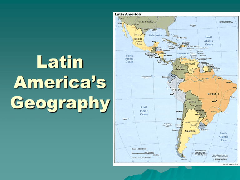
Latin America’s Geography Latin America starts with Mexico and runs all the way south. It includes 2 continents – part of North America and all of South America The part in North America is known as Central America or Middle America which goes from the Rio Grande to the Isthmus of Panama Rio Grande Isthmus of Panama Highlands La Cordillera start in the Rocky Mountains of the US, continue through the Sierra Madre of Mexico and extend through the Andes of South America Tierra Fria Literally meaning, “cold land,” this climate zone includes the areas that sit at least 6,000 ft. above sea level. http://faculty.evansville.edu/rl29/art105/sp04/art105-17.html http://www.uiowa.edu/~uiabroad/programs/Venezuela_summer/andes_photo.h Lowlands These are areas that are at or near sea level; they are usually near the coast and in some inland areas of South America Tierra Caliente Literally meaning, “Hot land,” this climate zone is found in places such as the Yucatan Peninsula and the Amazon River Basin http://www.theblisspages.com/travel/mexico.php http://www.nasa.gov/missions/earth/amazon_deforestation.html http://www.nasa.gov/vision/earth/lookingatearth/icesat_light.html Pampas The Pampas are also lowlands. They are grasslands that are located in Uruguay and Argentina http://www.nationalgeographic.com/wildworld/profiles/terrestrial/nt/nt080 6_pto.html http://au.encarta.msn.com/media_121642070_761574914_1_1/Pampas_Argentina.html http://www.condorjourneys-adventures.com/argentina_estancia.asp Tierra Templada These are areas that lie between 3,000 and 6,000 feet. This climate is in the valleys of the Andes and on the Central Plateau http://www.traveladventures.org/continents/southamerica/puentedelinca1.shtm http://www.blueplanetbiomes.org/andes.htm The Amazon River The Amazon River starts in the Andes Mountains and flows east across all of Brazil. It is the widest river in the world. http://www.votawphotography.com/photo/LatinAmerica/LatinAmerica3.htm http://www.defdesigns.com/Amazon.htm http://www.esa.int/esaEO/SEMDHU2VQUD_planet_1.html Around the river is the Amazon Rainforest, the largest in the world The Orinoco River The Orinoco River flows north through Venezuela and into the Caribbean Sea http://www.travellerspoint.com/photos/stream/photoID/195/users/cabezas/ http://www.galenfrysinger.com/venezeula.htm The Rio de la Plata Located on the border between Uruguay and Argentina, the Rio de la Plata is used as a major shipping route; “Plata” means “silver.” http://www.shunya.net/Pictures/Argentina/Argentina.htm http://disc.gsfc.nasa.gov/oceancolor/scifocus/oceanColor/black_water.shtml
