Information Sheet on Ramsar Wetlands (RIS)
advertisement
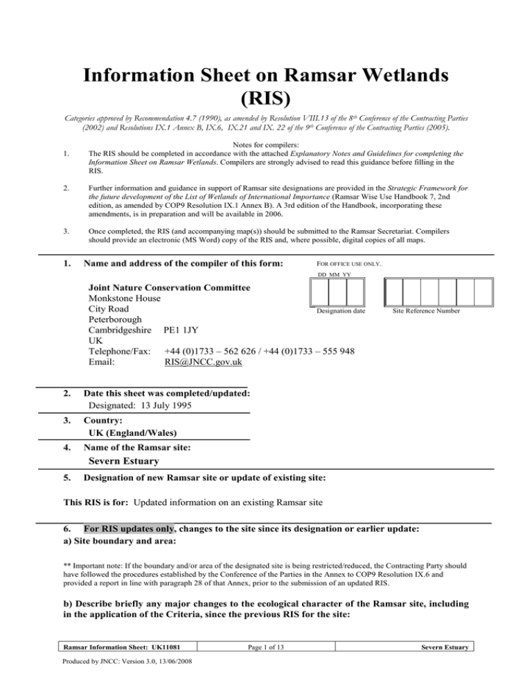
Information Sheet on Ramsar Wetlands (RIS) Categories approved by Recommendation 4.7 (1990), as amended by Resolution VIII.13 of the 8th Conference of the Contracting Parties (2002) and Resolutions IX.1 Annex B, IX.6, IX.21 and IX. 22 of the 9th Conference of the Contracting Parties (2005). 1. Notes for compilers: The RIS should be completed in accordance with the attached Explanatory Notes and Guidelines for completing the Information Sheet on Ramsar Wetlands. Compilers are strongly advised to read this guidance before filling in the RIS. 2. Further information and guidance in support of Ramsar site designations are provided in the Strategic Framework for the future development of the List of Wetlands of International Importance (Ramsar Wise Use Handbook 7, 2nd edition, as amended by COP9 Resolution IX.1 Annex B). A 3rd edition of the Handbook, incorporating these amendments, is in preparation and will be available in 2006. 3. Once completed, the RIS (and accompanying map(s)) should be submitted to the Ramsar Secretariat. Compilers should provide an electronic (MS Word) copy of the RIS and, where possible, digital copies of all maps. 1. Name and address of the compiler of this form: FOR OFFICE USE ONLY. DD MM YY Joint Nature Conservation Committee Monkstone House City Road Designation date Peterborough Cambridgeshire PE1 1JY UK Telephone/Fax: +44 (0)1733 – 562 626 / +44 (0)1733 – 555 948 Email: RIS@JNCC.gov.uk 2. Date this sheet was completed/updated: Designated: 13 July 1995 3. Country: UK (England/Wales) 4. Name of the Ramsar site: Site Reference Number Severn Estuary 5. Designation of new Ramsar site or update of existing site: This RIS is for: Updated information on an existing Ramsar site 6. For RIS updates only, changes to the site since its designation or earlier update: a) Site boundary and area: ** Important note: If the boundary and/or area of the designated site is being restricted/reduced, the Contracting Party should have followed the procedures established by the Conference of the Parties in the Annex to COP9 Resolution IX.6 and provided a report in line with paragraph 28 of that Annex, prior to the submission of an updated RIS. b) Describe briefly any major changes to the ecological character of the Ramsar site, including in the application of the Criteria, since the previous RIS for the site: Ramsar Information Sheet: UK11081 Produced by JNCC: Version 3.0, 13/06/2008 Page 1 of 13 Severn Estuary Information Sheet on Ramsar Wetlands (RIS), page 2 7. Map of site included: Refer to Annex III of the Explanatory Notes and Guidelines, for detailed guidance on provision of suitable maps, including digital maps. a) A map of the site, with clearly delineated boundaries, is included as: i) hard copy (required for inclusion of site in the Ramsar List): yes 9 -or- no ; ii) an electronic format (e.g. a JPEG or ArcView image) Yes iii) a GIS file providing geo-referenced site boundary vectors and attribute tables yes 9 -orno ; b) Describe briefly the type of boundary delineation applied: e.g. the boundary is the same as an existing protected area (nature reserve, national park etc.), or follows a catchment boundary, or follows a geopolitical boundary such as a local government jurisdiction, follows physical boundaries such as roads, follows the shoreline of a waterbody, etc. The site boundary is the same as, or falls within, an existing protected area. For precise boundary details, please refer to paper map provided at designation 8. Geographical coordinates (latitude/longitude): 51 13 29 N 03 02 57 W 9. General location: Include in which part of the country and which large administrative region(s), and the location of the nearest large town. Nearest town/city: Bristol In the south-west of the United Kingdom, between Wales and England Administrative region: Bro Morgannwg/ Vale of Glamorgan; Caerdydd/ Cardiff; Casnewydd/ Newport; Avon; City of Bristol; Fynwy/ Monmouthshire; Gloucestershire; Gwent; North Somerset; Somerset; South Glamorgan; South Gloucestershire 10. Elevation (average and/or max. & min.) (metres): 11. Min. -4 Max. 17 Mean 0 Area (hectares): 24662.98 12. General overview of the site: Provide a short paragraph giving a summary description of the principal ecological characteristics and importance of the wetland. The estuary's classic funnel shape, unique in Britain, is a factor causing the Severn to have the second-largest tidal range in the world (after the Bay of Fundy, Canada). This tidal regime results in plant and animal communities typical of the extreme physical conditions of liquid mud and tide swept sand and rock. The species-poor invertebrate community includes high densities of ragworms, lugworms and other invertebrates forming an important food source for passage and wintering waders. A further consequence of the large tidal range is the extensive intertidal zone, one of the largest in the UK, comprising mudflats, sand banks, shingle, and rocky platforms. Glassworts and annual sea-blite colonise the open mud, with beds of all three species of eelgrass Zostera occurring on more sheltered mud and sandbanks. Large expanses of common cord-grass also occur on the outer marshes. Heavily grazed saltmarsh fringes the estuary with a range of saltmarsh types present. The middle marsh sward is dominated by common saltmarsh-grass with typical associated species. In the upper marsh, red fescue and saltmarsh rush become more prominent. 13. Ramsar Criteria: Circle or underline each Criterion applied to the designation of the Ramsar site. See Annex II of the Explanatory Notes and Guidelines for the Criteria and guidelines for their application (adopted by Resolution VII.11). 1, 3, 4, 5, 6, 8 Ramsar Information Sheet: UK11081 Produced by JNCC: Version 3.0, 13/06/2008 Page 2 of 13 Severn Estuary Information Sheet on Ramsar Wetlands (RIS), page 3 14. Justification for the application of each Criterion listed in 13 above: Provide justification for each Criterion in turn, clearly identifying to which Criterion the justification applies (see Annex II for guidance on acceptable forms of justification). Ramsar criterion 1 Due to immense tidal range (second-largest in world), this affects both the physical environment and biological communities. Habitats Directive Annex I features present on the pSAC include: H1110 Sandbanks which are slightly covered by sea water all the time H1130 Estuaries H1140 Mudflats and sandflats not covered by seawater at low tide H1330 Atlantic salt meadows (Glauco-Puccinellietalia maritimae) Ramsar criterion 3 Due to unusual estuarine communities, reduced diversity and high productivity. Ramsar criterion 4 This site is important for the run of migratory fish between sea and river via estuary. Species include Salmon Salmo salar, sea trout S. trutta, sea lamprey Petromyzon marinus, river lamprey Lampetra fluviatilis, allis shad Alosa alosa, twaite shad A. fallax, and eel Anguilla anguilla. It is also of particular importance for migratory birds during spring and autumn. Ramsar criterion 8 The fish of the whole estuarine and river system is one of the most diverse in Britain, with over 110 species recorded. Salmon Salmo salar, sea trout S. trutta, sea lamprey Petromyzon marinus, river lamprey Lampetra fluviatilis, allis shad Alosa alosa, twaite shad A. fallax, and eel Anguilla anguilla use the Severn Estuary as a key migration route to their spawning grounds in the many tributaries that flow into the estuary. The site is important as a feeding and nursery ground for many fish species particularly allis shad Alosa alosa and twaite shad A. fallax which feed on mysid shrimps in the salt wedge. Ramsar criterion 5 Assemblages of international importance: Species with peak counts in winter: 70919 waterfowl (5 year peak mean 1998/99-2002/2003) Ramsar criterion 6 – species/populations occurring at levels of international importance. Qualifying Species/populations (as identified at designation): Ramsar Information Sheet: UK11081 Produced by JNCC: Version 3.0, 13/06/2008 Page 3 of 13 Severn Estuary Information Sheet on Ramsar Wetlands (RIS), page 4 Species with peak counts in winter: Tundra swan , Cygnus columbianus bewickii, NW Europe 229 individuals, representing an average of 2.8% of the GB population (5 year peak mean 1998/92002/3) Greater white-fronted goose , Anser albifrons 2076 individuals, representing an average of albifrons, NW Europe 35.8% of the GB population (5 year peak mean for 1996/7-2000/01) Common shelduck , Tadorna tadorna, NW 3223 individuals, representing an average of 1% Europe of the population (5 year peak mean 1998/92002/3) Gadwall , Anas strepera strepera, NW Europe 241 individuals, representing an average of 1.4% of the GB population (5 year peak mean 1998/92002/3) Dunlin , Calidris alpina alpina, W Siberia/W 25082 individuals, representing an average of Europe 1.8% of the population (5 year peak mean 1998/9-2002/3) Common redshank , Tringa totanus totanus, 2616 individuals, representing an average of 1% of the population (5 year peak mean 1998/92002/3) Species/populations identified subsequent to designation for possible future consideration under criterion 6. Species regularly supported during the breeding season: Lesser black-backed gull , Larus fuscus graellsii, 4167 apparently occupied nests, representing an W Europe/Mediterranean/W Africa average of 2.8% of the breeding population (Seabird 2000 Census) Species with peak counts in spring/autumn: Ringed plover , Charadrius hiaticula, 740 individuals, representing an average of 1% Europe/Northwest Africa of the population (5 year peak mean 1998/92002/3) Species with peak counts in winter: Eurasian teal , Anas crecca, NW Europe 4456 individuals, representing an average of 1.1% of the population (5 year peak mean 1998/9-2002/3) Northern pintail , Anas acuta, NW Europe 756 individuals, representing an average of 1.2% of the population (5 year peak mean 1998/92002/3) Contemporary data and information on waterbird trends at this site and their regional (sub-national) and national contexts can be found in the Wetland Bird Survey report, which is updated annually. See www.bto.org/survey/webs/webs-alerts-index.htm. See Sections 21/22 for details of noteworthy species Details of bird species occuring at levels of National importance are given in Section 22 15. Biogeography (required when Criteria 1 and/or 3 and /or certain applications of Criterion 2 are applied to the designation): Name the relevant biogeographic region that includes the Ramsar site, and identify the biogeographic regionalisation system that has been applied. a) biogeographic region: Atlantic b) biogeographic regionalisation scheme (include reference citation): Council Directive 92/43/EEC Ramsar Information Sheet: UK11081 Produced by JNCC: Version 3.0, 13/06/2008 Page 4 of 13 Severn Estuary Information Sheet on Ramsar Wetlands (RIS), page 5 16. Physical features of the site: Describe, as appropriate, the geology, geomorphology; origins - natural or artificial; hydrology; soil type; water quality; water depth, water permanence; fluctuations in water level; tidal variations; downstream area; general climate, etc. Soil & geology Geomorphology and landscape Nutrient status pH Salinity Soil Water permanence Summary of main climatic features alluvium, basic, biogenic reef, clay, cobble, gravel, limestone/chalk, mud, neutral, nutrient-rich, peat, sand, sandstone/mudstone, sedimentary, shingle cliffs, coastal, estuary, floodplain, intertidal rock, intertidal sediments (including sandflat/mudflat), islands, lowland, open coast (including bay), pools, subtidal rock (including rocky reefs), subtidal sediments (including sandbank/mudbank), tidal rapids eutrophic circumneutral brackish / mixosaline, saline / euhaline mainly mineral usually permanent Annual averages (Cardiff, 1971–2000) (www.metoffice.com/climate/uk/averages/19712000/sites /cardiff.html) Max. daily temperature: 14.3° C Min. daily temperature: 6.8° C Days of air frost: 33.0 Rainfall: 1111.7 mm Hrs. of sunshine: 1518.0 General description of the Physical Features: The Severn Estuary is a large estuary with extensive intertidal mudflats and sandflats, rocky platforms and islands. Saltmarsh fringes the coast backed by grazing marsh with freshwater ditches and occasional brackish ditches. The seabed is rock and gravel with subtidal sandbanks. The estuary's classic funnel shape, unique in the UK, is a factor causing the Severn to have the second-highest tidal range in the world. This tidal regime results in plant and animal communities typical of the extreme physical conditions of liquid mud and tideswept sand and rock. A further consequence of the large tidal range is an extensive intertidal zone, one of the largest in the UK. 17. Physical features of the catchment area: Describe the surface area, general geology and geomorphological features, general soil types, general land use, and climate (including climate type). The Severn Estuary is a large estuary with extensive intertidal mudflats and sandflats, rocky platforms and islands. Saltmarsh fringes the coast backed by grazing marsh with freshwater ditches and occasional brackish ditches. The seabed is rock and gravel with subtidal sandbanks. The estuary's classic funnel shape, unique in the UK, is a factor causing the Severn to have the secondhighest tidal range in the world. This tidal regime results in plant and animal communities typical of the extreme physical conditions of liquid mud and tide-swept sand and rock. A further consequence of the large tidal range is an extensive intertidal zone, one of the largest in the UK. 18. Hydrological values: Describe the functions and values of the wetland in groundwater recharge, flood control, sediment trapping, shoreline stabilization, etc. Shoreline stabilisation and dissipation of erosive forces, Sediment trapping Ramsar Information Sheet: UK11081 Produced by JNCC: Version 3.0, 13/06/2008 Page 5 of 13 Severn Estuary Information Sheet on Ramsar Wetlands (RIS), page 6 19. Wetland types: Inland wetland, Marine/coastal wetland Code G H D E Tp B F Name Tidal flats Salt marshes Rocky shores Sand / shingle shores (including dune systems) Freshwater marshes / pools: permanent Marine beds (e.g. sea grass beds) Estuarine waters % Area 84.1 4.7 4.7 4.4 1 0.9 0.2 20. General ecological features: Provide further description, as appropriate, of the main habitats, vegetation types, plant and animal communities present in the Ramsar site, and the ecosystem services of the site and the benefits derived from them. The large tidal range leads to strong tidal streams and high turbidity, producing communities characteristic of the extreme physical conditions of liquid mud and tide-swept sand and rock. Broad intertidal flats with areas of unstable sand and muddy flats support high densities of invertebrates. Intertidal rock platforms support a wide variety of invertebrate species. There are large areas of subtidal sand, rock and gravel with a variety of aquatic estuarine communities including Sabellaria alveolata reef. Areas of saltmarsh fringe the estuary, mostly grazed with a range of vegetation communities. There are gradual and stepped transitions between bare mudflat to upper marsh and grassland. Main vegetation types are: upper saltmarsh with Festuca rubra and Juncus gerardii; middle marsh dominated by Puccinellia maritima with Glaux maritima and Triglochin maritima; dense monocultures of Spartina anglica at the edge of the mudflats-brackish pools and depressions with Phragmites australis and Bolboschoenus maritimus. Ecosystem services 21. Noteworthy flora: Provide additional information on particular species and why they are noteworthy (expanding as necessary on information provided in 12. Justification for the application of the Criteria) indicating, e.g. which species/communities are unique, rare, endangered or biogeographically important, etc. Do not include here taxonomic lists of species present – these may be supplied as supplementary information to the RIS. Nationally important species occurring on the site. Higher Plants. Aster linosyris (nationally rare), Alopecurus bulbosus, Althaea officinalis, Bupleurum tenuissimum, Hordeum marinum, Lepidium latifolium, Petroselinum segetum, Puccinellia rupestris, Trifolium squamosum, Zostera marina/angustifolia, Zostera noltei (all nationally scarce) 22. Noteworthy fauna: Provide additional information on particular species and why they are noteworthy (expanding as necessary on information provided in 12. Justification for the application of the Criteria) indicating, e.g. which species/communities are unique, rare, endangered or biogeographically important, etc., including count data. Do not include here taxonomic lists of species present – these may be supplied as supplementary information to the RIS. Birds Species currently occurring at levels of national importance: Species regularly supported during the breeding season: Herring gull , Larus argentatus argentatus, NW 1540 apparently occupied nests, representing an Europe and Iceland/W Europe ) average of 1.1% of the GB population (Seabird 2000 Census) Species with peak counts in spring/autumn: Ramsar Information Sheet: UK11081 Produced by JNCC: Version 3.0, 13/06/2008 Page 6 of 13 Severn Estuary Information Sheet on Ramsar Wetlands (RIS), page 7 Little egret , Egretta garzetta, West Mediterranean Ruff , Philomachus pugnax, Europe/W Africa Whimbrel , Numenius phaeopus, Europe/Western Africa Eurasian curlew , Numenius arquata arquata, N. a. arquata Europe (breeding) Common greenshank , Tringa nebularia, Europe/W Africa 17 individuals, representing an average of 1% of the GB population (5 year peak mean 1998/92002/3) 12 individuals, representing an average of 1.7% of the GB population (5 year peak mean 1998/92002/3) 333 individuals, representing an average of 11.1% of the GB population (5 year peak mean 1998/92002/3 - spring peak) 2021 individuals, representing an average of 1.3% of the GB population (5 year peak mean 1998/92002/3) 26 individuals, representing an average of 4.3% of the GB population (5 year peak mean 1998/92002/3) Species with peak counts in winter: Eurasian wigeon , Anas penelope, NW Europe Northern shoveler , Anas clypeata, NW & C Europe Common pochard , Aythya ferina, NE & NW Europe Water rail , Rallus aquaticus, Europe Spotted redshank , Tringa erythropus, Europe/W Africa 4658 individuals, representing an average of 1.1% of the GB population (5 year peak mean 1998/92002/3) 297 individuals, representing an average of 2% of the GB population (5 year peak mean 1998/92002/3) 1118 individuals, representing an average of 1.8% of the GB population (5 year peak mean 1998/92002/3) 11 individuals, representing an average of 2.4% of the GB population (5 year peak mean 1998/92002/3) 10 individuals, representing an average of 7.3% of the GB population (5 year peak mean 1998/92002/3) Species Information Species occurring at levels of international importance on the site. Fish. Alosa alosa (IUCN Red data book – threatened; Habitats Directive Annex II, Annex V (S1102)), Alosa fallax (IUCN Red data book – threatened; Habitats Directive Annex II, Annex V (S1103)) Lampetra fluviatilis (IUCN Red data book – threatened; Habitats Directive Annex II (S1099)), Petromyzon marinus (Habitats Directive Annex II (S1095)) Nationally important species occurring on the site. Invertebrates. Tenellia adspersa (nationally rare); Corophium lacustre (nationally scarce); Gammarus insensibilis (nationally scarce) 23. Social and cultural values: Describe if the site has any general social and/or cultural values e.g. fisheries production, forestry, religious importance, archaeological sites, social relations with the wetland, etc. Distinguish between historical/archaeological/religious significance and current socio-economic values. Aesthetic Archaeological/historical site Environmental education/ interpretation Ramsar Information Sheet: UK11081 Produced by JNCC: Version 3.0, 13/06/2008 Page 7 of 13 Severn Estuary Information Sheet on Ramsar Wetlands (RIS), page 8 Fisheries production Livestock grazing Non-consumptive recreation Scientific research Sport fishing Sport hunting Tourism Traditional cultural Transportation/navigation b) Is the site considered of international importance for holding, in addition to relevant ecological values, examples of significant cultural values, whether material or non-material, linked to its origin, conservation and/or ecological functioning? No If Yes, describe this importance under one or more of the following categories: i) sites which provide a model of wetland wise use, demonstrating the application of traditional knowledge and methods of management and use that maintain the ecological character of the wetland: ii) sites which have exceptional cultural traditions or records of former civilizations that have influenced the ecological character of the wetland: iii) sites where the ecological character of the wetland depends on the interaction with local communities or indigenous peoples: iv) sites where relevant non-material values such as sacred sites are present and their existence is strongly linked with the maintenance of the ecological character of the wetland: 24. Land tenure/ownership: Ownership category Non-governmental organisation (NGO) Local authority, municipality etc. National/Crown Estate Private Public/communal Other On-site + Off-site + + + + + + + + + 25. Current land (including water) use: Activity Nature conservation Tourism Recreation Current scientific research Fishing: commercial Fishing: recreational/sport Gathering of shellfish Bait collection Arable agriculture (unspecified) Grazing (unspecified) Permanent pastoral agriculture Ramsar Information Sheet: UK11081 Produced by JNCC: Version 3.0, 13/06/2008 On-site + + + + + + + + + Off-site + + + + + + + + + Page 8 of 13 Severn Estuary Information Sheet on Ramsar Wetlands (RIS), page 9 Hunting: recreational/sport Industrial water supply Industry Sewage treatment/disposal Harbour/port Flood control Mineral exploration (excl. hydrocarbons) Mining/quarrying Transport route Urban development Military activities + + + + + + + + + + + + + + + + + + + + 26. Factors (past, present or potential) adversely affecting the site’s ecological character, including changes in land (including water) use and development projects: Explanation of reporting category: 1. Those factors that are still operating, but it is unclear if they are under control, as there is a lag in showing the management or regulatory regime to be successful. 2. Those factors that are not currently being managed, or where the regulatory regime appears to have been ineffective so far. 1 1 1 + + + + Major Impact? Off-Site Dredging Erosion Recreational/tourism disturbance (unspecified) Description of the problem (Newly reported Factors only) On-Site Adverse Factor Category Reporting Category NA = Not Applicable because no factors have been reported. + + + For category 2 factors only. What measures have been taken / are planned / regulatory processes invoked, to mitigate the effect of these factors? Is the site subject to adverse ecological change? NO 27. Conservation measures taken: List national category and legal status of protected areas, including boundary relationships with the Ramsar site; management practices; whether an officially approved management plan exists and whether it is being implemented. Conservation measure Site/ Area of Special Scientific Interest (SSSI/ASSI) Ramsar Information Sheet: UK11081 Produced by JNCC: Version 3.0, 13/06/2008 On-site + Page 9 of 13 Off-site + Severn Estuary Information Sheet on Ramsar Wetlands (RIS), page 10 National Nature Reserve (NNR) Special Protection Area (SPA) Land owned by a non-governmental organisation for nature conservation Management agreement Site management statement/plan implemented Other Management plan in preparation + + + + + + + + + + b) Describe any other current management practices: The management of Ramsar sites in the UK is determined by either a formal management plan or through other management planning processes, and is overseen by the relevant statutory conservation agency. Details of the precise management practises are given in these documents. 28. Conservation measures proposed but not yet implemented: e.g. management plan in preparation; official proposal as a legally protected area, etc. No information available 29. Current scientific research and facilities: e.g. details of current research projects, including biodiversity monitoring; existence of a field research station, etc. Contemporary. Fauna. Numbers of migratory and wintering wildfowl and waders are monitored annually as part of the national Wetland Birds Survey (WeBS) organised by the British Trust for Ornithology, Wildfowl & Wetlands Trust, the Royal Society for the Protection of Birds and the Joint Nature Conservation Committee. Wildfowl shooting monitoring. Returns received annually from Wildfowling Clubs. Completed. Flora and Fauna. CCW/EN Marine Intertidal Phase 1 survey of the biotopes of the Severn Estuary in 2003/4 BTO Research report 335 for CCW/EN (November 2003). Low tide distribution of waterbirds of Severn Estuary SPA. Results of 2002/03 WeBS low tide counts and a historical analysis (Burton et al. 2003). WWT Wetlands Advisory Service. Report for CCW (April 2003). Baseline bird monitoring of the River Severn. Joint Nature Conservation Committee (1997) Subtidal biotope survey at mouth of the River Parrett. Joint Nature Conservation Committee (1997) Upper estuary intertidal rocky shore survey. Mettam, C (1997) Biotopes in the subtidal sandbanks of the Severn estuary. Report to English Nature 30. Current communications, education and public awareness (CEPA) activities related to or benefiting the site: e.g. visitor centre, observation hides and nature trails, information booklets, facilities for school visits, etc. There are fixed interpretation panels and hides at Bridgwater Bay, Newport Wetlands Reserve, Flat Holm LNR and field centre. Interpretation boards at Black Rock. 31. Current recreation and tourism: State if the wetland is used for recreation/tourism; indicate type(s) and their frequency/intensity. Activities, Facilities provided and Seasonality. Walking, dog walking, and birdwatching are concentrated along the sea walls all the year round and on the saltmarsh and sandy beaches. Bathing, beach recreation, including sand yachting and wind surfing are practised on the sandy beaches, mainly in the summer. Ramsar Information Sheet: UK11081 Produced by JNCC: Version 3.0, 13/06/2008 Page 10 of 13 Severn Estuary Information Sheet on Ramsar Wetlands (RIS), page 11 There are boat clubs/marinas in the sub-estuaries with sailing, motor boats, and jet skiing. Angling is carried out from the shore and small boats. There is a certain amount of bait digging. Wildfowling is carried out from September to February all around the Estuary; consents and further management measures are being addressed. There are agreed refuge areas for the birds. 32. Jurisdiction: Include territorial, e.g. state/region, and functional/sectoral, e.g. Dept. of Agriculture/Dept. of Environment, etc. Head, Natura 2000 and Ramsar Team, Department for Environment, Food and Rural Affairs, European Wildlife Division, Zone 1/07, Temple Quay House, 2 The Square, Temple Quay, Bristol, BS1 6EB Head, Countryside Division, Welsh Assembly Government, Cathays Park, Cardiff, CF1 3NQ 33. Management authority: Provide the name and address of the local office(s) of the agency(ies) or organisation(s) directly responsible for managing the wetland. Wherever possible provide also the title and/or name of the person or persons in this office with responsibility for the wetland. Site Designations Manager, English Nature, Sites and Surveillance Team, Northminster House, Northminster Road, Peterborough, PE1 1UA, UK / Site Safeguard Officer, International Designations, Countryside Council for Wales, Maes-y-Ffynnon, Penrhosgarnedd, Bangor, Gwynedd, LL57 2DW 34. Bibliographical references: Scientific/technical references only. If biogeographic regionalisation scheme applied (see 15 above), list full reference citation for the scheme. Site-relevant references Association of Severn Estuary Relevant Authorities (2003) Severn Estuary European Marine Site. Foundation document for the management scheme. Association of Severn Estuary Relevant Authorities. www.severnestuary.net/asera/pubs/Final%20version.doc Association of Severn Estuary Relevant Authorities (2003) Severn Estuary European Marine Site. Management scheme. Association of Severn Estuary Relevant Authorities. www.severnestuary.net/asera/pubs/Final%20version.doc Barne, JH, Robson, CF, Kaznowska, SS, Doody, JP, Davidson, NC & Buck, AL (eds.) (1996) Coasts and seas of the United Kingdom. Region 11. The Western Approaches: Falmouth Bay to Kenfig. Joint Nature Conservation Committee, Peterborough. (Coastal Directories Series.) Bratton, JH (ed.) (1991) British Red Data Books: 3. Invertebrates other than insects. Joint Nature Conservation Committee, Peterborough Bratton, JH (2002) Aquatic invertebrates recorded in the Gwent levels: introduction, checklist and bibliography. CCW Natural Science Report, No. 02/5/2 Buck, AL (ed.) (1993) An inventory of UK estuaries. Volume 2. South-west Britain. Joint Nature Conservation Committee, Peterborough Burd, F (1989) The saltmarsh survey of Great Britain. An inventory of British saltmarshes. Nature Conservancy Council, Peterborough (Research & Survey in Nature Conservation, No. 17) Burton, NHK, Marchant, JH, Musgrove, AJ, Armitage, MJS, Holloway, SJ & Phillips, J (2003) Low-tide distributions of waterbirds on the Severn Estuary SPA: results of the 2002/03 WeBS Low Tide Counts and a historical analysis. British Trust for Ornithology, Thetford (BTO Research Report, No. 335) Countryside Council for Wales (1993) Welsh estuaries review. Countryside Council for Wales, Bangor Countryside Council for Wales (2004) CCW Phase 1 Intertidal Survey dataset (unpublished data) Cranswick, PA, Waters, RJ, Musgrove, AJ & Pollitt, MS (1997) The Wetland Bird Survey 1995–96: wildfowl and wader counts. British Trust for Ornithology, Wildfowl and Wetlands Trust, Royal Society for the Protection of Birds & Joint Nature Conservation Committee, Slimbridge Crowther, PR (ed.) (1992) The coast of Avon. Proceedings of the Bristol Naturalists' Society, 50 (Special issue, No. 3) Dargie, T (1999) NVC survey of saltmarsh habitat in the Severn estuary 1998. Final report to the Countryside Council for Wales and English Nature. CCW Contract Science Report, No. 341 Dargie, T (1999) Scarce plants survey of saltmarsh on the Welsh side of the Severn estuary. CCW Contract Science Report, No. 367 Dargie, T (2000) Description of the Severn estuary survey sectors identified in the 1998 NVC survey. CCW Contract Science Report, No. 399 Ramsar Information Sheet: UK11081 Produced by JNCC: Version 3.0, 13/06/2008 Page 11 of 13 Severn Estuary Information Sheet on Ramsar Wetlands (RIS), page 12 Davies, J (1998) Chapter 9. Bristol Channel and approaches (Cape Cornwall to Cwm yr Eglwys, Newport Bay) (MNCR Sector 9). In: Benthic marine ecosystems of Great Britain and the north-east Atlantic, ed. by K. Hiscock, 255-295. Joint Nature Conservation Committee, Peterborough. (Coasts and Seas of the United Kingdom. MNCR series) English Nature (1996) The scientific interest of the Severn Estuary/Môr Hafren pSAC. English Nature, Peterborough English Nature (1998) Bridgwater Bay National Nature Reserve Management Plan. English Nature, Somerset Team, Taunton English Nature & Countryside Council for Wales (2003) English Nature & the Countryside Council for Wales' draft advice for the Severn Estuary Special Protection Area given under Regulation 33(2) of the Conservation (Natural Habitats &c.) Regulations 1994. Consultation draft. English Nature, Peterborough. www.englishnature.gov.uk/pubs/publication/PDF/SPAandmaps.pdf Environment Agency (2004) Gwent Levels Foreshore Management Plan. Holistic analysis of foreshore evolution scheme and monitoring options, Phase 3 final report, AK4065.500/DGO8. Environment Agency Wales Ferns, PN (n.d.[1978]) The Severn estuary. A heritage of wildlife. Severn Estuary Conservation Group Ferns, PN (1984) Birds of the Bristol Channel and Severn estuary. Marine Pollution Bulletin, 15(2), 76-81 Ferns, PN (1994) The Severn estuary’s changing shorebird population during the last two decades. Biological Journal of the Linnaean Society, 51, 219-227 Ferns, PN, Green, GH & Round, PD (1979) Significance of the Somerset and Gwent Levels in Britain as feeding areas for migrant whimbrels Numenius phaeopus. Biological Conservation, 16(1), 17-22 Fowles, A (1994) Invertebrates of Wales: a review of important sites and species. Joint Nature Conservation Committee, Peterborough Gifford Associated Consultants (on behalf of the Severn Estuary Coastal Group) (2000) Severn Estuary Shoreline Management Plan. English Nature Goodger, B (2005) Mapping locations of non-breeding birds on the Welsh section of the Severn estuary SSSI, Ramsar site, SPA and cSAC. (Contractor: Just Ecology, Berkeley). Unpublished report to Countryside Council for Wales Halcrow (on behalf of the North Devon and Somerset Coastal Group) (1998) Bridgwater to Bideford Bay Shoreline Management Plan. English Nature Holbrook, A (1992) The Severn Barrage: a bibliography 1909–1991. 2nd edn. Bath University Library Jones, PS, Stevens, DP, Blackstock, TH, Burrows, CR & Howe, EA (eds.) (2003) Priority habitats of Wales: a technical guide. Countryside Council for Wales, Bangor Lacambra, C, Cutts, N, Allen, J, Burd, F & Elliott, M (2004) Spartina anglica: a review of its status, dynamics and management. English Nature Research Reports, No. 527. www.english-nature.org.uk/pubs/publication/PDF/527.pdf Langston, WJ, Chesman, BS, Burt, GR, Hawkins, SJ, Readman, J & Worsfield, P (2003) Characterisation of the South West European Marine Sites: The Severn Estuary (possible) Special Area of Conservation, Special Protection Area. Marine Biological Association of the United Kingdom, Plymouth (Occasional publication, No. 13) www.mba.ac.uk/nmbl/publications/occasionalpub13.htm Little, C, Wilson, RS, Hinton, RG & Morritt, D (1985) Ecology of the upper Severn estuary. Nature Conservancy Council, CSD Reports, No. 604 Lovell, MA & Mettam, C (1991) Severn tidal power. Intertidal sediments and fauna: 1, Distribution of shore birds and their invertebrate prey; 2, Collated bibliography of macroinvertebrates from intertidal sediments. United Kingdom Atomic Energy Authority (UKAEA), Didcot McLeod, CR, Yeo, M, Brown, AE, Burn, AJ, Hopkins, JJ & Way, SF (eds.) (2004) The Habitats Directive: selection of Special Areas of Conservation in the UK. 2nd edn. Joint Nature Conservation Committee, Peterborough. www.jncc.gov.uk/SACselection Mettam, C (1997) Biotopes in the subtidal sandbanks of the Severn estuary. Report to English Nature Milton, T & Dargie, T (2000) Severn estuary: evaluation of CASI and digital salt marsh survey information. (Contractor: University of Southampton, GeoData Institute). Unpublished report to English Nature. Moore, J, Smith, J, Northen, KO & Little, M (1998) Marine Nature Conservation Review Sector 9. Inlets in the Bristol Channel and approaches: area summaries. Joint Nature Conservation Committee, Peterborough (Coasts and seas of the United Kingdom. MNCR series) Morley, JV (1992) The birds of Bridgwater Bay. Unpublished, English Nature Musgrove, AJ, Langston, RHW, Baker, H & Ward, RM (eds.) (2003) Estuarine waterbirds at low tide. The WeBS Low Tide Counts 1992–93 to 1998–99. WSG/BTO/WWT/RSPB/JNCC, Thetford (International Wader Studies, No. 16) Musgrove, AJ, Pollitt, MS, Hall, C, Hearn, RD, Holloway, SJ, Marshall, PE, Robinson, JA & Cranswick, PA (2001) The Wetland Bird Survey 1999–2000: wildfowl and wader counts. British Trust for Ornithology, Wildfowl and Wetlands Trust, Royal Society for the Protection of Birds & Joint Nature Conservation Committee, Slimbridge. www.wwt.org.uk/publications/default.asp?PubID=14 Ramsar Information Sheet: UK11081 Produced by JNCC: Version 3.0, 13/06/2008 Page 12 of 13 Severn Estuary Information Sheet on Ramsar Wetlands (RIS), page 13 Otto, S (1996) A scientific bibliography of the Bristol Channel and Severn estuary. Kimberley Services, Reading (Publication No. 96/2) Palmer, M & Probert, K (1981) Natural environment of the Severn estuary and Bristol Channel area. Nature Conservancy Council, Information and Library Services, Banbury (Bibliography Series, No. 4) Potts, GW & Swaby, SE (1993) Review of the status of estuarine fishes. English Nature Research Reports, No. 34 Ratcliffe, DA (ed.) (1977) A Nature Conservation Review. The selection of biological sites of national importance to nature conservation in Britain. Cambridge University Press (for the Natural Environment Research Council and the Nature Conservancy Council), Cambridge (2 vols.) Severn Estuary Partnership (2003) Severn Estuary Gateway site. www.severnestuary.net Stewart, A, Pearman, DA & Preston, CD (eds.) (1994) Scarce plants in Britain. Joint Nature Conservation Committee, Peterborough Stroud, DA, Chambers, D, Cook, S, Buxton, N, Fraser, B, Clement, P, Lewis, P, McLean, I, Baker, H & Whitehead, S (eds.) (2001) The UK SPA network: its scope and content. Joint Nature Conservation Committee, Peterborough (3 vols.) www.jncc.gov.uk/UKSPA/default.htm Ward, R, Marshall, P & Woodward, R (2003) Baseline bird monitoring of the River Severn. (Contractor: WWT Wetlands Advisory Service, Slimbridge.) CCW Contract Science Report, No. 582 Weighell, AJ, Donnelly, AP & Calder, K (eds.) (2000) Directory of the Celtic coasts and seas. Joint Nature Conservation Committee, Peterborough Please return to: Ramsar Secretariat, Rue Mauverney 28, CH-1196 Gland, Switzerland Telephone: +41 22 999 0170 • Fax: +41 22 999 0169 • email: ramsar@ramsar.org Ramsar Information Sheet: UK11081 Produced by JNCC: Version 3.0, 13/06/2008 Page 13 of 13 Severn Estuary
