DANUBE DELTA (ROMANIA) EUROSION Case Study
advertisement
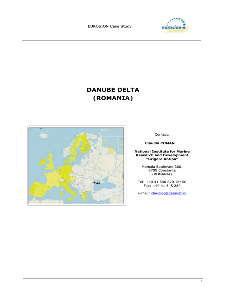
EUROSION Case Study DANUBE DELTA (ROMANIA) Contact: Claudia COMAN National Institute for Marine Research and Development “Grigore Antipa” Mamaia Boulevard 300, 8700 Constanta (ROMANIA) 44 Tel: +40 41 540 870 int 50 Fax: +40 41 545 280 e-mail: claudiac@datanet.ro 1 EUROSION Case Study 1. GENERAL DESCRIPTION OF THE AREA The Danube Delta is located the northern sector of Romania, just on the northwest limit of the Black Sea. Its coastline is almost 240km long, of which about 75km represents the coastline of Kilia Distributary Delta (Ukraine) and 165km comprising the Sulina section, the Sfântu Gheorghe distributary delta and lagoon complex Razim-Sinoie (Romanian territory). Fig. 1: Location map of the Danube Delta Biosphere Reserve, Tulcea County, Romania. 1.1. Physical process level 1.1.1 ! ! ! Classification General: sandy beach barriers, deltaic origin CORINE: beaches Coastal guide: delta plain The Danube Delta consists of a fluvial zone characterised by sandy levees and densely vegetated lakes, a transitional zone, and a marine zone, dominated by dune and barrier beach complexes. 1.1.2 Geology The deltaic conditions originate from the Quaternary. The oldest deposits in the area belong to Devonian and Silurian and due to their peculiarities belong mainly to the surface layer (see Figure 2). Surface layer deposits were constituted in four sedimentation cycles: Silurian-Carboniferous, Permian-Triassic, Jurassic-Cretaceous and Sarmatian-Romanian. The Quaternary depositions are characterised by red clay followed by a succession of gravels and argillaceous pellites. Deltaic deposits include several lithological complexes. 2 EUROSION Case Study Fig. 2: Stages in the evolution of the Danube Delta. The deltaic shelf basement is composed of metamorphic, magmatic and sedimentary rocks, belonging to the Northern-Dobrudja orogen. South Capidava-Ovidiu the basement is formed by the Moesian Platform, which consists of green schist, quartz sandstone, fine greywacke. Cretaceous and Palaeocene deposits compose the strata corresponding to the prolongation of the North-Dobrudja orogen. During the Quaternary, the sedimentation process continued, influenced by recurrent sea level oscillations, which emerged the shelf in different degrees. 1.1.3 Morphology The shore between Sulina and Sfântu Gheorghe is part of the unique delta sector situated between two river branches, The interdistributary shore shows various different forms, generated by different processes. The shore between Ciotica and Periteasca consists of an alternation of dunes ridges (height 0.5-1.0 m) and flat sectors between them. Between Periteasca and Edighiol the shoreline presents more simplified profiles, dunes are absent but well developed washover fans are present. Orientation is given by the direction of the main surges ENE-WSW. Distribution of these processes resulted in a change of the shoreline configuration in the last 150 years, from a quasi-convex, through a longitudinal profile to a linear-concave one. The southern limit of the studied zone is Midia Cape (green schist formation), which is characterized by the presence of Buhaz swamps. The foreshore has the form of a quasi-horizontal step, dipping slightly seaward, generally with a single ridge, at small depths -0.5 to -1.0m. Significant changes of the foreshore occur during storms, when, with no exception, volume variations are positive. Bars and through 3 EUROSION Case Study systems are a highly variable, a system with two bars being distinct on the shores Sulina, South of Sfântu Gheorghe, Chituc and many bars, 3 to 5 bars, on the accumulative shore Periteasca and South of Sahalin island. The ridge of the first submerged bar could be found at -0.8 to-1.5m depth, and the secondary one (active during storms) up to -2.5 to - 3.0m (see Figure 3). Fig. 3: Bathymetric profile of the Sf. Gheorghe sector. Fig. 4: Nearshore bathymetry of the Danube delta coast. 4 EUROSION Case Study 1.1.4 Physical processes Wind Northerly winds are strongly prevalent on the Delta’s littoral. A general tendency of the wind to rotate clockwise is noticeable, which pushes western winds into the north sector. The intensity of eolian processes is higher during the warm season when, due to increased temperatures, decreased humidity and nebulosity, intensification of wind at noon, the sand is dried and displaced in significant quantities. Sea level rise Wind-induced deformations of the sea surface are important for the present evolution of the deltaic shore. These short-term variations have high amplitudes, are frequent and are generated by the air pressure on sea surface causing the superficial water to follow their direction (wind drift). As a direct consequence, the winds blowing from the sea will push the water masses to the shore leading to maximum sea levels and opposite, winds blowing from the land will push water masses seaward causing minimum sea levels at the shoreline. Sea surface deformations in different zones are influenced by coast orientation and morphology. The sea level change over the last two centuries have been evaluated by various authors, leading to different interpretations. I. Gh. Miricã considers a 40cm rise in time interval 1880-1961. A. C. Banu points out a 29cm rise since 1856 until 1933. Archaeological data suggest a 20cm rise of the sea level in the last century and O. Selariu indicates +25.95cm/100 years at Constanta and 33.90cm/100 years for Sulina (see Figure 5). Fig. 5: Sea level oscillation at Constanta station (cf. PSMSL) 5 EUROSION Case Study 1.1.5 Erosion Erosion type Hydro-technical works built on the Danube and tributaries have resulted in serious decrease of Danube sediment load with negative consequences on the littoral sediment balance. Since 1858 until 1988 the flow volume increased from 178 to 203 km3/yr, but the sediment load decreases from 65 millions to 38 millions tones/yr. Prevalent drift direction alongshore is north to south and the quantity of the transport is 1.2 million tones/yr. The longshore transport is controlled by the Sulina jetties (8km long) which are breaking the southward longshore drift (see Figure 6). The Sulina jetties deplete the southern littoral cell of sediment, because the sediment input is by carried offshore, away from the shoreline. Accelerated erosion was recorded between 1962 and 1985, followed by moderate erosion until 2000. From the total length of Danube Delta Biosphere Reserve littoral, as much as 57% are eroded, 36% are under accretion and 7% shows a relatively constancy. Maximum shore retreating distance was 145m in the case of Sulina - Sf. Gheorghe sector and maximum accretion was of 101m distance near Sulina branch outlet. Fig. 6: Longshore sediment transport model for Danube delta coast. Rates and sink volumes are given in 103 m3/yr. 6 EUROSION Case Study Erosion cause Erosion is caused by the shortage in Danube sediment supply due to hydrotechnical works along the tributaries and the influence of the Sulina distributary jetties. Natural causes are represented by sea level rise (1.3mm/yr) and severe storms effect. Accretion around river mouths is accompanied by intensive erosion processes and accelerated regressive translocation of the deltaic, sandy barriers, was kept responsible for morphological profiles simplification. 1.2 Socio-economic aspects 1.2.1 Population rate In 1966 a total of 20,421 inhabitants were registered in the zone. After 1966 (particularly after the years 1968–1970) the delta population decreases. 1.2.2 Major functions of the coastal zone ! ! ! ! ! Agriculture and forestry: are the most important land uses. The farmland covers an area of 61,453 ha, of arable land and natural meadows. Since 1975 these areas have been extended and have replaced the humid inundation zones through damming and draining. Forests cover a surface area of 18,800ha, 836.7ha in the Danube meadow, 11,613ha in the fluvial delta and 6,308.4ha in the fluvial maritime-delta. Breeding is favoured by the natural and climate conditions. The breeding is completely free during the entire year or protected by some precarious reed curtains during winter. The free stalling in semi-wilderness is still frequent for bovina and horses. Nature conservation: the Danube Delta was declared a biosphere reserve in 1990. It covers an area of 46,403ha. According to the provisions of the Law No. 82/1993 the Danube Delta Biosphere Reserve, as an important national and international ecological zone, consists of the Danube Delta, the Saraturile MurighiolPlopu, the Razim-Sinoie lagoon complex area, the maritime Danube as far as Cotul Pisicii, the sector Isaccea-Tulcea with its inundation zone, and the Black Sea coast from the Chilia Branch to Cape Midia. The inland marine waters and the territorial sea as far as the -20m isobath are included in the biosphere reserve. Fisheries and aquaculture: the fresh water fishing resources are found in the 170,000-270,000ha of waters in the Danube Delta Biosphere Reserve. 112,000 ha are permanent waters, the remainder can be flooded with varying size and length. The marine fishing resources are spread over about 113,000ha of the Black Sea, which are part of the reserve. The level of the fishing resources depends on the intensity of fish migration towards the shore. Industry and Harbours: since ancient times, the harbours in the Danube are important for the economic activity of Romania. On the territory of the reserve and its conterminous zone are the fluvial-maritime harbours of Sulina and Tulcea . Tourism and recreation: the Danube Delta can meet various internal and international touristic demands from spring to autumn, owing to its favourable climate as well as to its rich fauna and flora. The touristic potential of the area is large. 7 EUROSION Case Study 1.2.3 Land use Table 1: Land use In the DDBR. Total DDBR 580,000 ha 100 % I Strictly protected areas 50,600 ha 8.7 % II Total Buffering zones of which marine buffering zones 223,300 ha 38.5 % III Total Economic zones of which agricultural polders 306,100 ha (103,000 ha) (14.2 %) (39,567 ha) (12.9 %) (6,442 ha) (2.1 %) ecological (27,243 ha) (8.9) hydrological (11,425 ha) (3.7 %) (178,032 ha) (58.2 %) silviculture built-up areas, private and official properties (Act 18/1991) other uses conditions 1.2.4 in for free 52.8 % (43,391 ha) fish ponds zones proposed rehabilitation (46.1 %) Assessment at capital at risk Information on this topic is not available 8 EUROSION Case Study 2. PROBLEM DESCRIPTION 2.1 Eroding sites Fig. 7: Sulina – Sfantu Gheorghe coast afferent to Danube Delta. 9 EUROSION Case Study Eroding sites from North to South of the studied area. ! Sulina to Sf. Gheorghe: see Figure 7 for locations. ! Deltaic barrier (R53-P18) is vulnerable to any marine energetic input. The mean height (0.5-1.0m) of the barrier allows mean and high waves to transport the sand over the dune's ridge and to deposit it, in the form of small overlapped wash-over fans on the deltaic muds and reed deposits. This mechanism pushes the deltaic barrier continuously westward. The structure of the deltaic barriers, with retreat rhythms 10m/yr, sometimes records total absence of sandy forms, so there is direct contact between the sea and reedy marsh (see Table 2). Table 2: Erosion rates From Sulina to Sf. Gheorghe. 1962-1979 1979-1997 (m/year) (m/year) Ghiol Buival (6,5) -4,4 -4,5 Gârla Împuţita (8,7) -6 -6,6 Sud Gârla Împuţita (9,5) -13,8 -11 Canal Sonda (10,2) -18,8 -15,5 Nord Japşa lui Matei (12) -9,5 -13 Location-distance Sulina (km) from Japşa lui Matei (16) -15,2 -9,5 Grindul Cerbului (17,5) -15 -8 ! Sandy barrier (R49-R53). Annual rates of shoreline withdrawal of 15-10-7 m/yr characterise the very simple morphological structure, where very large wash-over fans play a relevant role. The fans are periodically re- consolidated during storms and an impressive volume of sand is deposited here. The large, consolidate dunes occur after a period without sever storms, in the form of short belts prolonging the sand bank from Saraturile field (see Table 3). Table 3: Erosion rates in the Grindul-Cerbului sector (R49-R53). 1962-1972 1972-1979 1962-1979 1979-2000 (m/year) (m/year) (m/year) (m/year) R53 -18,2 -8 -14 -5,5 Câşla Vădanei -16,7 -10 -14 -5,2 R51 -12,5 -4 -8 -4,7 R50 +6 -2 +2,7 ? Landmark 2 km S R50 -1,2 +11,4 +4 ? R49 -6 +4,2 +3,6 -1,8 ! Sfântu Gheorghe: see Figure 8 for locations. ! Barrier Island Sakhalin is a lateral curved bar, situated in front of the river mouth. The island is continuously increasing in length, and at the same time migrating onshore by overwashing. 10 EUROSION Case Study ! Sfântu Gheorghe is an equilibrium shore. The quiet conditions of this shore are due to the presence of the Sakhalin Island, which shadows Sf. Gheorghe’s coast. Distance between landmark R-CSA 47 increased from 55m in 1962 to 460m in 1999. From Sf. Gheorghe to Chituc: ! Ciotica-Periteasca shore represents a deltaic barrier, composed from alternative sand waves separated by direct contact sea-reed marsh areas. Evolution of the deltaic barriers is characterised by the unidirectional movement in the form of regressive translations imposed by the overwash processes during storms. This shore includes an erosion sector, deltaic barrier Ciotica-Perisor, and an accumulative one, Periteasca shore (see Table 4). Fig. 8: Sahalin Island evolution for the period 1911-1993. 11 EUROSION Case Study Table 4: Erosion rates for Periteasca-Portita sector. 1962-1979 1979-1997 (m/year) (m/year) R29 (2,8) +8,6 +2,5 R28 (4,7) +9,3 +4,4 R27 (6,7) +5,4 +3,4 R26 (8,2) +3,0 +1,6 R25 (9,5) +1,5 +1,0 Location – distance from R 30 (km) ! Portita-Periboina is subject to strong erosion, due to intensive southward longshore sediment drift. Shore mean retreat rate was between 12 and 16 m/yr. ! Chituc shore is characterised by the presence of Buhaz swamps, which limit the active shore on the landward side. The southern half is the most complex, due to the border dunes. Beaches have considerable widths and lengths. This section is occasionally slightly eroded and characterised by strong longshore drift. 2.2 Impacts In the coastal zone in the period 1962-1992 2,200ha of beaches from DDBR were registered lost and a lot of values were endangered. This has lead to partial losses of touristic beaches and degraded littoral lakes ecosystems. 12 EUROSION Case Study 3. SOLUTIONS/MEASURES 3.1 Policy options The ruling policy option is ‘Do nothing’. Under the communist regime, actions to protect the coast against erosion have been carried out in the Danube Delta littoral only at Portita, based on the ‘Hold the line’ option. 3.2 Strategy 3.2.1 Approach related to the problem Until now there is no general strategy for Romanian Black Sea coastline protection. The local protection measures that have been undertaken had a “hold the line” option in view. Up to now almost all measures were of hard structures category. The Danube Delta coastal zone was and continues to be under state jurisdiction, under the management of the Danube Delta Biosphere Reserve Administration. 3.2.2 Issues concerning threat to life and property There is no evacuation plan or measure for the Sf. Gheorghe locality, which is the one locality on the coast where the erosion process and flooding is threatening. 3.3 Technical measures During 1980s a very large programme of Danube Delta transformation had been implemented. Fortunately, only a small part of it was performed. At present, under totally different political conditions and after the creation (in 1993) of the Danube Delta Biosphere Reserve with a specialised administration, measures have been taken for Danube Delta environmental recovery. Only few objectives of the former plan were continued. Among these, the project of cutting-off the meander belts of Sf. Gheorghe distributary has been completed by 1994, in order to activate the distributary water and reroute sediment fluxes for equilibrating the sedimentary budget of adjacent sections of the delta shore. The readjustment of water and sediment discharges after the rectification of the Sf. Gheorghe distributary is on the way to be realised. The preliminary results of the assessment after rectification suggest an sediment discharge augmentation by 5-10%. Such increasing of sediment supply into the littoral zone of Sakhalin Island and in the Sf. Gheorghe secondary delta has a very beneficial impact for the state of their sedimentary budget. The protection structures at Portita have been undertaken in three stages: in the first stage three groins have been built and in the next two stages two protection dykes have been settled consisting of concrete tetrapods, stones and concrete platforms. 13 EUROSION Case Study Fig. 9: Protection dyke using tetrapods and concrete platforms (Portita beach). Other technical features are the jetties built in Sulina mouth. These jetties have not been designed for coastal erosion management, but were intended to facilitate the navigation at the mouth bar and protect the navigable canal of the Sulina arm from the Kilia-born sediments. The building of the jetties started in 1858. In 1861 the length of jetties was 1,412m, in 1925 - 3,180m, in 1939 - 4,150m, in 1956 - 5,773m, in 1980 - about 8Km (see figures 10 & 11). Reaching such a length the jetties are breaking the southward longshore drift of sediments, especially those brought into the littoral zone by the Kilia distributary. There is a natural tendency of sand accumulation in this section, which has been used for beach protection and development. The material dug from the drainage canal surrounding Sulina town was used for beach nourishment. Fig. 10: Sulina jetties- landward view. 14 EUROSION Case Study Fig. 11: Sulina jetties – seaward view. In the southern part of the Danube delta the beach barrier was protected in the 1960-1980 period by a setback line of embankments for limiting losses of sand by overwashing. Locally, on the beach barrier different buildings and structures exist, for example at Portita there are a light house, a border police observing point, a tourist camp, a solar energy electric plant and a fishery. Two groins were designed and built to protect the structures. The coastline protection measures did not show the expected results 15 EUROSION Case Study 4. EFFECTS AND LESSONS LEARNT 4.1 Effects related to erosion For the moment the “Portita” shoreline is stabilized. The existing coastal defense achieved almost 20 years ago should be maintained at optimum parameters. The effects of Sulina jetties are described previously. 4.2 Effects related to socio-economic aspects As mentioned previously, no actions for coastal protection were carried out in the entire area, and no effects were recorded on users or the level of social acceptability. Except for Sulina which has 5,000 inhabitants, only the small locality of Sf. Gheorghe is located on the DDBR coast. 4.3 Effects in neighbouring regions The hard protections adopted at Portita have stopped coastal erosion the moment. Further south, where no coastal protection exists, erosion process becomes stronger. 4.4 Relation with ICZM ICZM is not practiced yet in Romania. 4.5 Conclusions Effectiveness Only 2% from the entire DDBR coast is protected against erosion with “hard” protection measure (Portita). The measure has resulted in stability of the shore, however it was only applicable for this part of the coast which was very vulnerable to erosion. The solution did not take into consideration the cost of the maintenance of this defence structure and its effect in the vicinity. The erosion phenomenon is now present on the southern part of Portita. Possible undesirable effects Effects of coastal protection measures are described previously. Undesirable effects regard Sulina jetties in relation with erosion worsening southwards. Gaps in information ! ! ! ! ! Coastal erosion information/reports Geological maps Beach measurements data Topographic maps for beaches Information about hard coastal protection of Portita beach 16 EUROSION Case Study ! ! ! ! ! Aerial photographs Shoreline mapping GIS and remote sensing images for the Romanian Black Sea coast Beach user perception Bathing water quality 17 EUROSION Case Study 5. REFERENCES Anonymous, Delft Hydraulics/RIZA Institute for Inland Water Management and Waste Water Treatment (1999). Sobek version 1.20.8, Technical Reference Manual Antipa, G. (1917). Problemele stiintifice si economice ale Deltei Dunarii. An. Inst. Geol. Rom. Bucuresti. Babioanu, G. (2002). Management objectives for Biodiversity, Conservation and Sustainable Development in the Danube Delta Biosphere Reserve, Romania. Danube Delta Biosphere Authority (DDBRA), Tulcea. Banu, A.C. (1961). Observation and measurements on the recent and secular oscillations of the Black Sea waters at the Romanian shore. Hidrologia, vol. II, p. 127–160. Bondar, C. (1972). Marea Neagra in zona litoralului romanesc. Monografie hidrologica. IMH Bucuresti. Bondar, C.; State, I.; Cernea, D. et al. “Rezultate ale cercetarilor privind morfologia litorala aferenta Del 0tei Dunarii”, Studii de Hidraulica, XXXIII, Minist. Mediului, ICIM, Bucuresti, pp. 43–61. Botnariuc, N.; Vadineanu, A. (1988). Tendinte in evolutia Deltei Dunarii si posibilitati de protectie. In: Stugren, B. (ed). Probleme actuale ale ocrotirii naturii. Edit. Dacia, Cluj. Botnariuc, N.; Toniuc, N.; Filipascu, A. (1975). Necesitatea infiintarii parcurilor nationale in Delta Dunarii. Ocrotirera naturii. Tom 19, nr. 2, Bucuresti. Cican-Sain, B. (1998). Integrated Coastal and Ocean Management: Concepts and Practices. In: GEF Black Sea Environment Programme (1997). Romanian National Report. Black Sea Biological Diversity. Washington, D.C, Island Press. Coman, C.; Postolache, I. (1997). “Protection Measures for Romanian Shore”, Proceedings of The 1st International Conference Port Coast Environment, July 1997, Varna, Bulgaria. Coman, C. (1997). “The Antropogenic Impacts on the Romanian Coast”, MEDCOAST Proceedings of the Third International Conference on The Mediterranean Coastal Environment, November 1997, Qawra, Malta. Coman, C. (2001). “Integrated Coastal Management in Romania”, Journal of Environmental Protection and Ecology , Balkan Environmental Association (B.EN.A), Greece. Chertic, E. et al. (1992). Studiul dinamic al caracteristicilor meteorologice pentru furtunile din bazinul vestic al Marii Negre in scopul determinarii campului vantului. Posibilitati de modelare si prognoza, Studii de Hidraulica, XXXIII, Minist. Mediului, ICIM, Bucuresti, pp.77103. Curry-Lindahl, K. (1969). Conservation in the Danube Delta in Rumania. WWF Year Book 1969. P. 20 & Pp. 272-276. DDBRA. Management Objectives for Biodiversity Conservation and Sustainable Development In the Danube Delta Biosphere Reserve. Support for the preparation of these objectives was 18 EUROSION Case Study provided by the European Bank for Reconstuction and Development, with financing from the EU PHARE Programme. DDBRA DDBRA DDBRA DDBRA (1994) – Rules for organizing and functioning of DDBRA (1999) - Univers Delta Dunarii, periodical newspaper, no.11 (2000) - Univers Delta Dunarii, periodical newspaper, no. 12 (2000) - Public Awareness Strategy, Tulcea, Romania De Vries, M. (1997). Possibilities for development of agro tourism in the Danube Delta Biosphere Reserve, Romania. Agricultural Univ., Wageningen, The Netherlands. EEN (1990). Romania - The Delta. Eastern Europe Newsletter 4(22). Environmental Performance Reviews Romania (2001). Chapter 9 Nature and Biodiversity Conservation. New York and Geneva, United Nations Publ., p.123-137. EU Demonstration Programme on Integrated Management in Coastal Zones (19971999). Towards a European Integrated Coastal Zone Management ICZM Strategy: General Principles and Policy Option. Gastescu, P.; Oltean, M.; Nichersu, I.; Constantinescu, A. (1993). Ecosystems of the Romanian Danube Delta Biosphere Reserve. RIZA workdocument 99.032x, pp. 16-30. Gastescu (1996). Geography of the Romanian Danube Delta Biosphere Reserve. Gasteanu, P. (1995). The Lakes of Romania. (Author's address: Geography Institute, str. D. Racovita 12, 70307 Bucharest, Romania) (in Romanian). GEF Black Sea Environmental Programme (1996). Technical Report on Coastal ErosionEconomic Effects and Their Valuation. GEF Black Sea Environment Programme (1997). Black Sea Transboundary Diagnostic Analysis. The Global Environment Facility. GEF Black Sea Environment Programme (1997). National ICZM Policies and Strategies: Romania, Constanta, Romania. Gistescu, P. (1971). Caractaristici morfogenetice si hidrologice ale lacurilor din Delta Dunarii. Peuce. Tulcea Hancu, S.; Duma, D.; Simbotin, A. (1992). Cercetari hydraulice privind amenajarile din Delta Dunarii in scopul ameliorarii alimentarii cu aluviuni a plajelor din sectorul litoral Sud Sf. Gheorghe - Cap Midia, Hydraulic Studies, vol 33. IUCN Conservation Monitoring Centre (1986). MAB Information System Biosphere Reserves Compilation 4, October 1986. Prepared for Unesco. IUCN-EEP (1990). Report of Second Meeting and Follow-up Meeting Conservation Activities on Romanian Sections of the Danube. 29 June 1990 Montreux, Switzerland. 2 July 1990, Moscow. International Union for Conservation of Nature, Gland, Switzerland. IUCN-EEP (1991). Unpublished notes of mission to Delta 25 May-4 June 1991. International Union for Conservation of Nature-East European Programme.Kiss, J.B. (1990). Romania Pitoreasca 7 (223). 19 EUROSION Case Study IUCN Eastern European Programme (1993). Wetlands of Central and Eastern Europe. 83 pp. ISBN 2-8317-0142-2. IWRB National Reports 1993-1995. Johnson, B.R.; Duncan, A.; Oldenkamp, L. (1998). Managing Nature in the CEEC Strategies for Developing and Supporting Nature Conservation Management in the Central and Eastern European Countries. Country Reports. Vol. 2. Eurosite, Wimereux/ Tilburg/ Peterborough. 261 pp. Langeveld, M.J.; Grimmett, R.F.A. Eds. (1990). Important Bird Areas in Europe Wetlands for the Shadow List of Ramsar Sites. International Council for Bird Preservation, International Waterfowl and Wetlands Research Bureau, Cambridge, UK. Law 82/1993 regarding the establishment of DDBR, Monitorul Oficial al Romaniei, Bucuresti, 7 december 1993. MAB Germany (1995). Guidelines for Protection, Maintainance and Development of the Biosphere Reserve in Germany, Bonn. Malciu, V. et al. “ Long term of the sea level at the Romanian littoral” IOC Workshop report No 171, Annex III pg 21. Mihailescu, S.; Oltean, M.; Stefanut, S. (2000). Europe depends on its biodiversity. Black Sea (Pontic) Biogeographic Region (first draft). Munteanu, I. Soils of the Romanian Danube Delta Biosphere Reserve. RIZA-nota 96.070, Ministry of Transport, Public Works and Water Management/ RIZA-institute, Lelystad, The Netherlands. ISBN 90-369-5037-6. Nenciu, C.; Coman, C. (1996). Coastal processes and issues, specific in Romania, Proceedings of the International Workshop, Nov.1996, Sarigerme, Turkey, pp. 309-313. Nichersu, I. et al. (1998). Anthropologic study in RBDD, Referat Anual, Institutul de Cercetare si Proiectare Delta Dunarii, Tulcea. Nichersu, I. et al (1998). Atlasul DDBR, Annual Report, national Institute for Research and Design “Danube Delta” Tulcea, Romania. DELTA - daily newspaper, no. January- August 2000, Tulcea. ACUM - daily newspaper, no. January- August 2000, Tulcea. Oosterberg, W. et al. (2000). Ecological gradients in the Danube Delta; present state and man-induced changes. RIZA The Netherlands, Danube Delta National Institute Romania and Danube Delta Biosphere Reserve Authority, RIZA rapport nr. 2000.015. Petranu, A. (1997). Black Sea Biological Diversity Romania. Black Sea Environmental Series, Vol. 4. New York, United Nations Publ., p. 314. Petrescu, I.G. (1957). Delta Dunarii. Geneza si evolutie. Editura stiin. Bucuresti. Pons, L. J.; Pons-Ghitulescu, M.N. (1990). The recent developments around the Danube. 20 EUROSION Case Study Pons, L.J. (1987). Recent information about the present ecological state of the Danube Delta and future threats by agricultural developments. Report. Postolache, I.; Nenciu, C. (1997). National Black Sea Environmental Priorities Study for Romania. Published by BSEP GEF, Romanian Marine Research Institute, Constanta. Postolache, I. et al. (1995). Geomorphological and physical aspects of the Romanian Coast: Assessment of coastal change, Proceedings of Conference on Coastal Change, Bordeaux, France, pp. 511-517. Report to the Convention on Biological Diversity 1998. Romanian Ramsar National Report 1998. Selariu, O. (1971). Black Sea level oscillation at Constanta, Hidrotehnica, vol. 3, p.169 – 176. Spataru, A. (1993). Lucrari de protectie contra eroziunilor litorale, Hydraulic Studies, vol 34. Stoenescu, S.M.; Tastea, D. (1962-1966). Climate of Romania, vol. 2 pg.167 –277. Strategic Action Plan for the Rehabilitation and Protection of the Black Sea (1997). Published by BSEP GEF. Török, Z. (2000). Zonele Umede din România - Tipuri, Importanta (wetlands of Romania types, importance). PETARDA No. 5/2000, Tulcea. ISSN 1454-2870. 16 pp. Ujvari (1965). The Hydrography of Romania. (Author's address: Faculty of Geography, Cluj University, str. Clinicilor 5-7, 3400 Cluj Napoca, Romania) (in Romanian). Vadineanu, A. (1990). Data available on the Danube Delta. Unpublished note Vadineanu, A.; Cristofor, S. (1994). Basic requirements for the assessment and management of large international water systems: Danube river/Black Sea. Proceedings of the international workshop, Monitoring Tailor Made. pp. 71-81. Vadineanu, A.; Voloshyn, V. eds. (1999). The Danube Delta Biosphere Reserve Romania/Ukraine. National UNESCO-MAB Committee of Romania and National UNESCO-MAB Committee of Ukraine, Kiyev. 46 pp. Wilson, A.M.; Moser, M.E. eds. (1994). Conservation of Black Sea Wetlands: a review and preliminary action plan. IWRB Publ. 33. 76 pp. Internet: DDBRA website Romanian Government website 21

