Public Consultation Centre #4 Report N Y S
advertisement
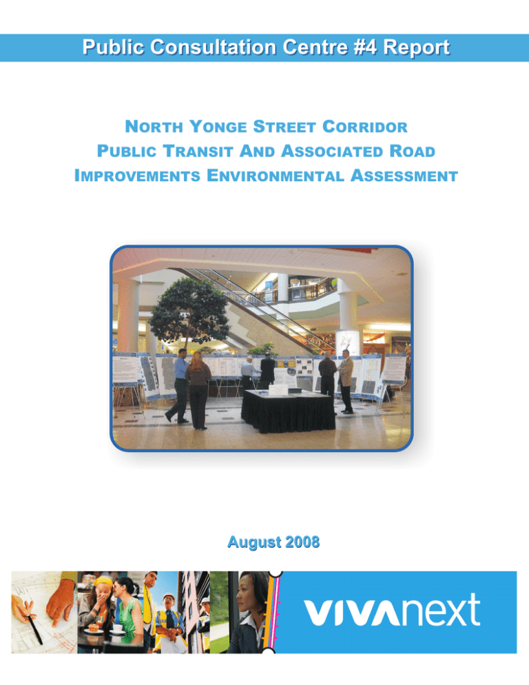
Public Consultation Centre #4 Report NORTH YONGE STREET CORRIDOR PUBLIC TRANSIT AND ASSOCIATED ROAD IMPROVEMENTS ENVIRONMENTAL ASSESSMENT August 2008 Public Consultation Centre #4 Report North Yonge Street Corridor Public Transit & Associated Road Improvements Environmental Assessment TABLE OF CONTENTS 1.0 INTRODUCTION.............................................................................................................. 1 2.0 PUBLIC CONSULTATION CENTRE #4........................................................................... 1 2.1 2.2 2.3 3.0 3.1 3.2 NOTIFICATION ................................................................................................................. 1 TECHNICAL ADVISORY COMMITTEE .................................................................................. 2 PRESENTATION MATERIAL ............................................................................................... 2 SUMMARY....................................................................................................................... 3 VISITOR SIGN-IN .............................................................................................................. 3 COMMENT SHEETS .......................................................................................................... 3 LIST OF APPENDICES APPENDIX 1 Notice for Public Consultation Centre #4 APPENDIX 2 TAC Meeting Minutes APPENDIX 3 Presentation Material APPENDIX 4 Sample Sign-in Sheet APPENDIX 5 Received Comment Sheets August 2008 Public Consultation Centre #4 Report North Yonge Street Corridor Public Transit & Associated Road Improvements Environmental Assessment 1.0 INTRODUCTION This report describes the details of the fourth and final Public Consultation Centre (PCC) held in June 2008. The main purpose of this final PCC was to present the project recommendations and obtain feedback from the public prior to finalizing the Environmental Study Report. There have previously been three PCC’s held relating to the project over a four year period. The first PCC in June 2004 introduced the study and described the process for preparing the EA Terms of Reference, approved by the Ministry of the Environment in August 2005. The second PCC, held in September 2006 described the alternatives to the undertaking as well as the evaluation and selection of the preferred alternative. The preliminary screening of the routes was also presented. The purpose of the third PCC in June 2007 was to present the evaluation of the rapid transit route alternatives and road capacity improvement alternatives along Yonge Street between Mulock Drive and Green Lane. 2.0 PUBLIC CONSULTATION CENTRE #4 The fourth series of Public Consultation Centres for the North Yonge Street Corridor Public Transit and Associated Road Improvements EA were held at the following locations: Wednesday, June 11, 2008 (4:00 pm to 8:00 pm) – Regional Municipality of York Administration Offices, 17250 Yonge Street, Newmarket, ON; Thursday, June 19, 2008 (5:00 pm to 8:00 pm) – Oak Ridges Recreation Centre – Norm Taylor Room, 70 Old Colony Road, Richmond Hill, ON During the two open houses, members of the study team were available to assist the public with reviewing the presentation material and to address any questions/concerns. 2.1 NOTIFICATION The notice of Public Consultation Centre, shown in Appendix 1, was advertised to area residents and interested parties using the following media: 1. Notices were placed in the following newspapers: Richmond Hill Liberal Era Banner Richmond Hill Liberal Era Banner Sunday, June 1, 2008 Sunday, June 1, 2008 Thursday, June 5, 2008 Thursday, June 5, 2008 2. The notice was sent by mail/email to: members of the public who signed in at previous PCC’s and agreed to receiving project information; members of the public who requested to be put on the project mailing list; First Nations groups; relevant municipal, provincial and federal agencies; utility companies; and all landowners within the corridor along Yonge Street, Davis Drive and Green Lane. 3. The notice was posted on the Region of York website at www.york.ca and on the Viva website at www.vivayork.ca. August 2008 Page 1 of 6 Public Consultation Centre #4 Report North Yonge Street Corridor Public Transit & Associated Road Improvements Environmental Assessment 2.2 TECHNICAL ADVISORY COMMITTEE A Technical Advisory Committee (TAC) was organized to facilitate the line of communication between the project team and relevant agencies, thereby ensuring a seamless integration of Rapid Transit into York Region. TAC members represent the following agencies: Region of York, Town of Richmond Hill, Town of Aurora, Town of Newmarket, Town of East Gwillimbury, Toronto and Region Conservation Authority, Lake Simcoe Region Conservation Authority, GO Transit, York Region Transit, Ministry of Natural Resources, Ministry of Culture, and Ministry of Transportation. TAC representatives ensure that any concerns their agencies may have with regards to the project are given proper consideration and their input is sought at various stages throughout the study. To this effect, a meeting with the TAC took place on Tuesday, April 22, 2008 to present the recommended alignments for Yonge Street, Davis Drive and Green Lane. Minutes of this meeting are included in Appendix 2. 2.3 PRESENTATION MATERIAL The PCC material on display at both locations consisted of a series of presentation boards as listed below, and included in Appendix 3. Introduction, Existing Conditions and Recap Welcome Environmental Assessment Process – Where are we? Viva Network Map Existing Social/Cultural Environment Land Use Existing Natural Environment Preferred Routing Cross-Sections Typical Cross-Sections (40-45 m ROW, 36 m ROW and 42.6 m ROW) Constrained Cross-Sections (Under GO Transit Rail Bridge north of Industrial Parkway in Aurora and New Keith Bridge on Davis Drive over East Holland River in Newmarket) Preferred Alignment th Yonge Street – 19 Avenue to Bloomington Road Yonge Street – Bloomington Road to St. John’s Sideroad Yonge Street – St. John’s Sideroad to Green Lane (Ultimate Stage, Dedicated Rapidway) Yonge Street – Davis Drive to Green Lane (Interim Stage, HOV lanes) Davis Drive – Yonge Street to Highway 404 Davis Drive Operational Improvements (Wilstead Drive Re-alignment and Parkside Drive Realignment) Green Lane – Yonge Street to East Gwillimbury GO Station Design Features Advantages of the Project Summary of Key Effects and mitigation Strategy Typical Viva Intersection Mid-block Access – Left and U-turns Traffic Signal Operations August 2008 Page 2 of 6 Public Consultation Centre #4 Report North Yonge Street Corridor Public Transit & Associated Road Improvements Environmental Assessment Next Stage in the EA Process What Happens Next? 3.0 SUMMARY 3.1 VISITOR SIGN-IN A total of 28 people signed in at the Wednesday session in Newmarket and 33 people signed in at the session in Richmond Hill on the Thursday. A sample of the sign-in sheet is included in Appendix 4. 3.2 COMMENT SHEETS In addition to verbal comments, a total of eight written comment sheets were completed and submitted to the project team during the two days. All of the comments sheets are included in Appendix 5. The comment sheet asked four questions of the public, as well as providing space for additional comments. The four questions were the following: What aspects of the preferred plan do you consider most important for enhancing quality of life in the corridor? Please suggest any changes to the preferred plan that would further improve the quality, cost-effectiveness, convenience, safety and/or security of the proposed rapid transit facilities and road improvements. What concerns, if any, do you have with the preferred plan? Other comments. The comments/suggestions/concerns/opinions noted on the comment sheets submitted by the public are summarized in Table 1. During the PCC, there were several positive comments voiced by the public regarding the existing Viva service as well as significant interest related to impacts on specific properties as a result of the rapid transit system. August 2008 Page 3 of 6 Public Consultation Centre #4 Report North Yonge Street Corridor Public Transit & Associated Road Improvements Environmental Assessment Table 1 – Summary of Public Comments COMMENT/CONCERN QUESTION 1: What aspects of the preferred plan do you consider most important for enhancing quality of life in the corridor? Continuity of lines without transfers. Stouffville’s connections north to Barrie or Newmarket are very poor. Bus Scheduling between YRT & VIVA – today is a mess. Please extend subway. Do not waste money on VIVA bus routes. To widen Davis Drive, but only 3 extra lanes are necessary The improvements along Davis drive are much needed. I like the proposal to widen and make various improvements on the Davis Drive corridor More green space (trees) Viva station at St. Johns Less congestion that people use public transit – which will likely not happen Planting of trees/ shrubs. Slow down the speed limit (reduce). Take into consideration that the future of York Region will be mostly seniors. Cater to their needs. Traffic flow. Pedestrian safety. QUESTION 2: Please suggest any changes to the preferred plan that would further improve the quality, cost-effectiveness, convenience, safety and/or security of the proposed rapid transit facilities and road improvements. th Subway north of 19 Avenue or mono rail on Highways 400 or 404 to Highway 7 and across 7 for Markham to Brampton Roads just do it right the first time – VIVA is not the way. Keep bus on Yonge Street as is and save money for subway. Davis Drive should have 3 lanes going east and west and 1 centre turning lane. The outer 2 lanes should be dedicated bus lanes at certain hours mimicking Yonge St. Wherever possible and warranted I would suggest putting dedicated left/right turn lanes. This is a major problem on Davis dr. now Lay down a sound absorbing asphalt on Yonge St, or sound attenuating shrubs, trees, etc... To reduce road noise for the citizens that live in homes along the VIVA route. QUESTION 3: What concerns, if any, do you have with the preferred plan? Are studies being conducted to assess the traffic flow on to secondary streets (Lorne Avenue, Queen Street, Eagle Street) from the rapid transit work being constructed on Davis & Yonge? There should be one fare. There should be billboards on each station and at bus stops saying when the next bus or train is coming. Accessing local business will be much more difficult. Good Idea – may reduce traffic congestion. August 2008 Page 4 of 6 Public Consultation Centre #4 Report North Yonge Street Corridor Public Transit & Associated Road Improvements Environmental Assessment COMMENT/CONCERN There is no left turning lane at Hill St. coming from west to east are there any u-turn areas? Doctors, patients and nurses are not able to make a left turn from medical clinic on Davis drive. Medical clinic at Hill St. My concern is we will never see the improvements made or it will not be completed as shown due to property implications How much will be our cost, the taxpayer? Access to Hadley George, time frame, construction etc. How the VIVA NEXT is going to affect my property, business etc. What compensation will be assessed for this effect? How will this impact our livelihood? Timeline? Costs and impact on taxpayer Parking spaces for vehicles in order to park & ride the VIVA transit without having my vehicle towed. What is the future plan for VIVA transit to travel and stop on Bathurst Street. Now that it’s a 4 lane road. Our sign and all the landscaping we have done. Has the Town of Newmarket asked the Region to conduct a study on infiltration of traffic onto secondary roads? During construction and post construction. OTHER COMMENTS Why was this project time line bumped up – I thought it was scheduled for 2012-15? The cost should also be mentioned. If I wish to travel from Stouffville to Toronto, I cannot get off the bus after #7 then I must go to Union Station. There should be a stop at other major streets ex. Finch, Sheppard, Eglinton, Bloor. Not Impressed. Public parking in the areas of Viva stations (cars & bikes) may be required. We need Subway up to Bradford. Get on with it! Subway only. Do not waste money on expanding/adding. The plan is being too hurried and does not suit many established businesses and services. Money is not all that matters There should be no centre ramp divider on Davis drive. This is long overdue. Let’s get started with construction Please send an enlarged aerial view of VIVA NEXT and how it will affect Davis Drive and Hill Street to Lorne Avenue area. Keep the fares down. Keep the buses combustion systems in changing with the times, e.g. dual fuel, electric... August 2008 Page 5 of 6 NORTH YONGE STREET CORRIDOR PUBLIC TRANSIT & ASSOCIATED ROAD IMPROVEMENTS ENVIRONMENTAL ASSESSMENT Public Consultation Centre #4 Report Appendix 1 Notice for Public Consultation Centre #4 August 2008 Notice of Public Consultation Municipal Class Environmental Assessment North Yonge Street Corridor Public Transit and Associated Road Improvements As one of the fastest growing municipalities in Canada, The Regional Municipality of York must ensure that its ever-increasing population and robust economy can enjoy the timely and efficient movement of people and goods throughout the Region. York Region’s 2002 Transportation Master Plan called for the development of a transportation system consisting of both a rapid transit network (Viva) and an enhanced road network. In March 2008, York Region published a notice advising that the North Yonge Street Corridor Public Transit and Associated Road Improvements Individual Environmental Assessment would be completed under the new Municipal Class Environmental Assessment process (Class EA - Schedule C project) and that the Davis Drive Operational and Safety Improvements Class EA was being integrated into this larger study. The figure below shows the EA study area boundary and the recommended rapid transit service route. The rapid transit service will run mostly within dedicated rapidway lanes with some segments of the service running in general traffic lanes and in proposed High Occupancy Vehicle (HOV) lanes. At the previous Public Consultation held in June 2007, the evaluation of both rapid transit route alternatives and associated road improvements were presented. At this final Public Consultation, the recommended design alternatives will be presented including effects of the project and mitigation. Input from this Public Consultation will be used to refine the preferred design for transit and road improvement infrastructure during the preparation of the Environmental Study Report (ESR), scheduled to be completed this summer. Once the ESR is complete, it will be placed on the public record for a 30 day review period. You are invited and encouraged to attend this upcoming final Public Consultation at one of the following locations: 1) Wednesday, June 11, 2008 from 4 to 8 p.m. Regional Administrative Centre 17250 Yonge Street, Newmarket, ON 2) Thursday, June 19, 2008 from 5 to 8 p.m. Oak Ridges Recreation Centre – Norm Taylor Room 70 Old Colony Road, Richmond Hill, ON To obtain further information on this study please visit York Region’s rapid transit web site at www.vivayork.ca or our homepage at www.york.ca. If you wish to have your name added to the project mailing list, or have any questions or comments, please contact one of the individuals below: Mr. Steve Mota, P.Eng. Program Manager - EA The Regional Municipality of York 17250 Yonge Street Newmarket, ON L3Y 6Z1 Phone: 1-877-464-9675 Ext. 5056 Fax: 905-895-0191 Email: steve.mota@york.ca Mr. Lynton Erskine, P.Eng. EA Studies Manager York Consortium 1 West Pearce Street, 6th Floor Richmond Hill, ON L4B 3K3 Phone: 905-943-0558 Fax: 905-943-0400 Email: l.erskine@delcan.com This notice first published on June 1, 2008. NORTH YONGE STREET CORRIDOR PUBLIC TRANSIT & ASSOCIATED ROAD IMPROVEMENTS ENVIRONMENTAL ASSESSMENT Public Consultation Centre #4 Report Appendix 2 TAC Meeting Minutes August 2008 MINUTES TO: Notes to File DATE: FROM: W. Leung SUBJECT: North Yonge Street Corridor Environmental Assessment – April 22, 2008 TAC Meeting ATTENDEES: York Consortium(YC) – Khaled El-Dalati, Lynton Erskine (LE), Winnie Leung York Region – Loy Cheah (LC), Steve Mota York RegionTransit – Irene McNeil (IM) GO Transit – Mike Sone (MS) NCE – Edward Chiu, Karl Van Kessel Town of Aurora – Jamal Massadeh Town of Newmarket – Mark Kryzanowski Town of East Gwillimbury – Dan Stone (DS) DISTRIBUTION: Attendees, Salim Alibhai, Paul Belton, David Clark, Paul May, Candace Bastedo, Brian Hollingworth, Marcel Lanteigne, Joanne Leung, Wayne Hunt, Tom Hogenbirk, Beverly Beoth, June Murphy, Winston Wong, Brian Ogden, Steven Strong April 22, 2008 Item Discussed 1. INTRODUCTION AND WELCOME The meeting commenced with general introductions. 2. RECAP OF SELECTED TRANSPORTATION SOLUTIONS; SCHEDULE UPDATE Overview of the project schedule noting the following: 3. • Municipal PPPs for Aurora, East Gwillimbury, Richmond Hill and Newmarket are scheduled for early May 2008. • PCC meetings to occur in late May. Input from TAC on presentation material will be requested via email. • Aurora and Oakridge PCC meetings may be combined. RECOMMENDED DESIGN ALTERNATIVE – RICHMOND HILL LE presented the recommended design of dedicated rapidway from 19th Avenue to Bloomington Road with 40m ROW between stations and major intersections. Proposed stations are at 19th Avenue, Tower Hill Road (future station), Jefferson Sideroad, King Road, Regatta Avenue, and Bloomington Road, with a provision for possible future station within median at Silver Maple Road. Action By Technical Advisory Committee Meting – North Yonge Street Corridor Public Transit and Associated Road Improvements EA April 22, 2008 Page 2 of 3 Action By The following was discussed: • YC will check property impacts and see if it is practical to keep the right-in, right-out entrances. YC • LC commented on the possibility of removing the landscape median at Townwood Drive, YC will review their option. YC • RapidCo has the information on the new VIVA station at Jefferson Sideroad. • LC mentioned the southbound double left turn lane design has been done for the Bloomington Road intersection; will confirm the need for this in the future using the traffic model. 4. YR, YC RECOMMENDED DESIGN ALTERNATIVE – AURORA The extent of dedicated rapidway in the Aurora segment is still to be determined. YC has developed both mixed traffic and dedicated rapidway options, which were both available at the meeting. A meeting will be held on April 23rd, 2008 with GO Transit to discuss the plans for the Aurora GO bridge. Proposed curb-side station locations are at Henderson Drive, Golf Links Drive, Wellington Street (note: with short 36m platform on east side due to existing properties), Orchard Heights Boulevard, and St. John’s Sideroad. The following was discussed: • 5. Once decision is made regarding the extent of dedicated rapidway, the proper transition treatment will be included. YC RECOMMENDED DESIGN ALTERNATIVE – NEWMARKET LE presented the recommended design of dedicated rapidway from Savage Road North to Davis Drive with 40m ROW between stations and major intersections, and 42.6m ROW mixed traffic with HOV lanes to the boundary of East Gwillimbury. Stations are at Savage Road North, Mulock Drive, Eagle Street, Davis Drive, and London Road. The following was discussed: • Once decision is made for the extent of dedicated rapidway, the proper transition treatment will be included. • YC will clarify the reason of the inconsistency of lane removal in northbound and southbound traffic between Savage Road North and William Roe Boulevard. • YC will provide YR with the future traffic volumes by the end of week. • Signalized intersection at Davis Drive provides opportunity for northbound bus transition from dedicated rapidway to mixed traffic HOV lane YC YR, YC YC Three options of Upper Canada Mall Station • o YC will set up meeting to discuss option with Upper Canada Mall. o YRT will provide the capacity, number of bus bays, access information, and parking information to YC for further evaluation. o YC will revise the drawing showing options as per YR’s comments. o Extend and design the landscape median on Davis Drive (west of Yonge Street) will be included once the preferred option is selected. IM noted that the section on service planning in the EA needs to reflect points of interest (i.e. malls, hospital etc). YC YRT YC YC YC Technical Advisory Committee Meting – North Yonge Street Corridor Public Transit and Associated Road Improvements EA April 22, 2008 Page 3 of 3 Action By • IM had asked that there be some additional information provided regarding the timing/staging/need for the extension of the Davis Drive section east to Leslie Street / Highway 404. • MS will provide a sketch of GO Transit route services to YC. 6. MS RECOMMENDED DESIGN ALTERNATIVE – EAST GWILLIMBURY 6 lanes mixed traffic with HOV lanes continues up to Green Lane and turns east on Green Lane to the East Gwillimbury GO Station. The Rapid Transit will operate in this in mixed traffic. Stations on Green Lane, a mid-block between Yonge Street and East Gwillimbury GO Station to be developed in accordance with Official Plan policies, and at the East Gwillimbury GO Station. Details of the station at the GO station will be developed in consultation with GO Transit. The following was discussed: 7. • DS will provide YC with a draft cross section of median transit design on Green Lane that East Gwillimbury has developed. DS • The justification where the transit service end will be included in the EA Report. YC • The EA Report will include discussion regarding protection of a 40m ROW in the event that widening of the Green Lane is required. OTHER BUSINESS a) Bike lanes DS raised the safety concern of putting bike lanes adjacent to traffic lanes. He suggested putting them on the boulevard beside the pedestrian sidewalks. YR has developed a cycling master plan, which YC will review with respect to bike lanes at intersections with right-turn lanes. J:\TOR\PM1452\5 General\5-03 Minutes and Agendas of Meetings\5-3-1 TAC\2006-12-14 Meeting\TAC Minutes 2008-04-22.doc NORTH YONGE STREET CORRIDOR PUBLIC TRANSIT & ASSOCIATED ROAD IMPROVEMENTS ENVIRONMENTAL ASSESSMENT Public Consultation Centre #4 Report Appendix 3 Presentation Material August 2008 Welcome.... to the final public consultation open house for the North Yonge Street Corridor Public Transit and Associated Road Improvements Environmental Assessment The purpose today is to: Present project recommendations and obtain feedback from the public prior to finalizing the Environmental Study Report The project encompasses: Rapidway along Yonge Street from 19th Avenue to Green Lane; Davis Drive from Yonge Street to Southlake Regional Health Centre; and Green Lane from Yonge Street to the East Gwillimbury GO Station Rapid transit in mixed traffic through Aurora from Golf Links Road to Aurora Heights Drive and Davis Drive from Southlake Regional Health Centre to Highway 404 Road improvements on Yonge Street from Davis Drive to Green Lane. These are proposed as HOV lanes as a precursor to ultimate rapidways Associated operational and safety improvements on Davis Drive from Yonge Street to Highway 404 All information presented here is available at www.vivayork.ca. Environmental Assessment Process: Where We Are Problem Statement Base Map Preparation Describe Undertaking from background studies (Transportation Master Plan) MOE Approval of ToR Identify Alternatives to the Undertaking (Alt. Strategies) Existing Conditions Describe & Analyse Alternative Strategies Evaluation of Alternative Strategies Select Preferred Alternative Strategy Identify Alternative Methods of carrying out the Undertaking EA Open House # 2 September 2006 Terms of Reference (ToR) Open House # 1 June 2004 Establish Planning & Design Criteria Prepare and Submit Terms of Reference to Ministry of Environment (MOE) Outline EA Work Plan Update Existing Conditions Develop Alternative Methods (Design) Develop Evaluation Criteria August 2005 EA Open House # 3 June 2007 Integration of Davis Drive Class EA Transition to Transit Class EA Assessment of Effects of Alternative Designs Evaluation of Alternative Designs Select preferred Design Today EA Open House # 4 June 2008 Refine preferred Alternative Design Complete ESR ESR placed on public record for 30 days (late summer 2008) Opportunities for public input Project Approved and moves to Design Phase Assessment of effects of Preferred Design Viva Network Map Existing Social/Cultural Environment & Land Use Existing Natural Environment Town of Newmarket Note: Sourced from the Town of Newmarket Official Plan 2006- 2026 Town of East Gwillimbury Note: Sourced from the Proposed Urban Structure Plan, Town of East Gwillimbury Preferred Routing N GO Tra n sit Ba rrie Lin e Widened to 6 lanes (Interim HOV Lanes with ultimate conversion to dedicated median rapidway) Legend: Station Mixed Traffic Widened to 6 lanes Dedicated Median Rapidway Yonge Street Bloomin gton Roa d Typical Cross-Sections 40 -45 m ROW - dedicated median rapidway with bike lanes on Yonge Street and Green Lane 36 m ROW - dedicated median rapidway on Davis Drive 42.6 m ROW - 6 lane widening on Yonge Street between Davis Drive and Green Lane (interim stage with HOV lanes) Cross-Section Source: “Towards Great Regional Streets: A Path to Improvement”, York Region Constrained Cross-Sections Under GO Transit Rail Bridge north of Industrial Parkway in Aurora Note: Sidewalk and bike path located in new underpass through embankment on east side West East New Keith Bridge on Davis Drive over East Holland River in Newmarket 33.8m New bridge width (inside railings) East Holland River Davis Drive Operational Improvements Wilstead Drive Re-alignment – Desirable ultimate scenario – Facilitated by the Town of Newmarket through future land redevelopment and site plan approval process – Not included in undertaking of EA Parkside Drive Re-alignment – Necessary due to close intersection spacing of Parkside Drive and Longford Drive – Permits standard station design – Traffic operations will be safer with one signalized intersection versus the two existing signals – Included in the undertaking of the EA Advantages of the Project • A four corridor network providing a fast, frequent and reliable transit alternative with good connections to local and GO Transit services • Convenient, safe access to station platforms for all passengers Built in Mitigation Natural Environment Protection • Placing the preferred rapidway alignment mostly in existing road right-of-way to limit the effects on creeks with bridge or culvert widening. • Doubling transit use in the Corridor to add to the anticipated improvement in air quality levels due to the lower emissions from improved automobile technology. • Replacement of the East Holland River bridge will include treatments that mitigate any effects on the watercourse. Community and Economic Benefits • Rapidway implementation can help shape revitalization and be a catalyst for the enhancement of streetscapes, creating a more attractive pedestrian-oriented environment. • Corridor road lane capacity maintained or increased where necessary and access to adjacent properties facilitated by dedicated signal phase for left and U-turns. • Transit routes reinforcing the Region's Centres and Corridors land use policy and encouraging transit-oriented development at key station nodes. Summary of Key Effects & Mitigation Strategy Issue/impact: Left turn traffic will only be allowed to cross the rapidway at signalized intersections. Access to and from driveways will be affected. Mitigation: U-turns will be permitted at signalized intersections with dedicated signal phase. Issue/impact: The proposed limits of the project are wider than the existing road allowance in some areas. Additional property will be required from affected landowners. Mitigation: York Region will acquire property from affected landowners through purchase or dedication as lands develop or re-develop. Issue/impact: The project may affect some properties regarding existing landscaping, signage on-site traffic circulation and parking. Mitigation: York Region will work with affected owners and tenants during the design phase to minimize site impacts. In exceptional cases, the mitigation strategy may include up to and including full buy-out and business relocation, which will be investigated with each significantly affected landowner. Issue/impact: The project will require widening or replacement of structures over watercourses. There may be potential impact to the watercourse and adjacent vegetation. Mitigation: York Region will work with the affected stakeholders during the design phase to acquire the necessary approvals. The design will include specific mitigation to minimize impacts. What Happens Next? The next stages of the EA process involves: Consider input received from this Public Open House Refinement of the preferred design for rapidways and road improvements Prepare and circulate the Environmental Study Report (ESR) to obtain agency comments Finalize the ESR and make it available for a 30 day public review period We encourage you to provide comments so that your ideas and concerns can be considered during the preparation of the ESR. NORTH YONGE STREET CORRIDOR PUBLIC TRANSIT & ASSOCIATED ROAD IMPROVEMENTS ENVIRONMENTAL ASSESSMENT Public Consultation Centre #4 Report Appendix 4 Sample Sign-In Sheet August 2008 NORTH YONGE STREET CORRIDOR PUBLIC TRANSIT AND ASSOCIATED ROAD IMPROVEMENTS ENVIRONMENTAL ASSESSMENT Public Consultation Centre #4: Wednesday, June 11, 2008 at York Regional Headquarters PLEASE SIGN IN Name Mailing Address Address City Postal Code Telephone Number Email Address Would you like to receive future info? 1 2 3 4 5 6 7 8 9 10 Privacy Policy: Providing personal information on the sign-in sheet is voluntary. All information provided to York Consortium (on behalf of York Region) regarding e-mail addresses/postal addresses is used only for our correspondence with you. This information is kept confidential and is not released to any other party without your authorization. NORTH YONGE STREET CORRIDOR PUBLIC TRANSIT & ASSOCIATED ROAD IMPROVEMENTS ENVIRONMENTAL ASSESSMENT Public Consultation Centre #4 Report Appendix 5 Received Comment Sheets August 2008
