Simulation of the snowmelt runoff contributing source area in a
advertisement
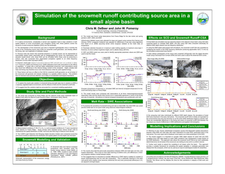
Simulation of the snowmelt runoff contributing source area in a small alpine basin Chris M. DeBeer and John W. Pomeroy Centre for Hydrology, University of Saskatchewan, 117 Science Place, Saskatoon, Saskatchewan, Canada, S7N 5C8 Background The model was forced using observations from Fisera Ridge for the late winter and spring periods in 2007, 2008, and 2009. Effects on SCD and Snowmelt Runoff CSA In alpine environments, complexities in terrain and vegetation lead to large variations in both spatial patterns of snow accumulation and energetics during melt; these patterns control the dynamics of areal snowcover depletion (SCD) over the landscape. Short-wave radiation inputs were adjusted for slope and aspect using routines from Garnier and Ohmura (1970). Longwave irradiance was adjusted for differences in sky-view using algorithms from Sicart et al. (2006) assuming terrain emits longwave radiation at the mean daily air temperature. Areal SCD was simulated over two opposing slopes in the adjacent cirque basin using melt rates computed based on average SWE depth, and also using melt rates computed individually for different SWE depth classes over the frequency distribution. The disintegration of the snowcover over time is important hydrologically since it controls the extent of the contributing source area (CSA) for snowmelt runoff generation, and thereby affects the timing, rate, and magnitude of meltwater release. Parameter selection focused on i) maximum water holding capacity, ii) maximum snow layer 1 thickness, iii) snow surface roughness height, and iv) albedo decay with time. Using the SWE depth class-based melt simulations, the snowmelt runoff CSA was quantified by multiplying the fraction of the SWE frequency distribution producing appreciable melt (> 5 mm) by the simulated snowcovered area fraction. Previous work has shown that snowmelt dynamics in complex terrain can be represented at intermediate spatial scales reasonably well by disaggregating the terrain into slope/aspect and elevation based terrain units. Areal SCD can be simulated within these units by presuming a uniform melt rate (computed from slope-based energetics) applied to an initial frequency distribution of snow water equivalent (SWE). 2007 and 2008 model runs were used to identify appropriate parameter values and 2009 was used to test the model. Daily oblique photographs of the cirque were projected orthogonally onto the digital elevation model using a technique from Corripio (2004) and were used to derive the observed SCD curves. Raw Image (May-20-2008) Orthorectified Image However, small scale statistical associations between SWE and melt rates can accelerate or delay SCD. Faria et al. (2000) and Pomeroy et al. (2004) attributed small scale associations to the effects of vegetation. In areas with a cold and highly redistributed snowcover, such associations would also result from differences in the internal energy content of the snowpack. Highly variable melt rates and timing may therefore occur over short distances under the same applied energy. These factors will have an effect on the CSA for snowmelt runoff generation as not all areas of the snowcover will generate and release meltwater in a spatially uniform manner. This problem has not received much previous attention, but is likely of considerable hydrological importance. Objectives North-facing slope To explore the small scale variation in snowmelt timing and melt rates due to variation in SWE in a sparsely vegetated alpine environment, and the effects on SCD and the snowmelt runoff CSA. To suggest how this variation might be accounted for in snowmelt modelling applications. Study Site and Field Methods The study was conducted at Fisera Ridge and the adjacent small upper headwater basin of Middle Creek within the Marmot Creek Research Basin, Kananaskis Valley, Alberta. Example comparisons of observed vs. simulated SWE and internal snowpack temperature for the south-east facing slope on Fisera Ridge. The model results were compared with observations at all three meteorological/snowpack observation sites and the results were found to be in reasonable agreement in terms of the timing and rate of snowmelt. Simulations of internal snowpack temperature were problematic until melt. South-facing slope Melt Rate – SWE Associations To examine the sensitivity of snowmelt timing and rate to initial SWE, the initial SWE was varied and the model was run at a point scale using observed meteorological conditions. South-east facing site (2008) North-facing site (2008) By computing melt rates individually for different SWE depth classes, the simulations of areal SCD were improved in the early melt period. The snowmelt runoff CSA is initially not equivalent to the snowcovered area and only becomes so as the entire SWE distribution begins to actively melt. There are considerable differences in the timing and extent of snowmelt runoff CSA between the two slopes as a result of differences in SWE distributions and applied melt energetics. Modelling Implications and Conclusions Meteorological conditions (T, RH, P, U, K↓, L↓) and snowpack conditions (d, T) were recorded at three stations on Fisera Ridge. Snow surveys were repeated across various terrain units to characterize the spatial distribution of SWE, and snow pits were dug to measure snow density. Warming of cold, heavily redistributed snowpacks causes time-dependent spatial associations between initial SWE and melt rates with major implications for areal SCD, particularly early in the melt period. The more rapid melt of shallower snow leads to an initial acceleration of the SCD. Two LiDAR (Light Detection And Ranging) digital elevation models were compared (snow-free and snow-covered) to determine the distribution and spatial pattern of snow depth over the basin. The results suggest it is important to consider SWE depth classes for areal melt and SCD modelling since melt rates based on mean SWE conditions may misrepresent a large fraction of the SWE distribution. This approach also allows the snowmelt runoff CSA to be more realistically determined since not all areas of the snowcover are melting at once and in a uniform manner. Snowmelt Modelling and Validation LvE H K↑ K↓ L↓ Snow layer 1 U Snow layer 2 U L↑ G P Further work needs to extend this modelling to all slopes within the basin. This approach provides a suitable framework for simulating the spatial variability in meltwater generation and release from the snowpack, which can be used as an input to hydrological models for streamflow. E Q Soil layer Schematic representation of the snowcover, energy and mass fluxes by Snobal. Snowmelt rates and internal snowpack temperature were simulated using the Snobal energy balance model (Marks et al., 1998; 1999), coupled to input variable estimation algorithms in the Cold Regions Hydrological Model (CRHM) platform (Pomeroy et al., 2007). The results show that the point-scale associations between SWE and melt rates are time- and location-dependent. This is due to more rapid warming of shallow snow, and differences in shortand longwave radiation receipt between slopes. Acknowledgements This suggests that it is important to consider differences in SWE depth in addition to variation in terrain slope/aspect/sky-view for melt rate computation. This is especially important in the early melt period when shallow snow becomes isothermal first and more pronounced differences in K↓ are apparent amongst slopes. Funding was provided by CFCAS (IP3 Network), NSERC, Canada Research Chairs and the U of C Biogeosciences Institute; We also thank Chad Ellis, Jimmy MacDonald, Matt MacDonald, Mike Solohub, Tom Brown and the Nakiska Ski Area for their assistance in aspects of field work and modelling.
