STREAMBANK AND SHORELINE PROTECTION (Feet) Code 580
advertisement
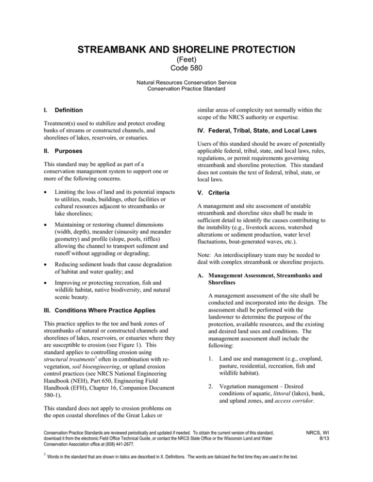
STREAMBANK AND SHORELINE PROTECTION (Feet) Code 580 Natural Resources Conservation Service Conservation Practice Standard I. Definition Treatment(s) used to stabilize and protect eroding banks of streams or constructed channels, and shorelines of lakes, reservoirs, or estuaries. similar areas of complexity not normally within the scope of the NRCS authority or expertise. IV. Federal, Tribal, State, and Local Laws This standard may be applied as part of a conservation management system to support one or more of the following concerns. Users of this standard should be aware of potentially applicable federal, tribal, state, and local laws, rules, regulations, or permit requirements governing streambank and shoreline protection. This standard does not contain the text of federal, tribal, state, or local laws. • V. Criteria II. Purposes • Limiting the loss of land and its potential impacts to utilities, roads, buildings, other facilities or cultural resources adjacent to streambanks or lake shorelines; Maintaining or restoring channel dimensions (width, depth), meander (sinuosity and meander geometry) and profile (slope, pools, riffles) allowing the channel to transport sediment and runoff without aggrading or degrading; • Reducing sediment loads that cause degradation of habitat and water quality; and • Improving or protecting recreation, fish and wildlife habitat, native biodiversity, and natural scenic beauty. III. Conditions Where Practice Applies This practice applies to the toe and bank zones of streambanks of natural or constructed channels and shorelines of lakes, reservoirs, or estuaries where they are susceptible to erosion (see Figure 1). This standard applies to controlling erosion using structural treatments1 often in combination with revegetation, soil bioengineering, or upland erosion control practices (see NRCS National Engineering Handbook (NEH), Part 650, Engineering Field Handbook (EFH), Chapter 16, Companion Document 580-1). A management and site assessment of unstable streambank and shoreline sites shall be made in sufficient detail to identify the causes contributing to the instability (e.g., livestock access, watershed alterations or sediment production, water level fluctuations, boat-generated waves, etc.). Note: An interdisciplinary team may be needed to deal with complex streambank or shoreline projects. A. Management Assessment, Streambanks and Shorelines A management assessment of the site shall be conducted and incorporated into the design. The assessment shall be performed with the landowner to determine the purpose of the protection, available resources, and the existing and desired land uses and conditions. The management assessment shall include the following: 1. Land use and management (e.g., cropland, pasture, residential, recreation, fish and wildlife habitat). 2. Vegetation management – Desired conditions of aquatic, littoral (lakes), bank, and upland zones, and access corridor. This standard does not apply to erosion problems on the open coastal shorelines of the Great Lakes or Conservation Practice Standards are reviewed periodically and updated if needed. To obtain the current version of this standard, download it from the electronic Field Office Technical Guide, or contact the NRCS State Office or the Wisconsin Land and Water Conservation Association office at (608) 441-2677. 1 Words in the standard that are shown in italics are described in X. Definitions. The words are italicized the first time they are used in the text. NRCS, WI 8/13 580-2 Figure 1: Location of Hydrologic Zones Along a Streambank or Shoreline Flood Prone Elevation Overbank Elevation OHWM or Bankfull Average Water Elevation Note: For the purposes of this standard the terms bankfull elevation and OHWM are deemed equivalent. 3. Access and use. 4. Watercraft use, restrictions, and potential impacts. 5. Willingness of landowner to carry out required maintenance. 6. Runoff and stormwater management. 7. Landowner’s desired condition and plans for site. hydraulic structures (e.g., dams, bridges, culverts, storm sewer outfalls). B. Streambank Site Assessment A site assessment shall be conducted and incorporated into the design. The assessment shall be performed to determine the physical, cultural, and historical site characteristics that will influence the construction, maintenance, and environmental integrity of the protection. 1. For all projects, the site assessment shall include: a. b. NRCS, WI 8/13 Stream bed stability – Determination whether the stream bed is aggrading, degrading, or stable. Hydrology and hydraulics, water level fluctuations, bankfull elevation, nearby 2. c. Bank and bed composition – Soil type, composition, Unified Soil Classification System (USCS) profile log, streambed material. d. Identification of the size and location of areas or habitats requiring avoidance (e.g., wetlands, riparian and upland areas, in-stream habitat). e. Drainage paths, flow patterns, runoff controls, roof gutters, impervious areas. f. Length of treatment area and accessibility for equipment. g. Site sketch or checklist illustrating items V.B.1.a through f. For single sites over 600 feet in length, or multiple sites in a ¼ mile reach totaling over 1,000 feet, assess items V.B.1.a through f, and the following items: a. Determination whether the causes of instability are local (e.g., poor soils, seepage, alignment, obstructions deflecting flows into bank, etc.) or 580-3 watershed related (e.g., aggradation due to increased sediment, increased runoff due to urban development, degradation due to channel modifications, etc.). b. Stream classification (Rosgen, 1994) (slope, sinuosity, entrenchment, width, depth, bed material) and stage of evolution (Schumm, 1984). c. Waterway designation: Areas of special natural resource interest, outstanding resource waters (ORW) and exceptional resource waters (, ERW), trout stream classification, type (cold or warm water, fish habitat) and characteristics. d. e. Stability of bank, stream lateral recession rates, bank height, bank angle, percent of bank protected by vegetation, rooting depth and density, presence of existing erosion control practices. Tiers of vegetation – Aquatic, bank and upland. Presence of invasive species. f. Number and orientation of existing or proposed decks, steps, piers, access points to water body, utilities, etc. g. Documentation of cultural and historical resources. h. Aquatic/terrestrial habitat and movement corridors for wildlife in a watershed context. i. Site sketch, photographic documentation or checklist illustrating items V.B.2.a through h (including items V.B.1.a through f). C. Shoreline Site Assessment A site assessment shall be conducted and incorporated into the design. The assessment shall be performed to determine the physical, cultural, and historical site characteristics that will influence the construction, maintenance, and environmental integrity of the protection. The site assessment shall include: 1. Determination whether the causes of instability are local (e.g., lake or overland actions, ice, seepage, sediment accumulation, littoral drift, etc.) or watershed related (e.g., water level control structure, recreation, etc.). 2. Waterway designation (area of special natural resource interest, ORW, ERW) and size and type of water body (seepage lake, groundwater drainage lake, drainage lake, impoundment). 3. Water level fluctuation, ordinary high water mark (OHWM), water depth at 20 feet and 100 feet from shore. 4. Shore orientation and geometry. 5. Bank recession rate. 6. Average fetch – Measured by the average of a central radial line, perpendicular to the shoreline, and two radials measured at 45 degree angles from the central radial. 7. Drainage paths, flow patterns, runoff controls, roof gutters, impervious areas. 8. Bank and bed composition and stability – Soil type, composition, Unified Soil Classification System (USCS) profile log, bank height, bank angle, percent of bank protected by vegetation, rooting depth and density, presence of existing erosion control practices. 9. Tiers of vegetation – Aquatic, littoral, bank, and upland. Presence of invasive species. 10. Identification of the size and location of areas or habitats requiring avoidance (e.g., wetlands, riparian and upland areas, near shore habitat). 11. Aquatic/terrestrial habitat and movement corridors for wildlife in a watershed context. 12. Length of treatment area and accessibility for equipment. 13. Location and size of access corridor. 14. Number and orientation of existing or proposed decks, steps, piers, access points to water body, utilities, etc. 15. Documentation of cultural and historical resources. NRCS, WI 8/13 580-4 16. Site sketch illustrating items V.C.1 through V.C.15. D. General Design Criteria For Streambanks and Shorelines Several general criteria apply to this practice. They are as follows: 1. 2. 3. Since each reach of a channel, lake, or estuary is unique, measures for streambank and shoreline protection must be installed according to a plan and adapted to the specific site. Recommended design procedures are located in the EFH Chapters 3, 16, and 18. Protective measures are to be consistent with management objectives and compatible with other improvements being planned or being carried out. Protective measures shall be compatible with the bank or shoreline materials, water chemistry, channel or lake hydraulics, and slope characteristics both above and below the water line. 4. Protective measures shall be designed to avoid or minimize the potential for increased erosion to an adjacent reach of shoreline or streambank. 5. The impacts of boat-generated waves shall be accounted for in the design. 6. Minimum clearing shall be performed to accomplish the project. Existing vegetation shall be preserved as much as possible. 7. Protection measures shall start and end at a stabilized or controlled point. 8. Control of surface runoff and internal drainage shall be addressed in the design and installation of all protection measures. 9. All disturbed areas shall be protected from erosion during and after construction by implementing a site erosion control plan. 10. Excavated material shall not be placed in wetlands, water bodies, or other areas or habitats requiring avoidance, and shall be stabilized to prevent erosion. NRCS, WI 8/13 11. Where livestock watering facilities are provided, design shall be as described for channel crossings in NRCS Wisconsin Field Office Technical Guide (FOTG), Section IV, Standard 560, Access Road. 12. Solid waste materials, such as construction debris, or tires, shall not be used for protection. 13. Vegetative Treatments a. Vegetation shall be selected that is best suited for the site conditions and intended purpose. The vegetation may need to tolerate frequent or long durations of inundation. b. Vegetation establishment shall be done in accordance with the conservation practice standards contained in the NRCS FOTG, Section IV. c. Existing stable bank zones may remain unshaped and treated with vegetation only. d. Bank zones to be treated only with vegetation that require shaping to be stable shall be sloped to a 2 horizontal to 1 vertical (2:1) side slope or flatter. Steeper slopes may be installed if a slope stability analysis can demonstrate adequate stability. e. Structural treatments shall be provided in the toe zone. 14. Soil Bioengineering Treatments a. Treatments shall follow the applicable “application and effectiveness” criteria found in EFH, Chapter 16, or other widely accepted references. b. Structural treatments shall be provided in the toe zone area. c. Installation shall be in accordance with NRCS specifications, or other widely accepted references. 15. Structural Treatments a. Structural treatments shall be selected and designed that are best suited for the site conditions and intended purpose. 580-5 b. Riprap revetments or other sloped structural measure stabilization practices shall be sloped to a 1.5:1 vertical side slope or flatter. c. Riprap revetments D50 shall be sized using EFH, Chapter 16, methods (e.g., wave heights for shore protection or velocities for stream bank protection). 4. In-stream structural treatments installed to redirect flow away from eroding banks may be used. Measures shall be designed using EFH, Chapter 16, methods. d. Other structural treatments shall be designed to be stable for all anticipated load conditions. They shall, at a minimum, be designed and installed according to manufacturer’s specification data. 5. Significant alterations to channel alignment or channel geometry shall be made only after an evaluation using current fluvial geomorphologic techniques. Effects on the land use, interdependent water disposal systems, hydraulic characteristics, wetlands, and existing structures shall be investigated. e. Bulkheads shall be designed to be stable for all anticipated load conditions. 6. Treatment measures shall be stable for the minimum design flow based on what the treatment is protecting unless out-of-bank flow occurs at a lower stage. Minimum design flows shall be calculated using USGS Flood-Frequency Characteristics of Wisconsin Streams (formerly known as the Conger method), or NRCS applicable hydrology model (EFH, Chapter 2, TR-55, or TR-20). Minimum design flow return periods are: restriction, or damage to structures. Habitat forming elements that provide cover, food, pools, and water turbulence shall be retained or replaced to the extent possible. 16. Other proposed methods or materials shall meet or exceed the level of protection expected from conventional practices. They shall, at a minimum, be designed and installed according to manufacturer’s specification data. E. Specific Streambank Design Criteria Several streambank criteria apply to this standard. They are as follows: 1. The channel grade must be controlled, either by natural or artificial means, before any permanent type of bank protection can be determined feasible. 2. Treatment measures shall be constructed to at least the: a. Minimum depth of the anticipated bottom scour. b. Highest elevation of the following: One foot above base flow conditions. ii To the height of seep lines in the bank, if not controlled in some other fashion. iii Bankfull elevation. • • • 7. Design criteria for livestock or equipment channel crossings shall be in accordance with NRCS FOTG, Section IV, Standard 578, Stream Crossing. 8. Fish habitat improvement or protection incorporated into streambank design shall be in accordance with NRCS FOTG, Section IV, Standard 395, Stream Habitat Improvement and Management. See EFH, Chapter 16, for further information. 9. The design elevations of treatment measures shall be referenced to the bankfull elevation. i 3. Channel clearing to remove stumps, fallen trees, debris, and sediment bars shall only be performed when they are causing or could cause unacceptable bank erosion, flow 10 year – for cropland, woodland, pastureland, or other lands. 25 year – for uninhabited structures, farm buildings, limited access roads and their appurtenances, parks, and other improved properties. 100 year – for residences, businesses, state and local highways and their appurtenances, or other structures which if imperiled would threaten the life and safety of people. NRCS, WI 8/13 580-6 F. Specific Shoreline Design Criteria • erosion and movement of sediment and sediment-attached substances carried by runoff and stream flow; • visual quality of on-site and downstream water resources; • construction and vegetation establishment; • changes in water temperatures; and • wetlands and water-related wildlife habitats for short and long-term periods. Shoreline criteria are as follows: 1. 2. Shoreline treatment measures shall be keyed as necessary to prevent anticipated bottom scour. Treatment measures shall be provided to at least the highest elevation of the following: a. OHWM plus the design storm wave height. b. To the height of seep lines in the bank if not controlled in some other fashion. c. The height of boat-generated waves. 3. Design elevations of treatment measures shall be referenced to the OHWM. 4. Temporary wave protection may be installed for the purpose of providing an area of quiescent water for the establishment of vegetative treatments. Maintain the temporary wave break until vegetation is well established, at which time the wave protection shall be removed. D. Artificial obstructions, such as fences or barriers, may be used to protect vegetation needed for streambank protection or to protect critical areas from damage by trail or vehicular traffic. Where needed, construct a permanent fence capable of excluding livestock from the streambanks. Refer to NRCS FOTG, Section IV, Standard 382, Fence. Floodgates may be used at channel crossings, property fence lines, and at other fence lines. Refer to EFH, Chapter 16, for an example of a floodgate. E. Observe adjacent stabilization treatment measures and comparable sections of shoreline when available. F. Stabilization practices using structural treatment measures are effective in the following situations: VI. Considerations Additional recommendations relating to design that may enhance the use of, or avoid problems with, this practice but are not required to ensure its basic conservation functions are as follows. A. When protecting improvements such as utilities, roads, buildings, or other facilities, consideration should be given to items such as cost of stabilization compared to the value of the structure, the possibility of relocating the structure, the remaining service life of the structure, and the effect of the stabilization on the future management system of the landowner. B. Consideration should be given to maintaining and increasing native vegetation. C. When planning streambank and shoreline protection, consider the following water quality effects: • vegetation filtering the movement of sediment, absorbed sediment and dissolved substances; NRCS, WI 8/13 • • • • sharp bends, at bridges where velocities are increased, along the opposite bank where another stream junctions, on large streams, and on shorelines with slumping due to seepage. G. Check for existing lake, stream, or watershed management plans and aim to make the protection project consistent with management objectives. 580-7 VII. Plans and Specifications Plans and specifications for streambank and shoreline protection shall be in keeping with this standard and shall describe the requirements for applying the practice to achieve its intended purpose. WDNR, Trout Stream Classifications. Information and maps: Http://dnr.wi.gov/topic/fishing/trout/streammaps.html USDA, NRCS, Technical Release 55, Urban Hydrology for Small Watersheds. VIII. Operation and Maintenance An Operation and Maintenance Plan shall be developed with the landowner or operator that is consistent with the purposes of this practice, intended life of the components, and criteria for design. IX. References Federal Interagency Stream Restoration Working Group (FISRWG) (15 Federal agencies of the US government). Stream Corridor Restoration Principles, Progress and Practices, GPO Item No. 0120-A; SuDocs No. A 57.6/2:EN3/PT.653. ISBN0-934213-59-3. 2001. http://www.nrcs.usda.gov/portal/nrcs/detailfull/national /water/?cid=stelprb1043244technical/stream_restoratio n/newgra.html. Rosgen, David L., 1994. A Classification of Natural Rivers. Catena vol. 22. Elsevier Press. Schumm, S.A., Harvey, M.D. and Watson, C.C. 1984. Incised Channels – Morphology, Dynamics and Control. Water Resources Publications. USDA, NRCS, Wisconsin Field Office Technical Guide (FOTG), Section IV, Practice Standards and Specifications. USDA, NRCS, National Engineering Handbook, Part 650, Engineering Field Handbook, and Wisconsin supplements. USDA, NRCS, National Water and Climate Center. Stream Visual Protocol, Technical Note 99-1. USDA, NRCS, Wisconsin Biology Technical Note WI-1, Shoreland Habitat. Wisconsin Department of Natural Resources (WDNR). Includes ORW/ERW Designated Waters Search Link: http://dnr.wi.gov/topic/Surface Water/orwerw.html/. USDA, NRCS, Technical Release 20, Computer Program for Project Formulation Hydrology. X. Definitions Access Corridor (V.A.2.) – Typically a low growing vegetated strip of land that provides pedestrian access and a view of the waterfront. Anticipated Bottom Scour (V.E.2.a.) – The depth necessary to maintain a stable foundation for the life of the practice as determined by accepted methodologies. Bankfull Elevation (V.B.1.b.) – In Wisconsin, the bankfull elevation of channels is roughly the water elevation during the 1.2-year discharge. In many channels, this is the point where water begins to flow out onto its floodplain. Note: Since floodplains may be small or inconspicuous in some stream types where floodplains are naturally indistinct or presently being developed, it is important to verify correct identification of the bankfull surface by checking it against the 1.2-year discharge. This can be done using Manning’s equation, USGS Flood-Frequency Characteristics of Wisconsin Streams (formerly known as the Conger method), TR20 or TR55, or from gauge data. Bank Zone (V.D.13.c.) – The area above the toe zone located between the average water level and the bankfull elevation or OHWM. Vegetation may be herbaceous or woody, and is characterized by flexible stems and rhizomatous root systems. D50 (V.D.15.c.) – The size of material of which 50 percent of the material sample is smaller by weight. Littoral (V.A.2.) – The near-shore shallow-water zone of a lake where aquatic plants grow. Ordinary High-Water Mark (OHWM) (V.C.3.) – Ordinary high-water mark is the point on the shore up to which the presence and action of the water is so continuous as to leave a distinct mark by one of the following: erosion, destruction of terrestrial vegetation, or other easily recognized characteristics. NRCS, WI 8/13 580-8 Soil Bioengineering (III.) – A system of living plant materials with a specified configuration installed as the primary means of soils stabilization. It also includes organic materials that are biodegradable such as shrubs and trees; live stakes and posts; nontreated wood; jute netting; fiber rolls and mats; logs; tree revetments; logs, root wads, dormant post; coir logs and branches in a specific configuration installed as a means of bank stabilization. Toe Zone (V.D.13.e.) – The portion of the bank that is between the average water level and the bottom of the lakebed or channel, at the toe of the bank. Structural Treatments (III.) – A system of non-living materials with a specific configuration installed as a means of (bank or shore) stabilization including, but not limited to, riprap, tree revetments, log/root wad/ boulder, dormant post, jacks, coir logs, bulkheads, and stream barbs. NRCS, WI 8/13
