Document 11821679
advertisement
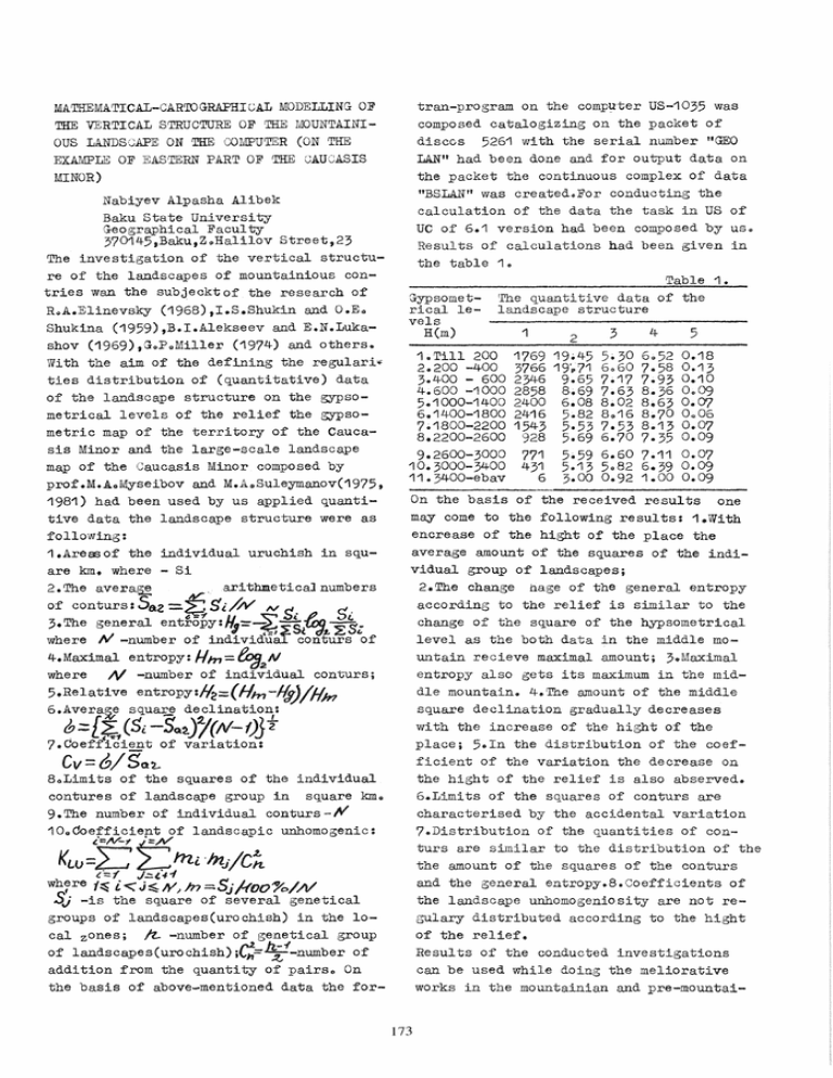
MATHEMATICAL-CAR'lOGRAPHIGAL MODELLING OF
THE VERTICAL STRUCTURE OF THE MOUNTAINIOUS LANDSCAPE ON THE COMPUTER (ON THE
EXAMPLE OF EASTERN PART OF THE CAUCASIS
MINOR)
Nabiyev Alpasha Alibek
Baku State University
G·eographical Faculty
370145,Baku,Z Q Halilov Street t 23
The investigation of the vertical structure of the landscapes of mountainious contries wan the subjecktof the research of
R~A.Elinevsky (1968),I.S.Shukin and 0.E4
Shukina (1959),B.I.Alekseev and E.N.Lukashov (1969),Gop o Miller (1974) and others.
With the aim of the defining the regulari~
ties distribution of (quantitative) data
of the landscape structure on the gypsometrical levels of the relief the gypsometric map of the territory of the Caucasis Minor and the large-scale landscape
map of the Caucasis Minor composed by
prof.M.AoMyseibov and M.A Q Suleymanov(1975,
1981) had been used by us applied quantitive data the landscape structure were as
following:
1.Areasof the individual uruchish in square km. where - Si
2.The avera~
, arithmetical numbers
of conturs: Saz
$i//V IV S.
S.
3.The general ent!-opy:H(f=-~ -S~ .I,.",' ~ ~ ..
d
,=,~ ( d £ ~V(,
where tV -number of individuaT conturs of
4.Maximal entropy: Hm=toa2N
where N -number of individual conturs;
5.Relative entro py :f4=(Hm -l(y)/fim
6.Avera~e square declination:
=.f
~=[?1(5i-SQ~/(N-f)Jt
7.Coefficient of variation:
Cv=6/Sot.-
80Limits of the squares of the individual
contures of landscape group in square kmo
9. The number of individual con turs -,.".
10 0 00efficient of landscapic unhomogenic:
Kw
=}; ~:miInJ/C~
(.==1
J.:::.t·rf
wh:re 1~ i", J ~ IV; In ::::,Sj /-100%/N
SJ -is the square of several genetical
groups of landscapes(urochish) in the local zones; ~ -number of genetical group
of landscapes(urochish);C~=~1-number of
addition from the quantity of pairso On
the basis of above-mentioned data the for-
tran-program on the COmpll'ter US-1035 was
composed catalogizing on the packet of
discos 5261 with the serial number ttGEO
LAN" had been done and for output data on
the packet the continuous complex of data
"BSLAN" was created<>For conducting the
calculation of the data the task in US of
UC of 6.1 version had been composed by uSo
Results of calculations had been given in
the table 1 <>
Table 1.
!rhe
quantitive
data
of
the
Gypsometrical le- landscape structure
vels
4
H(m)
1
5
3
2
1.Till 200
2.200 -400
3.400 - 600
4.600 -1000
5.1000-1400
6.1400-1800
7.1800-2200
8.2200-2600
9.2600-3000
10.3000-3400
11.3400-ebav
1769
3766
2346
2858
2400
2416
1543
928
771
431
6
19.45
19',,71
9.65
8.69
6.08
5.82
5.53
5.69
5.59
5.13
3.00
5.30
6060
7.17
7.63
8.02
8~16
7.53
6.70
6.60
5082
0.92
6052
7.58
7.93
8.36
8.63
8.70
8.13
7.35
7.11
6.39
1.00
0.18
0 .. 13
0.10
0<>09
0.07
0 0 06
0.07
0.09
0.07
0.09
0.09
On the basis of the received results one
may come to the following re sul ts: 1. \Vi th
encrease of the hight of the place the
average amount of the squares of the individual group of landscapes;
2.The change nage of the general entropy
according to the relief is similar to the
change of the square of the hypsometrical
level as the both data in the middle mountain recieve maximal amount; 3.Maximal
entropy also gets its maximum in the middle mountain. 4.The amount of the middle
square declination gradually decreases
with the increase of the hight of the
place; 5.In the distribution of the coefficient of the variation the decrease on
the hight of the relief is also abserved.
6.Limits of the squares of conturs are
characterised by the accidental variation
7.Distribution of the quantities of conturs are similar to the distribution of the
the amount of the squares of the conturs
and the general entropy.8.Coefficients of
the landscape unhomogeniosi ty are not regulary distributed according to the hight
of the relief.
Results of the conducted investigations
can be used while doing the meliorative
works in the mountainian and pre-mountai173
nian condictions,while working out scemes
of the regional planning while dOing the
erectional works in the mountainian conditions,while recreational evaluation of
the territory with the aim of rest and
turism.Besides these.the developed method
might be applied in the course of analysis of the vertical structure of the soil
-plant cover,ty:pes of relief,ty:pes of quantiniary lauers and in the process of
analysis of the other elements of the
geographical landscapeso
In the final stage of the investigation
one can come in to the following results
on the basis of recieved results:maps of
landscape structures of gypsometrical levels of the researched territories had
been composed on the printer of the personal computer IBM PC ATQ
Thg map of th~ digtribution
of th~ cogffici8nt of ~~omo=
(according;
RESEARCH EXAMPLE
HJ~gographic&l
map of
Phyg ical=G·g~Jgraphical
Figld of Thg Caucagis
Minor (within thg limits
"cae
Hy pS 0s,.,a..ph
CUYYlLtUye/.1)Q nd.
-the. Cu,"~o..-lu1Jl, Of 1:1'I.e, diSi-Y'iGuf:ilJl't Of -the fJulJ4~' i:!J oJ i.!Jpes
Of
HM
estMsca.peSl2PJ
physicae-S.eDg-
J"a.pki.cae Fi,.eeot., o:l-l:Ae
Ca.uco.sLs MLhOt'(Wi-l::ltlf'L. -the,
limits
SIOO
oJ.Rzd'8&iJ~n Rllp)
Sl.{oO
3000
2600
2.~Oo
4'00
11.400
(000
Plaing
For@ mountainious
'00
Lo\v mOl.l.a."1tains
too
-
-,.,..
-
OT-'--r~~~~~~~__~S
hlOU/t.-l;~ S
High mountain
Mirlc/.lt
o
o
174
loooo
'000
2000
i
to
11(000
N
18000
i
•
i
•
2.0
30
'10
50
,50 FORMAT(1H ,. ~LI= (I,F1003,
HDELTA= ,F1 0.3)
PRINT 75,AINFOR,A.\!AXIN ,OTINF
..
75 FOmu.T~1H ,IIGENERAL ENTROPY HO:::# t
*F1004IMAXIMAL ENTROPY H1~=',
*F10041#RELATIVE ENTROPY HOT=lI t
*F10.4)
CV=DOTK/SR
WRITE(6,24)AVAR,AKVAR.!DOTK,CV
24 FORMAT~1H 'AVAR=',F1U 2
*AKVAR= ,F10.2,'DOTK=·,F1~.2,
• 'cv:::(1 F6(2)
WRITE~6,71 )
NM=N
CALL KABKAZ(NM,X)
WRITE(6,71)
66 CONTINUE
WR!':PE (6 t 71 )
CALL FORMA(X ,AEN, UZUN ,SUJl(}R,NM)
44 CONTINUE
STOP
END
SUBROUTINE FORMA(NN ,NK,PLOSAD,
*SIRINA,DLINA,GRANIS N)
DI~lliNSION DLINA(1000)lSIRINA(1000),
"'GRANIS(1000)tPIOSAD(1uOO),TT(77),
·S(1000) ,NN(1uOO) ,NK(1000)
DO 3 1=1 N
GRANIS(I~=GRANIS(I)"'2.0
SIRINA(I)=SIRINA(I)·2.0
DLINA(I)=DLINA(I)*2.0
PLOSAD(I)::::PLOSAD(I)'''4 0 0
3 CONTINUE
DO 4 I=1,N
S(I)=DLINA(I)/SIRINA(I)
SPK(I)=GRANIS(I)/3.54"'SQRT(PLOSAD(I»
XS(I)=1.24*PIOSAD(I)/DLINA(I)*"'2
4 CONTINUE
WRITE(6,5)(S(I) I=1,N)1
*(SPK(I),I=1,N)/{XS(I),I=1,N)
5 FORMAT(12F10.41 '~12F10.4/12F10.4)
SUBROUTINE KABKAZ,N,SQ)
"'DIMENSION SQ(990) ,WVVA(80) ,QSQ(990) ,
*S(990),AM(99 0 )
WN=O.
AN=N
DO 3 I=1,N
3 WN=WN+SQ(I)
DO 33 I=1,N
S(I)=(SQ(I) IvVN)'" 1 00. 0
AM(I)=S(I)/C100.0/AN)
33 CONTINUE
SUM=O.
N1=N-1
00 7 I=1,N1
11=1+1
DO 4 J. 11,N
QSQ(I)=AM(I)*AM(J)
SUM=SUM+043Q (I)
4 CONTINUE
7 CONTINUE
ODNOR=SUM/(AN*(AN-1 0)/2.0)
IVRITE(6,5)WN,SUM,ODNOR
5 FORMAT(3X 1 "VlN=" ,F10.3,4X, 'SUM=",
*~1103,4X, COEFFICIENT LANDSCAPIC "':
'" UNHOMOGENIC -0DNOR= /I ,F10.4)
EXAMPLE FORTRAN PROGRAM PRIGLAN'
DIMENSION ABSVAR(990),SVVAR(99 0 )
'" (I
*W(990)~V(990)~TTe80),AKORRX(990):
*VKORRV,99 0 ),X,99 0 ),AEN(99 0),
*UZUN(990) NK(99 0),NN(99 0),
'" GRANIA( 1000, 10) ,SUMGR(1 000)
DO 44 KKz1,1
DADe5 20)TT
20 FORMAT~80,A1)
PRINT 20 1 TT
READ(5 1u2)N
102 FORMATlI3)
71 FORMAT(1H ,60(!.# ... 1I»
DO 3875 1=1.N
READ 200 J NN(I),NK(I),X(I),AEN(I),
·UZUN(I)"GRANIA(I,J)
J=1,10)
pRINT 200~NN(I)~NK(I~,X(I)tAEN(I),
,·UZUNeI), ('\$RANIA,I ,J) ,J=1 11 1u»
3875 CONTINUE
200 FOR1VIAT(I3,I2,F5,,1 ,F5.1 ,10F5.1)
DO 623 I=1,N
SUMGR(I)=O.O
00 571 J=1,10
SUMGR(I)=8UMGR(I)+GRANIA(I,J)
571 CONTINUE
623 CONTINUE
CALL FORMA(NN,NK,X~AEN,UZUN,
• SUMGR ,N)
DO 66 L1=1 3
IF(L1oEQo1~GO TO 985
IF(L1 4EQo2)GO TO 986
IF(L1tEQo3)GO TO 987
986 DO 456 L2=1,N
X(L2)=AEN(L2)
456 CONTINUE
GO TO 985
987 DO 867 L2=1,H
X(L2)=UZUN(L2)
867 CONTINUE
985 SYM=O.
XMIN=X(1)
XMAX=XMIN
IX) 77 I=1,N
Q
IF(X(I).LT.XMIN)X~nN=X(I)
IF(X(I) • GT.XIVlAX)XMAX=OCCI)
77 CONTINUE
PRINT 88 ,XMIN pXMAX
.....
..
88 FORMAT(1H l) *xMINz'" ,F10.2, *xMAxz- ,
*F10.2)
IX) 4 I=1,N
SYM=SYM+X(I)
4 CONirINUE
A.N=N
SR=SYM/AN
WRITE(6 400)SYM,SR
400 FORMATC'SYM= II ,F11o?, -MIDDLE" I
• # ARITHME!rIJAL" , "SR='1,F11.2)
AVAR=O.
AKVAR=O.
AINFOR=O.
DO 23 1=1 N
DOLJA=xeI~/SYM
AINFOR=A1NFOR+3·3222·ALOG10(OOLJA)*
*OOLJA
9
ABSVAR(I)~(I)-SR
AVAR=AVAR+ABSVAR(I)
SVVAR(I)=ABSVAR(I)·*2
AKVAR=AKVAR+SVVAR CI)
23 CONTINUE
AINFOR=ABS(AINFOR)
DOTK=SQRT(AKVAR/(Al~-1.0»
M!AXIN=303222*ALOG10(AN)
OTINF=(AMAXIN-AINFOR)/AMAX1N
HDO LI=AiVIAXIN-A1NFOR
HDELTA=AMAXIB/AINFOR
WRITE(6,50)HDOLI,HDELTA
RETURN
END
EXAMPLE SYSTEMIC PROCEDUR
IIPR1CLAND JOB MSGLEVEL=(1,1) ,MSGCIaSS=P
IIGEOGRAF EXEC FORTGCLG,PARM.FORT=SOURCE
lIFORT.SYSPRINT DD SYSOUT::::P
IIFORT.SYSIN DD UNIT=SYSDA,VOL::::SER=GEOLAN
II
DSN=PRO GLAN (PRICLAND)
t
I·
/IGO.SYSIN DD UNIT=SYSDA,VOL=SER=GEOBAB
II
DSN=LAN. DATA (LAND oBASE) ,
175
