Document 11629716
advertisement
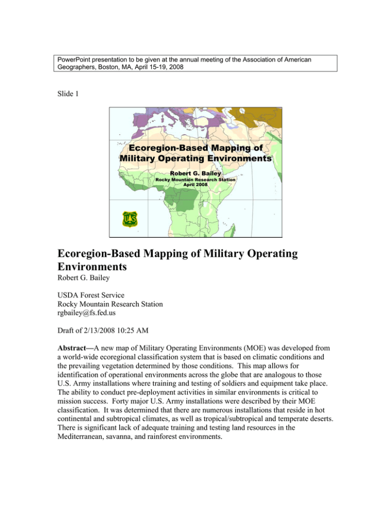
PowerPoint presentation to be given at the annual meeting of the Association of American Geographers, Boston, MA, April 15-19, 2008 Slide 1 Ecoregion-Based Mapping of Military Operating Environments Robert G. Bailey Rocky Mountain Research Station April 2008 Ecoregion-Based Mapping of Military Operating Environments Robert G. Bailey USDA Forest Service Rocky Mountain Research Station rgbailey@fs.fed.us Draft of 2/13/2008 10:25 AM Abstract—A new map of Military Operating Environments (MOE) was developed from a world-wide ecoregional classification system that is based on climatic conditions and the prevailing vegetation determined by those conditions. This map allows for identification of operational environments across the globe that are analogous to those U.S. Army installations where training and testing of soldiers and equipment take place. The ability to conduct pre-deployment activities in similar environments is critical to mission success. Forty major U.S. Army installations were described by their MOE classification. It was determined that there are numerous installations that reside in hot continental and subtropical climates, as well as tropical/subtropical and temperate deserts. There is significant lack of adequate training and testing land resources in the Mediterranean, savanna, and rainforest environments. 2 Slide 2 Introduction • Environments differ • Training and testing equipment in similar environments is critical to mission success Introduction The natural environments of the Earth differ. Training and testing equipment in similar environments is critical to mission success. Slide 3 Army’s Approach to Environment • Broad undifferentiated landscapes – “jungle”, “mountains”, “deserts” • Broad climatic regions – “cold”, “hot”, “wet”, and “dry” • Focus on extremes The Army’s approach to characterizing natural environments was derived from WWII and Vietnam Conflict. This approach generalized operational environments into broad undifferentiated landscapes, such as “jungle”, “mountains”, and “deserts”, or into broad climatic regions such as “cold”, “hot”, “wet”, and “dry”. These categories focus on extremes and ignore the complexity and variability of environments. Slide 4 3 Battle of the Bulge: Bedsheets for camouflage Lellig, Luxembourg, 30 Dec 1944. Signal Corps photo (Hustead) As a result, our troops have sometimes not been trained or equipped properly. Slide 5 New Approach Needed 1. Capture global patterns of climate, vegetation, and landform 2. Allow comparison and contrast between similar environments, or analogs A new approach is needed: one that, first, captures global patterns of climate, vegetation, and landform, and, second, allows the comparison and contrast between existing training and testing environments in the US and similar environments, or analogs, found worldwide. U Slide 6 U 4 Global Military Operating Environments • Army Science Panel • Ecosystem-based zoning, following a holistic approach • Bailey (US Forest Service) & Bill Doe (Center for Environmental Management of Military Lands at CSU) To address these needs a panel of military, federal, academic scientists recommended that a framework, entitled Global Military Operating Environments, be developed using an integrated ecosystem-based zoning, following a holistic approach. Bill Doe and I became involved because of past experience in this kind of work. Slide 7 A Holistic Approach • Both biotic and abiotic components of ecosystems are considered in the zoning scheme Approach and principles of the MOE ecological zoning By a holistic approach is meant that both biotic and abiotic components of the ecosystems are considered in the zoning. Slide 8 5 While the ecosystem concept implies equality among all the components of the system, all the components are not equally significant. Climate largely determines ecosystem boundaries. As it varies, the other components change in response. To a considerable extent, climatic factors determine ecosystem boundaries. Slide 9 The most important climatic factor is the climatic regime, defined as the daily and seasonal fluxes of energy and moisture. For example, tropical rainforest climates lack seasonal periodicity, whereas mid-latitude steppes have pronounced seasons. One can illustrate different regimes by studying climate diagrams, or climographs (sensu Walter et al. 1975). Slide 10 6 Macroclimate = ƒ (latitude & continental position) (climate unaffected by landform) Topoclimate = ƒ (landform) (e.g., south-facing, hotter and drier than normal) Yellowstone Plateau, Wyoming The arrangement of zones of similar climate depends on latitude and continental position. This pattern is overlain by landforms (geology and topography) that create local climates, called topoclimates. To develop a global system of climatic zones, we must, therefore, postulate a climate that lies just beyond those local modifying irregularities. To this climate we apply the term macroclimate. Slide 11 Ecological climatic map boundaries that correspond to significant biological boundaries Although ecological zones can be mapped by reference to a single feature (such as climate), they must always be checked to ensure that the boundaries have ecological significance. Slide 12 7 Global Ecological Climate Classifications • Köppen (1931) modified by Trewartha (1968) • Thornthwaite (1933) • Holdridge (1947) • Walter & Box (1976) For the choice of climatic classification to be used in zoning a number of global systems were surveyed including Köppen modified by Trewartha (Köppen 1931, Trewartha 1968), Thornthwaite (1933), Holdridge (1947), and Walter and Box (1976). Slide 13 Köppen classification system 9 number of classes suited to MOE needs 9 good correspondence with climax veg types and soil W. Köppen 1921, photo by Friedrich Becks Of these possibilities Köppen-Trewartha was a good candidate for MOE work due to the number of classes that correspond well to MOE needs. Moreover, further study showed that while Köppen-Trewartha is based on climate there is good correspondence between its types and the natural climax vegetation types and soils within them (Bailey 1996). [This is largely because Köppen derived his climate classes from observations on the distribution of natural vegetation on various continents.] Slide 14 8 Ecoregions of the Continents (1989, 1996) Based on the climate classes of Köppen-Trewartha (1968) and a map of potential vegetation (Gerasimov 1964) Domains Divisions Reduced scale rendition of a portion of ecoregion map. Scale: 1:30,000,000, 1996 A good precedent for using Köppen in global ecological zoning was carried out by me, in that I used the Köppen-Trewartha system for development of an ecoregion scheme for North America and the rest of the world (1989, 1995, and 1998). Two levels were identified. The broadest are domains and within them are divisions. Slide 15 MOE global ecological zoning (adapted from Bailey 1996) First level = World Climatic Regions (equivalent to ecoregion domains) Based on climatic groups of KöppenTrewartha • 3 humid, thermally differentiated • 1 defined on the basis of moisture alone MOE Global Ecological Zoning Following this precedent, Bill Doe and I developed a zoning scheme for MOE adapted from my work. Referred to as World Climatic Regions, the first level is based on the climatic groups of Köppen-Trewartha: 3 are humid, thermally differentiated; 1 is defined on the basis of moisture alone. Slide 16 9 World Climatic Regions (ecoregion domains) As shown on a hypothetical continent of low, uniform elevation, the four groups are: polar, with no warm season; humid temperate, rainy with mild to severe winters (4 months > 10C); humid tropical, rainy with no winters (cold month > 18C). The fourth, dry, is defined on the basis of moisture alone. Slide 17 World Climatic Regions (ecoregion domains) Based on climate groups of Köppen-Trewartha Adapted from Bailey, 1996 The geographic distribution of the individual world climatic regions is shown on this schematic world map. Slide 18 10 MOE global ecological zoning (adapted from Bailey 1996) Second level = Military Operating Environments (equivalent to ecoregion divisions) Based on climatic types of Köppen-Trewartha, in combination with vegetation physiognomy – 15 classes or Ecological Zones: • seasonality of precipitation • degree of dryness or cold names reflect dominant zonal vegetation (e.g., tropical rainforest, boreal forest) The second level, referred to as Military Operating Environments, is based on the climatic types of Koppen-Trewartha, in combination with vegetation physiognomy. Fifteen (15) classes or Ecological Zones are distinguished using seasonality of precipitation or degree of dryness or cold as additional criterion. The Ecological Zones reflect broad zones of relatively homogeneous vegetation, such as tropical rainforest, boreal coniferous forest, etc. U U Slide 19 Climatic types Plant formations Source: Dansereau 1951 Ontario, Canada In fact, visible and tangible expressions of climate, such as vegetation, help locate the boundaries of climatic types. Generally, each climate is associated with one or more natural plant formation classes (such as boreal forest), each responding to the climate regime to which it is subjected. [Of course, not all the space is taken up by the formation, for the nature of the topography will allow the differentiation into many habitats such as U U 11 bottomlands where water lies near the surface. One ignores these local variation in mapping climatic regions (and therefore MOEs/ecoregions).] Slide 20 MOE Level 2 Based on macroclimate data and a map of potential vegetation in Fiziko-geographicheskii atlas mira, Plate 75 (Gerasimov 1964) Scale: 1:80,000,000 Boundaries of these formations were adapted from a world map of natural landscape types in Atlas Mira (Gerasimov 1964), at a scale of 1:80,000,000. Slide 21 Not classified and mapped • Azonal vegetation types (e.g., saltbushgreasewood) Source: Kuchler (1970) • Mountain systems (with vertical zones) Sawtooth Mountains, Idaho Azonal vegetation types, for instance, saltbush-greasewood; as well as mountain systems in which vertical zones predominate is not separately classified and mapped. U U Slide 22 12 Mountain systems (with vertical zones) Within the ecoregion classification system, mountain systems are distinguished at the division level. Mountain systems contain a variety of vertical zones. Each mountain within a climatic type has a typical sequence or spectra of vertical zones. Mountains with a similar type of zonation are differentiated by color on this map. The current MOE framework does not address the high, mostly small-scale diversity of mountain systems. These environments, nevertheless, are important because they include 24% of the land mass of the continents. Slide 23 Military Operating Environments (ecoregion divisions) Rainforest Tundra Latosols (Oxisols) Tundra (Entisols, Inceptisols, Histosols) Evergreen tropical rainforest Tundra vegetation (treeless) Arrangement of the 15 MOEs is shown on this hypothetical continent. They range from the tundra at high latitudes to rainforests at low latitudes. In each climate, the developments of both the soil and the vegetation converge toward a characteristic family of types. 13 Slide 24 Military Operating Environments (ecoregion divisions) Based on macroclimate conditions (climate types of Köppen-Trewartha) with boundaries determined by plant formations Adapted from Bailey, 1996 This is a schematic world map of the MOEs. Each environment is characterized by a different climatic regime and associated plant formation. Slide 25 Transfer information Tropical/Subtropical Desert Southern Nevada, USA Southern Iraq Semi-desert on light desert soil (Aridisol) MOEs occur in regular and predictable patterns across the earth’s surface. The general climatic conditions, vegetation, and land surface patterns associated with a given MOE will be replicated wherever this MOE is located. Thus the classification provides a systematic framework for transferring knowledge. Data gathered from one MOE can be applied to another of the same type, where there is little of no data. Slide 26 14 Pattern within zones Tropical/subtropical desert (macroclimate) Topoclimates dunes bajada wash Mojave Desert, California Philip Stoffer, USGS However, this approach should be used with caution. Recall that, even within uniform macroclimate, landform leads to differences in local climate and soil moisture conditions and are reflected in variations in vegetation. Therefore, one should always transfer information between similar sites within an ecoregion and to similar sites in an ecoregion of the same type. U U Slide 27 Main principle of delineation Involves aggregating or matching ecological or potential vegetation maps into the global framework. The main principle in delineation of global MOEs involves aggregating or matching regional ecological or potential vegetation maps into the global framework Slide 28 15 Steps 1. Identification of Köppen-Trewartha climatic types; approximate level 2 MOEs 2. Establishment of correspondence between potential vegetation types and MOEs 3. Final definition and delineation of MOEs, using maps consulted in steps 1 and 2 The final steps can be distinguished: 1) Identification of Köppen-Trewartha climatic types; which will approximate the level 2 MOEs. 2) establishment of correspondence between potential vegetation types and the MOEs. 3) final definition and delineation of the global MOEs, using maps consulted in steps 1 and 2. Slide 29 Army Installation Analogs Army Installation Analogs Forty major U.S. Army installations are located with reference to their MOE classification on this map. As indicated by the map there are distributed primarily in the Southeast, Southwest, western states and Alaska. Slide 30 16 MOE (ecoregion) type Tundra Warm Continental Marine Prairie Mediterranean Savanna Tropical/Subtropical Steppe Temperate Steppe Rainforest Subarctic Temperate Desert Tropical/Subtropical Desert Hot Continental Subtropical Number of Army Installations 0 1 1 1 1 1 2 2 2 2 3 5 9 9 Based on the number of installations, the Army’s land inventory is adequate to prepare for conflict in temperate and tropical/subtropical deserts. Areas of hot continental and subtropical regions are also well represented. Slide 31 MOE (ecoregion) type Yuma White Sands, Ft Bliss Kabul Afghanistan Baghdad Iraq Tropical/Subtropical Deserts From Microsoft Encarta The National Defense Council Foundation identified existing and new major conflicts areas throughout the world. Comparing these conflict areas to the current Army land inventory yields obvious conclusions. Areas of tropical/subtropical deserts—such as Iraq and Afghanistan—where recent conflict and Army deployments are in effect, are well represented by Army installations (Yuma, White Sands, and Ft. Bliss). Slide 32 17 Conflict Area* MOE (ecoreg) Type Army Analog Iraq, Kuwait Saudi Arabia tropical/subtropical desert Bliss, Yuma White Sands Iran, Somalia tropical/subtropical steppe Hood, Sill Korea hot continental Campbell, Knox Drum, Leonard Haiti savanna, rainforest None Panama, Nicaragua savanna, rainforest None Bosnia, Kosovo Mediterranean None Rwanda savanna, rainforest None *Source: National Defense Council Foundation 1999 However, this comparison also reveals a significant lack of adequate training and testing land resources that represent potential conflict areas in the Mediterranean, savanna, and rainforest environments. Slide 33 As shown in this map, there are significant conflict areas (black) without an Army training and testing analog. The environments of conflict areas in South America, Africa, southern Asia, Southeast Asia and Micronesia, are underrepresented in the Army land inventory. Slide 34 18 Summary • MOEs provide an analog relationship between Army installations and similar environments worldwide • Analogs are adequate for: Hot continental and subtropical climates Temperate and tropical/subtropical deserts • Analogs are inadequate for: Mediterranean, savanna, and rainforest Mountain systems Summary MOEs provide an analog relationship between Army installations and similar environments worldwide. Analogs are adequate for: hot continental and subtropical climates (environments), as well as tropical/subtropical and temperate deserts. There is significant lack of adequate training and testing lands in Mediterranean, savanna, and rainforest environments, as well as mountain systems. Slide 35 Acknowledgments: William Doe Center for Environmental Management of Military Lands Colorado State University This research was conducted with funds provided by the U.S. Army Yuma Proving Ground, under the sponsorship of Graham Stullenbarger. Acknowledgments: I would like to acknowledge William Doe of the Center for Environmental Management of Military Lands at Colorado State University who contributed to this presentation. This research was conducted with funds provided by The U.S. Army Yuma Proving Ground, under the sponsorship of Graham Stullenbarger. 19 Slide 36 For More Information: For More Information: Bailey, R.G.1996. Ecosystem Geography. Springer. Doe, W.D. & R.G. Bailey. 2007. Military operating environments: An ecoregions framework to characterize U.S. Army testing and training lands as operational analogs. Fort Collins, CO: Center for Environmental Management of Military Lands, Colorado State University; interim report. 56 p. With CD-ROM of ecoregion maps and climate diagrams.

