Trimdon What was it like living in a late 19th Century... Education Service
advertisement

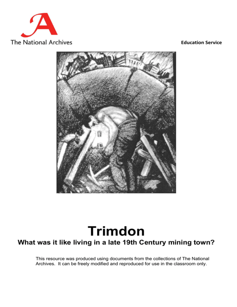
Education Service Trimdon What was it like living in a late 19th Century mining town? This resource was produced using documents from the collections of The National Archives. It can be freely modified and reproduced for use in the classroom only. Trimdon : What was it like living in a late 19th Century mining town? 2 Introduction Trimdon is an area of County Durham in the North of England which covers the towns of Trimdon, Trimdon Grange and Trimdon Colliery. At the beginning of the 19th century it was simply fields and moors. By the middle of the 19th century more people came to live and work in the area. A railway was built and houses sprang up near to the railway line. By the late 19th century Trimdon had grown even bigger; there were now several roads and rows of houses. In this lesson, we are going to look at a number of different sources about Trimdon. We are trying find out what it must have been like to live in Trimdon in the late 19th century. Tasks Look at Source 1 1. This is a map of the Trimdon area in 1857. a) b) c) d) e) Make a list of all the different things you can see on the map. Where did people work? Were the houses big or small? In 1857, was it a large town? Was Trimdon a middle class or working class area? How did you make up your mind? f) Why do you think a railway was needed in Trimdon? Look at Source 2 2. Now look at the same area in 1897 a) What things changed or stayed the same between 1857 and 1896 in Trimdon? b) Why do you think Trimdon had become a bigger place in 1897? c) Do you think people did the same jobs in 1897 as they did in 1857? d) Around what part of Trimdon has the railway grown? Look at Source 3 3. Look at all of the photos. Can you match the photographs to the correct place on the map? a) b) c) d) Describe the houses in Rose Street. What piece of clothing did most girls seem to wear? What seems to be the main form of transport? What type of street is Commercial Street? Hint: The clue is in the name of the street. e) In what ways is Commercial Street different from a high street today? © Crown Copyright 2008 Trimdon : What was it like living in a late 19th Century mining town? 3 f) Do you think that the people who lived in Rose Street were better or worse off than those who lived in Commercial Street? Explain how you made up your mind. Look at Source 4 4. This is part of the 1881 census return for Trimdon. a) b) c) d) e) f) g) Make a list of all the jobs that people on this street did. How many people did each job? What does this tell you about what kind of place Trimdon was? At roughly what age did children go out to work? Who was the youngest worker on this street? Who is the oldest person in this street? Did all the women go out to work? Look at Source 5 5. This is a drawing of a coal miner. a) • • • • b) Find: The town The miner A pick-axe Factories Does the drawing make mining look like an easy job? Give reasons for your answer. c) The town and the factories all need the coal that the miner is digging. The miner’s hard work means that homes are warm, dinners are cooked and factories work. What is resting on the miner’s back? d) Without miners what would happen? 6. Make a leaflet for visitors to Trimdon in the 19th Century. In the leaflet explain: • • • • how Trimdon has changed over the years what most people in Trimdon do for a living what Trimdon looks like. Include some drawings or a small map. Background In the 19th Century, Coal Mining was on the increase thanks to the Industrial Revolution. Small towns such as Trimdon were growing, and this growth could usually be seen around collieries (mines), quarries and other workings. Coal was one of the essentials of the Industrial Revolution. Without it, it was much more difficult to cook and heat your home. It was also important for the country's transport, such as the railways, and was used as a fuel for factories. © Crown Copyright 2008 Trimdon : What was it like living in a late 19th Century mining town? 4 As Trimdon grew, so did their colliery, and as a result of that, so did their slag heap (waste material from the mine). More houses needed to be built and there were more churches and a bigger school. Trimdon Grange was one of a group of three villiages in the area of Trimdon. The population of the area in 1801 was 278; in 1811, 274; in 1821, 302; in 1831, 276; in 1841, 382; in 1851, 1598; in 1861, 2975; in 1871, 3266; in 1881, 3057; and in 1891, 4135. The rapid increase between 1841 and 1851 was due to the opening of the colliery and lead to the creation of the villages of New Trimdon and Trimdon Grange. Teachers Notes Teachers could develop a similar a lesson for their own locality. They could explore their local archive for material and use the census records for 1841 t0 1901 available online at The National Archives. The two maps show Trimdon 41 years apart. They clearly show the growth of this town centred around the colliery, quarry and lime works. In both maps, the railway appears to serve the colliery rather than the town's population. Together the maps provide the opportunity for pupils to see how Trimdon changed. The colliery has grown; so too has the resulting slag-heap. The population has increased and more housing has been built, reducing the woodland in the south. There are more churches, an enlarged school, a reservoir and Temperance Hall. There are also examples of features that remained the same, such as Overman’s Row, the position of the slag-heap, the inn or public house, Commercial Street and Gravel Pit. Having studied the maps, pupils move on to look at some more visual evidence of life in Trimdon – photographs. There are few street names on the maps, so pupils will find it a challenge to match the photos to the correct place on the map. An element of good guess-work will have to be done. However, Commercial Street seems to be what is labelled ‘Lane + Row’. Teachers can ask pupils to describe the differences between Victorian streets and those of today. Notice the children are standing quite unconcerned in the middle of what would have been their high street. A more general question is how pupils can tell that this is a photograph from the past. The Victorian census material takes pupils further in their investigation. Explain to the children what a census is. This one entry will confirm some of the ideas that they have begun to form about life in Trimdon. The occupations reveal a working-class mining community, where children as young as 13 worked in the mines. Finally, pupils are provided with a drawing which summarizes the importance of mining in Britain at this time. According to the artist, mining is at the core of Britain. It forms the backbone of industry. Mining was at the heart of Trimdon. Further Teaching Suggestions © Crown Copyright 2008 Trimdon : What was it like living in a late 19th Century mining town? • • • • • 5 On printed copies of the maps, pupils could shade specific areas on such as the railway, housing, services, churches, and places of work Pupils can draw bar charts or use database software to manipulate information contained in a census return. Working in pairs, pupils could conduct their own ‘census’ at school or in their street. -Pupils could ‘interview’ someone from the census return - perhaps 81 year old William Clough. The aim would be to ask him how life in Trimdon changed between 1857 and 1896. Pupils can find out what is the most common work in their community and if that type of work existed in the 19th Century. We would like to thank Durham Record Office for their assistance in the production of this lesson. Sources Durham Record Office Ref: Source 1 and 2 - OS Durham XXXVI,1 (1857) and (1896), Source 3 - photos D/Ph40/2 - D/Ph40/4 Source 4 - RG 11/4904 Source 5 - COAL 13/116 Schemes of Work How did life change in our locality in Victorian times? Key Stage 1 & 2 Unit 12 Industrial changes action and reaction Key Stage 3 unit 11 © Crown Copyright 2008 Trimdon : What was it like living in a late 19th Century mining town? Source 1 : OS Durham XXXVI,1 (1857) © Crown Copyright 2008 6 Trimdon : What was it like living in a late 19th Century mining town? Source 2 : OS Durham XXXVI,1 (1896) © Crown Copyright 2008 7 Trimdon : What was it like living in a late 19th Century mining town? Source 3a : Photo of Trimdon Grange circa 1900 (Durham Record Office D/Ph40/2) Source 3b : Photo of Trimdon Colliery circa 1900 (Durham Records Office D/Ph40/3) © Crown Copyright 2008 8 Trimdon : What was it like living in a late 19th Century mining town? Source 3c : Photo of Trimdon Colliery circa 1900 (Durham Records Office D/Ph40/4) © Crown Copyright 2008 9 Trimdon : What was it like living in a late 19th Century mining town? Source 4 : Census Return for Trimdon Grange 1881 (RG 11/4904) Source 4 : Transcript of Census Return for Trimdon Grange 1881 (RG 11/4904) © Crown Copyright 2008 10 Civil Parish or Township of Trimdon City or Municipal Borough of Municipal ward of Houses Uninh abite d (U) or No of ROAD STREET &c Schedul and NO or NAME Inhab Buildi NAME and Surname ited ng e of HOUSE of each person 72 Burnetts Street I John Burnett Elanor D[itt]o William D[itt]o Joseph W D[itt]o Ellen S D[itt]o George C D[itt]o James W D[itt]o Robert D[itt]o 73 D[itt]o I William Clough Margaret D[itt]o Thomas D[itto] Matthew D[itto] William D[itt]o 74 D[itt]o I Henry Gill Sarah D[itt]o Thomas D[itto] Joseph D[itt]o William D[itt]o Mary D[itto] 75 D[itt]o I Michael Hobane Bridget D[itt]o Ellen D[itt]o Patrick D[itt]o Michael D[itt]o Ann D[itt]o Town or Village or Hamlet of Urban Sanitary Parliamentary Borough of District of Trimdon Colliery Age Last Birthday RELATIO N to head of family Head Wife Son D[itt]o Dau Son Son Son Head Wife Son D[itt]o Grandson Head Dau Son Son Son Dau Head Wife Dau Son Son Dau CONDITI ON as to Rank, Profession or Female OCCUPATION Marriage Male Mar 58 Labourer D[itt]o 55 Unmar 27 Coal Miner D[itt]o 22 D[itt]o D[itt]o 20 Servant D[itt]o 18 Coal Miner D[itt]o 16 D[itt]o D[itt]o 13 D[itt]o Mar 81 Depending on his sons D[itt]o 79 Unmar 39 Coal Miner D[itt]o 36 D[itt]o D[itt]o 26 D[itt]o Widower 49 Disabled through an accident Unmar 28 Servant D[itt]o 25 Coal Miner D[itt]o 19 D[itt]o D[itt]o 17 D[itt]o D[itt]o 15 Servant Mar 40 Labourer D[itt]o 44 Unmar 15 Servant D[itt]o 11 Scholar D[itt]o 8 D[itt]o D[itt]o 6 D[itt]o Total no of Males and Females 17 8 Rural Sanitary District of Sedgefield Ecclesiastical Parish or District of Deafhill cum Langdale If (1) DeafDumb (2) Blind (3) Imbecille or Idiot Where Born Fishtown Durham Martin Hall Durham Trimdon D[itt]o D[itt]o D[itt]o D[itt]o D[itt]o Hartworth Northumberland Blyth Northumberland Kellor Durham D[itt]o D[itt]o Souley Yorkshire [?] D[itt]o D[itt]o Seaton Durham Shotham Durham D[itt]o Ireland D[itt]o D[itt]o D[itt]o Coxhoe Durham D[itt]o Trimdon : What was it like living in a late 19th Century mining town? Source 5 : Drawing of a miner (COAL 13/116) © Crown Copyright 2008 11


