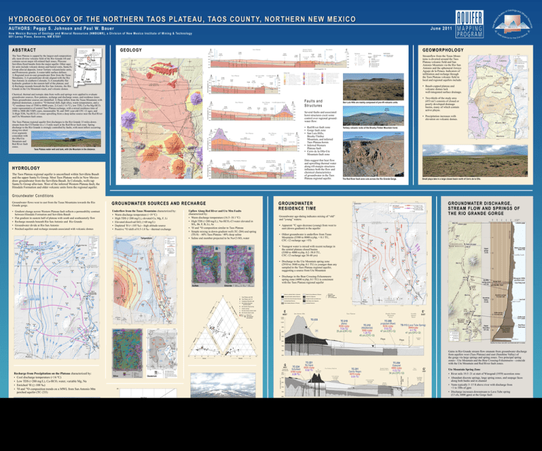
ABSTRACT
advertisement

HYDROGEOLOGY OF THE NORTHERN TAOS PLATEAU, TAOS COUNTY, NORTHERN NEW MEXICO June 2011 AU THO RS: P e g g y S . J o h n so n an d P au l W. B au er New M e x i c o B u r eau of Geol ogy and M ine r a l Re s our c e s (NMBGMR), a Div is ion of N e w Me x i c o I n s t i t u t e o f Mi n i n g & Te c h n o l o g y 8 01 L e r o y P la c e , S ocorro, N M 87801 CO-31 8500 TC-212 Middlemist Q 8000 TC-205 Ruil Bros. Tx Tb Tsf Tb 7500 Tb Tsf Tsf Tsf Th 7000 Th Th Th Tb Tao Tao Tao Th Th Q Tvr Tg 9000 Well Key 8500 RG-63022 Chiflo Tb Tvr Qf OSE well file number Well name Streamflow from the Tusas Mountains is diverted around the Taos Plateau volcanic field and San Antonio Mountain via the Rio San Antonio and the ephemeral Arroyo Aguaje de la Petaca. Indicators of infiltration and recharge through the Taos Plateau volcanic field to local and regional aquifers include: Water table surface in regional aquifer (Table 1) (actual elevation, if projected) Volcanic intervals, Tv 7500 (from well record) Tvr Measured water-level Recorded water-level Screened interval 7000 Tb Aquifer Symbols Well head 8000 Tb Th Th TC-249 BLM Visitors Center Tag Tg Tsf X 6500 Cerro de la Olla east flank (5.0 Ma) TC-204 Ezequiel RG-51763 TC-207 Chiflo dam site 9a G EO MO RPHO LO G Y SE Elevation feet above sea level Red River Gorge The Taos Plateau is capped by the largest and compositionally most diverse volcanic field of the Rio Grande rift and contains seven major rift-related fault zones. Pliocene Servilleta flood basalts form the major aquifer. Other aquifer units include volcanic domes and buried vents, Santa Fe Group alluvial deposits, lower Tertiary volcaniclastic units, and Proterozoic granite. A water-table surface defines: 1) Regional west-to-east groundwater flow from the Tusas Mountains; 2) A groundwater divide aligned with the Rio San Antonio in southern Colorado; 3) A remarkably flat hydraulic gradient in the eastern half of the plateau; and 4) Recharge mounds beneath the Rio San Antonio, the Rio Grande in the Ute Mountain reach, and volcanic domes. TC-227 Perlite mill Rio Grande Gorge 9000 TC-223 Stateline Cerro de la Olla fault Elevation feet above sea level A’ Taos Basin Brushy-Timber Mountain Horst Taos Plateau Rio San Antonio G E O LOGY Groundwater Divide AB STRA CT A NW Tsf 6500 Vertical Exaggeration = 8x CO-32 8500 TC-237 Saritas CO-33 TC-231 Twin Lakes TC-239 San Luis Hills 285 Q 8000 Tb Tsf Th X 6500 Tb Th Th Th 285 TC-214 Bagwell Q Tb No data Th Th X X No data ? Tsf Q Q Ta 7500 Ta 7000 Tsf Tsf Tsf Tsf 6500 10.500 San Antonio Mountain (3 Ma) Taos Plateau Tds Taos Plateau Horst TC-217 Alire/Duran/Mueller (aban.) 285 TC-212 Middlemist Q 8500 Ta Tx Ta 8000 Q Ta Q Tb Tsf 7500 Th Th Th 6500 X G Elevation feet above sea level 9000 Tx Tsf Th 8000 7500 7500 7000 Th Tres Piedras Platform X X X X Tx Tsf Brushy-Timber Mountain Horst Cerro del Aire north flank (3.6 Ma) Q Tr Tb Th Th X X Cerro de la Olla south flank (5.0 Ma) Q Tb Tb Tsf Th Th X TC-204 Ezequiel TC-245 Kessler Brushy Mountain Tb Tao Tsf 6500 Taos Graben TC-225 Chiflo dam site 7a TC-201 Cerrito Negro Taa Tb Tsf Th Tr 7000 8000 Q 6500 No Agua Peaks (4.1 Ma) Q 285 8500 8500 Sunshine Valley X TC-221 No Agua TC-234 Perlite Mine Schofield WEST TC-113 Lava Tube Spring Tb Th X Elevation feet above sea level Tsf Th X EAST 9000 Q Playa Tb Th 7000 Playa Playa E’ Costilla-Questa Basin Tat Rio Grande Gorge 9000 TC-233 Rio Grande Gorge 10,000 Tb Tg Q G’ EAST Elevation feet above sea level 9000 Guadalupe Mountain (5.3 Ma) 8500 8000 Q Tb 7500 Tb Th Tdg Tg Tag 7000 Tsf X Brushy Mountain Several faults and associated horst structures exert some control over regional groundwater flow: 8000 Tdu Tsf Tsf 6500 • Two-thirds of the study area (453 mi2) consists of closed or poorly developed drainage basins, many of which contain active playas. San Luis Hills are mainly composed of pre-rift volcanic units. 8500 Ta Tsf Th Th X Ute Mountain (2.7-2.1 Ma) Ta Tb No data Tsf Th 7000 9000 Tb Tb 9500 Vertical Exaggeration = 8x TC-211 Chiflo dam site R-11 Tb Elevation feet above sea level Vertical Exaggeration = 8x TC-229 Crow Tx E The Taos Plateau regional aquifer is unconfined within Servilleta Basalt and the upper Santa Fe Group. Most Taos Plateau wells in New Mexico draw groundwater from the Servilleta Basalt. In Colorado, wells tap Santa Fe Group alluvium. West of the inferred Western Plateau fault, the Hinsdale Formation and older volcanic units form the regional aquifer. TC-226 Shawcroft E Faults and Structures D’ EAST Elevation feet above sea level Red River fault zone Vertical Exaggeration = 8x 8500 WEST H YDR OLO GY 7000 Costilla-Questa Basin Taos Plateau Horst TC-222 Bagwell N 6500 Taos Plateau water well and tank, with Ute Mountain in the distance. 7500 6500 Taos Plateau 9000 • Basalt-capped plateau and volcanic domes lack well-integrated surface drainage. 8000 Tsf Elevation feet above sea level The Taos Plateau regional aquifer first discharges to the Rio Grande 33 miles downstream from the CO border in a 1.5-mile reach at the Red River fault zone. Spring discharge to the Rio Grande is strongly controlled by faults, with most inflow occurring along two short river segments coincident with the Olla/Ute Mountain and Red River fault zones. 8500 X D 7500 9000 No data Tsf WEST 8000 Elevation feet above sea level Qf Tb Tsf Th 7000 Tb B’ EAST Qa Tb Tsf 7500 TC-232 Lobatos Rio Grande Gorge Vertical Exaggeration = 8x 9000 TC-238 Alta Lake Costilla-Questa Basin San Luis Hills Horst Rio Grande Gorge Elevation feet above sea level Chemical, thermal and isotopic data from wells and springs were applied to evaluate groundwater sources, flow patterns, recharge and discharge zones, and residence times. Three groundwater sources are identified: 1) Deep inflow from the Tusas Mountains with depleted deuterium, a positive 18O thermal shift, high silica, warm temperatures, and a 14 C residence time of 5500 to 8000 years; 2) Cool (<16 ºC), low TDS, Ca-Na-Mg-HCO3 water representative of central Taos Plateau recharge, with a mixed residence time of 3500 to 5000 (RCYBP) years, measureable 3H, and 3045 year-old CFC-12 ages; and 3) High TDS, Na-HCO3-Cl water upwelling from a deep saline source near the Red River and Ute Mountain fault zones. Taos Plateau Rio San Antonio B WEST • Red River fault zone • Gorge fault zone • San Luis Hills, Brushy/Timber Mountain, and inferred Taos Plateau horsts • Inferred Western Plateau fault • Cerro de la Olla-Ute Mountain fault zone • Precipitation increases with elevation on volcanic domes. Tertiary volcanic rocks of the Brushy-Timber Mountain horst. Cerro Chiflo Cerro de la Olla Tb Tb Tb Tb Tg Tag Tag Tg Data suggest that heat flow and upwelling thermal water along rift-margin structures influence both the flow and chemical characteristics of groundwater in the Taos Plateau regional aquifer. Q Start of Bear Crossing spring zone The Red River fault zone cuts across the Rio Grande Gorge. Small playa lake in a large closed basin north of Cerro de la Olla. Groundwater Conditions 7600 • Apparent C ages decrease (young) from west to east (down-gradient) in the aquifer Rio Grande 5 • Oldest groundwater is underflow from Tusas Mountains (5500 to 8000 rcybp, < 0.1 TU, CFC-12 recharge age >55) State Line gage State Line 10 Upper gorge -2 cfs Elevation (feet) Lobatos gage 14 • Youngest water is mixed with recent recharge in the central plateau closed basins (3500 to 4000 rcybp, 0.2–50.8 TU, CFC-12 recharge age 30-40 yrs) Costilla Creek West Rim 15 • Discharge in the Ute Mountain spring zone (2910 to 3840 rcybp, 0.1 TU) is younger than any sampled in the Taos Plateau regional aquifer, suggesting a source from Ute Mountain • Discharge in the Bear Crossing-Felsenmeere spring zone (4400 rcybp, 0.1 TU) is consistent with the Taos Plateau regional aquifer TS-14 TS-71 TS-113 Chloride Ute Mtn. spring zone +37 cfs Sunshine springs Winograd (1959) accretion zone Gorge fault Cow Patty trail 20 Sulfate 7400 Groundwater age-dating indicates mixing of “old” and “young” waters: 0 Temperature Upflow Along Red River and Ute Mtn Faults characterized by: • Warm discharge temperature (16.5–18.1 ºC) • High TDS (>200 mg/L), Na-HCO3-Cl water elevated in SO4, Br, F, B, Li, As • 2H and 18O composition similar to Taos Plateau • Simple mixing in down-gradient well (TC-204) and spring (TS-8) – 60% Taos Plateau / 40% deep saline • Saline end member projected to be Na-Cl-SO4 water 7200 Underflow from the Tusas Mountains characterized by: • Warm discharge temperature (>19 ºC) • High TDS (>200 mg/L), elevated Ca, Mg, F, Li • Elevated dissolved SiO2 (>60 mg/L) • Depleted 2H (<-105 ‰)—high altitude source • Positive 18O shift of 0.5-1.0 ‰—thermal exchange G RO UNDWATER DISCHARG E, STREAM FLO W AND SPRING S O F THE RIO G RANDE G O RG E 7000 • Gradient change across Western Plateau fault reflects a permeability contrast between Hinsdale Formation and Servilleta Basalt • Flat gradient in eastern half of plateau with south and southeasterly flow • Recharge mounds beneath Rio San Antonio and Rio Grande • Groundwater divide at Rio San Antonio • Perched aquifers and recharge mounds associated with volcanic domes G RO UNDWATER RESIDENCE TIME 6800 G R O U N DWATER SOU R C ES A N D R EC H A R GE 6600 Groundwater flows west to east from the Tusas Mountains towards the Rio Grande gorge. and Ute Mtn. fault TS-72 100 10,500 (ft asl) TC-233 9500 4 ica rbo nat e TC -20 TC 9 -20 8 80 ate +B 60 8500 TC-212 (Middlemist) 3580 rcybp 1.25 TU 40 yrs (CFC-12) TC-209 projected (Rael) 5230 rcybp 0.02 TU 47 yrs (CFC-12) Playa 8000 Playa 3 1 4 0 100 80 40 60 Calcium 20 100 0 0 2 20 20 4 3 40 60 80 100 0 WEST Elevation feet above sea level Silica 9000 (ft asl) Deuterium Vertical Exaggeration = 8x Recharge from Precipitation on the Plateau characterized by: • Cool discharge temperature (<16 ºC) • Low TDS (<200 mg/L), Ca-HCO3 water, variable Mg, Na • Enriched 2H (≥-100 ‰) • 2H and 18O composition trends on a MWL from San Antonio Mtn perched aquifer (TC-233) -80 8500 No Agua Peaks (4.1 Ma) Tres Piedras Platform Cerro del Aire north flank (3.6 Ma) TC-201 Cerrito Negro 6070 rcybp 0.04 TU 8000 Cerro de la Olla south flank (5.0 Ma) Brushy Mountain 7500 δ2H (‰, VSMOW) 6500 Red River fault zone -100 -110 Tusas Mountain recharge PROJECT FUNDING Taos Plateau MWL δD = 7.2 δ18O + 7.7 Thermal 18O shift New Mexico Interstate Stream Commission The Healy Foundation, with Taos County as the fiscal agent The New Mexico Bureau of Geology & Mineral Resources, Aquifer Mapping Program -120 -16 -15 -14 18 δ O (‰, VSMOW) Bear CrossingFelsenmeere spring zone Red River fault zone G’ Taos Graben EAST Guadalupe Mountain (5.3 Ma) Ute Mountain Spring Zone • River mile 19.5–21 at start of Winograd (1959) accretion zone • Abundant discrete springs, large spring zones, and seepage faces along both banks and in channel • Vents typically 5–15 ft above river with discharge from <1 to 100s of gpm • Discharge increases downstream to Lava Tube spring (13 cfs, 6000 gpm) at the Gorge fault Bear Crossing-Felsenmeere Spring Zone TC-72 Taos Plateau recharge Arsenic springs Upper Taos Box +57 cfs Gains in Rio Grande stream flow emanate from groundwater discharge from aquifers west (Taos Plateau) and east (Sunshine Valley) of the gorge via large springs and spring zones. Two principal spring zones—Ute Mountain and the Bear Crossing-Felsenmeere—coincide with the Ute Mountain and Red River fault zones. TC-204 Ezequiel 4900 rcybp Brushy-Timber Mountain Horst 0.22 TU 34 yrs (CFC-12) 7000 -90 Large playa located at east end of a closed basin in the center of the Taos Plateau was filled by snowmelt and rainwater in May of 2008. TC-234 Schofield 8180 rcybp 0.09 TU Bear Crossing Felsenmeere TS-8 spring zone TS-61 Modified from Bauer etal (2007) and Kinslie etal (2011 in review) Chloride G Chiflo trail Cerro gage Red River 6500 TC-221 No Agua 6520 rcybp 0.02 TU Chiflo springs R.G east side Sunshine Valley 7000 Red River fault zone 2 1 Lee trail Latir Creek Chiflo springs EAST TS-113 (Lava Tube Spring) 3840rcybp 0.1 TU 41 yrs (CFC-12) 7500 20 E’ Costilla Questa Basin 40 Ca m siu rbo 285 9000 TC-218 (Alire) 8030 rcybp 0.04 TU 35 yrs (CFC-12) Brushy-Timber Mountain Horst Rio Grande Gorge Mixing line with projected end member Taos Plateau Rio Grande Gorge Gu we adalu lls and pe M m spr ounta ing s in 2 TS TC -8 -20 4 TC -21 San Antonio Mtn. WEST 100 nat e m siu E lf Su gne Sunshine Valley -13 cfs 35 3 tas Ma Undivided Proterozoic 0 Po 40 Older Andesites (Miocene or Pliocene) 10,000 2 m+ diu So 60 San Antonio Mountain perched aquifer 20 0 80 Older Tertiary rocks (Oligocene) 1 2 3 4 0 1 Guadalupe Mountain well Servilleta Basalt (Pliocene) Vertical Exaggeration = 8x te ulfa +S Ch lor 100 Hinsdale Formation and related rocks Rio Grande stream water m 0 Dacite of San Antonio Mountain (Pliocene) Sunshine springs R.G east side 30 40 20 Taos Plateau well, CO Rio San Antonio stream water u esi 40 Amalia Tuff (Oligocene) Arsenic springs gn Ma ide m+ lciu 60 Taos Plateau well, NM Xenocrystic basaltic andesite (Pliocene) Site number Apparent 14C age Tritium content CFC-12 recharge age Rio Grande Gorge spring Ca 60 Santa Fe Group (Miocene to Pliocene) 25 80 80 Alluvium, undivided (Pleist. to Holocene) -13 -12 View west of the eastern flanks of San Antonio Mountain. ACKNOWLEDGEMENTS We thank Rolf Schmidt-Petersen of the New Mexico Interstate Stream Commission for arranging the principal funding for this study. Trudy and Ed Healy provided a grant from the Healy Foundation for an overlapping study of the adjacent Rio Grande gorge springs. The funding and project planning were facilitated by the efforts of Ron Gardiner of Questa. We are especially indebted to Herb Chavez, James Harmon, and Stuart Smith (BLM, Taos Field Office) for invaluable assistance in finding, measuring, and sampling the BLM wells on the Taos Plateau. Mark Sundin (BLM, Taos Field Office) assisted with several aspects of the project. Ron Gervason and Tony Benson of the Taos Soil & Water Conservation District provided UTM locations of inventoried water wells in the study area. Ren Thompson (USGS, Denver) was kind enough to review the geologic cross sections and share his expertise on the geology of the northern Taos Plateau. Andrew Cambell generously reviewed isotopic and geochemical aspects of the study. Hamilton Brown and Jeff Ogburn collected winter tributary stream-flow samples for geochemical analyses. Finally, we are much obliged to the land owners and permittees who graciously allowed us access to their wells for water level measurements and sampling. • River mile 33–34 where Red River fault zone intersects gorge • Discharge from vents beneath basalt talus 50 to 100 ft or more above west bank • Bear Crossing Qtot ≈ 6400 gpm (14 cfs) • Felsenmeere Springs Qtot ≈ 9700 gpm (21.6 cfs) • High discharge reflects high river gradient (84 ft/mi) and deep incision through Upper Taos Box GIS/CARTOGRAPHY/LAYOUT: Brigitte Felix, The New Mexico Bureau of Geology & Mineral Resources


