The University of Arizona Cooperative Extension Climate Science Applications Program
advertisement

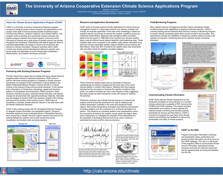
The University of Arizona Cooperative Extension Climate Science Applications Program Michael A. Crimmins 1,2 (1)Department of Soil, Water, & Environmental Science, University of Arizona, Tucson, AZ 85721 (2) Arizona Cooperative Extension, Tucson, AZ 85721 About the Climate Science Applications Program (CSAP) Research and Application Development Field Monitoring Programs CSAP is a University of Arizona Cooperative Extension program focused on bringing climate science research and applications to the people of the state of Arizona and the broader Southwest region including New Mexico, southern California, and northern Mexico. The program works to develop and coordinate outreach activities and applied research between the climate research community at the University of Arizona and a wide group of climate science user groups throughout the Southwest. Partnerships with federal agencies down to individual stakeholders are forged to improve the production and delivery of climate information. Research activities within CSAP include new climate product development tailored to specific user group needs and exploration of novel climate data visualization, dissemination, and analysis techniques and tools. CSAP works to develop practical climate applications for natural resource management based on cutting edge research into climate variability and change. An example application in the area of fire climatology is based on research into the occurrence of extreme fire weather conditions across the southwest United States. Regional-scale springtime (AMJ) circulation patterns for the period of 1988-2003 were clustered into discrete weather types using an artificial neural network algorithm (self-organizing map). These ‘weather types’ were compared to fire weather index values calculated using data from remote automated weather stations (RAWS) across Arizona and New Mexico. More than 80% of extreme fire weather days were associated with only three critical fire weather circulation patterns. Many natural resource management activities require specialized climate monitoring beyond the capabilities of existing monitoring networks. CSAP is currently working with the National Park Service Inventory & Monitoring Program to assess climate monitoring needs within several southern Arizona parks. This assessment includes the installation of temporary weather stations to help in the selection of long-term monitoring sites and to optimize climate monitoring strategies. Sequence of Patterns during Cerro Grande Wildfire in May of 2000 Springtime Weather Circulation Patterns (700 mb geopotential heights) 02 12 22 32 5/2 Climate Science Application Program Sponsors 5/12 Before Fire 01 11 21 31 5/7-5/9 5/3-5/4 Installation of temporary monitoring station in Saguaro National Park 5/13 00 10 Partnering with Existing Extension Programs 5/5-5/6 Climate science has a great deal of overlap with many natural resource programs within Arizona Cooperative Extension. CSAP works to partner with these existing programs to integrate a climate outreach component. An example of this coordination is demonstrated in the Master Watershed Steward Program. Arizona climate is a critical module in the training of these environmental stewards. In this module basic information on introductory climatology, spatial and temporal patterns of precipitation and temperature, ENSO dynamics, North American monsoon structure, seasonal climate forecasts, and climate change are all presented with supporting hardcopy materials. Stewards are encouraged to contact CSAP with questions outside of the training well beyond the duration of the training course. CSAP hopes to coordinate a volunteer climate observer network in the near future with the Master Watershed Stewards. CSAP is also working closely with the Geospatial Extension Program to integrate climate information into geospatial projects. Climate is inherently spatial and many existing products in Geospatial Extension have strong ties to climate. Decision support systems that build on the existing RangeView platform and include climate time-series visualization and analysis tools are being explored. Existing Tool Declared Wildfire 80% of extreme fire weather days in April, May and June (1988-2003) were associated with these circulation patterns 20 Climate Monitoring Locations 30 5/10 >400 homes burn in Los Alamos, NM 5/11 Critical Fire Weather Types Low Elevation Site These critical fire weather types were an important component controlling the fire behavior experienced the initial days of the Cerro Grande wildfire in northern New Mexico. Statistics from this analysis indicate that the occurrence of extreme fire weather conditions (high winds, low relative humidity) are much more frequent in May suggesting that extra caution be taken during this month with respect to wildland fire activities. Communicating Climate Information Preliminary analyses also indicate that the frequency of extreme fire weather events across the southwest U.S. may be related to sea surface temperature variability in the north and equatorial Pacific regions. Sea surface temperature anomalies may influence downstream circulation patterns over the southwest U.S. during the springtime fire season. This influence on circulation patterns may subsequently control the occurrence of extreme fire weather events across the region. More work is being done to investigate the strength of this relationship and the possibility of developing forecast tools to be used in seasonal prescribed burn plans and fire resource planning. CSAP works with the Climate Assessment for the Southwest (CLIMAS) on the production of a monthly climate outlook that is available in PDF format on the CLIMAS and CSAP websites. This product provides interpretation and analysis of many regional and national climate monitoring and forecast products specifically for Arizona and New Mexico. CSAP is involved in increasing the user base of the climate outlook and soliciting user feedback to improve the presentation and utility of climate products. High Elevation Site Soil moisture monitoring at two sites in Saguaro National Park New Tool Climate Time Series Analysis and Visualization CSAP on the Web RANGEVIEW Composite circulation pattern anomaly (700mb geopotential heights) for 144 extreme fire weather days (April, May & June, 1988-2003). Reconstructed May extreme fire weather event frequencies (top) and monthly Oceanic Nino Index (ONI) and Pacific Decadal Oscillation (PDO) values. Dashed vertical lines represent major shifts in north Pacific sea surface temperature patterns. Corresponding Author Contact Information: Michael A. Crimmins Dept. of Soil, Water, & Environmental Science The University of Arizona Tucson, AZ 85721 Email: crimmins@u.arizona.edu Project Abstract A monitoring project to explore both spatial and temporal variability within a small park management unit was initiated in September of 2003. Since then nine portable weather stations have been collecting high temporal resolution measurements across the Rincon Mountain District of Saguaro National Park. Ten meteorological variables are sampled every ten minutes up an elevational gradient and on two adjacent peaks within the park. Preliminary results reflect complex spatial and temporal climatic patterns relevant to different aspects of resource management within the park. Identification of variable oversampling and undersampling within the current network has assisted in defining future climate monitoring needs and objectives. The collection of new park-level climate data has also engaged resource management staff into the importance of high-resolution climate monitoring. May circulation anomaly (700mb geopotential heights) during La Nina events when PDO is in negative phase. (Notice similarity to extreme fire weather circulation pattern; shading indicates significance of pattern) http://cals.arizona.edu/climate Program and project information, workshop and presentation dates, publications and general climate information can all be found on the CSAP webpage. This site is a critical part of the program’s effort to communicate climate science information. Specialized climate resources and tools for extension personnel and the general public are being incorporated into the site.


