Chapter 15 Lecture and Maps Russia and the
advertisement
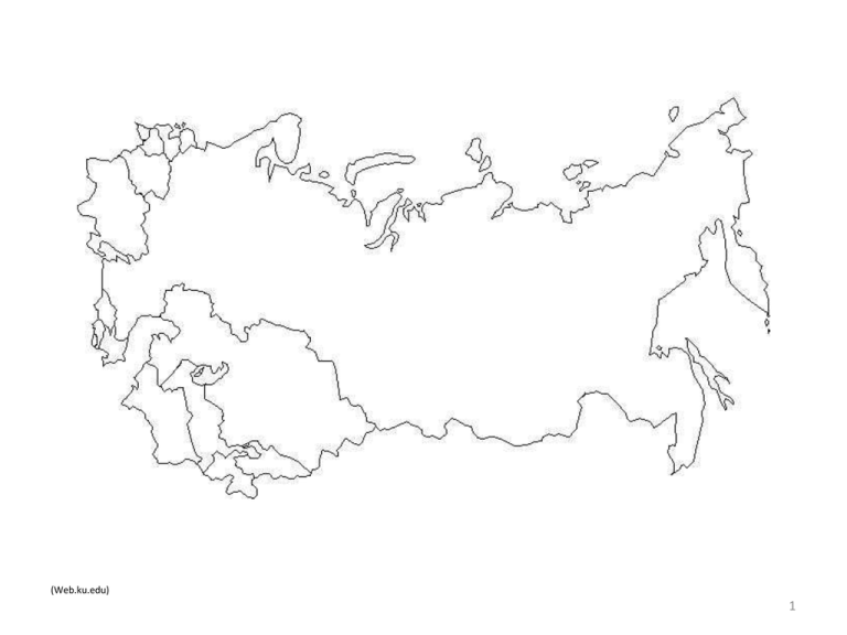
(Web.ku.edu) 1 Turkmenistan Uzbekistan Russia Kazakhstan Georgia Kyrgyzstan Physical Geography of Russia and the Republics: A Land of Extremes From the frozen Arctic tundra of Siberia to the deserts of Kazakhstan, size and climate help define Russia and its former republics. 2 Section 1: Landforms and Resources • Flat plains stretch across the western and central areas of the region. In the south and east, the terrain is more mountainous. • Many resources in Russia and the Republics are in hard-to-reach regions with brutal climates. 3 Northern Landforms A Tremendous Expanse of Territory • Russia and the Republics cover 1/6 of earth’s land surface – 8 1/2 million square miles – three times the land area of U.S. – region crosses 11 time zones Land Mass Comparison Russia Rest of the World • Northern 2/3 of region divided into four areas 4 http://biocitizen.org/chernozem http://www.torange.us/Objects/summer-residence-earth/Sowing-campaign-4016.html Northern European Plain • Northern European Plain an extensive lowland area – Stretches over 1,000 miles from the western border to the Urals • Chernozem—world’s most fertile soil, abundant in area • 75% of region’s 290 million people live on the Plain • cities: Moscow, St. Petersburg, Kiev 5 http://thelastreel.blogspot.com/2012/02/renny-harlin-direct-as-yet-untitled.html West Siberian Plain • Ural Mountains—separate Northern European, West Siberian Plains – some see them as dividing line between Europe and Asia – some consider Europe and Asia as single continent—Eurasia • Plain lies between Urals and Yenisey River (west to east) – between Arctic Ocean and Atay Mountains (north to south) – Plain tilts northward, so rivers flow to Arctic Ocean 6 http://welcome2siberia.com/ Central Siberian Plateau and Russian Far East • Uplands and mountains are dominant landforms • Central Siberian Plateau between Yenisey, Lena rivers – high plateaus that average 1,000 to 2,000 feet • East of Lena River is Russian Far East and system of volcanic ranges – Kamchatka Peninsula has 120 volcanoes, 20 still active • Sakhalin, Kuril islands at south of peninsula – taken from Japan by USSR after WWII; still claimed by Japan 7 Southern Landforms http://www.allcountries.eu/russia.htm The Caucasus and Other Mountains • Caucasus Mountains lie between Black and Caspian seas – border between Russia, Transcaucasia—Armenia, Azerbaijan, Georgia • Central Asia region includes “stan” republics – Kazakhstan, Kyrgyzstan, Tajikistan, Turkmenistan, Uzbekistan • Southern border a massive wall of mountains, including the Tian Shan 8 http://www.pbase.com/image/99541888 Kara Kum Desert The Turan Plain • Between Caspian Sea and the mountains, uplands of Central Asia • Very dry, despite Syr Darya and Amu Darya rivers • Two large deserts, Kara Kum and Kyzyl Kum 9 Rivers and Lakes Drainage Basins and Rivers • Main drainage basins (areas drained by major river, tributaries) http://www.blessedhopeacademy.com/Geoography/geography105.htm – Arctic and Pacific oceans; Caspian, Baltic, Black, and Aral seas – Arctic basin is largest • Ob, Yenisey, and Lena rivers drain over 3 million square miles • Volga River, longest in Europe, drains Caspian Sea basin – flows 2,300 miles south from Moscow – carries 60% of Russia’s river traffic 10 http://www.valuewalk.com/2011/11/russias-offshore-move-raises-tension-caspian-sea/ Lakes • Caspian Sea is 750-mile-long (north to south) saltwater lake – largest inland sea in world • Aral Sea, east of Caspian, is also saltwater – has lost 80% of water volume since 1960 due to irrigation 11 Lake Baikal • Deepest in world: a mile from surface to bottom at deepest point • 400 miles long, holds 20% of world’s fresh water • very clean lake, home to 1,200 unique plant, animal species 12 http://www.tripadvisor.com/Tourism-g298526-Lake_Baikal_Siberian_District-Vacations.html Regional Resources Abundant Resources • Huge reserves of coal, iron ore, other metals • Region also a leading producer of oil and natural gas – petroleum deposits around Caspian Sea among world’s largest • Forests have 1/5 of world’s timber • Large producer of hydroelectric power due to rivers 13 http://www.giantbomb.com/siberia/95-3893/all-images/52-576857/siberia/51-2023256/ Resource Management • Hard to get at, move resources due to climates, terrain, distances • many resources are in Siberia—frigid, arctic, Russian area of Asia • Mining, oil and gas production cause grave environmental damage • Hydroelectric plants damage animal and plant habitats through: • damming • discharge of unusually hot water (thermal pollution) • Leaders must balance economic needs, environmental responsibilities 14 Section 2: Climate and Vegetation • Much of Russia and the Republics lie in subarctic and tundra climate zones. • In the region’s southern areas, semiarid and desert climates feature warmer winters and hot summers. 15 A Climate of Extremes Major Climate Regions • Humid continental and subarctic climates dominate region • Continentality—effect the region’s enormous size has on its climates • Distance from sea decreases precipitation – moisture from Atlantic Ocean is lost further inland • Distance from sea also creates extreme temperatures – average Siberian temperatures are usually below 50 degrees F – Siberian temperatures can drop below –90 degrees F 16 Major Climate Regions • Cold weather has impact on daily life – Siberians use frozen lakes and rivers as roads for part of year – Region has layer of permafrost that can reach depths of 1,500 feet • Warmer, semiarid and desert climates in Central Asia – southeast mountain wall blocks moist Indian, Pacific ocean air • Moist Mediterranean air creates subtropical climate in Transcaucasia – region’s health resorts were once tourist destinations 17 Vegetation Regions Four Major Regions • The 4 major vegetation regions run east to west in wide strips 18 Tundra • Mostly in Arctic climate zone; only specific vegetation can survive • mosses, lichen, small herbs, low shrubs 19 http://www.knowledge.allianz.com/environment/climate_change/?669/ten-most-important-forests-worldwide-gallery Forest • South of tundra: – taiga—largest forest on earth, mostly coniferous – sable, fox, ermine, elk, bear, wolves – deciduous trees dominate lower latitudes 20 21 http://secondthoughts.typepad.com/second_thoughts/2008/05/m-linden-the-ne/comments/page/2/ Steppe • Temperate grassland from southern Ukraine to Altay Mountains • highly fertile chernozem soil • region is major source of grain for Russia and the Republics – Kara Kum (Turkmenistan) • Kyzyl Kum (Uzbekistan) 22 http://www.superhqwallpapers.com/2011/12/23/landscapes-hq-wallpapers/kyzyl-kum-desert-1920x1200/ Desert • Wide plains in west and central areas of Central Asia • Two main deserts together cover 230,000 square miles Section 3: HumanEnvironment Interaction • The region’s harsh climate has been both an obstacle and an advantage to its inhabitants. • Attempts to overcome the region’s geographic limits have sometimes had negative consequences 23 The Shrinking Aral Sea http://en.wikipedia.org/wiki/Aral_Sea http://news.nationalgeographic.com/news/2010/04/100402-aral-sea-story/ A Disappearing Lake • Aral Sea gets water from Amu Darya and Syr Darya rivers • In ’50s, rivers are drawn on to irrigate Central Asian cotton fields – flow from rivers becomes a trickle, sea begins to evaporate 24 The Effects of Agriculture • Pesticides and fertilizers for cotton are picked up by runoff – runoff—rainfall not absorbed by soil, runs into streams and rivers • chemicals carried into Aral kill all 24 native species of fish • Retreating sea waters expose fertilizers, pesticides, salt – windstorms blow them onto nearby populations • Substances increase diseases: throat cancer, typhoid, hepatitis • Central Asia child mortality rates are among highest in world 25 http://www.circleofblue.org/waternews/2009/world/europe/new-project-resurrects-hope-for-dying-aral-sea/ Saving the Aral • To maintain present lake level, 9 of 18 million farm acres have to go – would cause great hardship for farmers • many argue only such drastic measures can save the Aral 26 http://www.ozzienews.com/news/world-news/a-pack-of-four-hundred-wolves-terrify-russian-town/ The Russian Winter Coping in Siberia • 32 million Siberians live with the earth’s most variable temperatures – city of Verkhoyansk can be -90° F in winter, 94° F in summer • most of the time it is cold • Warm weather melts ice, forms pools, swamps that become breeding grounds for mosquitoes, black flies • Buildings on permafrost sink and fall when their heat thaws ground – buildings must be set off ground on concrete pillars 27 War and “General Winter” • Harsh climate has helped Russia fight off invaders • In early 1800s, French leader Napoleon Bonaparte conquers Europe • Bonaparte invades Russia from Poland in 1812 – arrives in Moscow in September, as winter begins – Muscovites burn the city leaving no shelter • Napoleon retreats; cold helps doom 90% of his 100,000 men Russian ship covered with ice in Moscow! 28 http://scrapetv.com/News/News%20Pages/Everyone%20Else/pages-5/Russian-military-on-high-alert-after-string-of-icicle-deaths-Scrape-TV-The-World-on-your-side.html Crossing the “Wild East” http://www.us-passport-service-guide.com/trans-siberian-railroad.html The Trans-Siberian Railroad • In late 1800s, Siberia is like U.S. “Wild West” • travel is dangerous, slow • Emperor orders 5,700-mile Trans-Siberian Railroad built • links Moscow to Pacific port of Vladivostok 29 An Enormous Project • From 1891 to 1903, 70,000 workers move 77 million cubic feet of earth • clear 100,000 acres of forest; bridge several major rivers Resource Wealth in Siberia • Railroad helps populate area so resources can yield profit • in first 10 years, 5 million people use railway to settle Siberia – begin mining coal, iron ore http://www.worldtopjourneys.com/2011/03/trans-siberian-railway.html 30 Bibliography • Mcdougal Littell, World Geography. Houghton Mifflin Company. 2012 31
