Chapter 10E—Tools, Resources and Information Management
advertisement
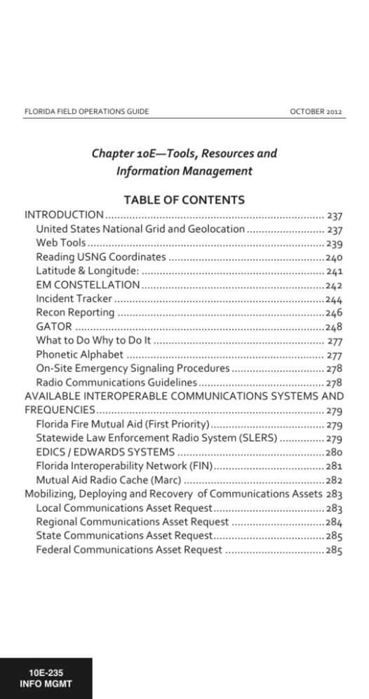
FLORIDA FIELD OPERATIONS GUIDE OCTOBER 2012 Chapter 10E—Tools, Resources and Information Management TABLE OF CONTENTS INTRODUCTION ......................................................................... 237 United States National Grid and Geolocation .......................... 237 Web Tools ............................................................................... 239 Reading USNG Coordinates .................................................... 240 Latitude & Longitude: ............................................................. 241 EM CONSTELLATION ............................................................. 242 Incident Tracker ...................................................................... 244 Recon Reporting ..................................................................... 246 GATOR ................................................................................... 248 What to Do Why to Do It ......................................................... 277 Phonetic Alphabet .................................................................. 277 On-Site Emergency Signaling Procedures ............................... 278 Radio Communications Guidelines .......................................... 278 AVAILABLE INTEROPERABLE COMMUNICATIONS SYSTEMS AND FREQUENCIES ............................................................................ 279 Florida Fire Mutual Aid (First Priority) ...................................... 279 Statewide Law Enforcement Radio System (SLERS) ............... 279 EDICS / EDWARDS SYSTEMS ................................................. 280 Florida Interoperability Network (FIN) ..................................... 281 Mutual Aid Radio Cache (Marc) ............................................... 282 Mobilizing, Deploying and Recovery of Communications Assets 283 Local Communications Asset Request ..................................... 283 Regional Communications Asset Request ............................... 284 State Communications Asset Request ..................................... 285 Federal Communications Asset Request ................................. 285 10E-235 INFO MGMT 10E-236 INFO MGMT FLORIDA FIELD OPERATIONS GUIDE This page intentionally left blank OCTOBER 2012 FLORIDA FIELD OPERATIONS GUIDE OCTOBER 2012 Chapter 10E Tools, Resources and Information Management INTRODUCTION The purpose of this portion of the Florida Operations Guide (FOG) is to provide an overview of information management resources supported by the State Emergency Response Team. An introduction to the resource, notes on accessing the resource, and brief instructions are provided. United States National Grid and Geolocation As directed in the Florida Comprehensive Emergency Management Plan (CEMP), the State of Florida has adopted the U.S. National Grid (USNG) for use during response and recovery efforts as well as shared situational awareness. The USNG provides a common location language for both point and area referencing, allowing a uniform method of describing areas of operation, and framing situational awareness. US Military assets, typically the largest force multiplier in disaster response operations, use a grid system that is functionally the same as the USNG–the Military Grid Reference System (MGRS). Land based Department of Defense responders are therefore able to share location based information and readily interpret areas of operation defined using the USNG immediately upon joining disaster operations. Additionally, local and state jurisdictions across the Nation have implemented the use of the USNG for disaster operations to increase interoperability in support of unified 10E-237 INFO MGMT 10E-238 INFO MGMT FLORIDA FIELD OPERATIONS GUIDE OCTOBER 2012 operations and its use will improve the integration of mutual aid resources. The USNG is the geographic grid reference system identified by the National Search and Rescue Committee as the primary catastrophic incident search and rescue geo-referencing system that must be used by federal land Search and Rescue (SAR) responders, including the land SAR & aerial SAR interface. The USNG creates an interoperable environment for location-based services used in support of disaster operations and increases interoperability of location services appliances (i.e. GPS) with printed map products by establishing a nationally consistent grid reference system. In accordance with the CEMP, the State Emergency Response Team (SERT) utilizes the USNG to designate ground-based scalable areas of operation for strategic, regional, and tactical operations 100,000meter grid cells will be used to designate strategic operational areas; 10,000-meter areas will be used for regional operations; and 1,000-meter or below grid, cells will be used for tactical missions. Strategic areas of operation are described using the grid zone designation (GZD) and 100,000-meter grid ID (16R GU). Regional areas of operation are described using the GZD, 100,000-meter grid ID, and the SW coordinate of the target grid cell (16R GU 67). Tactical areas of operation are described similar to regional areas of operation (16R GU 6171). The SERT will utilize the USNG with Geographical Information System (GIS) products to identify high-density areas and priority response areas. Essential elements of information such as types of FLORIDA FIELD OPERATIONS GUIDE OCTOBER 2012 structures, year built, known hazardous materials locations, demographics, and other key information should be identified for each grid square. This actionable information provides the field response and command elements with valuable pre-incident information to help pre-script missions and deploy the appropriate resources. Several web resource and tools are available to support use of the USNG in preparing for or conducting disaster operations: Web Tools Allows for determination of USNG coordinates from a computer or to display a field reported coordinate/location on a computer. a. b. c. d. e. USNG Web Map: http://dhost.info/usngweb/ Florida Incident Mapper: http://map.floridadisaster.org/mapper/ National Map Viewer: http://viewer.nationalmap.gov/viewer/ GATOR: http://map.floridadisaster.org/GATOR/map.html NOAA Coordinate Conversion: http://www.ngs.noaa.gov/cgi-bin/usng_getus.prl MGRS and/or USNG options are found in all modern hand-held, some vehicle GPS units and most smartphone application stores (search for "MGRS"). GPS Setup a. b. Set map datum to NAD83. If not found, use WGS 84. Set coordinate system to: US National Grid (USNG). If not found, use MGRS. 10E-239 INFO MGMT 10E-240 INFO MGMT FLORIDA FIELD OPERATIONS GUIDE c. OCTOBER 2012 Dual display with USNG as primary and Lat/Long as secondary, only DD-MM.mmm format is recommended. See Lat/Long information below. USNG coordinates represent meters and can be translated to distance allowing field responders to calculate the distance between two coordinates. Additionally, USNG coordinates can be easily plotted on USGS topographic or similar maps that have the USNG graticule embedded by using a simple “read right, then up” method. Reading USNG Coordinates The USNG Grid Reference Box/Legend is located in the Key section of the map. This provides the unique grid zone designation (e.g. 18S). This GZD is a 6 degree by 8 degree longitude by latitude band. The GZD is further subdivided into a large square with 100,000 meter square identification. The reference box provides a key to these identifiers (e.g. UJ). Precision of USNG coordinates are determined by the number of digits used. Abbreviate to the degree of precision you require within a local area: 4 digits – 2306 - 1,000m (neighborhood) 6 digits – 234064 - 100m (soccer field) 8 digits – 23480647 - 10m (home) 10 digits – 2348306479 - 1m (parking spot) FLORIDA FIELD OPERATIONS GUIDE OCTOBER 2012 Latitude & Longitude: Air & water assets supporting ground operations shall utilize USNG/MGRS. When this is not possible coordinates should be reported using degrees, minutes, decimal minutes (DD-MM.mmm) in accordance with the National Search & Rescue Committee (NSARC) guidance in the Catastrophic Search and Rescue Supplement to the National Search and Rescue Plan. EOCs and ESFs should have software at the ready to convert between coordinate systems. Several conversion tools are available on the Internet as discussed above in the web tools section. Figure 34 – National SAR Committee CIS Geo-Referencing Matrix a. During SAR operations (and to avoid confusion) Latitude and Longitude should be in one standard format: DDMM.mm. If required, use up to 2 digits to the right of the decimal. If required, allow 3 digits in the degrees field for longitude (i.e., DDD-MM.mm). Do not use leading zeros to 10E-241 INFO MGMT 10E-242 INFO MGMT FLORIDA FIELD OPERATIONS GUIDE b. c. d. e. f. g. OCTOBER 2012 the left of the decimal for degrees or minutes that require fewer than the maximum number of possible digits to express their value. The minimum number of digits is always one, even if it is a zero. (Example: Recommended: 9-0.3N 4-2.45W; Not Recommended: 09-00.300N 00402.45W). GARS: Global Area Reference System. Land SAR responders use U.S. National Grid; however, a good familiarity with latitude and longitude is necessary to ensure effective interface between Land and Aeronautical SAR responders (Note: Land SAR includes SAR on flooded terrain). Aeronautical SAR responders will use latitude and longitude for SAR response. However, aeronautical SAR responders that work directly with Land SAR responders should understand the U.S. National Grid system for effective Land SAR/Aeronautical SAR interface. Air space deconfliction will only be implemented and managed using latitude and longitude. Aeronautical SAR responders working with Land SAR responders have the primary responsibility of coordinating SAR using USNG. However both groups must become familiar with both georeference systems. Describes the requirement for providing situational awareness of SAR operations geographically to Federal, military, state, local and tribal leadership. Provides for quick reference to send SAR resources closest to incident. EM CONSTELLATION EM Constellation is the web-based information management software platform adopted by the State of Florida for emergency management. The platform allows the State Emergency Response Team composed of county, state, federal, volunteer, and mutual aid FLORIDA FIELD OPERATIONS GUIDE OCTOBER 2012 entities to use the same operating environment when responding to and recovering from an emergency. Requests for assistance may be made through the platform, these requests approved and tasked as missions, and tracked throughout their life cycle. Information messages like situation reports, press releases, and incident action plans may also be shared through the platform. Having this information all in one place allows for effective response to and recovery from emergencies while documenting events for reimbursement and after-action-reporting. EM Constellation is available at: http://seoc.floridadisaster.org/emc. Figure 35 – EM Constellation Log-In Page Accounts to access EM Constellation are issued to Counties and ESFs. Counties may contact their Regional Coordinators for assistance, and ESFs may contact their Emergency Coordinating Officers. Once logged in, click Events to select an event, which may be a disaster or a special event. 10E-243 INFO MGMT 10E-244 INFO MGMT FLORIDA FIELD OPERATIONS GUIDE OCTOBER 2012 Upon first visiting an event, an event dashboard may be configured, adding widgets like H+ Timer, Battle Rhythm, Weather Alerts, or Following Missions and Messages. To browse Missions, click Missions. To browse Information Messages (Situation Reports, Incident Action Plans, Press Releases, Maps, Weather, and other message types), click Info. Help is available by clicking Help. There are no requirements restricting the use of website on mobile devices, but screen size and connectivity may limit use of this website on a mobile device. EMCx, or EM Constellation for Exercises, is available at: https://seoc.floridadisaster.org/emcx. Incident Tracker The mission of the State Watch Office (SWO) is to provide members of the State Emergency Response Team and employees of the Florida Division of Emergency Management (FDEM) with accurate and timely information related to ongoing or impending hazardous situations that could affect Florida and its citizens. The Incident Tracker is a web-based information log with mapping and notification capabilities. The State Watch Office uses it to track day to day incidents and share information. Report incidents include FLORIDA FIELD OPERATIONS GUIDE Aircraft Incidents Animal/Agriculture Issues Bomb/Threat or Device Cape Canaveral Launch Chemical/Biological/Radiological Civil Disturbance Criminal Activity Dam Failure Energy Emergency Environmental Crime Hazardous Materials Major Road/Bridge Closure/Accident 10E-245 INFO MGMT OCTOBER 2012 Major Structure Fire Migration Incidents Nuclear Power Plants Petroleum Spills Public Safety Officer Injuries/Death Railroad Search and Rescue ELT Severe Weather Sinkhole Suspicious Activity Tomahawk Missile Launch Wastewater Spills Wildfire 10E-246 INFO MGMT FLORIDA FIELD OPERATIONS GUIDE OCTOBER 2012 Incident Tracker is available at https://apps.floridadisaster.org/swo Figure 36 – Florida Disaster Incident Tracker For access or to report incidents, contact the State Watch Office at 800-320-0519 or swp@em.myflorida.com. Once logged in, click Current Incidents to display a list of incidents. Incidents may be searched, sorted, and filtered. Clicking View Incident will display a report. There are no requirements restricting the use of website on mobile devices, but screen size and connectivity may limit use of this website on a mobile device. Recon Reporting The purpose of the State Emergency Response Team RECON Unit is to provide an initial assessment of the impacted area boundaries, evacuation routes and communities for the SERT. Information will FLORIDA FIELD OPERATIONS GUIDE OCTOBER 2012 be provided to the SERT Chief and the State Emergency Operations Center (SEOC) Plans and Operations Sections. RECON Teams expedite situation assessments of areas impacted by emergencies when deployed. RECON Reporting is a reporting website for the RECON Unit. Using the website, RECON reports may be entered online. RECON Reporting is available at: https://apps.floridadisaster.org/recon Access to RECON Reporting is for trained RECON team members. More information, including standard operating procedures may be found at http://floridadisaster.org/recon. Once logged in, click Add RECON Report. Information collected includes – Date/Time Location (Lat/Long or USNG) Debris Flooding Structure Damage Infrastructure Transportation Emergency Services Causalities RECON Reports are triaged by a team at the State EOC, and coded: Routine Priority Emergency Flash 10E-247 INFO MGMT 10E-248 INFO MGMT FLORIDA FIELD OPERATIONS GUIDE OCTOBER 2012 RECON Reports are available for viewing through RECON Reporting site, and more widely available via GATOR (see below). There are no requirements restricting the use of website on mobile devices, but screen size and connectivity may limit use of this website on a mobile device. Visitors to RECON Reporting with mobile devices are offered alternative methods for accessing available map services. GATOR GATOR, or the Geospatial Assessment Tool for Operations and Response, is the flagship common operation picture/situational awareness, web-based map viewer for the Florida Division of Emergency Management and the State Emergency Response Team. GATOR is an interactive web-mapping tool for the display of geographic information to support emergency preparedness, operations, and response. Real-time data like weather radar, weather watches and warnings, and tropical storm tracks are displayed along with base map data like roads, facilities, and aerial photographs. In addition to the open access version of GATOR available at http://map.floridadisaster.org/gator, secured versions of GATOR are embedded within EM Constellation and Incident Tracker. These versions of GATOR contain additional data layers of interest to responders, like mission requests from EM Constellation, more detailed RECON reports, and logistical staging areas. Upon your first visit, GATOR will display a welcome message. You may check Don’t show again to bypass this window on future visits. FLORIDA FIELD OPERATIONS GUIDE OCTOBER 2012 GATOR has navigation and mapping tools, many widgets, and numerous data layers. Navigation tools are used to pan and zoom the map. Zooming in is best done by selecting the Zoom In tool, clicking on the map, holding down the left-click button, dragging a box, and releasing the mouse. Figure 37 – GATOR Tools and Widgets are used to interact with the map and display map layers. Click Identify, place the cursor over the map, and click to identify attributes for features displayed on the map. Explore options under Tools to easily zoom the map, create and save bookmarks, and obtain demographic information. 10E-249 INFO MGMT 10E-250 INFO MGMT FLORIDA FIELD OPERATIONS GUIDE OCTOBER 2012 Widgets are available to add data like severe weather warnings, traffic incidents and cameras, open shelters, RECON Reports, and other data layers. Widgets are also available to display/hide Lat/Long and USNG grids, to display/hide a map legend, and to print a map. Layers and Backgrounds are used to turn on/off layers and map backgrounds. To access feature map Layers, click More, pull down, and turn on/off layers by checking/unchecking boxes next to a layer name. Map Backgrounds may be changed by clicking one of the many choices available – Bing – base maps from Microsoft Bing Bing Aerials – aerials photos from Microsoft Bing Bing Hybrid – aerial photos and transportation from Bing Streets – ESRI street map Aerial – ESRI aerials Topo – ESRI topographic maps Ocean – ESRI ocean map Ocean Nav – nautical navigation charts Air Nav – aeronautical navigation charts Scale and Coordinates displays the current map scale and coordinates in Latitude/Longitude. Accessing GATOR requires devices capable of running Adobe Flash. Visitors to GATOR with mobile devices that do not meet this requirement are offered alternative methods for accessing available map services. FLORIDA FIELD OPERATIONS GUIDE Figure 38 – Alternate Methods for Accessing Available Map Services 10E-251 INFO MGMT OCTOBER 2012 10E-252 INFO MGMT FLORIDA FIELD OPERATIONS GUIDE This page intentionally left blank OCTOBER 2012

