R cue Behind the Rocks Special Section By Mike Price, Entrada/San Juan, Inc.
advertisement

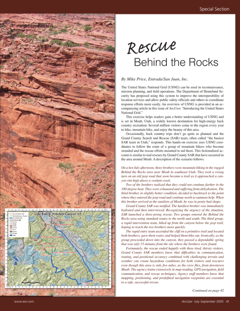
Special Section Rcu e Behind the Rocks By Mike Price, Entrada/San Juan, Inc. The United States National Grid (USNG) can be used in reconnaissance, mission planning, and field operations. The Department of Homeland Security has proposed using this system to improve the interoperability of location services and allow public safety officials and others to coordinate response efforts more easily. An overview of USNG is provided in an accompanying article in this issue of ArcUser, “Introducing the United States National Grid.” This exercise helps readers gain a better understanding of USNG and is set in Moab, Utah, a widely known destination for high-energy back country recreation. Several million visitors come to the region every year to hike, mountain bike, and enjoy the beauty of this area. Occasionally, back country trips donʼt go quite as planned and the Grand County Search and Rescue (SAR) team, often called “the busiest SAR team in Utah,” responds. This hands-on exercise uses USNG coordinates to follow the route of a group of mountain bikers who become stranded and the rescue efforts mounted to aid them. This fictionalized account is similar to real rescues by Grand County SAR that have occurred in the area around Moab. A description of the scenario follows. On a hot July afternoon, three brothers were mountain biking in the rugged Behind the Rocks area near Moab in southeast Utah. They took a wrong turn on an old jeep road that soon became a trail as it approached a canyon rim high above a verdant creek. Two of the brothers realized that they could not continue farther in the 100-degree heat. They were exhausted and suffering from dehydration. The third brother, in slightly better condition, decided to backtrack to the point where they entered the jeep road and continue north to summon help. When this brother arrived at the outskirts of Moab, he was in pretty bad shape. Grand County SAR was notified. The hardiest brother was immediately hydrated and then interviewed. Recognizing the urgency of the situation, SAR launched a three-prong rescue. Two groups entered the Behind the Rocks area using standard routes to the north and south. The third group, a rapid intervention team, hiked up from the canyon below the jeep trail, hoping to reach the two brothers more quickly. The rapid entry team ascended the cliff on a primitive trail and located both brothers, gave them water, and helped them hike out. Ironically, as the group proceeded down into the canyon, they passed a dependable spring that was only 15 minutes from the site where the brothers were found. Fortunately, the rescue ended happily with three tired, thirsty visitors. Grand County SAR members know that difficulties in communication, routing, and positional accuracy combined with challenging terrain and weather can create hazardous conditions for both visitors and rescuers even though this area is only five miles, as the crow flies, from downtown Moab. The agency trains extensively in map reading, GPS navigation, field communication, and rescue techniques. Agency staff members know that mapping, positioning, and predefined navigation waypoints are essential to a safe, successful rescue. Continued on page 42 www.esri.com ArcUser July–September 2005 41 Rescue Behind the Rocks Continued from page 41 Finding the Lost Bikers The exercise requires only a Web browser and a high-speed Internet connection. The National Map Viewer will be used to view the rugged terrain surrounding Moab and visit significant spots (listed as waypoints) along the routes used by the lost bikers and their rescuers. The National Map provides public access to high-quality, geospatial data and information from multiple partners. Waypoint 1—Moab, Southeastern Utah, USA USNG 12SXH2670 Letʼs visit the National Map Viewer and use the Locate Point feature to get an overview of Moab and the surrounding area. 1. Go to nmviewogc.cr.usgs.gov. After the page has loaded, click the Find Place tool in the list of tools to the left of the map area. 2. In the Find Place popup, under the section called Zoom to a Point, click on U.S. National Grid (USNG) Coordinates. 3. In the Zoom to Point dialog box, enter the characters 12SXH2670 into the six guide cells. Enter 12, representing UTM Zone 12, in the first cell. 4. Type S in the second cell. Combined with the 12, this identifies the Grid Zone Designation (GZD) as 12S. Remember that a latitude band denoted by S represents values between 24 and 36 degrees north latitude; it does not mean south. 5. In the next two cells, enter X and H to specify the 100,000-meter square. 6. Finally, type 26 as the easting and 70 as the northing. This will display a positional precision of 1,000 meters (or 1 kilometer). This is plenty of precision for an initial look at Moab. Use the Guided Entry form to enter the parsed USNG address. 7. Set the Zoom Level to Region, click Zoom To Point, and wait for the map to draw. These characters represent the USNG address 12SXH2670 (or One Two Sierra X-ray Hotel Two Six Seven Zero, when spoken in the International Phonetic Alphabet). Table 1 lists the waypoints and corresponding USNG addresses that will be used in this exercise. Steps 1 and 2 will be N/A 537 100 M City N/A 2533 6162 10 M Neighborhood N/A H 23 63 1000 M Region City X H 2558 6977 10 M Neighborhood N/A S X H 26443 70501 1M Local N/A 12 S X H 2207 6613 10 M City N/A 12SXH36805373 12 S X H 3680 5373 10 M City Region Kane Creek Spring 12SXH22496425 12 S X H 2249 6425 10 M Neighborhood N/A 10 Rescued Bikers! 12SXH2333763087 12 S X H 23337 63087 1M Local N/A 11 Allen Memorial Hospital 12SXH25117104 12 S X H 2511 7104 10 M Local N/A 12SXH2670 12 S 2 Blue Hill Trailhead 12SXH368537 12 S 3 Hunter/Pritchett Intersection 12SXH25336162 12 4 Approximate Biker Location 12SXH2363 5 Moab Employment Center 6 100KB Moab, Utah, and Environs 100KA 1 Easting Northing X H 26 70 X H 368 S X H 12 S X 12SXH25586977 12 S Search and Rescue Headquarters 12SXH2644370501 12 7 Pritchett Canyon Trailhead 12SXH22076613 8 Back to Blue Hill 9 Precision Region GZD 1000 M USNG/MGRS Coordinate UTM Second Zoom Level Waypoint Initial Zoom Level Point Label Table 1: Article waypoints and USNG coordinates 42 ArcUser July–September 2005 www.esri.com Special Section In the vicinity of USNG address 12SXH2363, the bikers realized they were lost and very thirsty. used throughout the rest of the exercise to refocus the map viewer using USNG addresses. The Zoom to Point dialog box form provides two options—Guided Entry or Quick Entry. The default, Guided Entry, parses the USNG address and helps in understanding its structure and verifying its precision level. The regional view in the National Map Viewer contains a shaded relief image of the Moab area and a road network that includes a special rural transportation prototype provided by the Grand County Road Department. This is pretty rough country. Get an even better look by adding imagery to the map. 1. On the right, on the Layers, click the Orthoimagery triangle to open imagery types and check the DOQ box. 2. Open the Elevation triangle and uncheck SHADED RELIEF. This will allow the map to redraw faster. Click Refresh Required and wait as the imagery loads. Waypoint 2—Blue Hill Trailhead, Behind the Rocks Area USNG 12SXH368537 The bikers started their adventure by driving approximately 12 miles south on U.S. Highway 191 to the top of Blue Hill, where they unloaded their bikes and headed west and then north into some very wild country. To view the bikersʼ starting place using the National Map Viewer, choose Find Place > U.S. National (USGS) Coordinates. In the Guided Entry form, enter 12, S, X, H, 368, and 537 in the manner previously described. Set the Zoom Level to City and click Zoom To Point to go to the top of Blue Hill, which will be displayed with a coordinate precision of 100 meters. The road the bikers traveled on is labeled Unnamed Street. Click the navigation arrows on the western map edge, and then on the north, to www.esri.com follow this route into the Behind the Rocks area. In the upper right corner of the screen, locate the scale. Change to a larger scale by selecting shorter scale bars that represent neighborhood and local views. Notice that as the view zooms in, additional jeep trails, mapped by the Grand County Roads Department, begin to appear. Waypoint 3—The Troublesome Intersection USNG 12SXH25336162 By mid-afternoon, the bikers reached a very important intersection. Access the Zoom to Point dialog box and use the Quick Entry form to enter the USNG address 12SXH25336162 and set the Zoom Level to City. This address shows the intersection where the bikers went wrong at 10-meter precision. The bikers headed west, instead of north, and soon became disoriented. Use the Neighborhood zoom to check out the area. The bikers headed out along the trail labeled Above Hunter 1549. Waypoint 4—Lost Bikers! USNG 12SXH2363 The bikers, now in the vicinity of 12SXH2363, realized they were lost and very thirsty. Enter this address and set the Zoom Level to Region to see the big picture. Then set the Zoom Level to City to see more detail. At this point, two bikers were unable to continue and sought shelter in the limited shade available while the strongest biker returned to the intersection visited in the previous waypoint. He rode the remaining route north to Pritchett Canyon and on into Moab for help. This was not a short ride! Waypoint 5—Moab Employment Center, Kane Creek Road, Moab USNG 12SXH25586977 Some time later, the strongest rider arrived at the Moab Employment Center on the outskirts of Moab. Enter USNG 12SXH25586977 and zoom to Neighborhood to find this spot. SAR was immediately activated and the biker hydrated and interviewed. Waypoint 6—Grand County Search and Rescue Shed, Grand County Courthouse, Moab USNG 12SXH2644370501 Meanwhile, the SAR team devised a rescue strategy that would take two vehicle teams into the area from the north and south along rough roads that would require several hours to traverse. At the same time, the team on foot began at Kane Creek Spring and climbed up a primitive trail hoping that the bikers were on the cliff above. Enter USNG 12SXH2644370501 and set the Zoom Level to Local to see where the rescue efforts began. Waypoint 7—Pritchett Canyon Entry Point, Behind the Rocks Area, Kane Creek Road USNG 12SXH22076613 Enter USNG 12SXH22076613 and set the Zoom Level to City to see where the first vehicle team—carrying water, communication equipment, and overnight supplies—left the pavement at the mouth of Pritchett Canyon and began traversing one of Moabʼs classic jeep trails. The estimated time to reach the lost bikers using this route was approximately two hours, which would place them on the scene as night was falling. If the stranded pair did decide to continue north on foot, this rescue group would intercept them. Waypoint 8—Blue Hill Entry Point, Behind the Rocks Area, U.S. Highway 191 USNG 12SXH36805373 The second vehicle team traveled a smoother but much longer access route that began at Blue Hill Continued on page 44 ArcUser July–September 2005 43 Special Section Rescue Behind the Rocks Continued from page 43 and followed the bikersʼ entire route for the day. Enter USNG 12SXH36805373 and set the Zoom Level to City initially. Then reenter the address and set the Zoom Level to Region. The estimated travel time for this team was nearly three hours. This group swept the southern area in case the lost pair tried to exit to the south. This route would allow the bikers to be transported by surface roads, if necessary. Because of the late hour and possible condition of the bikers, a third team traveled on foot up the cliff from Kane Creek Spring. Enter USNG 12SXH22496425 and set the Zoom Level to Neighborhood to see this route. Although the trail was difficult to follow, considering the time and likely condition of the bikers, it might pay off. Travel time from mobilization to the bikersʼ last known location could be less than an hour. Waypoint 9—Kane Creek Spring Back Country Trailhead, Kane Creek Road USNG 12SXH22496425 Waypoint 10—Rescued Bikers USNG 12SXH2333763087 The foot team did reach the stranded pair in fairly short order and right where the third biker said they would be waiting. Go to USNG 12SXH2333763087 and set the Zoom Level to Local. Waypoint 11—Allen Memorial Hospital USNG 12SXH25117104 Before leaving the area, make one more stop at Allen Memorial Hospital. Enter USNG 12SXH25117104 and set the Zoom Level to Local. The hospital staff is highly trained to treat injuries and illnesses common to the back country. CareFlight helicopter medical service from Saint Maryʼs Hospital in Grand Junction, Colorado, provides patient transfer, evacuation, and back country medical services to Moab. A Happy Conclusion Finding the errant bikers has helped make The National Map Web site, the parts of a USNG address, and the levels of precision available with the USNG coordinate system more familiar. See the sources listed in “Introducing the United States National Grid” to learn more about USNG. Acknowledgment The author thanks Grand County Search and Rescue and Moab Fire Department staff for their assistance in researching and telling this story. For more information on Grand County SAR, visit www.gcsar.org. The first vehicle team left the pavement at the mouth of Pritchett Canyon (USNG 12SXH22076613) and began traversing one of Moabʼs classic jeep trails. 44 ArcUser July–September 2005 www.esri.com


