5.Urban Structure
advertisement
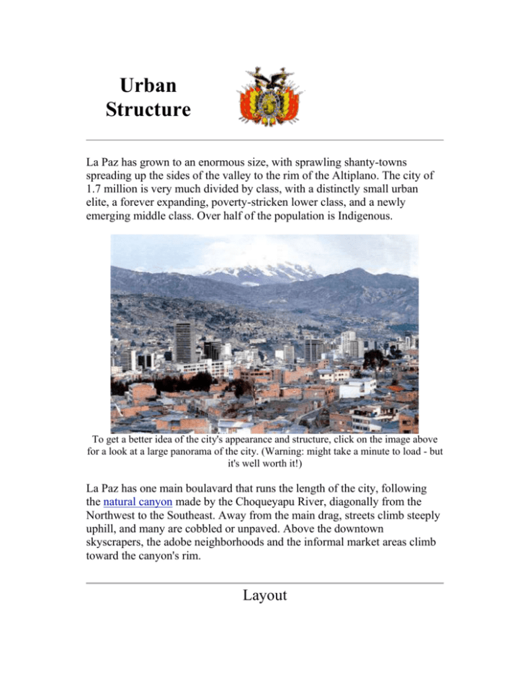
Urban Structure La Paz has grown to an enormous size, with sprawling shanty-towns spreading up the sides of the valley to the rim of the Altiplano. The city of 1.7 million is very much divided by class, with a distinctly small urban elite, a forever expanding, poverty-stricken lower class, and a newly emerging middle class. Over half of the population is Indigenous. To get a better idea of the city's appearance and structure, click on the image above for a look at a large panorama of the city. (Warning: might take a minute to load - but it's well worth it!) La Paz has one main boulavard that runs the length of the city, following the natural canyon made by the Choqueyapu River, diagonally from the Northwest to the Southeast. Away from the main drag, streets climb steeply uphill, and many are cobbled or unpaved. Above the downtown skyscrapers, the adobe neighborhoods and the informal market areas climb toward the canyon's rim. Layout Contrary to most North American Cities, the higher areas of the steep, narrow valley are where the lower class lives, and the lower spots are occupied by the wealthy. This is due to the fact that the city model was established long before good transportation or infrastructure was available for any distance outside the core, so the elite sought to reside toward the central plazas, while the poor were forced to fend for themselves in the outskirts. As the population grew (mainly due to poor migrants from the countryside) and transportation and infrastructure became available farther away from the core, the upper class took up the better, flatter land, where the valley descends southwest of the city. The lower land also has a better climate. By the time that moving to the outer regions above the city would have been feasible for the upper class, the squatter settlements had already over-taken the land, making it into a disamenity zone. The poor now reside in a U-shape around the CBD, in the Zone of In-Situ Accretion, sprawling up onto the sides of the valley all the way to the top, where el Alto is located. The higher land is prone to landslides, making it less desirable than the lower land. La Paz is basically divided into three parts: El Alto, El Centro, and the Zona Sur. (The High, the Center, and the South Zone) The map shows these, where the major breaks in road structure can be seen.(You can click on each part of the map to go to that zone's page.) Urban Model This city fits relatively well with Larry Ford's Model of Latin American Cities. This model was made possible by the Spanish Emporer way back in the early centuries of colonialism. He evolved the Code of the Indies, which was basically a set of rules and regulations for cities in the new world. Thus, many Latin American cities came to look similar in structure. However, there is little left of the old colonial and nineteenth-century town with the exception of some steep narrow streets and layout of some plazas. The city today has sprawled out and joined with el Alto, the growing shanty-town on the top of the canyon. Larry Ford's Model for Latin American Cities As you can see, the main difference between the model and the city is that La Paz has an elongated version of the model, where the poor and wealthy areas have both traveled equal distances from the CBD, in opposite directions. The Zone of Peripheral Squatter Settlements is mainly concentrated in el Alto, just on the West side of the city, while the Elite Residential Sector is primarily in the Zona Sur, a suburb to the city, extending to the Southeast. In keeping with the model, the CBD and Zone of Maturity are in the central part of La Paz, el Centro, shaped in an oval, centered around the main boulavard that runs Northwest to Southeast. The Zone of In-Situ Accretion makes up the city from the edge of el Centro to the canyon edge, where el Alto begins. La Paz | Culture | Physical Landscape | Transportation | Economic Base | Urban Structure | History | Bolivia | Tourist Information | Weather | Bibliography | Urbanization Geography Page | Macalester Homepage


