Ch10Pres
advertisement
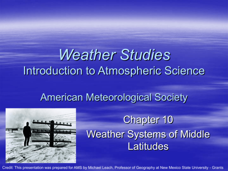
Weather Studies Introduction to Atmospheric Science American Meteorological Society Chapter 10 Weather Systems of Middle Latitudes Credit: This presentation was prepared for AMS by Michael Leach, Professor of Geography at New Mexico State University - Grants Case-In-Point Extra-tropical cyclones are major weather makers in middle and high latitudes In 1703, Daniel Defoe was the first to propose that storms generally track from west to east in middle latitudes In 1743, Benjamin Franklin was the first American to discover that storms usually move in an easterly or northeasterly direction – Based on observations, he concluded that wind direction in a storm was not an indication of the storm’s direction of movement 2 Driving Question What systems shape the weather of the middle latitudes? – Middle latitudes extend from Tropics of Cancer and Capricorn, poleward to the Arctic/Antarctic Circles – Weather is particularly dynamic because of the migration of cyclones and anticyclones embedded in the prevailing westerlies – This chapter examines: Air masses, fronts, cyclones, and anticyclones Local and regional circulation systems 3 Air Masses An air mass is a huge expanse of air covering thousands of square kilometers, and is relatively uniform horizontally in temperature and water vapor concentration (humidity) Abbreviations for air mass types: – Cold (polar or P) or warm (tropical or T) – Dry (continental or c) or humid (maritime or m) – Arctic (A) air Air mass source regions have nearly homogeneous surface characteristics over a broad area with little topographic relief – The air mass stays over the source region for an extended period, and takes on the characteristics of the source region 4 North American Types and Source Regions 5 North American Air Masses 6 Air Masses Modification of Air Masses – Air masses eventually move out of their source region – As they move, their properties are modified by the surface they pass over – Air mass modification occurs from: Exchange of heat or moisture, or both, with the surface over which the air mass travels Radiational heating or cooling Adiabatic heating or cooling associated with largescale vertical motion 7 Air Masses Modification of Air Masses, continued – In winter, as a cP air mass travels southeastward from Canada into the lower 48-states, its temperature usually modifies rapidly By the time it arrives in the southern states, temperatures will not usually drop much below freezing The sun warms snow-free ground, and the warmer ground heats the bottom of the air mass. Heat is then distributed vertically. – A similar process of heating and destabilization occurs when a cP air mass crosses the East Coast and moves over the western Atlantic. Evaporation from the sea surface leads to extensive areas of low clouds and fog – cP traveling over snow-covered ground experiences less modification Much of the incoming solar radiation is reflected rather than being absorbed 8 Air Masses Modification of Air Masses, continued – Tropical air masses modify less than polar masses They are often warmer than the ground they travel over The bottom of the air mass cools, and stabilizes Convective currents are suppressed If a tropical air mass moves over a warmer surface, the air mass can become even warmer – Air masses undergo significant modification through orographic uplifting (e.g., mP air mass sweeping inland from the Pacific Ocean) Rising air cools adiabatically, condensation/deposition occur, and precipitation is triggered on the windward slopes Descent on the leeward side leads to adiabatic warming and cloud dissipation Air mass emerges considerably milder and drier (e.g., modified Pacific air) 9 Frontal Weather A front is a narrow zone of transition between air masses that differ in density – Density differences are usually due to temperature contrasts, hence the names cold fronts and warm fronts – Density differences may also be caused by humidity contrasts – A front’s transition zone may be 100+ km and a line representing a front on a weather map is drawn along the warm edge of the zone A front is also associated with a trough in the sea-level pressure pattern, a corresponding wind shift, and converging winds When air masses meet at fronts, the colder, denser air forces the warmer, less dense air to rise – This induces adiabatic cooling and often cloud/precipitation development The slope of the front influences the types of clouds that form – Cold and warm fronts have different slopes associated with them 10 Frontal Weather Stationary Front – A front that exhibits essentially no lateral motion – This often happens along the Front Range of the Rocky Mountains when a shallow pool of polar air surges south over the plains and the leading edge is too shallow to cross the mountains. Milder air remains in the Great Basin to the west of the Rockies. – May also develop when a preexisting front becomes parallel to the upper-level flow pattern or along a boundary in the surface temperature pattern – Typical front Slopes from Earth’s surface towards denser air Lies in a trough in the pressure pattern Wind changes direction rather abruptly across the front May have broad region of clouds and precipitation (e.g., overrunning) 11 Stationary Front 12 Frontal Weather Warm Front – Warm air advances while cold air retreats – Overall characteristics very similar to a stationary front – As a warm front approaches: Clouds thicken and become lower in altitude Sequence is cirrus, cirrostratus, altostratus, nimbostratus, and stratus when the advancing warm air is relatively stable Initial cirrus appearance may be more than 1000 km (620 mi) ahead of the front Just ahead of the front, steady precipitation usually gives way to drizzle and sometimes frontal fog If advancing warm air is unstable, more vigorous uplift can occur with thunderstorms embedded in the overrunning zone 13 Warm Front Cirrus clouds 14 Frontal Weather Cold Front – Colder air displaces warmer air – In North America in winter, the temperature contrast along a cold front is usually greater than across a warm or stationary front – In summer, temperatures on either side of the front may be essentially the same Density contrasts arise because of humidity differences – The slope on a cold front is much steeper than the slope on a warm front Uplift is confined to a narrow area at or near the cold front’s leading edge If the warm air is unstable, thunderstorms may form and a squall line can develop If the warm air is relatively stable, nimbostratus and altostratus may form 15 Cold Front 16 Advancing Back-Door Cold Front A cold front generally trails south or southwestward from the center of an extra-tropical cyclone. Back-door cold fronts move south along the eastern side of the Appalachian Mountains. 17 Frontal Weather Occluded Fronts – Typically form late in a cyclone’s life cycle as it moves into colder air – Faster moving cold front catches up with the warm front – There are 3 types of occlusions, distinguished by the temperature contrast between the air behind the cold front and ahead of the warm front Cold occlusion – Air behind cold front colder than cool air ahead of warm front – Like a cold front at the surface but, with less air mass contrast Warm occlusion – Air behind cold front is not as cold as the air ahead of the warm front – Like a warm front at the surface Neutral occlusion – Little difference between air masses – Marked by a trough, wind shift line, band of cloudiness & precipitation 18 Cold-Type Occlusion Air behind advancing cold front colder than cool air ahead of warm front More common in eastern North America, where the colder air follows behind the front on northwest winds 19 Warm-Type Occlusion Air behind the advancing cold front is not as cold as the air ahead of the warm front Occurs in northerly portions of western coasts, such as in Europe or the Pacific Northwest, where mP air is behind the cold front 20 Air Masses Summary – Fronts are characterized based on the movement of the cold air mass – Clouds and precipitation may develop along fronts when there is a significant density contrast between air masses and there is an adequate supply of water vapor – Properties that define a front are differences in temperature and humidity, wind shift, convergence, and a pressure trough – Frontogensis: front forms or grows stronger – Frontolysis: front weakens 21 Extra-tropical Cyclones The extra-tropical cyclone (also called a low-pressure system or low), is a major weather maker of middle and high latitudes. Surface winds blow counterclockwise and inward. Surface winds converge, air rises, expands, and cools, resulting in clouds and precipitation. 22 Extra-tropical Cyclones The comma-shaped cloud pattern is characteristic of a well-developed extratropical cyclone. 23 Extra-tropical Cyclones Life Cycle – Norwegian cyclone model: conceptual model originally developed around WWI still closely approximates our current understanding – (A) Incipient cyclone: Cyclogenesis (birth of a cyclone) usually takes place along the polar front directly under an area of strong horizontal divergence in the upper troposphere Air pressure at the bottom of the air column falls, a horizontal air pressure gradient develops, and cyclonic circulation begins Westerlies aloft steer and support the cyclone as it progresses through its life cycle West of the low center, the polar front pushes southeast as a cold front. East of the low, the polar front advances north as a 24 warm front. Extra-tropical Cyclones warm sector Life Cycle – (B) Wave cyclone: In this stage, the central pressure continues to drop and winds strengthen due to an increased pressure gradient. The upper-level trough deepens while remaining west of the surface low center. Warm sector becomes better defined Fronts form a pronounced wave pattern and comma cloud is seen in satellite images Extensive stratiform cloudiness appears north of the warm front Cyclone moves eastward or northeastward at 40-55 km per hr 25 (25-35 mph) Extra-tropical Cyclones Life Cycle – (C) Beginning of occlusion Faster moving cold front advances on the warm front Warm sector area diminishes and occluded front begins to form Upper level pattern shows closed circulation and is directly over the surface low (vertically stacked) Dry slot separates the cold front cloud band from the comma cloud Cyclone moves slower at approximately 30 km per hr (20 mph) 26 Extra-tropical Cyclones triple point Life Cycle – (D) Bent-back occlusion Surface low may become detached from the westerly steering flow and the occluded front is drawn around the low center Warm sector is detached from cyclone center Triple point favors development of a secondary cyclone Eventually the cyclone weakens (cyclolysis) 27 Extra-tropical Cyclones Entire cycle can occur over several days, or a much shorter period – Speed of development depends on upper air support Weak divergence aloft will cause poorly defined systems – Sometimes cloudiness and precipitation occur with an upper-level or surface trough, which is not associated with a closed surface cyclonic circulation When upper-level conditions are ideal, the entire life cycle can occur in less than 36 hours 28 Extra-tropical Cyclones Cyclone Bomb – This is the term applied to a rapidly intensifying cyclone, and is defined as a central pressure drop of at least 24 mb in 24 hours – Few cyclones meet this criteria, and most that do occur in winter over a warm ocean surface current (e.g., Gulf Stream) Conveyor Belt Model – This is an alternate, 3-D model to the steps discussed previously (Norwegian cyclone model) – Combines horizontal and vertical air motions – Depicts the circulation in a mature cyclone in terms of three broad interacting systems called conveyor belts, which transport air with certain properties from one location to another Belts are (1) warm and humid, (2) cold, and (3) dry 29 Extra-tropical Cyclones Conveyor Belt Model, continued – (1) Warm and humid conveyor belt originates in the cyclone’s warm sector Ascends slightly as it flows northward in the warm sector at low levels and then ascends more rapidly over the warm front Helps explain the broad region of clouds/precipitation north of the warm front – (2) Cold conveyor belt originates north of the warm front Ascends as it progresses toward the west Forms the comma cloud and produces precipitation Turns clockwise at upper levels and follows westerly flow aloft – (3) Dry conveyor belt This air originates high in the troposphere and low stratosphere upstream of the upper-level trough One branch descends southward behind the cold front; the other forms the dry slot that separates the head & tail of the comma cloud 30 Conveyor Belt Model 31 Extra-tropical Cyclones Cyclone Weather Figure below represents an intensifying cyclone in the Upper Midwest Four sectors about the low center: – Strong cold air advection, stratiform clouds, and non-convective precipitation northwest of the low – Cold front south of low is accompanied by convective precipitation. Sinking air and mostly clear skies characterize the southwest sector behind the cold front. – The mildest air is in the southeast (warm) sector of the cyclone – An extensive overrunning zone is found to the northeast of the low center 32 Principal Cyclone Tracks As a general rule, the cyclone center moves forward in the same direction and at about one-half the speed of the 500-mb winds Principal storm tracks tend to converge toward the northeast Storm tracks appear to originate just east of the Rocky Mountains, but actually form over the Pacific Ocean near Alaska – As a cyclone travels over the mountains, it often loses its identity, but reforms over the Great Plains Nor’easters often intensify off the North Carolina coast and track toward the northeast along the East Coast – 2 motions exist Movement of the cyclone along the coast Counterclockwise flow of winds around the storm center; winds in northeast sector of the cyclone blow from the northeast (gives the name “nor-easter”) – Some may become powerful systems; drawing copious amounts of water vapor from the ocean and producing large amounts of precipitation over a broad area Generally, cyclones that form in the south yield more precipitation because they have access to greater amounts of mT air Cyclogenesis is more frequent in the winter when the mean position of the polar front and jet stream shift southward 33 Principal Cyclone Tracks 34 Extra-tropical Cyclones Cold Side/Warm Side – Storm track determines weather at points on the ground – Track A puts Chicago on the warm side with passage of the warm and cold fronts – Track B puts Chicago on the cold side with no frontal passage – Table summarizes the general sequence of weather conditions at Chicago 35 Extra-tropical Cyclones Winter Storms – An extra-tropical cyclone that produces any combination of frozen or freezing precipitation – An associated hazard is a cold wave, which often follows a winter storm – Necessary ingredients include cold air (typically brought in by a sprawling cold high to the north), a moisture supply, and uplift mechanisms – A major storm requires warm and humid air brought northward – A storm moving to the northeast produces heaviest snow to the north and west of the low center – Blizzard: a severe storm characterized by high winds and reduced visibility due to falling or blowing snow 36 Colorado-track Winter Storm System 37 Extra-tropical Cyclones Cold and Warm Core Systems An occluded cyclone is a cold-core system – Lowest temperatures occur in a column just above the surface low – Depth of low increases with altitude – Cyclonic circulation prevails throughout the troposphere and is most intense at high altitudes – The requirement that thickness (mean temperature) be lowest at the low center produces the classic isobar pattern 38 Extra-tropical Cyclones Cold- and Warm-Core Systems A non-occluded cyclone is a warm-core system – Lowest temperatures are northwest of the cyclone’s center, and highest temperatures are to the southeast – Low aloft is displaced to cold side of the storm – The system tilts with altitude – Upper-level low lags behind surface low Vertical cross-section of a low from northwest (cold) to southeast (warm) 39 Extra-tropical Cyclones Cold and Warm Core Systems Warm-core cyclone (thermal low) – Stationary, have no fronts, and are generally associated with fair weather – From over a broad expanse of arid/semiarid land in response to intense solar heating of the ground Hot surface heats the overlying air and lowers the density of the air column enough for a low to form – Usually very shallow – Anticyclone aloft overlies low 40 Anticyclones In anticyclones, subsiding air and diverging surface winds favor formation of a uniform air mass, no fronts, and generally fair skies Arctic and Polar Highs (cold-core anticylone) – Labeled either a polar high (cP air) or arctic high (A air) and are products of extreme radiational cooling, often over snow-covered land – Clockwise circulation weakens with altitude, and may reverse – Usually has a cold trough overlying it – These exert the highest pressure in winter – They are extremely stable, with an inversion in the lower km or so – Interact with the circulation of an extra-tropical cyclone by helping to maintain and strengthen the temperature 41 contrast along the cyclone’s cold front Anticyclones Warm High (warm-core anticyclone) – Forms south of the polar front and consists of extensive areas of subsiding warm and dry air – These strengthen with altitude – Examples are Bermuda-Azores high and systems that may develop over the interior of North America, especially in summer – The greater mass of air over the anticyclone center (related to a higher tropopause) is responsible for the high surface pressure – A cold-core anticyclone can become warm-core as it moves south and modifies 42 Anticyclones Anticyclone Weather – Fair weather system because surface winds blowing in a clockwise and outward direction (Northern Hemisphere) induce subsidence over a broad area – Arctic highs produce the lowest temperatures of winter – A stalling warm anticyclone can lead to drought and excessive summer heat – A weak horizontal air pressure gradient near the center leads to intense nighttime radiational cooling – Ahead of an anticyclone, there may be strong northwest winds ushering in polar or arctic air May bring heavy lake-effect snows to the lee side of the lakes In the summer, the most noticeable effect is not a lowering of temperatures, but a lowering of humidity – Highs may become entrenched east of the Rockies in summer, and form blocking highs High temperatures and eventually drought result 43 Local and Regional Circulation Systems Land and Sea (or Lake) Breezes Sea Breeze – Under exposure to the same intensity of solar radiation, the land surface warms more than the water surface – Highest pressure over water, and cool breeze sweeps inland – Shallow circulation has maximum strength in mid-afternoon – Uplift may lead to thunderstorms Land Breeze – By late evening, winds blow offshore due to a reversal in the heat differential between land and water – Obtains maximum strength around sunrise but is weaker than a sea 44 breeze Local and Regional Circulation Systems Chinook Winds A relatively warm and dry wind that develops when air descending the leeward slopes of a mountain range is adiabatically compressed Strong winds cause stable air in the lower troposphere to ascend on the windward side On the leeward side, stable air descends to the original altitude, and the larger scale of circulation causes further descent Called Santa Ana winds in southern California – The figure is a schematic representation of the surface weather pattern that favors development 45 Local and Regional Circulation Systems Chinook Winds Boulder, CO, situated in the foothills of the Rocky Mountains, experiences particularly strong and destructive downslope winds, sometimes gusting to 160 km per hr (100 mph) On average, the community sustains about $1 million in property damage each year due to these winds 46 Local and Regional Circulation Systems Desert Winds Hot surfaces (i.e., deserts) may develop superadiabatic lapse rates in the lowest levels of the atmosphere – These are highly unstable, and generate vigorous upwelling and gusty surface winds, but very few clouds form A dust devil is a whirling mass of dust-laden air formed by localized hot spot – Air is heated, and rises rapidly – Cooler surface winds converge on the hot spot – Horizontal wind shear causes the column of rising hot air to spin about a nearly vertical axis – Dust and debris are picked up, making these visible to altitudes topping 900 m (3000 ft) – May cause damage, as some have winds as higher than 75 km per hr (45 mph) Strong thunderstorm downdrafts may generate dust storms known as a haboob 47 Local and Regional Circulation Systems Mountain or Valley Breezes Valley Breeze – Bare valley walls absorb solar radiation and heat the surrounding air – Cooler, denser air over the valley sinks and air adjacent to the valley walls blows upslope – Cumulus clouds may form near summit – Best developed between late morning and sunset Mountain Breeze – Bare valley walls are chilled by radiational cooling and cool the surrounding air – Colder, denser air near the valley walls sinks and gusty breeze blows downslope – Fog or low stratus clouds may form in 48 the valley
