Oceania Map
advertisement
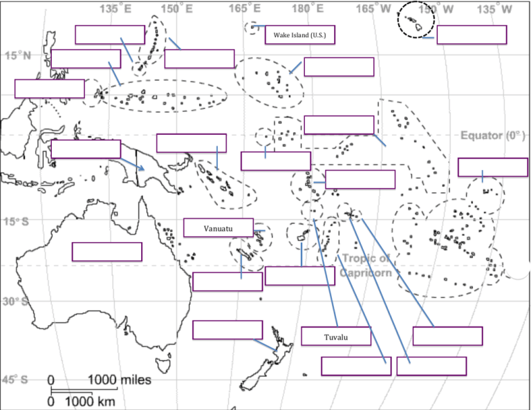
Wake Island (U.S.) Vanuatu Tuvalu Name: ____________________________________________ Hour: _____ Labeling the Map of Oceania Please label the following countries and physical features on your map of Oceania. Label the map neatly using a black or blue pen or a pencil. Color all countries (archipelagos) and physical features. Example: Color in the whole enclosed area for the grouping of islands. Part 1: PHYSICAL FEATURES Pacific Ocean- blue Indian Ocean- blue Tasman Sea- blue Coral Sea - blue Great Barrier Reef – purple Australian Outback – brown Part 2: Countries of Oceania American Samoa (U.S.) Australia Cook Islands (N.Z.) Fiji Islands French Polynesia (France) Kiribati Marshall Islands Micronesia Micronesia New Caledonia (France) New Zealand Northern Mariana Islands (U.S.) Palau Papua New Guinea Samoa Solomon Islands Tonga Tuvalu Vanuatu Wake Islands (U.S.) Map Assignment Rubric 5 – Each location on the physical and political map is labeled correctly and neatly and is printed in black or blue ink or pencil. (NO RED PEN) Labels are in horizontal direction. All country names are capitalized and are spelled correctly. Countries and physical features are colored in- each of a different color (with colored pencils not markers or crayons). (A+) 4 – ¾ of the locations are labeled with capitals, spelled correctly, and are in the correct locations. Labels are not neatly readable by the instructor or are not all in horizontal direction. Countries are not colored. (C) 3 – Assignment is a little more than half complete. Labels are messy or unreadable by instructor or are not in horizontal direction. (F) 2 – Assignment is poorly attempted or locations are not labeled accurately. (F) Grade: __________ Comments:

