WhiteGadsdenS - Arizona Geographic Alliance
advertisement
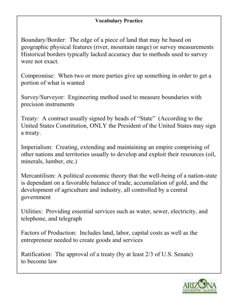
Vocabulary Practice Boundary/Border: The edge of a piece of land that may be based on geographic physical features (river, mountain range) or survey measurements Historical borders typically lacked accuracy due to methods used to survey were not exact. Compromise: When two or more parties give up something in order to get a portion of what is wanted Survey/Surveyor: Engineering method used to measure boundaries with precision instruments Treaty: A contract usually signed by heads of “State” (According to the United States Constitution, ONLY the President of the United States may sign a treaty. Imperialism: Creating, extending and maintaining an empire comprising of other nations and territories usually to develop and exploit their resources (oil, minerals, lumber, etc.) Mercantilism: A political economic theory that the well-being of a nation-state is dependant on a favorable balance of trade, accumulation of gold, and the development of agriculture and industry, all controlled by a central government Utilities: Providing essential services such as water, sewer, electricity, and telephone, and telegraph Factors of Production: Includes land, labor, capital costs as well as the entrepreneur needed to create goods and services Ratification: The approval of a treaty (by at least 2/3 of U.S. Senate) to become law Territory/Statehood: Territories are under jurisdiction of the U.S. government but do not have the same powers as a state Filibuster: A rule in the Senate that allows a Senator to keep talking and delay the debate of a bill Opportunity Cost: The cost in every choice you make since you could have done smoothing else with the time, resources, or money Cost/Benefit Analysis: Computing the fixed, variable and marginal costs and then computing the benefits resulting from those costs to determine if the cost is worth the benefit Slavery: Work without payment Appropriation: Funding for treaties or bills Dictatorship: A command form of government usually with no democratic voting of the citizens and commonly uses the military to hold power “Snapshot Timeline” 1800 - Under pressure from Napoleon, Spain returns Louisiana to France in exchange for certain Italian lands. 1803 - Through the Louisiana Purchase, the United States, under President Thomas Jefferson, doubles the size of its territory by buying what would become its midsection from France. 1819 - Spain sells Florida to the United States and gives up its claims on the Oregon Territory. 1821 - Mexico gains independence from Spain. 1836 - Texans declare their independence from Mexico. 1845 - The United States annexes the Republic of Texas, which becomes the 28th state. 1846 - Britain cedes the Oregon Territory to the United States. 1846 - War over Texas begins between the United States and Mexico. 1846 - The Mormon Battalion under Lt. Col. Philip St. George Cooke enters Tucson without resistance from Mexican presidio soldiers. 1847 - U.S. forces under Gen. Winfield Scott enter Mexico City. Peace negotiations with Mexico begin. 1848 - The Treaty of Guadalupe Hidalgo brings the Mexican War to an end. The treaty calls for Mexico to give up almost half of its territory, which would become California, Nevada, Utah, Texas and parts of Colorado, Arizona and New Mexico, and the United States pays Mexico $15 million. This is called the Mexican Cession. 1848 - Gold is discovered at Sutter's Mill in California. 1848 - Apaches drive settlers from Tubac. 1850 - California becomes the 31st state as part of The Compromise of 1850. The Compromise also provided that the lands in the Mexican Cession could decide by popular vote to have slavery or not. 1853 - James Gadsden, the American minister to Mexico under President Franklin Pierce, negotiates the Gadsden Purchase, which would bring what is now Southern Arizona and New Mexico, including Tucson, into the U.S. territorial system. 1854 - The Gadsden Purchase is ratified. The United States agrees to pay $10 million for more than 45,000 square miles south of the Gila River and west from El Paso to California. 1856 - Mexican troops leave Tucson. 1859 - The first newspaper in Arizona - The Weekly Arizonian - is published in Tubac. 1861-65 - The Civil War divides the nation. 1863 - Arizona officially becomes a U.S. territory, separate from the New Mexico Territory. 1867 - Tucson becomes the capital of Arizona Territory. 1869 – First Transcontinental Railroad is completed at Promontory Point, Utah linking the east and west coasts of the US. Name____________________ Student Handout 1 (Time Line/Guided Lecture Notes) Westward Expansion Progress: 1803: ______________________________ (Control mouth of Mississippi River) 1819: ______________________________ (Peninsula ceded by Spain) 1845: ______________________________ (Annexation from Mexico) 1846: ______________________________ (Northwest=British claims extinguished) 1848: ______________________________ (Treaty of Guadalupe Hidalgo) 1854: ______________________________ (Transcontinental rail route desired) Related Arizona Events/Locations: 1821: ______________________________ (Independence from Spain) 1- ___________________________ (Religion) 2- ___________________________ (Ranching) 3- ___________________________ (Trail-Land Port of Entry) 4- ___________________________ (Beaver) 5- ___________________________ (Indian Revolts) 1846: _______________________________ (Conflict) 1- ___________________________ (Took Tucson without firing a shot) 2- ___________________________ (Treaty Ending war-1848) 3- ___________________________ (Payment by U.S. to Mexico) 1850: _______________________________(Allowed voters to decide on slavery issue) 1853: _______________________________(U.S. Minister to Mexico) 1- ___________________________ (U.S. President) 2- ___________________________ (U.S. Secretary of War & future Confederacy President) 3- ___________________________ (Mexico’s dictator and President) 4- ____________________________(Who wanted a railroad) 5- ____________________________(Why would Mexico sell) 6-___________________________ (Options and Amounts) a- ______________________ b- ______________________ c- ______________________ d- ______________________ e- ______________________ f- ______________________ 1854: _____________________________(Agreement made on July 19 th) _____________________________(Final price) _____________________________ (Major peninsula kept by Mexico) 1854: Physical Features of the AZ Territory that made building a RR easier a- ______________________ b- ______________________ c- ______________________ d- ______________________ e- ______________________ Future Economic Advantages to building a RR in the Gadsden Purchase territory a- _____________________ b- _____________________ c- _____________________ d- _____________________ e- ______________________ Political Issues ________________________________ (Would new states permit slavery or not?) 1860-1865: ___________________________ (Union & Confederacy) 1869: _______________________________ (Promontory Point, Utah) 1881: _______________________________ (27-years after Gadsden Purchase) Student Handout 1 (Time Line/Guided Lecture Notes) Answer Key Westward Expansion: 1803: Louisiana Purchase _____________ (Control Mouth of Mississippi River) 1819: Florida _______________________ (Peninsula Ceded by Spain) 1845: Texas Republic _________________ (Annexation from Mexico) 1846: Oregon Country_________________ (Northwest=British claims extinguished) 1848: Mexican Cession _______________ (Treaty of Guadalupe Hidalgo) 1854: Gadsden Purchase_______________ (Transcontinental Rail route desired) Related Arizona Events/Locations: 1821: Mexican Republic ______________ (Independence from Spain) Missions Closed ____________ (Religion) Mexican Land Grants_________ (Ranching) Santa Fe Trail/Santa Fe _______ (Trail-Land Port of Entry) Mountain Men/Trappers_______ (Beaver) Apache Raids _______________ (Indian Revolts) 1846: Mexican War (1846-1847) _________ (Conflict) Mormon Battalion ________ (Took Tucson without firing a shot) Guadalupe Hidalgo __________ (Treaty Ending War-1848) $15-million__________________(Mexico ceded 2/5’s of their land=Payment by U.S.) 1850: The Compromise of 1850__________ (Allowed voters to decide on slavery issue) 1853: James Gadsden__________________ (U.S. Minister to Mexico) Franklin Pierce ________ (U.S. President) Jefferson Davis ____________ (U.S. Secretary of War=future Confederacy President) Antonio Lopez de Santa Anna (Mexico’s dictator and President) Pierce, Gadsden, Davis, South_______ Who wanted railroad Bankrupt, US would take, Indian claims Why would Mexico sell 6 options = Mexico needs cash _ (Options and Amounts): See map a- 120,000 sq mi + Baja/$50-million b- 120,000 sq mi no Baja/$35-million c- 1st option plus Indian Claims/$30-million d- Excluded Indian Claims/$20-million e- 32nd N./access to Gulf/$15-million a- 32nd N./no Gulf acesss/$10-million*Addition land south of 32nd parallel surveyed 1854: Gadsden Purchase signed Agreement made on July 19th $10 M (Final price) Baja (Major peninsula kept by Mexico) Future Economic Advantages to building a RR in Gadsden Purchase territory a- connecting east to CA b- agriculture c- ranching d- mining e- military Political Issues Brought slavery into Westward Expansion (Would new states permit slavery or not?) 1854: Physical Features of the Arizona Territory that were Good for Building a RR a- easy terrain b- few mountains or deep valleys c- acceptable water table d- rapid construction e- construction costs would be low 1860-1865: US Civil War _______________ (Union & Confederacy) 1869: Transcontinental rail open (Central Rt.) (Promontory Point, Utah) 1881: Southern Route open Transcontinental (27 years after Gadsden Purchase) Student Handout 2 (Gadsden Purchase Treaty: December 30, 1853) BY THE PRESIDENT OF THE UNITED STATES OF AMERICA A PROCLAMATION. WHEREAS a treaty between the United States of America and the Mexican Republic was concluded and signed at the City of Mexico on the thirtieth day of December, one thousand eight hundred and fifty-three; which treaty, as amended by the Senate of the United States, and being in the English and Spanish languages, is word for word as follows: IN THE NAME OF ALMIGHTY GOD: The Republic of Mexico and the United States of America desiring to remove every cause of disagreement which might interfere in any manner with the better friendship and intercourse between the two countries, and especially in respect to the true limits which should be established, when, notwithstanding what was covenanted in the treaty of Guadalupe Hidalgo in the year 1848, opposite interpretations have been urged, which might give occasion to questions of serious moment: to avoid these, and to strengthen and more firmly maintain the peace which happily prevails between the two republics, the President of the United States has, for this purpose, appointed James Gadsden, Envoy Extraordinary and Minister Plenipotentiary of the same, near the Mexican government, and the President of Mexico has appointed as Plenipotentiary "ad hoc" his excellency Don Manuel Diez de Bonilla, cavalier grand cross of the national and distinguished order of Guadalupe, and Secretary of State, and of the office of Foreign Relations, and Don Jose Salazar Ylarregui and General Mariano Monterde as scientific commissioners, invested with full powers for this negotiation, who, having communicated their respective full powers, and finding them in due and proper form, have agreed upon the articles following: ARTICLE I The Mexican Republic agrees to designate the following as her true limits with the United States for the future: retaining the same dividing line between the two Californias as already defined and established, according to the 5th article of the treaty of Guadalupe Hidalgo, the limits between the two republics shall be as follows: Beginning in the Gulf of Mexico, three leagues from land, opposite the mouth of the Rio Grande, as provided in the 5th article of the treaty of Guadalupe Hidalgo; thence, as defined in the said article, up the middle of that river to the point where the parallel of 31° 47' north latitude crosses the same; thence due west one hundred miles; thence south to the parallel of 31° 20' north latitude; thence along the said parallel of 31° 20' to the 111th meridian of longitude west of Greenwich; thence in a straight line to a point on the Colorado River twenty English miles below the junction of the Gila and Colorado rivers; thence up the middle of the said river Colorado until it intersects the present line between the United States and Mexico. For the performance of this portion of the treaty, each of the two governments shall nominate one commissioner, to the end that, by common consent the two thus nominated, having met in the city of Paso del Norte, three months after the exchange of the ratifications of this treaty, may proceed to survey and mark out upon the land the dividing line stipulated by this article, where it shall not have already been surveyed and established by the mixed commission, according to the treaty of Guadalupe, keeping a journal and making proper plans of their operations. For this purpose, if they should judge it necessary, the contracting parties shall be at liberty each to unite to its respective commissioner, scientific or other assistants, such as astronomers and surveyors, whose concurrence shall not be considered necessary for the settlement and of a true line of division between the two Republics; that line shall be alone established upon which the commissioners may fix, their consent in this particular being considered decisive and an integral part of this treaty, without necessity of ulterior ratification or approval, and without room for interpretation of any kind by either of the parties contracting. The dividing line thus established shall, in all time, be faithfully respected by the two governments, without any variation therein, unless of the express and free consent of the two, given in conformity to the principles of the law of nations, and in accordance with the constitution of each country respectively. In consequence, the stipulation in the 5th article of the treaty of Guadalupe upon the boundary line therein described is no longer of any force, wherein it may conflict with that here established, the said line being considered annulled and abolished wherever it may not coincide with the present, and in the same manner remaining in full force where in accordance with the same. ARTICLE II. The government of Mexico hereby releases the United States from all liability on account of the obligations contained in the eleventh article of the treaty of Guadalupe Hidalgo; and the said article and the thirty-third article of the treaty of amity, commerce, and navigation between the United States of America and the United Mexican States concluded at Mexico, on the fifth day of April, 1831, are hereby abrogated. ARTICLE III. In consideration of the foregoing stipulations, the Government of the United States agrees to pay to the government of Mexico, in the city of New York, the sum of ten millions of dollars, of which seven millions shall be paid immediately upon the exchange of the ratifications of this treaty, and the remaining three millions as soon as the boundary line shall be surveyed, marked, and established. ARTICLE IV. The provisions of the 6th and 7th articles of the treaty of Guadalupe Hidalgo having been rendered nugatory, for the most part, by the cession of territory granted in the first article of this treaty, the said articles are hereby abrogated and annulled, and the provisions as herein expressed substituted therefor. The vessels, and citizens of the United States shall, in all time, have free and uninterrupted passage through the Gulf of California, to and from their possessions situated north of the boundary line of the two countries. It being understood that this passage is to be by navigating the Gulf of California and the river Colorado, and not by land, without the express consent of the Mexican government; and precisely the same provisions, stipulations, and restrictions, in all respects, are hereby agreed upon and adopted, and shall be scrupulously observed and enforced by the two contracting governments in reference to the Rio Colorado, so far and for such distance as the middle of that river is made their common boundary line by the first article of this treaty. The several provisions, stipulations, and restrictions contained in the 7th article of the treaty of Guadalupe Hidalgo shall remain in force only so far as regards the Rio Bravo del Forte, below the initial of the said boundary provided in the first article of this treaty; that is to say, below the intersection of the 31° 47'30'/ parallel of latitude, with the boundary line established by the late treaty dividing said river from its mouth upwards, according to the fifth article of the treaty of Guadalupe. ARTICLE V. All the provisions of the eighth and ninth, sixteenth and seventeenth articles of the treaty of Guadalupe Hidalgo, shall apply to the territory ceded by the Mexican Republic in the first article of the present treaty, and to all the rights of persons and property, both civil and ecclesiastical, within the same, as fully and as effectually as if the said articles were herein again recited and set forth. ARTICLE VI. No grants of land within the territory ceded by the first article of this treaty bearing date subsequent to the day-twenty-fifth of September-when the minister and subscriber to this treaty on the part of the United States, proposed to the Government of Mexico to terminate the question of boundary, will be considered valid or be recognized by the United States, or will any grants made previously be respected or be considered as obligatory which have not been located and duly recorded in the archives of Mexico. ARTICLE VII. Should there at any future period (which God forbid) occur any disagreement between the two nations which might lead to a rupture of their relations and reciprocal peace, they bind themselves in like manner to procure by every possible method the adjustment of every difference; and should they still in this manner not succeed, never will they proceed to a declaration of war, without having previously paid attention to what has been set forth in article twenty-one of the treaty of Guadalupe for similar cases; which article, as well as the twentysecond is here reaffirmed. ARTICLE VIII. The Mexican Government having on the 5th of February, 1853, authorized the early construction of a plank and railroad across the Isthmus of Tehuantepec, and, to secure the stable benefits of said transit way to the persons and merchandise of the citizens of Mexico and the United States, it is stipulated that neither government will interpose any obstacle to the transit of persons and merchandise of both nations; and at no time shall higher charges be made on the transit of persons and property of citizens of the United States, than may be made on the persons and property of other foreign nations, nor shall any interest in said transit way, nor in the proceeds thereof, be transferred to any foreign government. The United States, by its agents, shall have the right to transport across the isthmus, in closed bags, the mails of the United States not intended for distribution along the line of communication; also the effects of the United States government and its citizens, which may be intended for transit, and not for distribution on the isthmus, free of custom-house or other charges by the Mexican government. Neither passports nor letters of security will be required of persons crossing the isthmus and not remaining in the country. When the construction of the railroad shall be completed, the Mexican government agrees to open a port of entry in addition to the port of Vera Cruz, at or near the terminus of said road on the Gulf of Mexico. The two governments will enter into arrangements for the prompt transit of troops and munitions of the United States, which that government may have occasion to send from one part of its territory to another, lying on opposite sides of the continent. The Mexican government having e agreed to protect with its whole power the prosecution, preservation, and security of the work, the United States may extend its protection as it shall judge wise to it when it may feel sanctioned and warranted by the public or international law. ARTICLE IX. This treaty shall be ratified, and the respective ratifications shall be exchanged at the city of Washington within the exact period of six months from the date of its signature, or sooner, if possible. In testimony whereof, we, the plenipotentiaries of the contracting parties, have hereunto affixed our hands and seals at Mexico, the thirtieth (30th) day of December, in the year of our Lord one thousand eight hundred and fifty-three, in the thirty-third year of the independence of the Mexican republic, and the seventy-eighth of that of the United States. JAMES GADSDEN, MANUEL DIEZ DE BONILLA JOSE SALAZAR YLARBEGUI J. MARIANO MONTERDE, And whereas the said treaty, as amended, has been duly ratified on both parts, and the respective ratifications of the same have this day been exchanged at Washington, by WILLIAM L. MARCY, Secretary of State of the United States, and SENOR GENERAL DON JUAN N. ALMONTE, Envoy Extraordinary and Minister Plenipotentiary of the Mexican Republic, on the part of their respective Governments: Now, therefore, be it known that I, FRANKLIN PIERCE, President of the United States of America, have caused the said treaty to be made public, to the end that the same, and every clause and article thereof, may be observed and fulfilled with good faith by the United States and the citizens thereof In witness whereof I have hereunto set my hand and caused the seal of the United States to be affixed. Done at the city of Washington, this thirtieth day of June, in the year of our Lord one thousand eight hundred and fifty-four, and of the Independence of the United States the seventy-eighth. BY THE PRESIDENT: FRANKLIN PIERCE, W. L. MARCY, Secretary of State. Student Handout 3 (Student Activity Writing) The Gadsden Treaty was the subject of much debate in the United States Congress from late 1853 through midyear 1854. Imagine you are the press secretary for President Franklin Pierce. Your job is to prepare a brief press release for the newspapers describing the Gadsden Purchase and the benefits for the United States to spend $10-million dollars of taxpayer money for this barren desert land. _____ (50 pts) Introduction: Briefly describe the Gadsden Purchase, its location, and the key treaty elements. Remember: This will be read by the average American in 1854 so keep it simple to understand. _____ (30 pts) Describe and support at least three elements of the Gadsden Purchase that will be politically or economically beneficial to the United States and explain why. _____ (10 pts) Summarize in your ending paragraph why the President was wise in spending $10million (an approximate equivalent of $250-million in today’s dollars) so he will remain popular with voters. _____ (10 pts) Length: (1 page minimum and 2 pages maximum) with correct punctuation and grammar. ______ (100 pts possible) 90-100=A 80-89=B 70-79=C 60-69=D 59 & below=F Student Handout 4 (Economics Activity) (1) Consumer Price Index/Rate of Inflation (Real vs. Nominal) 1854 price for Gadsden Purchase (Ratified) ________________ 2008 CPI = 645.40 *Federal Reserve Bank of Minneapolis 1854 CPI = 25 *Ethel D. Hoover (1851-1890) P1854 x (CPI2008/CPI1854) = y (today’s dollars) ______________ X ( _______ / ________) = ___________ (2) Unit Costing: Acres per square miles = 640 Square Miles Purchased = 29,640 Sq Mi X Acres per sq mi = total acres __________ X ____________ = ______________ Purchase Price = $10,000,000.00 Price / Total Sq Mi = unit cost per square mile _________ / _____________ = _______________ per square mile Price / Total Acres = unit cost per acre _________ / _____________ = _______________ per acre (3) Area Percentage: Square Miles Purchased = 29,640 Future State of AZ Portion = 27,305 Future State of NM Portion = _____ Percent: _____ Percent: _____ Current Arizona Square Miles = 114,006 (6th largest state in area) AZ portion of Gadsden Purchase _______ / 114,006 = % gained Percent of current day Arizona gained through the Gadsden Purchase: _________ Student Handout 4 (Economics Activity Answer Key) (1) Consumer Price Index/Rate of Inflation (Real vs. Nominal) 1854 price for Gadsden Purchase (Ratified) $10,000,000 2008 CPI = 645.40 *Federal Reserve Bank of Minneapolis 1854 CPI = 25 *Ethel D. Hoover (1851-1890) P1854 x (CPI2008/CPI1854) = y (today’s dollars) $10,000,000.00 X (645.4 / 25) = $258,160,000 (2) Unit Costing: Acres per square miles = 640 Square Miles Purchased = 29,640 Sq Mi X Acres per sq mi = total acres 29,640 X 640 = 18,969,600 Purchase Price = $10,000,000.00 Price / Total Sq Mi = unit cost per square mile $10,000,000 / 29,640 = $337.38 per square mile Price / Acre = unit cost per acre $10,000,000 / 18,969,600 = 53 cents per acre (3) Area Percentage: Square Miles Purchased = 29,640 Future State of AZ Portion = 27,305 Future State of NM Portion = 2,335 Percent: 92% Percent: 8% Current Arizona Square Miles = 114,006 (6th largest state in area) AZ portion of Gadsden Purchase 27,305 / 114,006 = % gained Percent of current day Arizona gained from Gadsden Purchase: 24% Student Handout 5 (Gadsden Purchase Map) Student Handout 6 (Assessment) Geography: (1) The Southern Boundary of Arizona Territory resulting from the Treaty of Guadalupe Hidalgo was along which physical geographic feature: (2) Two of the six Gadsden Purchase options allowed for the inclusion of which peninsula: (3) The gulf desired for a port, if included in the Gadsden Purchase was: (4) What was the geographic appeal to the United States for the Gadsden Purchase? (5) Into the future, which state would benefit most from the Gadsden Purchase? Which other state would benefit? History: (1) What role did Franklin Pierce play in the Gadsden Purchase? (2) Who the Mexico’s dictator/President during the Gadsden Treaty period? (3) Why was the Mexican President wishing to sell land to the US? (4) Why did the southern states desire a southern transcontinental rail line? (5) The original Gadsden Treaty was rejected by the US Senate primarily because: Economics: (1) Why was the Gadsden Purchase so important at that time? (2) List two major economic benefits that Gadsden Purchase would eventually provide: (3) Once the final treaty was ratified, how much did the United States pay for the Gadsden Purchase? (4) How much would that be per acre? (5) Adjusted for inflation in today’s dollars, what would the Gadsden Purchase have cost? Student Handout 6 (Assessment Answer Key) Geography: (1) The Southern Boundary of Arizona Territory resulting from the Treaty of Guadalupe Hidalgo was along which physical geographic feature: Gila River (2) Two of the six Gadsden Purchase options allowed for the inclusion of which peninsula: Baja (3) The gulf desired for a port, if included in the Gadsden Purchase was: Gulf of California (4) What was the geographic appeal to the United States for the Gadsden Purchase? Favorable terrain for rail line (5) Into the future, which state would benefit most from the Gadsden Purchase? Arizona Which other state would benefit? New Mexico History: (1) What role did Franklin Pierce play in the Gadsden Purchase? President of the United States/appointed James Gadsden as US Minister to Mexico (2) Who the Mexico’s dictator/President during the Gadsden Treaty period? Antonio Lopez de Santa Anna (3) Why was the Mexican President wishing to sell land to the US? He needed cash for his military and also felt the US would just come and take the land anyway. (4) Why did the southern states desire a southern transcontinental rail line? Expand slavery west. (5) The original Gadsden Treaty was rejected by the US Senate primarily because: Anti-slave states feared westward support Economics: (1) Why was the Gadsden Purchase so important at that time? Provide a southern transcontinental rail line that could be constructed at relatively low cost due to the favorable terrain. (2) List two major economic benefits that Gadsden Purchase would eventually provide: Metals Mining and Agriculture/Ranching (3) Once the final treaty was ratified, how much did the United States pay for the Gadsden Purchase? 10-million dollars (4) How much would that be per acre? About 53 cents (5) Adjusted for inflation in today’s dollars, what would the Gadsden Purchase have cost? About 258 million dollars.
