HISTORICAL BACKGROUND OF RIZAL PROVINCE
HISTORICAL BACKGROUND OF RIZAL PROVINCE
I.
GENERAL INFORMATION
The province of Rizal was born out of the union of parts of the old
Manila and the district of Morong by virtue of Act No. 310 which was passed by the first Philippine Commission on June 11,
1901.
The province is divided into four
(4) political districts, has 13 municipalities and one (1) city with one hundred eighty eight (188) barangays. The 1 st congressional district composed the municipalities of Cainta, Taytay, Angono and Binangonan. San Mateo, Rodriguez,
Teresa, Morong, Baras, Cardona, Pililla,
Tanay and Jalajala are under the 2 nd congressional district; and the two (2)
Congressional Districts of Antipolo City wherein it is now the new seat of the provincial government.
Rizal has a total land area of 130,383 hectares or 1,303.83 square kilometers representing 2.8% of Region IV’s area coverage. The city of
Antipolo and the municipalities of Rodriguez and Tanay have the biggest land areas. Cainta, with a land area of 1,019 hectares, comprises only 0.8% of the provincial total, is the smallest municipality of Rizal.
The Rizal Province has a total civilian population of 2,930,670. The
City of Antipolo has the highest concentration of population with 725,926.
Geography & Climate - Going
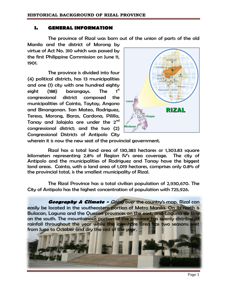
over the country’s map, Rizal can easily be located in the southeastern portion of Metro Manila. On its north is
Bulacan, Laguna and the Quezon provinces on the east, and Laguna de Bay on the south. The mountainous portion of the province has evenly distributed rainfall throughout the year while the lakeshore area has two seasons: wet from June to October and dry the rest of the year.
Page 1
HISTORICAL BACKGROUND OF RIZAL PROVINCE
Population and Languages -
People of Rizal province are mostly
Tagalogs who are conversant in Tagalog, Cebuano, and Bicol.
Commerce and Industry
-
The major industries of Rizal include agricultural production, marine and aquaculture production, tourism, mining, services, and banking. While rice is considered the major agricultural crop, the potentials of other crops like mango, citrus, coffee, cacao, and cashew cannot be discounted. Likewise, there is the potential to transform the vast upland areas of the province into a productive plantation of high value crops such as black pepper, pineapple, and Guaynabo.
Tours and Transport -
Like other provinces, Rizal boasts of numerous scenic spots that never fail to attract tourists. These include the following:
Daranak and Batlag Waterfalls
in
Tanay. A 14- meter high waterfall located beneath a running stream. A few steps away from the top of Daranak is the
Batlag waterfall, a smaller yet enchanting cascading stream. These natural wonders have been featured in several local and international films as well as for commercials.
Puente del Diablo.
An islet within the periphery of the town proper of Binangonan. It is known to have a cave where hard, black stones abound.
Batlag Waterfalls
Daranak Waterfalls
Page 2
HISTORICAL BACKGROUND OF RIZAL PROVINCE
Talim Island
lies in Laguna de Bay. It is part of the municipalities of Binangonan and
Cardona. The hour-long boat trip from the
Pritil wharf in the Binangonan side brings the tourists to this typical fishing community.
Ugong Falls.
A perfect hideaway from the maddening crowd of the metropolis. Considered a nature’s sanctuary, an ideal place to unwind, it is located at a hilltop in the historic town of Morong.
Blanco Family Museum.
Displays the impressive collection of paintings by Jose V. Blanco, his wife, and his seven children. A visit to the Artist’s
Village in Angono, Rizal is not complete until one visits the museum of this remarkable family.
Manansala Historical Landmark.
The residence of National Artist Vicente
Manansala, located at San Carlos Heights,
Binangonan. Now a national historical shrine, it houses the Manansala masterpieces, which range from realism to cubism.
Boso-Boso Church Ruins.
A remnant of a century old church that was not spared from destruction during the Second
World War. A small chapel was built inside the ruins offering
Sunday services to the parishioners.
Page 3
HISTORICAL BACKGROUND OF RIZAL PROVINCE
Our Lady of Antipolo Shrine.
The Antipolo Cathedral is the home of Our
Lady of Peace and Good Voyage
(Nuestra Senora de la Paz y Buenviaje), the patron saint of travelers. Thousands of devotees go on pilgrimage to the shrine during the entire month of May.
St Jerome Church
in Morong is a stone and mortar church built in 1615 by Chinese craftsmen as evidenced by the two Chinese lion sculptures guarding the entrance to the steep driveway. It has a three-story façade and an octagonal bell tower whose cross illuminates at night.
Baras Church
is one of the oldest churches in Rizal province. Completed in 1686, the main features of the church are the altar and lecterns that are stone artifacts unearthed from beneath the church.
The other equally popular places of interest in Rizal are the
Hinulugang
Taktak,
a mountain resort;
The
Calinawan Cave
in Tanay. Calinawan, which is actually a system of caves, is surrounded by dirt road, lush greenery and rocky rivers off Sampaloc Road. It has been a place of attraction for locals and tourists, treasure hunters, and television and movie producers.
Page 4
HISTORICAL BACKGROUND OF RIZAL PROVINCE
Wawa Dam,
situated at the foot of
Sierra Madre in Rodriguez, surrounded by limestone hills.
The proximity of Rizal to Metro Manila makes it accessible to tourists. They can board jeepneys that will take them to any town of the province which they wish to visit. These vehicles are lined up near the
Farmers Market in Cubao, Quezon City, or at the EDSA crossing terminal in
Mandaluyong.
Page 5
