Land of Israel – Regions
Pin Maps and Flags Directions
Pins/Flags for the Regions of Israel
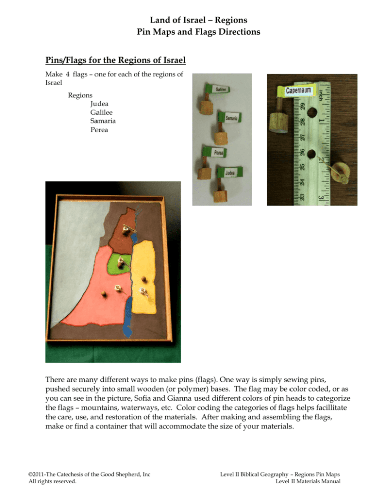
Make 4 flags – one for each of the regions of
Israel
Regions
Judea
Galilee
Samaria
Perea
There are many different ways to make pins (flags). One way is simply sewing pins,
pushed securely into small wooden (or polymer) bases. The flag may be color coded, or as
you can see in the picture, Sofia and Gianna used different colors of pin heads to categorize
the flags – mountains, waterways, etc. Color coding the categories of flags helps facillitate
the care, use, and restoration of the materials. After making and assembling the flags,
make or find a container that will accommodate the size of your materials.
©2011-The Catechesis of the Good Shepherd, Inc
All rights reserved.
Level II Biblical Geography – Regions Pin Maps
Level II Materials Manual
Land of Israel – Regions
Pin Maps and Flags Directions
Maps for the Regions of Israel
Enlarge (copy/draw) Pin Map (11 x 17 inches) on
mat board or poster board.
Map Title:
The Land of Israel
at the Time of Jesus
Regions
Color in the Mediterranean Sea, the River Jordan, the Sea
of Galilee and the Dead Sea.
Colors: Judea –
Samaria –
Perea
–
Galilee –
orange (terra cotta)
green
yellow
brown
Write the names of the regions on the flags
and on the map, itself.
Regions Pin Map and Pins (flags) - Rome
Mountains, Deserts & Waterways Mute
©2011-The Catechesis of the Good Shepherd, Inc
All rights reserved.
Level II Biblical Geography – Regions Pin Maps
Level II Materials Manual
Land of Israel – Regions
Pin Maps and Flags Directions
©2011-The Catechesis of the Good Shepherd, Inc
All rights reserved.
Level II Biblical Geography – Regions Pin Maps
Level II Materials Manual
Land of Israel – Regions
Pin Maps and Flags Directions
©2011-The Catechesis of the Good Shepherd, Inc
All rights reserved.
Level II Biblical Geography – Regions Pin Maps
Level II Materials Manual

