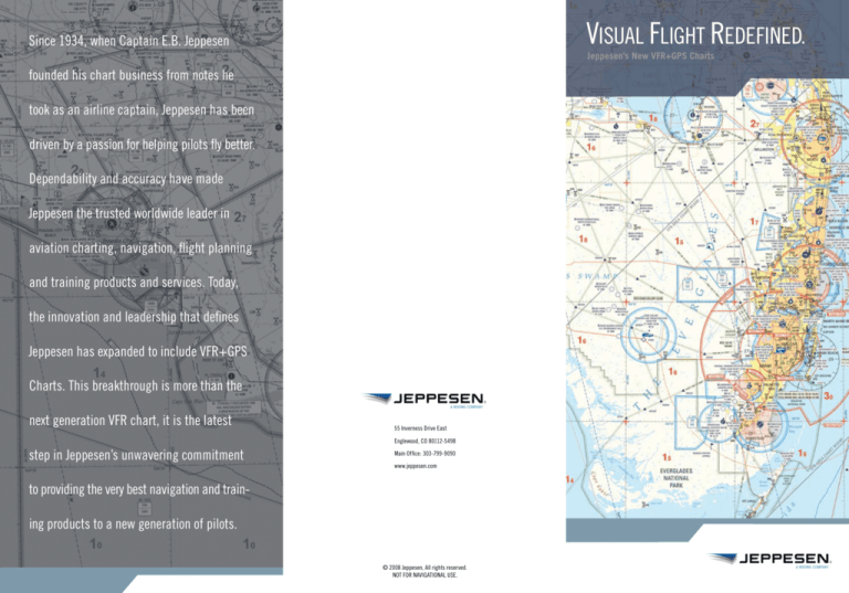
VISUAL FLIGHT REDEFINED.
Since 1934, when Captain E.B. Jeppesen
Jeppesen’s New VFR+GPS Charts
founded his chart business from notes he
took as an airline captain, Jeppesen has been
driven by a passion for helping pilots fly better.
Dependability and accuracy have made
Jeppesen the trusted worldwide leader in
aviation charting, navigation, flight planning
and training products and services. Today,
the innovation and leadership that defines
Jeppesen has expanded to include VFR+GPS
Charts. This breakthrough is more than the
next generation VFR chart, it is the latest
55 Inverness Drive East
Englewood, CO 80112-5498
step in Jeppesen’s unwavering commitment
Main Office: 303-799-9090
www.jeppesen.com
to providing the very best navigation and training products to a new generation of pilots.
© 2008 Jeppesen, All rights reserved.
NOT FOR NAVIGATIONAL USE.
Over time, the airplanes you fly, the technology you utilize, the skills
you possess and the knowledge you apply for safe flight keep getting better.
The future is clear.
GPS Waypoints—
Waypoints—They’re spelled-out easily and clearly, making planning flight
A VFR chart is only as good as your trust in the information provided and your
However, with the exception of semi-annual updating, your VFR charts have
ability to quickly interpret and act upon it. For students learning to fly, Jeppesen
remained basically unchanged.
VFR+GPS Charts are easier to use and read, thanks to a more simplified layout.
Until now.
Jeppesen’s new VFR+GPS Charts offer a fresh perspective on what a VFR
chart should be with better use of color and contrast, coverage areas based on
the way you fly, intuitive symbols for easier interpretation, and Space Shuttle radar
and flying the plan much easier.
For instructors, they are easier to use as a teaching aid. And for all aviators,
Jeppesen VFR+GPS Charts makes your VFR chart a more effective tool for flight
planning, and you a more effective pilot, through enhancements like:
Clear Airspace Boundaries—Easier recognition of controlled airspace with
color-coding and clear labels to show airspace class and altitude segments.
data to more accurately depict terrain. Jeppesen VFR+GPS Charts are easier to
use in the cockpit or at the kitchen table, they’re designed to help you get more
from your GPS, and they come from one of the most trusted names in aviation..
• All VFR checkpoints and waypoints
are listed on the back side with GPS
coordinates—an industry first.
• Waypoints are clearly identified.
JeppGuide® Airport Diagrams—With airport diagrams on the back, your VFR
chart can be a useful guide from engine start-up to shut-down.
A better view.
Severe clear is more than a term for sunny skies. It defines the level of clarity
that drove Jeppesen to create the next generation of intuitive single-sided, VFR
charts that:
Emphasize GPS Navigation—A first in the United States, Jeppesen VFR+GPS
Charts enable your paper chart and GPS to work together seamlessly.
• Faster recognition of controlled airspace.
• Airspace “flags” show classes
and altitudes.
• No need to search and decode
airspace altitudes.
Utilize Pilot Input—We asked pilots just like you what they wanted in a new
generation VFR chart. The result was better color and contrast; more intuitive
symbology; and white space for note-taking, to name just a few.
Reflect How You Fly—Coverage areas are built around popular VFR flight
plans; you’re more likely to need fewer charts to get where you’re going.
• “Pink” fill indicates controlled airspace
to floor to help visualize the “upside down
wedding cake.”
• Color-coding adds a “third dimension” to
airspace structure.
• Easier to learn for a student, easier to
teach for an instructor.
Streamlined Airport Symbology—
Symbology—Jeppesen has updated familiar VFR chart
symbology, making it easier to understand. This is especially important when
approaching a busy unfamiliar airspace.
• Better situational awareness on the ground, day or night.
• Invaluable local airport information for unfamiliar airports.
• Local restaurants and hotels in the “Local Area Guide” section.
Work In the Air and On the Ground—Proven JeppGuide® Airport diagrams are
on the back of each chart, creating better situational awareness on the ground—
day or night.
Your next VFR chart should come from a name you trust. To get your new
Jeppesen VFR+GPS Charts, visit your favorite pilot shop, FBO or aviation dealer.
,
• Large airports (over 9,000 ft.) are depicted
with the airport property boundary for faster
recognition from the air.
• Private airports are depicted with runway
layouts to aid VFR navigation.

