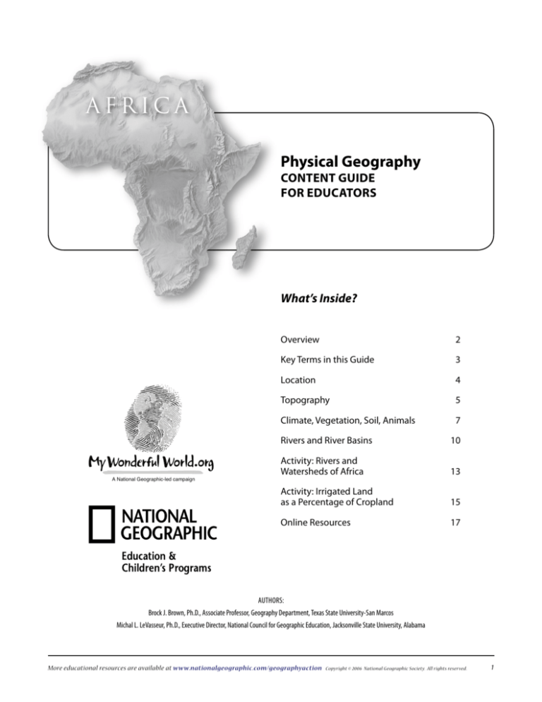
Africa
Physical Geography
Content Guide
for educators
What’s Inside?
A National Geographic-led campaign
Overview
2
Key Terms in this Guide
3
Location
4
Topography
5
Climate, Vegetation, Soil, Animals
7
Rivers and River Basins 10
Activity: Rivers and Watersheds of Africa
13
Activity: Irrigated Land as a Percentage of Cropland 15
Online Resources
17
Authors:
Brock J. Brown, Ph.D., Associate Professor, Geography Department, Texas State University-San Marcos
Michal L. LeVasseur, Ph.D., Executive Director, National Council for Geographic Education, Jacksonville State University, Alabama
More educational resources are available at www.nationalgeographic.com/geographyaction
Copyright © 2006 National Geographic Society. All rights reserved.
Content Guide:
PHYSICAL Geography of Africa
2 of 1
Overview
T
he physical landscape of any continent or region on Earth
is composed of those features of the natural environment
that serve as the essential background for human activity.
Landscapes, therefore, often have more than just scientific
appeal or meaning for people. They may be seen as having
religious or political significance, or they may be seen as objects
of beauty, for example. The physical features of any landscape
Kongou Falls, Gabon
are created by processes that include forces that work in the
atmosphere, lithosphere, hydrosphere, and biosphere and
thereby give a set of characteristics to the place in which they
are found. Like any continent, Africa’s physical geography is
unique and the result of complex physical forces, as well as the
interaction of humans and their environments.
More educational resources are available at www.nationalgeographic.com/geographyaction
Copyright © 2006 National Geographic Society. All rights reserved.
Content Guide:
PHYSICAL Geography of Africa
3 of 21
Key Terms in this Guide
Climograph – type of graph used to display temperature and
precipitation data of climatic types; a climograph for a particular
place usually displays monthly average temperature as a line and
Landform – a specific feature that forms part of the overall
shape of Earth’s surface. Tectonic activity, including volcanism,
folding, and faulting, derives its energy from within the Earth,
usually occurs at plate boundaries as they break apart and
collide with one another, and is a dominant process in
building landforms.
monthly average precipitation as a bar
Landscape – a region of associated landforms
Fault – a fracture in the crustal rock involving displacement of
the rock on either side of the break, or fault plane. A normal
fault is a result of tension and rifting. The fault plane separates
a block that has remained stationary from one that has dropped
down. Normal faults may exist in a set of roughly parallel faults
so that there is a down-dropped block (graben or rift valley)
between two uplifted blocks.
Relative location – indicates a position in reference to
something else
Absolute location – defined by precise points on a geographic
grid system using coordinates such as latitude and longitude;
answers the question “where” and identifies the location
Rifting – the pulling apart of Earth’s crust that creates faults
Watershed – the land area that is drained by a river and its
tributaries; it is separated from other watersheds by higher land
known as a drainage divide. Watersheds exist at different scales
and may be nested within one another. More educational resources are available at www.nationalgeographic.com/geographyaction
Copyright © 2006 National Geographic Society. All rights reserved.
Content Guide:
PHYSICAL Geography of Africa
4 of 21
Location
A basic and fundamental tenet of geography is that location matters. Location is the “where element” of geography. It helps us understand
the way in which things are distributed in space. Locations are expressed in either absolute or relative terms.
Historically, since about 250 B.C., geographers have been concerned with answering the fundamental question of where on Earth
things and places are located in absolute and relative terms. Knowing what is found in particular places and the human and physical
characteristics of these places enables us to build an understanding of the ways in which space and place connect. Geographers may ask
why phenomena—any attribute of the physical or cultural landscape—are located in particular places, the processes that affect their
location, and how places are related and connected. Is there a pattern to the locations? Of equal value: Where are phenomena
not located?
Key geographic questions:
Key facts:
What is the absolute location of Africa as a continent? (To define
the absolute location of a continent—which can be determined
by its latitudinal and longitudinal extent—look at the grid
coordinates of its boundaries.)
• Africa is located in all four hemispheres: Eastern, Northern,
Western, and Southern.
What is the relative location of Africa to other continents?
(This question may have many correct answers.)
• East Africa is located at the boundary between tectonic
plates. This affects the development of the East African
topography.
What is the significance of Africa’s location to the physical
environment?
• Africa’s absolute location affects its climate. The continent is
in the tropical and sub-tropical zones.
More educational resources are available at www.nationalgeographic.com/geographyaction
Copyright © 2006 National Geographic Society. All rights reserved.
Content Guide:
PHYSICAL Geography of Africa
5 of 21
Topography
Topography is characterized by features such as these:
•
•
•
•
•
•
Elevation
Relief
Orientation
Aspect (direction a slope faces)
Slope gradient
Slope length
• Curvature of Earth
Spatial Distributions of Culture
Some landscapes are sites of events that remind us of our history and become objects of patriotism. Some are sites of religious
significance. Sometimes, landscapes are seen as objects of beauty, painted and set aside in preserves
and parks for our enjoyment.
REGIONS
Natural/Physical
Cultural
Key geographic questions:
Key facts:
What are the topographic regions of Africa?
•The African continent is primarily an uplifted plateau.
The African escarpment lies in close proximity to
the coast and contributes to rapids on rivers and
hampers transportation routes.
What are the characteristics of the topographic regions of Africa?
What processes account for the development of specific
topographic features in particular locations?
Formal
Vernacular
Functional
In what ways is the topography of Africa similar to and different
from other continents?
Plateau Surface
Escarpment
UPLIFT
More educational resources are available at www.nationalgeographic.com/geographyaction
Copyright © 2006 National Geographic Society. All rights reserved.
Content Guide:
PHYSICAL Geography of Africa
6 of 21
Topography Key facts con’t.
•The continent displays shallow basins with rivers in watersheds
or drainage basins.
•The Great Rift in East Africa is one of the best examples of riftvalley topography in the world. The tectonic process of rifting
or tension creates a set of faults.
• While it is unusual for a continent not to have a backbone
mountain system, Africa has few mountains. Mountains affect
local weather and climatic conditions and provide source
• Africa has a narrow coastal plain backed by escarpments.
Coastal plains provide the settlement location for much of the
world’s population.
regions for surface waters; and volcanic mountains contribute
to fertile soils.
• Africa has a difficult shore characterized by a narrow
continental shelf; reefs, rocks, and submerged bars; and very
few good natural harbors.
Rifting
RIFT
VALLEY
Fault plane
Down-dropped
block
More educational resources are available at www.nationalgeographic.com/geographyaction
Copyright © 2006 National Geographic Society. All rights reserved.
Content Guide:
PHYSICAL Geography of Africa
7 of 21
Climate, Vegetation, Soil, Animals
Climate is composed of the following weather variables averaged over time:
• Moisture (precipitation, condensation, and humidity)
•Temperature
• Pressure
• Winds
The values of these variables for a given place are determined by climatic controls, which include the following:
• Latitude
• Continentality
•Ocean currents
• Pressure systems
• Prevailing winds
• Elevation
•Surface topography
• Vegetation cover
One of the most commonly used classification systems to define climate regions (the Köppen system) uses values of temperature and
precipitation to define climate regions.
Key facts:
•The spatial distributions of climate, soils, and vegetation are
correlated worldwide. This spatial correlation suggests that
natural/physical processes are all closely interrelated.
• Climate is dictated by the receipt of energy, and influences
the type of vegetation, soil, and animals found in a region, as
well as the available water supply.
•Heat is produced at the surface of the Earth by sunlight
(shortwave electromagnetic radiation) that is converted to
heat energy (long-wave radiation). The distance between the
Earth and the sun has little effect on heat production at the
surface of the Earth. Instead, heat production is due to
the following:
a. Angle of the sun’s rays
b. Length of exposure (number of daylight hours)
to sunlight
c. Albedo (reflectivity)
More educational resources are available at www.nationalgeographic.com/geographyaction
Copyright © 2006 National Geographic Society. All rights reserved.
Content Guide:
PHYSICAL Geography of Africa
8 of 21
Migration of ITCZ (Inter-Tropical Convergence Zone)
and Sub-Tropical Highs (STH) as a Result of Hadley Circulation
ITCZ
STH
Dry all year
30ºN
Wet/dry
Wet all year
STH
Wet/dry
Dry all year
0º
30ºS
TROPICAL LATITUDES
Sub-Tropical High
STH
Inter-Tropical Convergence Zone
ITCZ
Sub-Tropical High
STH
At the Equator a region exists that is wet all year. This is due to the predominance of the Inter-Tropical Convergence Zone (ITCZ), which
is a huge rain-producing circulation feature in the atmosphere. Progressing poleward from the ITCZ the climate remains warm in Africa
due to the low latitude, but it becomes increasingly dry. At about 30 degrees latitude it is so dry that great deserts exist. This is due to the
dominance of the Sub-Tropical High (STH), a circulation feature that greatly restricts the formation of precipitation.
• At the Equator precipitation is abundant and there is a minimum of drought stress for plant growth. Progressing to higher tropical
latitudes, drought stress increases due to the following climatic factors:
a. Less precipitation
b. Longer dry season, emerging into drought
c. Increased potential evaporation
•Tropical vegetation biomes are distributed spatially according to climate. The following biomes exist in Africa:
a. Equatorial rain forest—wet all year
b. Dry season deciduous forest—short dry season
c. Woodlands—longer dry season
d. Savannah—dry season long enough that trees are replaced with grasses as the dominant life-form
e. Grasslands—long dry season
f. Desert scrub—dry most or all of the year
More educational resources are available at www.nationalgeographic.com/geographyaction
Copyright © 2006 National Geographic Society. All rights reserved.
Content Guide:
PHYSICAL Geography of Africa
9 of 21
• The impact of climate on soils in Africa can be summarized as follows.
Equatorial Rain Forest
Oxisols: Very old, highly weathered soils of low latitudes; aluminum and iron oxides, low nutrients; 99 percent of ecosystem nutrients
in living biomass
Transitional
Ultisols: Tropical with accumulation of clay; can be used for agriculture with the aid of fertilizers and lime
Dry Tropical
Aridisols: Soils of dry climates, loss in organic matter, nutrients accumulate at surface, low clay or humus, rapidly lose nutrients
when watered
•The impact of climate on life-forms can be summarized as follows.
Rain Forest
Minimum migration, life at many levels of ecosystem, many specific niches, animal pollinators
Wet/Dry
Fosters migration of first order consumers and many higher tropic-level consumers, insect and wind pollination
Dry
Extreme adaptation to specific niches, insect pollination is common, often specialized
More educational resources are available at www.nationalgeographic.com/geographyaction
Copyright © 2006 National Geographic Society. All rights reserved.
Content Guide:
PHYSICAL Geography of Africa
10 of 21
Rivers and River Basins
Water moves across Earth’s surface through organized networks of channels, known as rivers or streams. Although the flow of water may
be seasonal, the channels and the networks remain, and are organized into drainage networks. These networks are an integral part of
drainage basins or watershed systems, which function as physical regions.
Watershed and Drainage Divides
DIVIDES
SUB-WATERSHED
Watersheds play a critical role in the natural functioning of Earth’s environment. Physically, they integrate the surface water runoff
into organized drainage nets. Economically, they play a critical role as sources of water, food, hydropower, recreational localities, and
transportation routes. Ecologically, watersheds provide habitats for a wide range of flora and fauna.
Throughout history human settlement has been drawn to rivers and river valleys since alluvial material from deposition along some
rivers creates fertile soils for agriculture. For example, 95 percent of Egypt’s rapidly growing population lives within the narrow watered
strip along the Nile River Valley. The first developments of sedentary agriculture and urbanization began in the great river valleys of the
world, among which are the Nile, Indus, Hwang Ho, and Tigris-Euphrates systems. In virtually all agrarian and industrial societies, river
valleys, and especially floodplains, are among the most attractive yet hazardous environments for settlement.
More educational resources are available at www.nationalgeographic.com/geographyaction
Copyright © 2006 National Geographic Society. All rights reserved.
10
Content Guide:
PHYSICAL Geography of Africa
11 of 21
A central concept of management and conservation of rivers and watersheds is planning for human use that is the least disruptive and
damaging to the natural systems. In whatever manner the river and watershed system is utilized, those uses affect the entire watershed
and even areas beyond the watershed. Thus, use in one state or country may be affected by decisions made in another state or country.
Individual rivers have different physical characteristics along their courses and create many of the landforms and landscapes within
watersheds. Thus, the particular use of a river system is influenced by the nature of the individual river, the nature of the topography
associated with the river, and where within the watershed one is located. African rivers often have unusual courses, waterfalls, and
rapids, and some lack deltas at the shore.
Key geographic questions:
Key facts:
Where are the river basins (watersheds) located on the continent
of Africa?
• Water is transferred into the atmosphere by evaporation
and evapo-transpiration. Following condensation, water
reaches the surface of a watershed as precipitation, where it
may follow one of several paths:
a. Interception by vegetation
b. Infiltration into the soil
c. Percolation into the groundwater
d. Surface retention and storage (lakes, ponds, puddles,
reservoirs, etc.)
e. Runoff
f. Streamflow or rivers
What are the characteristics of rivers and their watersheds on the
African continent?
What significance might the characteristics have for the use of
the river?
ATTENTION EDUCATORS:
Student Activity: Rivers and Watersheds of Africa (pp. 13–14), demonstrates the locations, characteristics, and significance
of Africa’s watersheds. Materials required: student atlas, base map of Africa (page 16 of this Guide), color pencils/markers,
transparency—base map of Africa, transparency markers
Student Activity: Irrigated Land as a Percentage of Cropland (p.15), asks how and why irrigated land as a percentage of cropland
might be correlated with other factors such as water resources, cultural aspects of water usage, and demographic characteristics.
Materials required: access to Internet or printouts of the Natural Resources Conservation Service (NRCS) U.S. Map: Percentage of
Cropland in Irrigation, 1997, at http://www.nrcs.usda.gov/TECHNICAL/land/meta/m5301.html
More educational resources are available at www.nationalgeographic.com/geographyaction
Copyright © 2006 National Geographic Society. All rights reserved.
11
Content Guide:
PHYSICAL Geography of Africa
12 of 21
Rivers and River Basins Key facts, cont’d
•The rivers within a watershed may have different degrees
of flow.
a. Permanent or perennial rivers exist in well-watered
areas and flow throughout the year.
b. Ephemeral rivers carry water during and immediately
after some rainfall event and are dry most of the year.
c. Intermittent rivers are also dry through part of the
year but flow when the groundwater is high enough;
they also flow during and immediately after a rainfall
event or snowmelt. Many of the smaller streams of
North Africa are intermittent streams.
d. Exotic rivers are permanent rivers that do not gain water
along their courses. The Nile River is an example of an
exotic river–the sources of the Nile are in the more
watered highland areas, while the main course of the
river flows through desert regions of the Sudan
and Egypt.
• In-stream Water Use is the in-channel, or non-withdrawal,
use of water. Examples include:
a. Hydroelectric power generation
b. Fish and wildlife management
c. Transportation–requires rivers to be navigable
d. Recreation
• Off-stream Water Use is water withdrawn or diverted from
the stream channel. In many cases a high percentage of
off-stream water is returned to the stream but with some
aspect of its quality changed. For example, most of the water
withdrawn for power plant cooling is returned, but at a
higher temperature. Examples include:
a. Irrigation and other agricultural needs (primary use of
water in Africa)
b. Municipal, industrial and power plant cooling
• Egypt has historically relied on the Nile to provide the water
needed to support human habitation, including irrigation
agriculture. Sudan also diverts water from the Nile to support
an expanded irrigation cultivation of cotton for commercial
export. The diagram below indicates the irrigation projects of
Sudan. Note that this is a diagram, not a map.
Diagram: Irrigation Projects in Sudan
(NOT TO SCALE)
Nile River
WHITE NILE
DAM
White Nile
ow
ion
ect
dir
of
r fl
rive
to Lake
Victoria
More educational resources are available at www.nationalgeographic.com/geographyaction
GEZIRA
(Gravity-fed
irrigation)
SENNAR
DAM
river flow
direction of
AL MANAQIL
(Pump irrigation)
Khartoum
Blue
Nile
Copyright © 2006 National Geographic Society. All rights reserved.
12
Content Guide:
PHYSICAL Geography of Africa
13 of 21
HANDOUT
Activity: Rivers and Watersheds of Africa
Rivers, organized in watersheds (or drainage basins), provide vital resources for human activity and use. As a physical region, a
watershed’s boundary may overlap the boundaries of other types of regions, especially political ones. The nature of the river system
within a watershed affects the potential human use of the system.
Where are the river basins (watersheds) located on the continent of Africa?
1.On the base map, draw and label the major rivers of the African continent.
2. Draw the boundaries of the watersheds of each major river system.
3. Which regions of Africa do and do not lie in a major watershed region? What might account for the distribution pattern of rivers
and watersheds?
More educational resources are available at www.nationalgeographic.com/geographyaction
Copyright © 2006 National Geographic Society. All rights reserved.
13
Content Guide:
PHYSICAL Geography of Africa
14 of 21
HANDOUT
Activity: Rivers and Watersheds of Africa (page 2)
What are the characteristics of rivers and their watersheds on the African continent?
What significance might the characteristics have for the use of the river?
4. Select one watershed and examine the characteristics of the major river and its tributaries within the watershed, noting source,
course, and final discharge area.
5. Your answer:
What is the relationship of the watershed as a region to political regions of Africa? What are the implications for control of water?
6. For the selected watershed, mark the course of the river with a different color every time it crosses a political border into a
different country.
7.How many segments did you color?
8. Your answers:
More educational resources are available at www.nationalgeographic.com/geographyaction
Copyright © 2006 National Geographic Society. All rights reserved.
14
Content Guide:
PHYSICAL Geography of Africa
15 of 21
HANDOUT
Activity: Irrigated Land as a Percentage of Cropland
Irrigation agriculture depends upon the use of surface and ground waters to augment precipitation amounts necessary for crop
production.
Answer the questions below using the Natural Resources Conservation Service (NRCS) map showing “Percentage of Cropland in Irrigation,
1997,“ in the United States at http://www.nrcs.usda.gov/TECHNICAL/land/meta/m5301.html
1. How might this information be correlated with surface water resources, groundwater resources, soils, and other physical features?
2. How might this information be correlated with cultural aspects, such as methods of agriculture, crops produced under irrigation,
and dams?
3. How might this information be correlated with demographic characteristics of the population, such as rate of natural increase,
population density, and caloric intake?
More educational resources are available at www.nationalgeographic.com/geographyaction
Copyright © 2006 National Geographic Society. All rights reserved.
15
Content Guide:
PHYSICAL Geography of Africa
16 of 21
HANDOUT
Africa: Political Boundaries
0
0
8 0 0 mi
800 km
More educational resources are available at www.nationalgeographic.com/geographyaction
Copyright © 2006 National Geographic Society. All rights reserved.
16
Content Guide:
PHYSICAL Geography of Africa
17 of 21
Online Resources
Physical Geography of Africa Content Guide: Online Resources
Related Links:
National Geographic Guides for Educators: The Geographic Perspective
Written for educators, these National Geographic content guides offer background on and real-world examples of the geographic
perspective, and how it can be applied across the curriculum.
Geographic Perspective: Content Guide for Educators (PDF)
http://www.nationalgeographic.com/xpeditions/guides/geogpguide.pdf
Examples of ways educators can apply the geographic perspective across the curriculum to enhance students’ examination of
complex issues that arise from human interaction with the environment
Africa: Physical Geography Content Guide for Educators (PDF) (this guide)
http://www.nationalgeographic.com/xpeditions/guides/physicalafricaguide.pdf
Explores ways of teaching physical geography—specifically, of Africa—to students, including location, topography, climate,
vegetation, and rivers. Developed for Geography Action! 2006: Africa.
Africa: Human Geography Content Guide for Educators (PDF)
http://www.nationalgeographic.com/xpeditions/guides/humanafricaguide.pdf
By exploring the cultural landscape of a place, educators can help students understand how people learn and integrate culture—
something unique to humans. Developed for Geography Action! 2006: Africa.
Africa: Contemporary Issues Content Guide for Educators (PDF)
http://www.nationalgeographic.com/xpeditions/guides/contempafricaguide.pdf
How educators can use the geographic perspective to infuse numerous kinds of contemporary issues—in this instance, issues in
Africa—into their curricula. Developed for Geography Action! 2006: Africa.
More educational resources are available at www.nationalgeographic.com/geographyaction
Copyright © 2006 National Geographic Society. All rights reserved.
17
Content Guide:
PHYSICAL Geography of Africa
18 of 21
Africa Multidisciplinary Educator Guide (PDF)
http://www.nationalgeographic.com/xpeditions/guides/multidafricaguide.pdf
This guide offers K–12 educators dozens of resources for teaching about Africa across the curriculum when something new and
interesting is needed. Grouped into four grade bands, the guide lists lesson plans, interactive features, and more that can be used
to teach science, social studies, Language Arts, art, and more. Developed for Geography Action! 2006: Africa.
Brock Brown’s Geographical Summary of Earth as a Natural/Physical Environmental System
and Humans Interacting with the System (PDF)
http://www.nationalgeographic.com/xpeditions/guides/geogsummary.pdf
This thought-provoking essay explores the Earth’s dynamic energy/matter system and how humans impact that system through
the use of technology. Dr. Brown is an Associate Professor of Geography at Texas State University–San Marcos.
CIA: The World Factbook
https://www.cia.gov/cia/publications/factbook/index.html
Maps and country profiles with information about location, geographic coordinates, climate, terrain, land use, irrigated land,
and much more
Climate Controls: World Climographs
http://cwx.prenhall.com/bookbind/pubbooks/lutgens3/medialib/abcontrol/pages/question.html
World map with associated climograph for selected locations
My Wonderful World
http://www.mywonderfulworld.org
Give kids the power of global knowledge with resources from this National Geographic-led campaign—backed by a coalition of major
partners—to expand geographic learning in school, in the home, and in the community.
National Drought Mitigation Center for Kids: Maps, Climographs, and Other Graphs
http://www.drought.unl.edu/kids/maps.htm
Discussion about and links to climographs of selected U.S. and world cities using interactive maps
National Geographic on Africa
http://www.nationalgeographic.com/africa/
Explore Africa with classroom resources, interactive features, photographs, Web sites for kids, and more.
More educational resources are available at www.nationalgeographic.com/geographyaction
Copyright © 2006 National Geographic Society. All rights reserved.
18
Content Guide:
PHYSICAL Geography of Africa
19 of 21
National Geographic: Africa MegaFlyover
http://www7.nationalgeographic.com/ngm/megaflyover/
Follow Michael Fay’s aerial survey of Africa through dispatches, photos, a forum, and more.
National Geographic EdNet
http://www.ngsednet.org
The National Geographic free online site for educators—a one-stop shop for education news, resources, discussion, and more
National Geographic EdNet: Classroom Companion Africa Resources
http://www.ngsednet.com/community/resource_uploads/250_08172005_2891.pdf
Comprehensive list of National Geographic resources on Africa
National Geographic: Geography Action! 2001: Rivers
http://www.nationalgeographic.com/geographyaction/rivers/
K–12 river resources include activities for educators and students, conservation activities, and an interactive river system.
National Geographic: Geography Action! 2003: Habitats
http://www.nationalgeographic.com/geographyaction/habitats/
K–12 resources on six habitats—cities and suburbs, desert and tundra, forests, fresh water, oceans and coasts, and prairies—
include games and activities, photo galleries, lessons for educators, conservation activities, and more.
National Geographic: Geography Action! 2006: Africa in 3–D
http://www.nationalgeographic.com/geographyaction/
National Geographic’s annual K-12 conservation and awareness program focused on Africa in 3-D in 2006, the first of a five-year,
round-the-world curriculum series.
National Geographic Online
http://www.nationalgeographic.com
Photos, videos, daily news, interactive features, maps, world music, and more, as well as resources for educators and kids
National Geographic: People and Places: Africa
http://www3.nationalgeographic.com/places/continents/continent_africa.html
Regional and country profiles, fast facts, maps, flags, music, photos, news and many other related features
More educational resources are available at www.nationalgeographic.com/geographyaction
Copyright © 2006 National Geographic Society. All rights reserved.
19
Content Guide:
PHYSICAL Geography of Africa
20 of 21
South Hill Education Centre: World Climates
http://southhill.vsb.bc.ca/Departments/Humanities/Geogpraphy/Kyle/Notes/2_Atmosphere/Climographs/WorldClimates.html
Climographs of low-, mid-, and subtropical, and high-latitude climates around the world
University of Pennsylvania: African Studies Center
http://www.africa.upenn.edu
Up-to-date resources for K–12 teachers include lessons, country pages, images, maps and flags, and links to sites about African
anthropology, population, women’s studies, and more.
PHYSICAL GEOGRAPHY OF AFRICA RELATED LESSON PLANS:
National Geographic: Xpeditions Lesson—How’s the Weather—in Africa?! (Grades K–2)
http://www.nationalgeographic.com/xpeditions/lessons/04/gk2/pgafrica1.html
Students describe and compare how weather affects human activity in two places on opposite sides of the world. Students first identify
the seasons and weather in their community and compare how the weather of northern Africa impacts human activities there. Students
conclude that the impact of weather on human activities is a common thread in human communities all over the world.
National Geographic: Xpeditions Lesson—Topography of Africa (Grades 3–5)
http://www.nationalgeographic.com/xpeditions/lessons/03/g35/pgafrica2.html
Students will study some of Africa’s diverse landscape and investigate how its features impact the available water supply, food sources,
and population distribution. Three countries are highlighted in different locations with distinctive landforms: Algeria in North Africa,
Ethiopia in East Africa, and the country of South Africa. From the Sahara desert to the Great Rift Valley to the South African veld, students
will compare topographical features and their effect on each country’s physical and human environments.
National Geographic: Xpeditions Lesson—Navigating the Niger (Grades 6–8)
http://www.nationalgeographic.com/xpeditions/lessons/14/g68/pgafrica3.html
Students will research the Niger River, paying particular attention to the Niger Delta, and will consider how the ecology of the river is
being compromised, and what possible effect this may have, both regionally and globally.
National Geographic: Xpeditions Lesson—Seeing the Human Impact on Africa: What Can You Learn From a Plane? (Grades 6-8)
http://www.nationalgeographic.com/xpeditions/lessons/01/g68/africaplane.html
Students analyze several maps of Africa to see where the greatest levels of human impact can be observed. They look at photographs from
different parts of Africa showing both its human and natural landscapes, and consider what theses images might look like from the air.
More educational resources are available at www.nationalgeographic.com/geographyaction
Copyright © 2006 National Geographic Society. All rights reserved.
20
Content Guide:
PHYSICAL Geography of Africa
21 of 21
National Geographic: Xpeditions Lesson—Climographs: Temperature, Precipitation, and the Human Condition (Grades 9–12)
http://www.nationalgeographic.com/xpeditions/lessons/15/g912/pgafrica4.html
Students learn about how to read, analyze, and construct climographs. They also practice matching climographs to locations in the
United States and in Africa, and discerning climate patterns and making some predictions about their effects on humans in different
places in Africa.
Authors:
Brock J. Brown, Ph.D., Associate Professor, Geography Department, Texas State University-San Marcos
Michal L. LeVasseur, Ph.D., Executive Director, National Council for Geographic Education, Jacksonville State University, Alabama
Photograph page 2: Michael Nichols
Diagrams pages 5, 6, 10, & 12 : Michal LeVasseur
Diagram page 8: © Brock Brown
A National Geographic-led campaign
More educational resources are available at www.nationalgeographic.com/geographyaction
Copyright © 2006 National Geographic Society. All rights reserved.
21


