article iii - Canyon Estates Idaho
advertisement
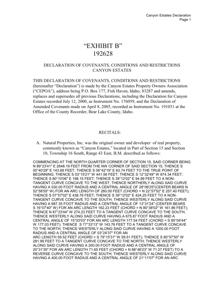
Canyon Estates Declaration Page 1 “EXHIBIT B” 192628 DECLARATION OF COVENANTS, CONDITIONS AND RESTRICTIONS CANYON ESTATES THIS DECLARATION OF COVENANTS, CONDITIONS AND RESTRICTIONS (hereinafter “Declaration”) is made by the Canyon Estates Property Owners Association (“CEPOA”), address being P.O. Box 177, Fish Haven, Idaho, 83287 and amends, replaces and supersedes all previous Declarations, including the Declaration for Canyon Estates recorded July 12, 2000, as Instrument No. 176059, and the Declaration of Amended Covenants made on April 8, 2005, recorded as Instrument No. 191031 at the Office of the County Recorder, Bear Lake County, Idaho. RECITALS: A. Natural Properties, Inc. was the original owner and developer of real property, commonly known as “Canyon Estates,” located in Part of Section 15 and Section 10, Township 16 South, Range 43 East, B.M. described as follows: COMMENCING AT THE NORTH QUARTER CORNER OF SECTION 15, SAID CORNER BEING N 89°23'41" E 2648.19 FEET FROM THE NW CORNER OF SAID SECTION 15; THENCE S 00°40'29" E 143.68 FEET; THENCE S 06°42'19" E 63.74 FEET TO THE TRUE POINT OF BEGINNING; THENCE S 03°15'21" W 441.56 FEET; THENCE S 12°32'49" W 874.34 FEET; THENCE S 80°10'06" E 198.15 FEET; THENCE S 39°12'02" E 94.99 FEET TO A NONTANGENT CURVE CONCAVE TO THE WEST; THENCE NORTHERLY ALONG SAID CURVE HAVING A 530.00 FOOT RADIUS AND A CENTRAL ANGLE OF 28°06'25"(CENTER BEARS N 52°58'55" W) FOR AN ARC LENGTH OF 260.00 FEET (CHORD = N 22°57'52" E 257.40 FEET); THENCE S 07°57'02" E 438.76 FEET; THENCE S 39°12'02" E 424.25 FEET TO A NONTANGENT CURVE CONCAVE TO THE SOUTH; THENCE WESTERLY ALONG SAID CURVE HAVING A 687.35 FOOT RADIUS AND A CENTRAL ANGLE OF 13°31'24" (CENTER BEARS S 16°07'40" W) FOR AN ARC LENGTH 162.23 FEET (CHORD = N 80°38'02" W 161.86 FEET); THENCE N 87°23'44" W 274.23 FEET TO A TANGENT CURVE CONCAVE TO THE SOUTH; THENCE WESTERLY ALONG SAID CURVE HAVING A 675.87 FOOT RADIUS AND A CENTRAL ANGLE OF 15°03'03" FOR AN ARC LENGTH 177.54 FEET (CHORD = S 85°04'44" W 177.03 FEET); THENCE S 77°33'13" W 143.76 FEET TO A TANGENT CURVE CONCAVE TO THE NORTH; THENCE WESTERLY ALONG SAID CURVE HAVING A 1000.00 FOOT RADIUS AND A CENTRAL ANGLE OF 03°24'37" FOR AN ARC LENGTH 59.52 FEET (CHORD = S 79°15'31" W 59.51 FEET); THENCE S 80°57'50" W 281.99 FEET TO A TANGENT CURVE CONCAVE TO THE NORTH; THENCE WESTERLY ALONG SAID CURVE HAVING A 200.00 FOOT RADIUS AND A CENTRAL ANGLE OF 20°31'35" FOR AN ARC LENGTH 71.65 FEET (CHORD = N 88°46'23" W 71.27 FEET) TO A REVERSE CURVE CONCAVE TO THE SOUTH; THENCE WESTERLY ALONG SAID CURVE HAVING A 400.00 FOOT RADIUS AND A CENTRAL ANGLE OF 21°11'07" FOR AN ARC Canyon Estates Declaration Page 2 LENGTH OF 147.90 (CHORD = N 89°06'09" W 147.06 FEET); THENCE S 80°18'17" W 110.45 FEET TO A TANGENT CURVE CONCAVE TO THE NORTH; THENCE WESTERLY ALONG SAID CURVE HAVING A 300.00 FOOT RADIUS AND A CENTRAL ANGLE OF 15°29'57" FOR AN ARC LENGTH 81.15 FEET (CHORD = S 88°03'16" W 80.91 FEET); THENCE N 84°11'46" W 80.56 FEET TO A TANGENT CURVE CONCAVE TO THE SOUTH; THENCE WESTERLY ALONG SAID CURVE HAVING A 700.00 FOOT RADIUS AND A CENTRAL ANGLE OF 10°09'37" FOR AN ARC LENGTH 124.13 FEET (CHORD = N 89°16'34" W 123.97 FEET); THENCE S 85°38'37" W 139.84 FEET TO A TANGENT CURVE CONCAVE TO THE SOUTH; THENCE WESTERLY ALONG SAID CURVE HAVING A 159.31 FOOT RADIUS AND A CENTRAL ANGLE OF 15°00'21" FOR AN ARC LENGTH 36.16 FEET (CHORD = S 79°08'27" W 36.09 FEET); THENCE N 17°58'50" E 909.70 FEET; THENCE N 33°13'04" E 197.52 FEET; THENCE N 06°54'07" E 297.48 FEET TO A NON-TANGENT CURVE CONCAVE TO THE SOUTH; THENCE WESTERLY ALONG SAID CURVE HAVING A 120.00 FOOT RADIUS AND A CENTRAL ANGLE OF 49°09'22" ( CENTER BEARS S 34°15'40" W) FOR AN ARC LENGTH OF 102.95 FEET (CHORD = N 80°19'01" W 99.82 FEET); THENCE S 75°06'17" W 87.13 FEET TO A TANGENT CURVE CONCAVE TO THE NORTH; THENCE WESTERLY ALONG SAID CURVE HAVING A 330.00 FOOT RADIUS AND A CENTRAL ANGLE OF 22°48'59" FOR AN ARC LENGTH OF 131.41 FEET (CHORD = S 86°30'47" W 130.55 FEET); THENCE N 07°55'16" E 60.00 FEET; THENCE N 38°50'17" E 897.24 FEET; THENCE S 66°21'09" E 202.20 FEET; THENCE S 85°44'44" E 265.90 FEET; THENCE N 80°20'00" E 275.56 FEET TO THE TRUE POINT OF BEGINNING. TOGETHER WITH: Canyon Estates- 1st Addition A PARCEL OF LAND IN THE NORTHWESTERLY HALF OF SECTION 15 AND THE SOUTHWESTERLY HALF OF SECTION 10, TOWNSHIP 16 SOUTH, RANGE 43 EAST, BOISE MERIDIAN, BEAR LAKE COUNTY, IDAHO. IT IS MORE PARTICULARLY DESCRIBED AS FOLLOWS: COMMENCING AT THE NORTH QUARTER CORNER OF SECTION 15, SAID CORNER BEING N 89°23'41" E 2648.19 FEET FROM THE NW CORNER OF SAID SECTION 15, THE TRUE POINT OF BEGINNING; THENCE S 00°40'29" E 143.68 FEET; THENCE S 06°42'19" E 63.74 FEET; THENCE S 80°20'00" W 275.56 FEET; THENCE N 85°44'44" W 265.90 FEET; THENCE N 66°21'09" W 202.20 FEET; THENCE S 38°50'17" W 897.24 FEET; THENCE S 07°55'16" W 60.00 FEET TO A NON-TANGENT CURVE CONCAVE TO THE NORTH; THENCE EASTERLY ALONG SAID CURVE HAVING A 330.00 FOOT RADIUS AND A CENTRAL ANGLE OF 22°48'59"(CENTER BEARS N 07°55'16" E) FOR AN ARC LENGTH OF 131.41 FEET (CHORD = N 86°30'47" E 130.55 FEET); THENCE S 75°06'17" E 87.13 FEET TO A CURVE CONCAVE TO THE SOUTH; THENCE EASTERLY ALONG SAID CURVE HAVING A 120.00 FOOT RADIUS AND A CENTRAL ANGLE OF 49°09'22" FOR AN ARC LENGTH OF 102.95 FEET (CHORD = S 80°19'01" E 99.82 FEET); THENCE S 06°54'07" W 297.48 FEET; THENCE S 33°13'04" W 197.52 FEET; THENCE S 17°58'50" W 874.29 FEET TO A NON-TNAGENT CURVE CONCAVE TO THE SOUTH; THENCE WESTERLY ALONG SAID CURVE HAVING A 189.31 FOOT RADIUS AND A CENTRAL ANGLE OF 06°12'45"(CENTER BEARS S 11°08'59" E) FOR AN ARC LENGTH OF 20.53 FEET (CHORD = S 75°44'38" W 20.52 FEET) TO THE BEGINNING OF A REVERSE CURVE CONCAVE TO THE NORTH; THENCE WESTERLY ALONG SAID CURVE HAVING A 127.90 FOOT RADIUS AND A CENTRAL ANGLE OF 49°53'51" FOR AN ARC LENGTH OF 111.39 FEET (CHORD = N 82°24'48" W 107.90 FEET); THENCE N 59°09'20" W 77.63 FEET; THENCE N 00°05'56" W 1003.39 FEET; THENCE S 89°39'27" W 1065.25 FEET; THENCE N 00°08'45" W 815.96 FEET; THENCE N 00°08'167" W 299.38 FEET TO THE SAID NW CORNER OF SECTION 15; THENCE N 00°22'19" W 515.56 FEET; THENCE N 00°18'55" W 812.72 FEET; THENCE N 89°39'00" E 1070.81 FEET; THENCE N 89°38'43" E 1578.99 FEET; THENCE S 00°15'57" E 1316.60 FEET TO THE TRUE POINT OF BEGINNING. Canyon Estates Declaration Page 3 TOGETHER with perpetual rights of ingress and egress from Fish Haven Cemetery Road and Fish Haven Canyon Road. B. Natural properties Inc., subdivided the above-described property, in accordance with Subdivision Plat approved by the Bear Lake County Board of Planning and Zoning, dated, July 12, 2000, and recorded as Bear Lake County Recorder’s Instrument No. 176060. Canyon Estates First Addition Subdivision Plat was approved by the Bear Lake County Board of Planning and Zoning, dated Sept 12, 2000, and recorded as instrument # 176480. C. Natural Properties, Inc., the original Declarant of Canyon Estates, has annexed the following real property to Canyon Estates with the Declaration made on March 7, 2005 and recorded as instrument No. 190705 at the Office of the County Recorder, Bear Lake County, Idaho. The CEPOA agrees to this annexation and the following real property is subject to this Declaration as final plats are approved by Bear Lake County Planning and Zoning. The Pointe at Canyon Estates A parcel of land located in Section 15, Township 16 South, Range 43 East, Boise Meridian, Bear Lake County, Idaho, and further described as follows: Beginning at the North Quarter Corner of said Section 15; thence following an existing fence line through the following courses: South 89°55'55" East 262.67 feet; thence South 89°28'03" East 270.01 feet; thence North 88°48'13" East 268.08 feet; thence South 86°05'13" East 333.14 feet; thence South 88°29'20" East 641.60 feet to a fence corner; thence following a fence line through the following courses: thence South 04°04'24" West 232.71 feet; thence South 06°43'59" West 58.27 feet; thence South 01°57'20" West 87.96 feet; thence South 03°54'42" West 135.46 feet; thence South 06°18'16" West 115.28 feet; thence South 04°19'49" West 262.57 feet; thence South 03°38'23" West 396.80 feet; thence leaving said fence line and going South 04°22'21" West 388.68 feet to a 5/8" rebar with cap labeled "AA HUDSON PLS 4735" set at a found 3/4" pipe; thence South 89°20'07" West 428.00 feet to a found 1/2" rebar; thence South 89°37'45" West 448.86 feet to a found 1/2" rebar; thence South 00°30'37" East 543.77 feet (South 567.76 feet by record) to a 5/8" rebar with cap set on the Northerly Right of Way Line of the Fish Haven Canyon Road; thence North 60°20'53" West 181.24 feet to the point of curvature of a 717.35 foot radius curve concave to the Southwest; thence Northwesterly along said curve through a central angle of 13°47'50", a distance of 172.74 feet (chord = North 67°14'48" West 172.33 feet) to a 5/8" rebar with cap set on a fence line; thence North 39°47'23" West 741.48 feet along said fence line to a fence corner; thence North 79°48'22" West 198.22 feet (North 79°42'28" West 199.30 feet by record) to a 5/8" rebar with cap set at a fence corner; thence along a fence line through the following courses: North 12°10'56" East 500.29 feet (North 15°21'37" East 512.37 feet by record); thence North 13°15'32" East 372.68 feet; thence North 03°21'30" East 441.83 feet; thence North 07°43'25" West 63.66 feet; thence North 00°37'52" West 144.37 feet to the True Point of Beginning. Canyon Estates Declaration Page 4 EXCEPT THEREFROM: A parcel of land set aside as the “well lot” in Parcel 2D, also a parcel of land in the North One-Half of Section 15, Township 16 South, Range 43 East, Boise Meridian, Bear Lake County, Idaho, and more particularly described as follows: Commencing at the North Quarter Corner of Section 15, said Corner being North 89°23'41" East 2648.19 feet from the Northwest Corner of said Section 15; thence South 00°40'29" East 143.68 feet; thence South 06°42'19" East 63.74 feet; thence South 03°15'21" West 441.56 feet; thence South 12°32'49" West 874.34 feet; thence South 80°10'06" East 198.15 feet; thence South 39°12'02" East 94.99 feet to the TRUE POINT OF BEGINNING, said point being on a non-tangent curve concave to the West; thence Northerly along said curve having a 530.00 foot radius and a central angle of 28°06'25" (center bears North 52°58'55" West) for an arc length of 260.00 feet (chord = North 22°57'52" East 257.40 feet); thence South 07°57'02" East 438.46 feet; thence North 39°12'02" West 254.91 feet to the True Point of Beginning. TOGETHER with perpetual rights of ingress and egress from Fish Haven Cemetery Road and Fish Haven Canyon Road as further defined herein. D. This Declaration shall constitute covenants to run with all of the land, as provided by law, and shall be binding, on all parties and all persons claiming under them, and for the benefit of and limitations upon all future owners in said subdivision. NOW THEREFORE, as part of the General plan for improvement of the above-described real property, the undersigned hereby declares said property subject to this Declaration. ARTICLE I DEFINITIONS Section.1.01 : "CEPOA" shall mean and refer to the Canyon Estates Property Owners Association, as further described hereinbelow. Section 1.02 : "Property" or "Project" shall mean all the real property described above, consisting of all acreage and any and all annexations to Canyon Estates. Section 1.03: "Lot" shall mean any plot of land or parcel shown upon any recorded subdivision plat of the property, with the exception of common areas. Section 1.04: "Owner" shall mean the record owner of a fee simple title to any lot which is a part of the Property, but excludes any person or entity which holds an interest merely as security for the performance of an obligation. Section 1.05: "Mortgage - Mortgagee - Mortgagor"; reference in this Declaration to a mortgage shall be deemed to include a deed of trust; reference to a mortgagee shall be deemed to include the beneficiary of a deed of trust; reference to a mortgagor shall be deemed to include the trustor of a deed of trust. Section 1.06: "Member" shall mean and refer to every person or entity that holds . Canyon Estates Declaration Page 5 Membership in the CEPOA. An owner must be a member of the CEPOA. Section 1.07: "Family" shall mean a group of natural persons related to each other by blood, or legally related to each other by marriage or adoption. Section 1.08 : "Common Area" shall mean property owned by the CEPOA for the common use and benefit of the members of the CEPOA. Section 1.09: "Management Committee" or "Committee" shall mean the elected management committee of the CEPOA, as set forth in the provisions of Article VI, herein. ARTICLE II CLASSIFICATION OF PROPERTIES The property in the subdivision shall be considered in two classifications, namely dwelling lots and Common Area. Dwelling lots shall be utilized by the owners thereof subject to this Declaration and any other requirement or restriction of applicable municipal, county, state or federal laws or regulations. The Common Area of the project consists of streets, culinary water distribution system, wells and the perimeter fence. ARTICLE III MEMBERSHIP Every person or entity who is a record owner of a fee or undivided fee interest in any lot which is subject by covenants of record to assessment by the CEPOA, including contract sellers, shall be a member of the CEPOA. The foregoing does not include persons or entities that hold an interest merely as security for the performance of an obligation. Membership shall be appurtenant to and may not be separated from ownership of a Lot, which is subject to assessment by the CEPOA. Ownership of a Lot shall be the sole qualification for membership. ARTICLE IV MANAGEMENT Performance of the duties and obligations of the CEPOA shall be done by the Management Committee. The Members of the CEPOA, as defined in Article III, shall hold an election for the Management Committee, which shall consist of not less than three (3) members. The Management Committee may at that time adopt such by-laws, rules or regulations as it may deem reasonable or necessary. The Committee shall have the duties, power and authority, to perform the following acts, among others: Canyon Estates Declaration Page 6 1.) Levy Assessments, in the manner set forth below, for the following purposes, among others: maintenance of private streets, (including any repairs required where streets cross irrigation canals) and the perimeter fence. 2.) Provide for, or contract for snow removal from the streets, and such repairs, maintenance or alteration to the streets as from time to time may be necessary; and enforce, in the manner described below, these Covenants, Conditions and Restrictions. 3.) Adopt such rules and regulations as deemed reasonable or necessary addressing the terms of office of the Management Committee members, resignations and terminations; and to carry out its’ duties and obligations in accordance with this Declaration. 4.) The above-stated itemization of powers, authorities, duties and obligations of the CEPOA and/or its Management Committee are not exclusive. The Management Committee may undertake such further duties and responsibilities as may become reasonable or necessary, and as may be approved by the Members, from time to time, in accordance with voting procedures set forth herein. ARTICLE V VOTING RIGHTS The association of Members shall have two classes of voting rights: Class A. Class A Members shall be all Owners with the exception of the Developer of that portion of land annexed on March 07, 2005 pursuant to this Declaration. When more than one person holds an interest in any Lot, all such persons shall be Members. The vote for such Lot shall be exercised as they determine, but in no event shall more than one vote be cast with respect to any Lot. Class B. The Class B Member(s) shall be the Developer (as defined herein), and shall be entitled to one vote for each Lot owned and shall be limited to casting votes on issues directly impacting the annexed portion of the CEPOA. Class A Members of the CEPOA, as defined hereinabove, shall have voting rights in the management of the CEPOA, in the formation of its Management Committee, and election of Members to the Management Committee. Each person or entity that is a record owner of a fee or undivided fee interest in any Lot which is subject by covenants of record to assessment by the CEPOA shall have one vote for each Lot owned by that person or entity. Canyon Estates Declaration Page 7 ARTICLE VI COVENANT FOR MAINTENANCE ASSESSMENTS Section 6.01. Creation of the Lien and Personal Obligation of assessments: Each owner of any Lot, by acceptance of a deed or conveyance thereof, whether or not it shall be so expressed in any such deed or instrument of conveyance, is deemed to covenant and agree to pay to the CEPOA (1) annual assessments or charges, and (2) special assessments for capital improvements. Such assessments shall be fixed, established and collected from time to time as hereinafter provided. The annual and special assessments, together with such interest thereon and costs of collection thereof, as hereinafter provided, shall be a charge upon the land and shall be a continuing lien upon the property against which such assessment is made. Each such assessment, together with such interest, costs and reasonable attorney fees, shall be the personal obligation of the person who was the owner of such property at the time when the assessment fell due. Section 6.02. Purpose of Assessments: The assessments levied by the CEPOA shall be used for the following purposes, among others: maintenance of perimeter fence of the project, maintenance and repair of streets within the project, (including any repairs required where streets cross irrigation canals), and snow removal, legal fees, and maintenance and repair of the entryways. Section 6.03. Basis and Maximum of Annual Assessment: The Management Committee shall fix an annual assessment as set forth herein. After consideration of current maintenance costs and future needs of the CEPOA, the Management Committee may fix the annual assessment at an amount sufficient to fulfill the needs of the CEPOA. Whenever annual assessments are increased or decreased, the Management Committee shall provide to each Member a summary of the record of expenditures of the prior year, and a statement of the basis of expected expenditures for the following year upon which the change in annual assessment is based. The annual assessment may be changed; effective January 1 of each year, without a vote of the membership, in conformance with the appropriate expenditure record of the previous year, adjusted in accordance with expected expenditures for the following year Section 6.04. Special Assessments: In addition to the annual assessments authorized above, the Management Committee may levy in any assessment year, such special assessments, applicable for that year only, as may be necessary for the following purposes, among others: paying the cost of any construction or reconstruction, unexpected repair or replacement of or to the streets within the project (including any required repairs to areas where streets cross irrigation canals), legal fees, maintenance and repairs of the entryways, and the perimeter fence around the project. Section 6.05. Date of Commencement of Annual Assessments: The annual assessments provided for herein shall commence on the date of closing when a Lot is sold or transferred, excepting those lots owned by the Developer, in which case annual assessments shall commence on the recording date of these Covenants. Section 6.06. Effect of Non-Payment of Assessments; Remedies of the CEPOA: Any assessments, which are not paid when due, shall be delinquent. If the assessment is not paid within 30 days after due date, a late fee of $100.00 shall be charged and, the assessment shall bear interest from the date of delinquency at the rate of twelve per cent Canyon Estates Declaration Page 8 (12%) per annum, and the CEPOA may bring an action of law against the property. Costs, interest, and reasonable attorney's fees of any such action shall be added to the amount of such assessment. No owner may waive or otherwise escape liability for the assessments provided for herein by non-use of the streets, or abandonment of his Lot. In addition, if a delinquent assessment exists for more than six months the CEPOA may have a lien against the Lot subject to foreclosure to collect the same.. Section 6.07. Professional Management: It shall be within the authority of the Management Committee without vote of the membership to contract for professional management of the CEPOA, and to assess the members under the other provisions for assessment herein, to pay for such management. Under this provision the Professional Manager would be responsible only to the Management Committee for the performance of his or her duties, and any request for his or her services or complaints shall be referred to the Management Committee. ARTICLE VII IMPROVEMENTS Section 7.01. Streets: Natural Properties Inc. is obligated to, and has or will, provide streets to each Lot in the Project, in accordance with the standards set by the County of Bear Lake, Idaho. Repair and maintenance of the streets shall be performed in accordance with the provisions of Article VI, above. Section 7.02. Central Culinary Water Distribution System:. Water for domestic and irrigation purposes is delivered to all lot owners in Canyon Estates by the CEPOA which owns, operates and maintains a water system consisting of water rights, well, pump, motor, tank and pipelines. Each lot owner in Canyon Estates is entitled to receive water service upon payment of hook-up fees and water delivery charges billed at metered rates. Section 7.03. Other Utilities: Declarant will install trunk electric lines. Connection by lot owners to such trunk lines will involve payment of connection fees by the lot owner, which fees will be paid to the providers of such services. Payment of such connection fees will or may result in refund of the installation costs advanced by Declarant. Such refunds shall be the sole right and property of Declarant. The Association shall be responsible for payment of any utility maintenance fees. Funds for such fee shall be contributed by the members of the association, as defined in Article 3, and funds may be assessed and collected in the same manner as provided herein for other maintenance, and shall be subject to the same lien and collection procedures as set forth in Article 7 hereof. Canyon Estates Declaration Page 9 ARTICLE VIII ARCHITECTURAL CONTROL Section 8.01. Architectural Control Committee: There shall be an Architectural Control Committee consisting of, three (3) owners of Lots in the project, not members of the Management Committee, who shall be appointed by the Management Committee. If the Management Committee is unable to find three (3) willing Lot owners to serve on the Architectural Control Committee, the Management Committee may appoint a professional. No member of the Architectural Control Committee may be compensated for services performed pursuant to this Declaration. However, the Architectural Control Committee may, at its discretion, employ an outside professional architect or engineer, or other consultant or professional, to assist it in its functions, and a reasonable fee may be charged to the lot owner for such services, in which event the provisions Article VI shall be applicable. No member of the committee shall be liable to any person for his for her decisions or failure to act in making decisions as a member of the Committee. Section 8.02. Scope: No building, residence, dwelling, garage, carport, wind generation device, accessory building or fence, wall, non-living screen or any other structure or landscaping shall be commenced, erected, placed or meaningfully altered on any lot until the plans, specifications and plot plans showing the location and nature of such structure, building, landscaping or other improvement or meaningful alteration have been submitted to and approved in writing, by the Architectural Control Committee, which may consider factors as (but not limited to) the quality of workmanship and materials, design, harmony of external design with existing project, structures, location with respect to topography and finish grade, elevation, preservation and enhancement of the natural beauty of the area and safety. The committee may condition such approval on the lot owner depositing cash in the sum of not to exceed Five Hundred Dollars ($500.00) with the Architectural Control Committee, the purpose of which shall be to further ensure that the lot owner (1) fulfills his responsibility to keep his Lot in a condition so as to prevent the rubbish and debris which accumulates during the construction process from blowing, or collecting on neighboring, lots, and (2) reasonably cleans up his Lot at or near the completion of the construction process. If the lot owner fails in either of these two responsibilities, the Architectural Control Committee may keep the deposit as a fine upon such lot owner or as liquidated damages. If any such failure is not remedied within 14 days after written notice thereof, the Architectural Control Committee may remedy such condition itself and shall charge the lot owner for the cost of the remedy, in which case the provisions of Article VI shall be applicable. Section 8.03. Process of Approval: Plans and re-submittal thereof shall be approved, disapproved or otherwise acted upon in writing, within thirty (30) days of submission. All plans and specifications and other materials shall be submitted in triplicate. One (1) set shall be returned to the lot owner. Failure of the Committee to respond to a submittal or re-submittal of plans or materials within thirty (30) days shall be deemed to be an approval of plans as submitted or resubmitted. Lot owners shall have one (1) year to start construction from the date of plan approval before approval expires and all plans must be resubmitted. Canyon Estates Declaration Page 10 If, after such plans and specifications have been approved, the improvements are altered, erected, or maintained upon the lot otherwise than as approved by the committee, such alteration, erection and maintenance shall be deemed to have been undertaken without the approval of the Committee. After the expiration of one (1) year from the date of completion of any improvement, said improvement shall, in favor of purchasers and encumbrances, in good faith and for value, be deemed to comply with all of the provisions hereof unless a Notice of such non-compliance or non-completion, executed by one or more members of the Architectural Control Committee shall appear of record in the office of the County Recorder, or legal proceedings have been instituted to enforce compliance with these provisions. The approval of the Committee of any plans or specifications submitted for approval for use on any residence shall not be deemed to be a waiver by the Committee of its right to object to any of the features or elements embodied in such plans an specifications, if or when the same features or elements are embodied in any subsequent plan submitted for approval for use on other residences. Upon approval of the Committee acting, in accordance with the provisions of this Declaration, it shall be conclusively presumed that the location and height of any improvement do not violate the provisions of this Declaration. Until later published, the address of the Committee is Canyon Estates POA, PO Box 177, Fish Haven, Idaho, 83287. ARTICLE IX GENERAL RESTRICTIONS AND REQUIREMENTS Section 9.01. Land Use and Building Type: All Lots shall be used exclusively for single family residential purposes. Except as may be specifically approved as provided in Article VIII hereof, no building shall be erected, altered, placed or permitted to remain on any Lot other than one detached single family dwelling, one building for garage and one barn, unless otherwise approved by the Architectural Control Committee. No Lot may be divided, subdivided or separated into smaller parcels. Any building, being constructed, must be complete on the exterior, Eighteen (18) months from the starting, date of construction of the building. Section 9.02. Dwelling Size and Materials: No single story dwelling shall be constructed, altered, placed or permitted to remain on any Lot unless the main floor area, exclusive of basement, open porches and garages, is 1,300 square feet or greater. No two story dwelling shall be constructed, altered, placed or permitted to remain on any Lot unless the main floor and other floors, exclusive of basements, open porches and garages is a total of 1,800 square feet or greater. No structure shall have a height greater than two stories, excluding basements. No structure shall, without written approval, have a height greater than 35 feet above ground level. If the structure has a walkout basement on one side, this is still considered a basement and the structure may be two full stories above this. Unless prior written approval is first given by the Canyon Estates Declaration Page 11 Architectural Control Committee, all above ground construction of all buildings including garages and barns shall be log, log siding, cedar siding or some comparable material which harmonizes with the natural surroundings in both color and material, and is approved in writing by the Architectural Control Committee. In no event shall modular housing, vinyl siding, aluminum siding, or T- 111 siding be permitted. Aluminum soffits are not considered siding. All dwellings must have a street-side landscaping plan approved by the Architectural Control Committee at the time of approval of building. These plans which will extend the entire street-side length of the building and have a minimum depth from the building of 20 feet. Use of plant native materials and stone are highly encouraged. This landscaping plan must be completed within the 18 months along with the building exterior. The Committee may approve a home of a size smaller than as provided herein only where, after considering all relevant factors, it is determined to be clearly as unreasonable, under the given circumstances, to require the larger size home. Section 9.03. Building Location: No building walls or foundation shall be located on any Lot nearer to the front lot line or nearer to the side street line than the minimum building set-back described under prevailing county Zoning. Notwithstanding, any zoning requirements to the contrary, except where special written approval is first given, no building shall be located on any Lot nearer than 20 feet to the front (street-side) line, or nearer than 20 feet to any side lot line, or nearer than 20 feet to the rear lot line. Certain Lots will also have deeded setbacks for the winter wildlife range. Section 9.04. Nuisances, Unreasonable Annoyance and Noxious Activities: No noxious or offensive activity shall be carried on upon any Lot, nor shall anything be done thereon which may be or may become an unreasonable annoyance, nuisance or danger to the neighborhood. (Dogs that continually bark or music loud enough to annoy adjoining landowners would be examples of unreasonable annoyances.) Except for legitimate construction and maintenance purposes, no excessively loud noises shall be permitted in the project. Recreation vehicles (i.e. ATV’s) will be operated with the consideration of residents of the project in mind and not be allowed to use the streets of Canyon Estates as a “racetrack”. Use of firearms inside the project is prohibited. In addition, no building may be placed on the 30% slope areas as shaded on the approved plat. Any area of disturbed ground, which is not a driveway, must be revegetated with grass or the Big Game Winter Range mix recommended by the Idaho Fish and Game. Lot owners shall control all noxious weeds within their Lot boundary. After due notice is given, failure to comply or remedy a violation is subject to the remedies in ARTICLE XI. Section 9.05. Signs: No signs, posters, displays or other advertising devices of any character shall be erected or maintained on, or shown or displayed to the public view on any Lot without written approval having, been first obtained from the Architectural Control Committee; provided however, that the restrictions of this paragraph shall not apply to any sign or notice seven square feet or smaller in size which states that the premises are for sale, or which identifies the residents owners. The CEPOA may cause all unauthorized signs to be removed Section 9.06 Animals: Animals kept on the property shall be for recreational use Canyon Estates Declaration Page 12 only. Absolutely no commercial use may be made of any animal, including renting leasing, or sale. Animals will be limited to Horses, Dogs and Domestic Cats, with a maximum of five (5) total animals per Lot. Written approval from the CEPOA Management Committee is required to exceed these animal limits. Lot owners shall at reasonable intervals remove animal excretions from the Lot, to a location outside the project. Each owner shall, in so doing, be responsible for observance of any law, ordinance or regulation that may be applicable to such disposal. Section 9.07. Rubbish and Unsightly Debris, Etc.: Notwithstanding any other provision in the Declaration, no owner shall allow his Lot to become so physically encumbered with rubbish, unsightly debris, equipment or other things or materials so as to constitute an eyesore as reasonably determined by the CEPOA. Within 20 days of receipt of written notification by the CEPOA of such failure, the owner shall be responsible to make appropriate corrections. Section 9.08. Temporary Structures, Etc.: No structure of a temporary character, or trailer, camper, tent, shack, garage or other outbuilding shall be used on any Lot at any time as residence, either temporarily or permanently, unless approved in writing, by the Architectural Control Committee; provided however, that this section shall not be applicable to temporary structures utilized during construction of a dwelling on the Lot, not to exceed 18 months in duration. Section 9.09. Non-Residential Uses Prohibited: No part of the property shall be used for any commercial, manufacturing, mercantile, vending or other such non-residential purposes; provided however, that professional and administrative occupations may be carried on within the residence so long as there exists no meaningful external evidence thereof. Leasing of the property must be approved by the Management Committee, and will be limited to once annually. Section 9.10. Drilling Operations: No oil drilling, oil development operations, exploration, oil refining, quarrying, or mining, operations of any kind shall be permitted upon any Lot nor shall oil wells, tunnels, mineral excavations or shafts be permitted. No derrick or other structure designed for use in drilling boring for oil, natural gas or water, be erected, maintained or permitted on any Lot. Section 9.11. Fences and Walls, Hedges and Screens: No fences, walls, or nonliving screen shall be constructed on any Lot without written approval first having been obtained from the Architectural Control Committee, and in no event will approval be Given to any fence that is not constructed of wood; log fencing is preferred, and an owner may be required to show good reason for other fence type to be used. Front yard fences, walls and nonliving screens are discouraged and require prior approval before construction. Such fences, walls and screens may be approved only following careful scrutiny by the Architectural Control Committee. Section 9.12. Environmental Concerns: The winter months (i.e. DecemberMarch) require special consideration. It will be understood by the residents of Canyon Estates that they are living in a Wildlife Winter Range. It is expected that during the winter months motor vehicle traffic will be at a minimum. A speed limit of 15 mph will be imposed at all times. If Bear Lake County finds it necessary to restrict traffic to use the south entryway only, during the winter months, all residents will comply with this restriction Canyon Estates Declaration Page 13 and the north entryway will be closed during this time Lots, where possible, shall provide a means for wildlife to traverse. The land shall be left in its natural state, with the exception of reasonable yards, trees, shrubs and the like for aesthetic purposes. Vegetable gardens for use of the lot owner only are permitted. A maximum of 40% of the property may be disturbed from its natural habitat. A maximum of one tenth (1/10) of one acre can be irrigated on any one lot. Each lot owner must plant a minimum of 10 Idaho native trees at the start of any construction on their Lot. These trees should be a minimum of 8 feet in height when planted. All trees must be kept alive and growing. Dead trees must be replaced. All dogs with potential of chasing wildlife must be restrained, penned, or on a leash, etc. during that time. No commercial agriculture or gardening, or sale of produce shall be permitted. ARTICLE X EASEMENTS HILLSIDE DISTURBANCE AND FLOOD CONTROL Section 10.01. Utility Easements: Easements for installation and maintenance of drainage facilities and public utilities are generally reserved over the front, rear, and side 20 feet of each Lot. Within these easements, no structure, planting or other material shall be placed or permitted to remain which may interfere with or damage utilities or drainage facilities. However, the Architectural Committee may approve a structure such as a fence or landscaping where constructed at the Lot Owner's risk of having it dismantled, removed or destroyed where necessary because of drainage or utility servicing, installation, alteration or maintenance. The easement area of each Lot and all improvements in it shall be maintained continuously by the owner of the Lot, except for those improvements for which a public authority or utility company is responsible to maintain. All roads and common areas shall have a general blanket easement for utility installation. Section 10.02 Fire Control Easement & Responsibility: Each homeowner will provide as part of their landscape, a firebreak around their home in case of a brush fire. Also, there is an existing, easement across all Lots for firebreak equipment to disturb any of the Lots upon demand to stop a brush fire from spreading Section 10.03. Flood Control Responsibility: Construction of berms, channels or other flood control facilities is the sole responsibility of the lot owner and shall be done in accordance with flood control district plans approved by Bear Lake County. Any such construction shall commence at the time the Lot is graded or otherwise altered from its natural state. The grade of any Lot shall not be changed by more than one (1) percent during construction. Culverts, where driveways meet roadway, shall be installed at the start of construction. Canyon Estates Declaration Page 14 ARTICLE XI VIOLATIONS Section 11.0l. Committee's Power of Enforcement: Enforcement of the provisions of this Declaration shall be accomplished by any lawful means, including proceedings at law or in equity, against the person or persons violating or attempting to violate any provision herein, either to restrain violation, compel compliance, or recover damages. The violator shall be required to pay any and all expenses incurred therein. No liability shall attach to the Committees in acting pursuant to the provisions of this Declaration. Twenty (20) days after receiving written notice, if a lot owner fails to remedy a violation, the CEPOA (in addition to any other lawful remedies available) cause such violation or condition to be remedied, and the cost thereof shall be deemed a special assessment against the owner of the Lot, and which shall be subject to levy enforcement and collection in accordance with the assessment lien procedure provided for in Article VI. Failure to comply with any of the provisions in this Declaration or regulations adopted pursuant thereto shall be grounds for relief which may include, without limitation, recovery of damages, injunctive relief, foreclosure of lien, or any combination thereof. Failure on one occasion to enforce any provision hereof shall not be deemed a waiver of the right to enforce said provision or any other provision hereof. Section 11.02. Enforcement by Others: Additionally, and after reasonable notice in writing, an owner not at the time in default hereunder, shall have the option of bringing an action for damages, specific performance or injunctive relief against a defaulting owner. Any judgment entered in such case shall include an award of reasonable attorney's fee to the prevailing party. Section 11.03. Rights of Entry: The committees shall have a limited right of entry in and upon all Lots and the exterior of all residences for the purpose of taking corrective action that it may deem necessary and proper. Nothing, in this Article shall in any manner limit the right of the owner to exclusive control over the interior of his residence. ARTICLE XII DURATION AND AMENDMENT Section 12.01. Duration: This Declaration shall continue in full force and effect for a term of fifty (50) years from the date hereof, after which time the same shall be automatically extended for successive periods of ten (10) years, unless a declaration of termination is recorded with the County Recorder, which declaration must meet the requirements of an Amendment, as set forth hereinbelow. There shall be no severance by sale, conveyance, encumbrance or hypothecation of an interest in any Lot from membership in the CEPOA so long as this Declaration shall continue in full force and effect. Canyon Estates Declaration Page 15 Section 12.02. Amendment: Notice of the subject matter of a proposed Amendment to this Declaration in reasonably detailed form shall be included in the notice of any meeting of the Owners at which meeting such amendment is to be discussed. All amendments shall be effective upon written approval by not less than 75% of record owners of all Lots in the CEPOA at the time of notice of such amendment. ARTICLE XIII MISCELLANEOUS AND GENERAL PROVISIONS Section 13.01. Severability: Invalidity of any one of these covenants, or any portion thereof by judgment or court order shall in no way effect any of the other provisions of this Declaration. Section 13.02. Singular Includes Plural: Whenever the context of the Declaration requires the same, the singular shall include the plural, and the masculine shall include the feminine. Section 13.03. Liability: Neither the Management Committee, their assignees, delegates, nor the Architectural Control Committee shall be liable to any other person for any action or failure to act hereunder where such action or failure was in good faith. Section 13.04. Annexation of Additional Property: Any real property may be annexed to Canyon Estates upon written approval of 75% of the record owners of all Lots in the CEPOA at the time of such annexation. Such real property shall be made subject to this Declaration at the time that it is annexed. Section 13.05: As the Project is being constructed in a wildlife area Lot owners should expect wildlife in the area and upon the Lots, and neither the Declarant, the Management Committee, their successors, delegates, assigns, or the Architectural Control Committee, nor any member thereof, shall have any responsibility for any damage caused by wildlife, or for removal of wildlife from the Project Canyon Estates Declaration Page 16 IN WITNESS WHEREOF, the Canyon Estates Property Owners Association has executed this instrument the day and year first above written. _____________________ Jack McPhie (President, Canyon Estates Property Owners Association STATE OF IDAHO :ss County of On the________day of _______________________2004, personally appeared before me______________________, who being by me duly sworn did say for himself that he is Jack McPhie, President of Canyon Estates Property Owners Association. Notary Public My commission Expires Residing, at: Canyon Estates Declaration Page 17
