Wellfield Protection Application
advertisement
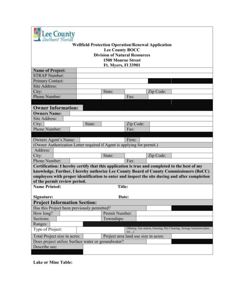
Wellfield Protection Operation/Renewal Application Lee County BOCC Division of Natural Resources 1500 Monroe Street Ft. Myers, Fl 33901 Name of Project: STRAP Number: Primary Contact: Site Address: City: Phone Number: State: Zip Code: Fax: Owner Information: Owners Name: Site Address: City: Phone Number: State: Zip Code: Fax: Owners Agent’s Name: Firm: (Owner Authorization Letter required if Agent is applying for permit.) Address: City: State: Zip Code: Phone Number: Fax: Certification: I hereby certify that this application is true and completed to the best of my knowledge. Further, I hereby authorize Lee County Board of County Commissioners (BoCC) employees with proper identification to enter and inspect the site during and after completion of the permit review period. Name Printed: Title: Signature: Date: Project Information Section: Has this Project been previously permitted? How long? Permit Number: Sections: Townships: Ranges: (Mining, Gas station, Farming, Dry Cleaning, Sewage treatment plant, Type of Project: ect…) Total Project size in acres: Project area land use size in acres: Does project utilize Surface water or groundwater? Describe use: Lake or Mine Table: Lake or Mine Number Depth Acres Proposed or Existing Distance from Closest Public Supply Well Hazardous materials Section: List of hazardous materials and amounts stored onsite at any time: Name of Material Location stored Amount stored Applied Use Checklist of Material to be submitted: Number Item: 1 2 3 Completed Application Project Location Map (Street Location Map) Project site plan showing the location of all existing and proposed hazardous materials storage and monitoring facilities Aerial (www.leepa.org) Proof of ownership, such as a tax record or warranty deed, listing both the owner name and Section, Township and Range for the project If is for an exemption, a concise statement by a licensed Hydrogeologist detailing the circumstances upon which the applicant is exempt from this Ordinance. A detailed description of the activities that involve the storage, handling, use or production of the regulated substances, indicating the unit quantities in which the substances are contained or manipulated. A description of the containment, the emergency collection devices and containers and emergency plan that will be employed to comply with the restrictions required for protection zones 1, 2, 3 & 4 A description of the maintenance that will be provided for the containment facility, monitoring system and emergency equipment required to comply with the restrictions of protection zones 1, 2, 3 & 4 A description of the groundwater monitoring wells, in addition to the surface water facilities including the latitude and longitude, that have been or will be installed, and the arrangements made for all certified quarterly analyses for specified regulated substances. An agreement to indemnify and hold the county harmless from any and all claims, liabilities, causes of action or damages arising out of issuance of the permit. The county will provide reasonable notice to the permittee of any such claims. Name and address of adjacent property owners Fee 4 5 6 7 8 9 10 11 12 13 Monitoring Section: Check if applicable Groundwater Section: Description of Wells Well Name or Number Aquifer Monitored Existing or Proposed Diameter Total Depth Cased Depth Screened Interval Purpose(Water Level and or chemical constituent Monitoring) Monitoring frequency Elevation of wellhead in ft N.A.V.D. Date of Construction Latitude/ Longitude Section Township Range Surface Water Section: Description of Surface water monitoring devices Name or Number Water Body Monitored Type of Device Existing or Proposed Purpose(Water Level and or chemical constituent Monitoring) Monitoring frequency Elevation of device in ft N.A.V.D. Date of installation Latitude/ Longitude Section Township Range Minimum Monitoring Requirements: Mining area: The Water level Monitoring plan includes measurement of surface water and groundwater levels on site. Surface water levels at the project will be measured in the on-site lake using a staff gauge. All Water levels shall be referenced to the NAVD elevation. The applicant shall construct at a minimum, on each boundary of each section of land in which the project encompasses, a nested pair of wells which meet the following requirements: one well shall extend to the lowest depth of the sand formation, the second well shall extend to the proposed bottom depth of the mine. On the second well the applicant shall record water quality and level profiles for every change in material as you are obtaining the lithology of your project until the bottom depth of the proposed mine is reached. Each well shall be outfitted with an electronic water level monitoring device. To evaluate any potential changes in groundwater conditions which maybe caused by the project, the Permittee shall design a Groundwater water quality monitoring program to be approved by the Natural Resources Division. The program shall include chemical constituent monitoring from the provided list of groundwater constituents attached. The program shall include a minimum of four wells with one well located up gradient and one well down gradient of each chemical storage facility which is located with in the wellfield protection zones. If wet season and dry season groundwater flow directions are significantly different than predicted seasonal flows, additional wells may be required to capture changes in upstream and downstream characteristics. All wells shall be installed a minimum of six months prior to commencement of any excavation construction and in a fashion as to reduce any potential damage during the mining activity. Initial Chemical monitoring: (groundwater water) each monitoring well shall be monitored for chloride, TDS, sulfate, pH, conductivity, iron, total hardness, and Florida PRO. During the excavation phase, quarterly water quality monitoring shall consist of the following: Surface Water: Florida PRO, chloride, and stage Groundwater: Florida PRO, chloride, and water table elevation. All field activities shall be conducted in accordance with FDEP’s Standard Operating Procedures for Field Activities, FDEP-SOP-00101, February 1, 2004 (or current revision). Analytical test shall be conducted by a Florida DOH NELAC certified laboratory. All information shall be provided to Lee County Natural Resources Division in electronic form in addition to a paper copy. Results from the water quality sampling are submitted to the Lee County Natural Resources Division prior to the initiation of the Lake construction activities on-site. Water level Data shall recorded monthly and submitted quarterly water quality monitoring data will be submitted on a semiannual basis to the Natural Resources Division.

