How Erosion Builds Mountains
advertisement
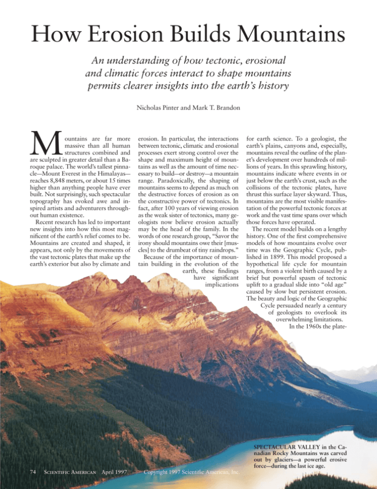
How Erosion Builds Mountains An understanding of how tectonic, erosional and climatic forces interact to shape mountains permits clearer insights into the earth’s history Nicholas Pinter and Mark T. Brandon M ountains are far more massive than all human structures combined and are sculpted in greater detail than a Baroque palace. The world’s tallest pinnacle—Mount Everest in the Himalayas— reaches 8,848 meters, or about 15 times higher than anything people have ever built. Not surprisingly, such spectacular topography has evoked awe and inspired artists and adventurers throughout human existence. Recent research has led to important new insights into how this most magnificent of the earth’s relief comes to be. Mountains are created and shaped, it appears, not only by the movements of the vast tectonic plates that make up the earth’s exterior but also by climate and erosion. In particular, the interactions between tectonic, climatic and erosional processes exert strong control over the shape and maximum height of mountains as well as the amount of time necessary to build—or destroy—a mountain range. Paradoxically, the shaping of mountains seems to depend as much on the destructive forces of erosion as on the constructive power of tectonics. In fact, after 100 years of viewing erosion as the weak sister of tectonics, many geologists now believe erosion actually may be the head of the family. In the words of one research group, “Savor the irony should mountains owe their [muscles] to the drumbeat of tiny raindrops.” Because of the importance of mountain building in the evolution of the earth, these findings have significant implications for earth science. To a geologist, the earth’s plains, canyons and, especially, mountains reveal the outline of the planet’s development over hundreds of millions of years. In this sprawling history, mountains indicate where events in or just below the earth’s crust, such as the collisions of the tectonic plates, have thrust this surface layer skyward. Thus, mountains are the most visible manifestation of the powerful tectonic forces at work and the vast time spans over which those forces have operated. The recent model builds on a lengthy history. One of the first comprehensive models of how mountains evolve over time was the Geographic Cycle, published in 1899. This model proposed a hypothetical life cycle for mountain ranges, from a violent birth caused by a brief but powerful spasm of tectonic uplift to a gradual slide into “old age” caused by slow but persistent erosion. The beauty and logic of the Geographic Cycle persuaded nearly a century of geologists to overlook its overwhelming limitations. In the 1960s the plate- SPECTACULAR VALLEY in the Canadian Rocky Mountains was carved out by glaciers—a powerful erosive force—during the last ice age. 74 Scientific American April 1997 Copyright 1997 Scientific American, Inc. lateral convergence between adjacent plates or through the upward flow of heat and magma (molten rock). Subduction or Collision C onvergence of tectonic plates generally occurs in one of two ways. One plate may slide down, or subduct, below the other, into the mantle. At a subduction-zone boundary, the upper plate is thickened as a result of the compression and from magma being added by the melting of the descending plate. Many mountains, including almost all the ranges that surround the Pacific Ocean in a geologically active area known as the ring of fire, formed by subduction. With continental collision, on the other hand, neither plate subducts into the mantle, and therefore all the mass added as a result of the collision contributes to the building of mountains. Such collisions have created some spectacular topography, such as the Tibetan Plateau and the Himalayas, which include all 10 of the world’s highest peaks. The flow of magma and heat to the earth’s crust, for example, during volcanic activity, can also drive mountain building. The earth’s longest mountain chains—the mid-ocean ridges—are the result of magma welling up as adjacent plates move apart, forming new crust under the ocean. These ridges run through the Atlantic, eastern Pacific and Indian oceans like the seam on a baseball; the Mid-Atlantic Ridge alone is more than 15,000 kilometers long, rising as much as 4,000 meters above the surrounding abyssal plains of the ocean floor. On land, Copyright 1997 Scientific American, Inc. heat associated with the flow of magma can also help uplift large areas by making the crust less dense and more buoyant on the underlying mantle. The emerging, system-oriented view of mountain building adds to those tectonic phenomena the often closely intertwined effects of erosion and climate. Erosion includes the disaggregation of bedrock, the stripping away of sediment from slopes and the transport of the sediment by rivers. The mix of erosional agents active on a particular landscape— gravity, water, wind and glacial ice—depends on the local climate, the steepness of the topography and the types of rock at or near the surface. Climate is inextricably linked with erosion because it affects the average rate of material loss across a landscape. In general, wetter conditions favor faster rates of erosion; however, more moisture also promotes the growth of vegetation, which helps to “armor” the surface. Mountains in polar latitudes are the least vulnerable to erosion, partly because of the aridity of cold climates and partly because continental ice sheets such as those on Greenland and Antarctica commonly are frozen to the underlying rock and cause little erosion. In contrast, mountain glaciers such as those of the European Alps and the Sierra Nevada in California aggressively attack the subsurface rock, so that this type of glacier may be the earth’s most potent erosional agent. There are many other links among erosion, climate and topography. For example, mountains lift the winds that Scientific American April 1997 75 RICHARD SISK Panoramic Images tectonics revolution explained how mountain building is driven by the horizontal movements of vast blocks of the lithosphere—the relatively cool and brittle part of the earth’s exterior. According to this broad framework, internal heat energy shapes the planet’s surface by compressing, heating and breaking the lithosphere, which varies in thickness from 100 kilometers or less below the oceans to 200 or more below the continents. The lithosphere is not a solid shell but rather is subdivided into dozens of plates. Driven by heat from below, these plates move with respect to one another, accounting for most of our world’s familiar surface features and phenomena, such as earthquakes, ocean basins and mountains. Earth scientists have not by any means discarded plate tectonics as a force in mountain building. Over the past couple of decades, however, they have come to the conclusion that mountains are best described not as the result of tectonics alone but rather as the products of a system that encompasses erosional and climatic processes in addition to tectonic ones and that has many complex linkages and feedbacks among those three components. Plate tectonics still provides the basic framework that accounts for the distribution of mountains across the earth’s surface. Mountain building is still explained as the addition of mass, heat or some combination of the two to an area of the earth’s crust (the crust is the upper part of the lithosphere). Thicker or hotter crust rises upward, forming mountains, because the crust is essentially floating on the mantle under it, and crust that is either thicker or hotter (less dense) floats higher. Plate tectonics contributes to the thickening of the crust by either THE GEOSPHERE PROJECT/TOM VAN SANT, INC. as well—it is known as nega- offer a useful analogy: because ice is tive feedback. In contrast, about 90 percent as dense as water, a positive feedback has the op- given mass of ice above the water is supposite effect, accelerating any ported by nine times that mass underchange in a system. The cre- neath the waterline. Continental crust ation of a rain shadow is an is about 80 to 85 percent as dense as the example of positive feed- mantle beneath, enabling crustal roots back; erosion is inhibited, al- tens of kilometers deep to support mounlowing a mountain range to tains several kilometers high. continue its rapid growth. Isostasy is the key mechanism that The rain shadow north of links a mountain’s tectonic, or internal, the Himalayas has contribut- evolution to its geomorphic, or extered to the formation of the nal, development. When erosion at the high-standing Tibetan Pla- surface removes mass, isostasy responds HIMALAYAS and Tibetan Plateau are clearly visible teau [see box on pages 78 by lifting the entire mountain range up in this satellite image as a mostly white area north and 79]. to replace about 80 percent of the mass and east of India. The ridges along the southern The concept of feedback is removed. This uplift explains a number boundary of this area are the Himalayas, which are at the heart of the new under- of phenomena that were puzzling bethe stunning manifestation of an ongoing collision standing of how mountains fore researchers fully appreciated the that began 50 million years ago, when the Indian tecare built—and even how role of feedback in mountain building. tonic plate began plowing into the Asian one. mountain building affects For example, high-precision surveys the earth system as a whole. along the U.S. Atlantic Coast have reflow over them, causing increased pre- Numerous different types of feedback vealed that the land is rising at rates of cipitation on the range’s windward have been recognized or postulated. a few millimeters to a few centimeters a slopes, intensifying erosion as a result. Among the most unexpected insights century. This was puzzling because the Known as orography, this effect is also that have accrued from these discover- Appalachian Mountains lie in the interesponsible for the “rain shadow” that ies is the realization that several impor- rior of the North American plate, where creates deserts on the leeward sides of tant feedbacks enable surface processes, there is no convergent plate boundary many mountain ranges [see photograph such as climate and erosion, to influence to account for the uplift. Some geologists on opposite page]. Elevation can also profoundly tectonic processes deep be- suggested that the survey results must affect erosion, because average tempera- low the surface (and vice versa). therefore be in error. Given our new ture decreases with altitude, so that highunderstanding, however, some or all of er peaks are less likely to be protected by Isostasy Is Key the measured uplift may be the isostatic vegetation and more likely to be eroded response to erosion, especially in the ne important feedback occurs high-relief areas of the Appalachians. by glaciers. In temperate regions the rate through the phenomenon known Erosion that is concentrated at the botof erosion is proportional to the average steepness of the topography, apparently as isostasy, which refers to the buoyan- tom of river valleys may be especially because gravity- and water-driven pro- cy of the earth’s crust as it floats on the significant because it can lift mountain cesses are stronger on steeper slopes. denser, fluidlike mantle below it. A peaks to elevations higher than the eleTaken together, all these facts suggest mountain range, like any physical struc- vations before erosion started. This is that mountains evolve their own cli- ture, must be supported, and it turns out possible because the removal of mass is mates as they grow—becoming typically that this support comes mainly from the localized (in the valleys), but the isostatic wetter, colder and characterized by more strength of the crust and from isostasy. response lifts the entire mountain block, intense erosion. Under the soaring peaks of every moun- including both valleys and peaks. The links described above demon- tain range is a buoyant “root” of crust Although isostasy can prop them up strate that mountain ranges are best that penetrates into the mantle. Icebergs for many millions of years, landscapes viewed as a system. To understand the behavior of any such system, it is necesPREVAILING WINDS a b PREVAILING WINDS sary to identify both its components and the interactions among those components. Because these interactions are so important, simple system inputs can lead to surprisingly complex outputs. Such EROSION EROSION complexities include feedback—stabilizing or destabilizing links between component processes. In the simple example we have outlined, the output of the system is the height of the mountain range, SUBDUCTION SUBDUCTION whereas one of the inputs is erosion rate. As the mountains grow taller, erosion OROGRAPHY refers to the phenomenon in which mountains lift the air currents flowing increases, reducing the growth rate. Be- over them, increasing precipitation over the crest and windward slopes of the range. In a cause this feedback tends to lessen the mountain range near an ocean, for example, when the prevailing winds blow offshore, oppoinput—thereby moderating the output site to the direction of subduction (a), erosion is concentrated on the inland side of the range, LAURIE GRACE; SOURCE: Sean Willett, Christopher Beaumont and Philippe Fullsack, Geology, Vol. 21, No. 4, April 1993 O 76 Scientific American April 1997 Copyright 1997 Scientific American, Inc. How Erosion Builds Mountains Unusual Tectonic Times? T ISOSTATIC UPLIFT occurs as a result of the buoyancy of a mountain on the more dense, fluidlike mantle (not shown) on which it “floats.” Erosion causes the crust to rise up, whereas deposition of the resulting sediment weighs the crust downward. same geologic period, however, also saw a major climate shift on the earth, a global cooling that transformed Greenland and Antarctica from temperate, vegetated lands to permanent ice sheets and that culminated in the glaciers that covered North America and Europe during the past two million years. Thus, at present there are two opposing theories about mountain building and climate over the past 40 million years: either the surge of mountain building caused the global climate shift, or the climate shift caused the surge of mountain building. The first of these two theories asserts that powerful and widespread mountain building cooled the earth as a result of the feedback between mountains and climate. For example, glaciers tend to be self-perpetuating: once established, they increase the reflectivity, or albedo, of the surface, thus lowering temperatures and allowing more ice to form. Widespread uplift of large mountain masses in the past 40 million years could have increased the area of the earth covered by mountain glaciers, which would have increased the albedo of the planet. Atmospheric carbon dioxide may have been another important feedback agent. GERALD FRENCH Panoramic Images he construction of mountains, including ancient mountains that were built and eroded away in the distant past, can leave a variety of marks in the geologic record, such as those from lava flows, intrusion of magma, the exposure of once deeply buried rocks, as well as copious sediment deposited in lowland basins and the fossils of plants known to thrive only at high altitudes. By studying such indicators from many different periods, geologists can make inferences about the extent of mountain building on the earth at different times, thereby gaining insights into the planet’s development. Various geologists have looked at the relative abundance of sediment, magmatic activity and other potential indicators of mountain building and concluded that the past 40 million years represents an anomalous surge of tectonic activity and mountain building. This EROSION LAURIE GRACE without tectonic uplift do eventually succumb to erosion. Several studies have suggested that large areas of Australia are good examples of very old, decaying landscapes. These areas, which have not experienced tectonic uplift for hundreds of millions of years, are at most a few hundred meters above sea level. Their rates of surface uplift seem to be consistent with only isostatic response to erosion. In such tectonically active mountains as the Himalayas and the European Alps, measured uplift reflects a combination of tectonic driving forces and erosionally driven isostatic uplift. Given the rates at which mountains grow and then decay, we can infer that dozens of major mountain ranges may have come and gone on the earth throughout its history. exposing the deepest, most deformed rocks in that area. When the wind is in the same direction as subduction (b), erosion denudes the coastal side of the range, literally pulling buried rocks toward the surface. In this case, the inland side of the mountain range lies in an arid “rain shadow,” such as the desert east of the Sierra Nevada (photograph). How Erosion Builds Mountains Copyright 1997 Scientific American, Inc. One interpretation states that mountain building can alter the global distribution of rain and snowfall, increasing the pace at which rock is broken down by dissolution and chemical reactions. According to this hypothesis, accelerated chemical weathering removed carbon dioxide from the atmosphere, reducing the greenhouse effect and thereby leading to a cooler global climate. But perhaps climate change was the more powerful, independent change during the past 40 million years. This theory suggests that climate change produced geologic evidence that has been falsely interpreted as accelerated mountain growth. Many climate scientists believe global cooling was driven by continental drift, which changed the distribution of land and ocean area with respect to latitude as well as the pattern of ocean currents, which are major mechanisms by which the earth equilibrates the heat imbalance between the equator and the poles [see “Chaotic Climate,” by Wallace S. Broecker; Scientific American, November 1995]. How could these climate changes mimic mountain building? Through isostatic uplift. According to this interpretation, global cooling intensified erosion in many mountain ranges. Stepped-up erosion, particularly in the bottom of river and glacial valleys, resulted in increased uplift of mountain summits as isostasy compensated for the erosion. The cause-and-effect ambiguity between global climate and mountain building has been billed as a geologic paradox to rival the “chicken and egg” question, but such circularity is common in feedback-rich systems. Geologists may not currently know what initiated the changes in climate and topography that occurred in the past 40 million years, but they now understand that the many kinds of feedback in this system Scientific American April 1997 77 The Himalayas and the Appalachians he Himalayas and the Appalachians are two of the earth’s grandest mountain ranges. Both were built by continental collisions, but the two ranges are about as different as mountains can be. Their comparison illustrates well the key principles of the new, system-oriented view of mountain building. Stretching 2,500 kilometers across northern India and southern Tibet, the Himalayas are the king of mountain ranges. In this range stand many of the world’s highest peaks, including Mount Everest, the tallest at 8,848 meters. Together with the Tibetan Plateau, to the north of the range in southwest China, the Himalayas contain the globe’s greatest total mountain mass. It has even been suggested that this mountain belt is the largest high-elevation mass that the earth has seen in the past billion years. The plateau, on the other hand, gives the impression of a low desert plain—except that its altitude can take one’s breath away. The plateau is the earth’s largest expanse of land above 5,000 meters—a region approximately half the area of the continental U.S., most of it at least 600 meters higher than Mount Whitney, the highest single point in the continental U.S. All this dramatic and varied topography developed during the past 50 million years, as a result of the collision between the Indian and the Asian tectonic plates. The collision began to squeeze both India and Tibet, activating a series of crustal-scale contractional faults that thrust part of the Indian continent underneath southern Asia. The northward velocity of India before the collision was 15 to 20 centimeters a year, and the velocity afterward was about five. Such deceleration of an entire continent is less surprising than the are capable of amplifying any change and that tectonics, climate and erosion must have acted together in creating the geologic evidence that we find today. Erosion’s Pull T he recognition of the many types of feedback in the mountain-building system reveals that erosion not only participates in shaping mountains but also guides tectonic processes deep within the crust. The ultimate limiting force to mountain growth is gravity. Thus, erosion, by reducing the weight of the mountain range, actually accelerates tectonic processes beneath the mountains. For this reason, erosional processes can be viewed as “sucking” crust into mountain ranges and up toward the surface. And in this manner, erosion leaves a distinct fingerprint on the rocks and on the pattern of crustal deformation in and under mountains. The type of rock at the surface of a mountain is determined, in part, by the local climate and by the rate and pattern of erosion. In this way, erosion influences both the topography and also the composition and structure of mountains. Metamorphism of rocks (changes as a result of heating and pressure) and the 78 Scientific American April 1997 CLYDE H. SMITH Peter Arnold, Inc. T APPALACHIANS AND HIMALAYAS were formed by the same set of geologic processes, but roughly 250 million years apart. Many more years of erosion have given the older Appalachians (left) a less fact that India has continued to plow into and through southern Asia at about five centimeters a year for the past 40 to 50 million years. India has advanced 2,000 kilometers into the Asian plate, give or take 800 kilometers, roughly doubling the thickness of the crust, uplifting the Himalayas and the Tibetan Plateau and pressing huge areas of Indochina and eastern China out to the east and southeast. Construction of the Himalayas and the Tibetan Plateau illustrates many of the principles of feedback-rich mountain building. For example, uplift of the plateau apparently triggered a climatic change creation of many rock-forming minerals are governed by the pressure and temperature profile within the crust. Seemingly small details of climate and erosion, such as wind speed and direction or minor differences in latitude, can profoundly influence the temperature history, and therefore the type of rock created, as a mountain range evolves. Recently computer models have examined the effects of prevailing wind direction and orography on the distribution of different metamorphic zones in mountain ranges. For mountains formed by subduction, prevailing winds in the same direction as subduction cause most of the precipitation to fall on the seaward side of the mountain range, which faces the subducting plate. This phenomenon intensifies deformation and exhumation of rocks from deep in the crust. If, on the other hand, the prevailing winds are in the opposite direction as subduction, erosion is concentrated on the landward side of the mountain range, so that deformation is relatively uniform throughout the range, and deep exhumation is limited to the interior, or continental, side of the range. One study of the eroded cores of several ancient mountain ranges revealed that the fingerprint of orography and wind Copyright 1997 Scientific American, Inc. direction remains clear, in the distribution of rocks sucked into the range by climatically driven erosion, up to two billion years after the ranges had become tectonically inactive. With growing evidence that tectonic uplift and erosion can occur over similar timescales and at similar rates, many researchers have concluded that some mountain ranges have achieved a steadystate topography. In this state, the size and basic shape of the mountains can remain stable for hundreds of thousands to millions of years, undergoing little or no change, because the rate of erosion matches the rate of uplift. Three Stages A lthough relatively few of the earth’s mountains are now believed to be in perfect equilibrium, many of them may have achieved such a balance at some time in their history. Mountain ranges, it appears, often go through three distinct phases. The first, formative stage begins with the converging of plates or some other tectonic event that thickens crust and causes topography to rise. During this stage, rates of uplift exceed those of erosion. Erosion rates increase dramatically, however, as elevations and How Erosion Builds Mountains GALEN ROWELL Mountain Light rugged appearance than the Himalayas (right), which are still being uplifted by strong tectonic forces. The Himalayas may be the largest high-elevation mass to arise on the earth in the past billion years. around eight million years ago, which dramatically strengthened the Asian monsoon, the pattern of intense seasonal rainfall across southern Asia. The monsoon pattern sharply intensified erosion in the Himalayas, increasing the flux of sediment from the Indus and Bengal rivers by factors as high as 13. The strengthening of the Asian monsoon apparently caused a surge of uplift in the Himalayas, as the isostasy (buoyancy) of the crust responded to the intensified erosion in the region. Meanwhile the interior of the Tibetan Plateau evolved much more slowly because it lies in the rain shadow of the Himala- relief increase. Depending on the size of the range and the local climate, uplift may persist until erosion rates or the strength of the crust limits the average elevation of the range from increasing any more. This is the second stage, a steady state that continues as long as the rates of uplift and erosion remain equal. When uplift diminishes, erosion begins to dominate and the final stage begins. The average elevation of the mountain range begins a long, slow decline. The cycle may be interrupted or complicated at any stage by tectonic or climatic yas and because the major rivers have not yet eroded their way into it. Although the present-day Appalachians are less spectacular than the Himalayas, they were created by the same tectonic processes and are now being shaped by the same system feedback. The primary difference is age: the Himalayas are about 50 million years old, whereas the main uplift of the Appalachians culminated 250 to 350 million years ago. Geologically, the eastern coast of North America is the quiet side of the continent today. Before 200 million years ago, however, it was a hotbed of mountain building. During the previous several hundred million years, the predecessor to the Atlantic Ocean (called the Iapetus Ocean) was subducting underneath eastern North America. As the Iapetus gradually closed, at least three smaller landmasses, probably island arcs analogous to present-day Japan, slammed into the continent. Later, the mountain-building process culminated with the collision of Africa and the eastern U.S. The early Appalachians that resulted from these collisions are estimated to have been 250 to 350 kilometers wide, with average elevations of 3,500 to 4,500 meters and isolated peaks perhaps much higher. One study suggests that during the past 270 million years, erosion has stripped between 4,500 and 7,500 meters of material from the surface of the Appalachians. (This fact does not mean that the mountains were once 4,500 to 7,500 meters higher; isostatic uplift, it should be recalled, would continually prop the mountains up in response to erosion.) Over the past 200 million years, as North America rifted away from Africa and the Atlantic Ocean began to open, secondary events may have triggered minor episodes of uplift, but erosion has been the —N.P. and M.T.B. dominant process shaping the mountain range. events, and the feedback among those processes and erosion. The new model of how mountains develop promises to be as revolutionary as was plate tectonics some three decades ago. Just as plate tectonics managed to explain the worldwide distribution of earthquakes, volcanoes, fossils and many different rocks and minerals, the new understanding of mountain building shows how tectonic forces, the earth’s climate and topography interact to create some of the earth’s most spectacular landscapes. Like plate tectonics, the new model also illuminates phenomena that had long puzzled geologists. Computer simulations incorporating many of the model’s principal precepts, for example, have proved very successful in mimicking the effects of complex tectonic histories, climatic variability and different geologic settings. Continuing research will provide even more details of how the earth’s magnificent mountain ranges grow, evolve and decline, as well as details concerning the importance of mountains in shaping the climate and tectonics of our planet. SA The Authors Further Reading NICHOLAS PINTER and MARK T. BRANDON began their collaboration at Yale University in the emerging field of active tectonics—which emphasizes the interactions between tectonic deformation and the earth’s topography. Pinter carried out postdoctoral research there and is now an assistant professor at Southern Illinois University at Carbondale. His research focuses on the topographic expression of tectonic processes, especially related to fault activity and earthquake hazard. Brandon is an associate professor of structural geology and tectonics at Yale. His research in Washington State, Kamchatka and New Zealand is focused on understanding the interrelation between tectonic uplift and erosion at subduction zones and collisional mountain ranges. Landform Development by Tectonics and Denudation. T. Yoshikawa in Themes in Geomorphology. Edited by A. Pitty. Croom Helm, 1985. Erosional Control of Active Compressional Orogens. C. Beaumont, P. Fullsack and J. Hamilton in Thrust Tectonics. Edited by K. R. McClay. Chapman and Hall, 1992. “Long-Term” Land Surface Processes: Erosion, Tectonics and Climate History in Mountain Belts. B. L. Isaacs in TERRA-1: Understanding the Terrestrial Environment: The Role of Earth Observations from Space. Edited by P. M. Mather. Taylor and Francis, 1992. Tectonic Forcing of Late Cenozoic Climate. R. E. Raymo and W. F. Ruddiman in Nature, Vol. 359, No. 6391, pages 117–122; September 10, 1992. How Flat Is Tibet? E. Fielding, B. Isacks, M. Barazangi and C. Duncan in Geology, Vol. 22, No. 2, pages 163–167; February 1994. Megageomorphology. E. A. Keller and N. Pinter in Active Tectonics: Earthquakes, Uplift and Landscape. Prentice Hall, 1996. How Erosion Builds Mountains Copyright 1997 Scientific American, Inc. Scientific American April 1997 79
