Further Studies of Forest Structure Parameters
advertisement
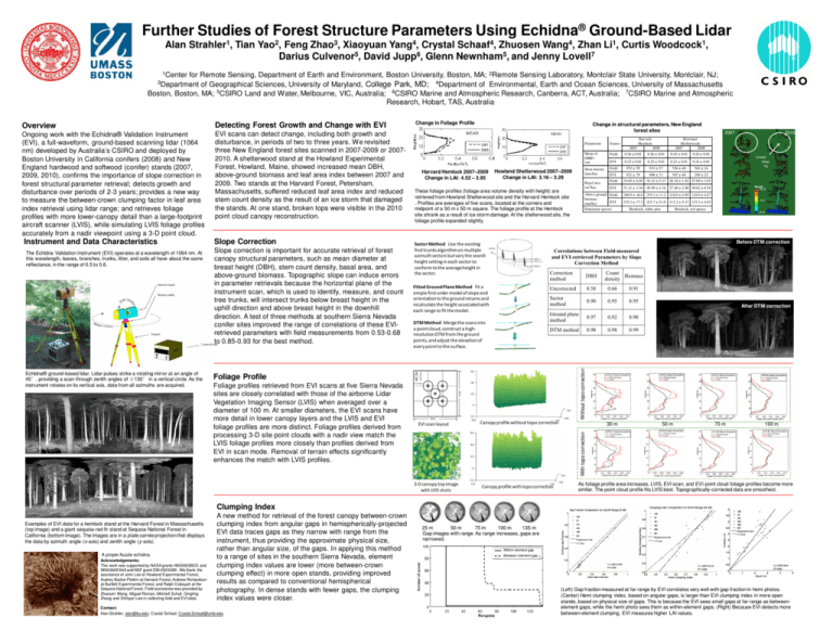
Further Studies of Forest Structure Parameters Using Echidna® Ground-Based Lidar Alan Strahler1, Tian Yao2, Feng Zhao3, Xiaoyuan Yang4, Crystal Schaaf4, Zhuosen Wang4, Zhan Li1, Curtis Woodcock1, Darius Culvenor5, David Jupp6, Glenn Newnham5, and Jenny Lovell7 1Center for Remote Sensing, Department of Earth and Environment, Boston University, Boston, MA; 2Remote Sensing Laboratory, Montclair State University, Montclair, NJ; of Geographical Sciences, University of Maryland, College Park, MD; 4Department of Environmental, Earth and Ocean Sciences, University of Massachusetts Boston, Boston, MA; 5CSIRO Land and Water, Melbourne, VIC, Australia; 6CSIRO Marine and Atmospheric Research, Canberra, ACT, Australia; 7CSIRO Marine and Atmospheric Research, Hobart, TAS, Australia 3Department Detecting Forest Growth and Change with EVI Ongoing work with the Echidna® Validation Instrument (EVI), a full-waveform, ground-based scanning lidar (1064 nm) developed by Australia’s CSIRO and deployed by Boston University in California conifers (2008) and New England hardwood and softwood (conifer) stands (2007, 2009, 2010), confirms the importance of slope correction in forest structural parameter retrieval; detects growth and disturbance over periods of 2-3 years; provides a new way to measure the between-crown clumping factor in leaf area index retrieval using lidar range; and retrieves foliage profiles with more lower-canopy detail than a large-footprint aircraft scanner (LVIS), while simulating LVIS foliage profiles accurately from a nadir viewpoint using a 3-D point cloud. EVI scans can detect change, including both growth and disturbance, in periods of two to three years. We revisited three New England forest sites scanned in 2007-2009 or 20072010. A shelterwood stand at the Howland Experimental Forest, Howland, Maine, showed increased mean DBH, above-ground biomass and leaf area index between 2007 and 2009. Two stands at the Harvard Forest, Petersham, Massachusetts, suffered reduced leaf area index and reduced stem count density as the result of an ice storm that damaged the stands. At one stand, broken tops were visible in the 2010 point cloud canopy reconstruction. Instrument and Data Characteristics Slope Correction Echidna® ground-based lidar. Lidar pulses strike a rotating mirror at an angle of 45°, providing a scan through zenith angles of ±130° in a vertical circle. As the instrument rotates on its vertical axis, data from all azimuths are acquired. Slope correction is important for accurate retrieval of forest canopy structural parameters, such as mean diameter at breast height (DBH), stem count density, basal area, and above-ground biomass. Topographic slope can induce errors in parameter retrievals because the horizontal plane of the instrument scan, which is used to identify, measure, and count tree trunks, will intersect trunks below breast height in the uphill direction and above breast height in the downhill direction. A test of three methods at southern Sierra Nevada conifer sites improved the range of correlations of these EVIretrieved parameters with field measurements from 0.53-0.68 to 0.85-0.93 for the best method. Change in structural parameters, New England forest sites Mean of DBH† (m) Field 0.26 ± 0.01 0.26 ± 0.01 0.24 ± 0.01 0.24 ± 0.01 EVI 0.25 ± 0.01 0.25 ± 0.01 0.23 ± 0.01 0.24 ± 0.01 Field 953 ± 59 933 ± 57 556 ± 40 562 ± 24 Harvard Hemlock 2007–2009 Change in LAI: 4.52 – 3.95 Howland Shelterwood 2007–2009 Change in LAI: 3.16 – 3.29 587 ± 40 589 ± 25 These foliage profiles (foliage area volume density with height) are retrieved from Howland Shelterwood site and the Harvard Hemlock site . Profiles are averages of five scans, located at the corners and midpoint of a 50 m x 50 m square. The foliage profile at the Hemlock site shrank as a result of ice storm damage. At the shelterwood site, the foliage profile expanded slightly. Stem density (tree/ha) Basal area 2 (m /ha) 2009 EVI 921 ± 79 906 ± 71 Field 54.65 ± 6.03 54.23 ± 5.37 26.34 ± 1.01 27.89 ± 1.03 EVI 51.21 ± 3.54 49.99 ± 4.16 27.88 ± 2.08 30.62 ± 0.58 Above-ground Field biomass EVI (ton/ha) Dominant species 2007 2010 Howland Shelterwood 2007 2009 Source 2007 260.9 ± 16.6 255.2 ± 11.2 110.0 ± 4.05 118.0 ± 4.87 235.3 ± 17.3 222.7 ± 21.0 112.2 ± 9.21 125.2 ± 4.65 Hemlock, white pine Crown missi ng Hemlock, red spruce Before DTM correction Sector Method Use the existing find trunks algorithm on multiple azimuth sectors but vary the search height setting in each sector to conform to the average height in the sector. Fitted Ground Plane Method Fit a simple first-order model of slope and orientation to the ground returns and recalculate the height associated with each range to fit the model. After DTM correction DTM Method Merge the scans into a point cloud, construct a highresolution DTM from the ground points, and adjust the elevation of every point to the surface. Foliage Profile Foliage profiles retrieved from EVI scans at five Sierra Nevada sites are closely correlated with those of the airborne Lidar Vegetation Imaging Sensor (LVIS) when averaged over a diameter of 100 m. At smaller diameters, the EVI scans have more detail in lower canopy layers and the LVIS and EVI foliage profiles are more distinct. Foliage profiles derived from processing 3-D site point clouds with a nadir view match the LVIS foliage profiles more closely than profiles derived from EVI in scan mode. Removal of terrain effects significantly enhances the match with LVIS profiles. Harvard Hemlock Parameters Canopy profile without topo correction EVI scan layout 30 m 50 m 70 m 100 m With topo correction The Echidna Validation Instrument (EVI) operates at a wavelength of 1064 nm. At this wavelength, leaves, branches, trunks, litter, and soils all have about the same reflectance, in the range of 0.5 to 0.6. Change in Foliage Profile Without topo correction Overview 3-D canopy top image with LVIS shots Canopy profile with topo correction As foliage profile area increases, LVIS, EVI scan, and EVI point cloud foliage profiles become more similar. The point cloud profile fits LVIS best. Topographically-corrected data are smoothest. Clumping Index Examples of EVI data for a hemlock stand at the Harvard Forest in Massachusetts (top image) and a giant sequoia-red fir stand at Sequoia National Forest in California (bottom image). The images are in a plate carrée projection that displays the data by azimuth angle (x-axis) and zenith angle (y-axis). A proper Auzzie echidna. Acknowledgements: This work was supported by NASA grants NNG06GI92G and NNX08AE94A and NSF grant DBI-0923389 . We thank the assistance of John Lee at Howland Experimental Forest, Audrey Barker Plotkin at Harvard Forest, Andrew Richardson at Bartlett Experimental Forest, and Ralph Dubayah at the Sequoia National Forest. Field assistance was provided by Zhuosen Wang, Miguel Roman, Mitchell Schull, Qingling Zhang and Shihyan Lee in collecting field and EVI data. A new method for retrieval of the forest canopy between-crown clumping index from angular gaps in hemispherically-projected EVI data traces gaps as they narrow with range from the instrument, thus providing the approximate physical size, rather than angular size, of the gaps. In applying this method to a range of sites in the southern Sierra Nevada, element clumping index values are lower (more between-crown clumping effect) in more open stands, providing improved results as compared to conventional hemispherical photography. In dense stands with fewer gaps, the clumping index values were closer. Contact: Alan Strahler, alan@bu.edu; Crystal Schaaf, Crystal.Schaaf@umb.edu. 25 m 50 m 75 m 100 m 135 m Gap images with range. As range increases, gaps are narrowed. Within-element gap Between-element gap (Left) Gap fraction measured at far range by EVI correlates very well with gap fraction in hemi photos. (Center) Hemi clumping index, based on angular gaps, is larger than EVI clumping index in more open stands, based on physical size of gaps. This is because the EVI sees small gaps at far range as betweenelement gaps, while the hemi photo sees them as within-element gaps. (Right) Because EVI detects more between-element clumping, EVI measures higher LAI values.
