Earth’s Landforms
reflect
If you could go anywhere you like on vacation, where would you go? Would you choose
to go the mountains to go skiing? Or take a trip down the Colorado River through the
Grand Canyon?
What makes places like mountains, rivers,
and canyons so special? All are different
kinds of landforms. What other kinds of
landforms can you think of? How do you
think they are formed?
What is a landform?
A landform is a natural structure on
Earth’s surface. Most landforms are formed
slowly over millions of years. They form
Earth’s geography, or physical structure.
Scientists who study geography are called
geographers.
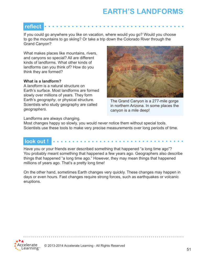
The Grand Canyon is a 277-mile gorge
in northern Arizona. In some places the
canyon is a mile deep!
Landforms are always changing.
Most changes happy so slowly, you would never notice them without special tools.
Scientists use these tools to make very precise measurements over long periods of time.
look out !
Have you or your friends ever described something that happened “a long time ago”?
You probably meant something that happened a few years ago. Geographers also describe
things that happened “a long time ago.” However, they may mean things that happened
millions of years ago. That’s a pretty long time!
On the other hand, sometimes Earth changes very quickly. These changes may happen in
days or even hours. Fast changes require strong forces, such as earthquakes or volcanic
eruptions.
© 2013-2014 Accelerate Learning - All Rights Reserved
51
Earth’s Landforms
What are different types of landforms?
Landforms come in different shapes and sizes. Four common landforms are mountains,
hills, valleys, and plains. You can use certain characteristics to identify each type.
•Mountains: Mountains are large rock structures with pointed tops. Some mountains
are so tall that their upper heights are covered in snow year round—even during the
summer!
Groups of mountains are called mountain
ranges. The longest mountain range in
the western United States is the Rocky
Mountains. The longest mountain range
in the eastern United States is the
Appalachian Mountains.
In Texas, the tallest peaks are in the
Guadalupe Mountains. The Guadalupe
Mountains are not as tall as the Rocky
Mountains.
•Hills: Hills are land formations that are
similar to mountains. Unlike mountains, however, hills are not peaked on top. Instead,
hills have soft, rounded tops. They are made of grass, dirt, and rocks.
Hills are usually not as tall as mountains.
Northern California and Texas Hill
Country are good examples of hilly
regions.
•Valleys: Valleys are mostly flat areas
between two mountains or hills. A valley
can be large or small. It depends on the
distance between the two mountains
or hills.
Rivers flow through many valleys. The
Rio Grande River runs through the
Rio Grande Valley in Texas. As water
runs through the valley, the valley gets
wider over time through weathering and erosion. Weathering is the breakdown of rock
into smaller particles by the water.Erosion is the movement of soil from one place to
another.
52
© 2013-2014 Accelerate Learning - All Rights Reserved
Earth’s Landforms
try now
You can cause erosion on a small scale at home. Fill a watering can with water. Go outside, and
push together a mound of dirt a few inches tall. Use the watering can to slowly pour water down
one side of the dirt hill. The water may look like a small river. The water will carry away dirt. This
erosion is a small version of how a river gets wider over time when running through a valley.
•Plains: Plains are the flattest landforms. Just like valleys, plains are flat. But unlike
valleys, plains are not surrounded by
mountains or hills nearby.
Plains can be very large. The Great
Plains of the United States stretch
from the Mississippi River to the Rocky
Mountains. The Panhandle area of
northern Texas is also a plain.
What are some landforms where you live?
How do you think they formed over time?
Career Corner: What does a
surveyor do?
A surveyor is a person who measures landforms to create detailed drawings called
surveys. Surveys give information about the height and width of each landform.
Surveys are important when planning new buildings or roads.
How are landforms created?
Landforms are made as rocks and soil are added or removed from a place over millions
of years. For instance, mountains form when pieces of Earth are pushed upward.
When rocks and soil are added
from above, it is called deposition.
Think of it as depositing (or putting)
stuff somewhere. Where does the
soil come from that is deposited?
It is soil moved to a new place by
erosion. Remember that moving
water can cause erosion. Wind can
also cause erosion as it blows over
a region. Moving sheets of ice called
glaciers can also cause erosion.
Earth can push a landform upward
to create hills. Water, wind, or ice
can move the land at the top. As the
land erodes away, or is pushed away, that force smoothes the tops of hills.
© 2013-2014 Accelerate Learning - All Rights Reserved
53
Earth’s Landforms
Valleys are also made by erosion and deposition. Water and a glacier, a large piece of
moving ice, moving down mountains
causes erosion. This creates a valley
between the two mountains. The
dirt that is carried away is deposited
downstream. The deposited dirt forms
plains.
The shape of a valley tells scientists
how the valley was created. A new
river moving through mountains makes
a V-shaped valley because the water
moves very fast. Over time, erosion
around the river makes the river wider.
Glaciers can also form valleys. As a
glacier melts, it creates a U-shaped
valley. The valleys are in spaces where the ice was pushing against nearby mountains.
Over time, erosion makes the valleys wider.
Discover Science: The Rio Grande
The Rio Grande River is the second longest river in the United States. Only the Mississippi
River is longer. When the river moves through the
southern tip of Texas, it goes through the Rio Grande
Valley.
Most rivers create the valleys they flow through, but
the Rio Grande Valley is unusual. Originally, it was a
dry valley. When the Rio Grande River began to flow
through the land, it flowed into a valley that was already
there. Slowly, the river has been filling the valley with
dirt through deposition.
The Rio Grande Valley
surrounds the Rio Grande
River.
54
© 2013-2014 Accelerate Learning - All Rights Reserved
Earth’s Landforms
What Do You Know?
Take a look at the pictures below. Below each picture, write the name of the type of landform
shown in the picture.
© 2013-2014 Accelerate Learning - All Rights Reserved
55
Earth’s Landforms
connecting with your child
Naming Landforms
Take a trip with your child to a local national
park. If you do not live near a national park,
find another scenic area where you know
there are at least two landforms of the types
studied in this lesson, such as hills and a
valley. Be sure to bring along a notebook
and crayons or colored pencils.
While at the park, ask your child to identify
the types of landforms you both observe.
After identifying each type of landform, ask
your child to create a drawing of the landform
in their notebook. Be sure to label the drawing
as a mountain, hill, valley, or plain. You may
wish to ask questions, such as:
•How do you know that landform is a hill
and not a mountain? (Or, how do you
know that landform is a mountain and
not a hill?)
56
•If you are in a valley, do you see a
river? Do you think the river created
the valley?
•If you are in a valley, what is the shape
of the valley? Do you think a river or
a glacier was the main shaper of this
valley?
If possible, find a map of the area at the
park ranger station. Review the map
with your child, noting places where the
specific features of the area are named
for landforms (e.g., Davis Mountains,
Rio Grande Valley). Discuss with your child
how place names can give information
about the types of landforms in an area.
© 2013-2014 Accelerate Learning - All Rights Reserved


