Peter Goin - University of Nevada, Reno
advertisement
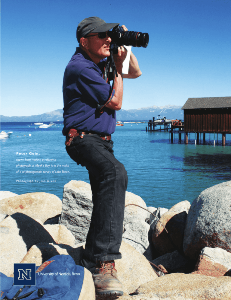
Pe t e r G o i n , shown here making a reference photograph at Meek’s Bay, is in the midst of a re-photographic survey of Lake Tahoe. P h o t o g r a p h b y Je a n D i x o n Peter Goin Art professor’s challenge: Through photography, capture Tahoe’s yesterday and today for a safer tomorrow B y Jo h n Tre n t College of Liberal Arts www.unr.edu/cla Emerald Bay Then and Now “That’s a milestone along the way,” Goin said, adding that the larger goal of the project is to re-photograph entire, distinct areas of Lake Tahoe, stretching from the south shore and the ruins of the devastating, wind-driven 2007 Angora Fire all the way to Tahoe’s west shore and east to Sand Harbor. By capturing a treasure trove of images today, Goin said, scientists will have specific data points from which to work in assessing fuel loads, tree density and other key information in the event of a major fire. “If we measure these ‘pre-data’ points and you have these photographs, the managers of the resource can then go in and determine the critical point when say, the fuel load increased to the point it became the source of a major fire,” Goin said. “I’ve always believed that if you can look at the landscape and come to terms with the concept of fire and develop the appropriate strategies, you can live with fire. Sometimes a photographic image can bear testimony to not only what was happening then, but what could potentially happen in the future.” Photograph by Jean Dixon A t this point, Peter Goin has the photography part down pat. As one of the most respected photographers of the West, Goin’s portfolio speaks for itself. The Foundation Professor of Art at the University of Nevada, Reno has produced 16 books, documentaries and exhibitions in more than 40 major collections throughout the country and the world. In 2007, in acknowledgment of his vast and varied research career, Goin was named the University’s Outstanding Researcher. Now, in the midst of a yet another ambitious project–a re-photographic survey of Lake Tahoe– the challenge isn’t necessarily capturing Tahoe’s landscape with the discerning and creative eye that has characterized Goin’s work for the better part of 25 years. It’s about the smaller things. The much smaller things. Like finding the exact spot where a 1930s era cabin once stood, or pinpointing the exact rock on a trail where Mount Tallac stood in the background at precisely the same angle taken in a photograph from a half century ago. “It’s painstaking work, I’m not going to lie to you,” Goin said of the project. “We are out for 8, 10, 12 hours, hiking and on our feet, for maybe one photograph. But the effort really is goal-driven. We are trying to develop a model on how the arts and photography can be integrated with scientific research in a way that will help all of the residents at Lake Tahoe and areas like Tahoe throughout the country.” The short-term goal of Goin’s re-photographic survey of Tahoe will be the publication of a book, “South Lake Tahoe: Then and Now,” which will be available late October 2009 from Arcadia Publishers. The book will feature a series of historic photographs from the south shore, juxtaposed by images taken this year from the same spots. Peter Goin, second from right, discusses the day’s fieldwork with Megan Berner, a team leader on the project. In the background, two students relax after re-photographic work on Tahoe’s south shore. http://environment.unr.edu/tahoe Lake Tahoe Then and Now P h o t o g ra p h s by Pe t e r G o i n T h e n Emerald Bay, prior to construction on Fannette Island N ow Then and Now The explorer John Charles Frémont encountered Washo Indians in early February 1844, whereupon he was told of a spectacular body of water three or four days travel away. One of the Washo men drew a map, but he counseled Frémont against crossing the Sierra Nevada in the middle of winter. Frémont led his party south to what is now the Carson River, and disregarding the Washo’s advice, headed west into the mountains. The weather was severe, and Frémont’s party suffered mightily as many of their animals perished in the biting cold and deep snow. From the top of Red Lake Peak, now called Carson Pass, at the south end of the Tahoe Basin, Frémont made the first official sighting on February 14, 1844 of what is now known as Lake Tahoe. Today, the resilient essence of South Lake Tahoe is a cornerstone of an evolving tourist economy. South Lake Tahoe’s story chronicles the evolution from an industrial environment to a tourist destination based upon the mountain beauty of the place and its climate. Peter Goin, Foundation Professor of Art at the University of Nevada, Reno and author or coauthor of several highly respected books including Stopping Time: A Rephotographic Survey of Lake Tahoe and the seminal Black Rock, was awarded the governor’s Millennium Award for Excellence in the Arts in 2000. Drawing from the collections of the Nevada Historical Society, North Lake Tahoe Historical Society, South Lake Tahoe Historical Society and Special Collections at the University of Nevada, Reno, Goin redefines this faceted jewel named Lake Tahoe within the visual context of landscape change. Selections from this project will be published in Arcadia’s “Images of America” series which celebrates the history of neighborhoods, towns, and cities across the country. Using archival photographs, each title presents the distinctive stories from the past that shape the character of the community today. The book, South Lake Tahoe: Then and Now, will be available in October 2009. T h e n Fallen Leaf Lake and Mt. Tallac N ow T h e n Construction of roadway, Meyer’s grade, Highway 50 N ow


