De Geer Moraines and Eskers in Pasvik, North Norway
advertisement
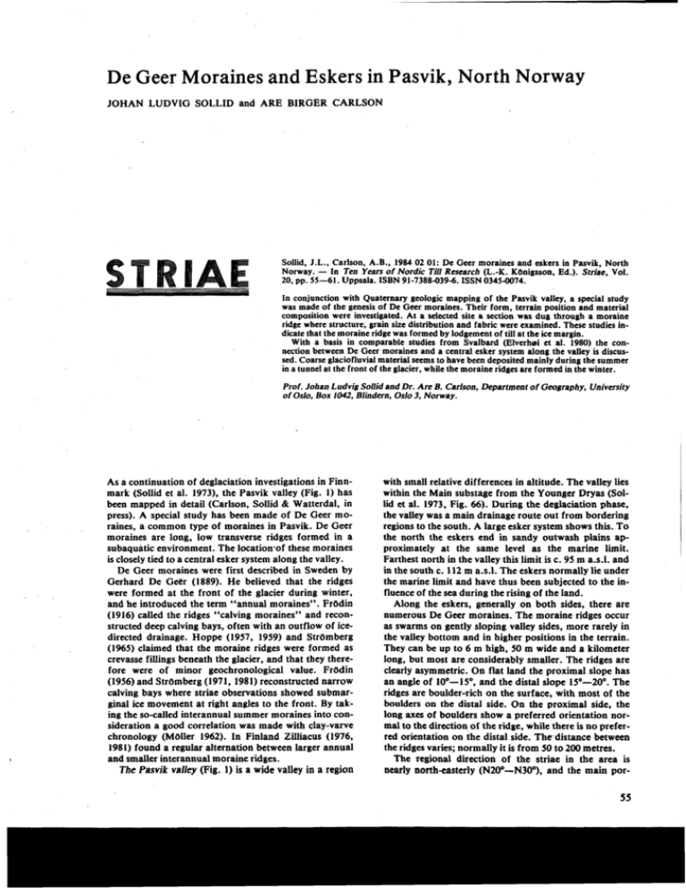
De Geer Moraines and Eskers in Pasvik, North Norway JOHAN LUDVIG SOLLID and ARE BIRGER CARLSON Sollid, J.L., Carlson, A.B., 1984 02 01: De Geer moraines and eskers in Pasvik, North Norway. - In Ten Years of Nordic Till Research (L.-K. Kbnigsson, Ed.). Striae, Vol. 20, pp. 55-61. Uppsala. ISBN 91-7388-039-6. ISSN 0345-0074. In conjunction with Quaternary geologic mapping of the Pasvik valley, a special study was made of the genesis of De Geer moraines. Their form, terrain position and material composition were investigated. At a selected site a section was dug through a moraine ridge where structure, grain size distribution and fabric were examined. These studies indicate that the moraine ridge was formed by lodgement of till at the ice margin. With a basis in comparable studies from Svalbard (Elverhei et al. 1980) the connection between De Geer moraines and a central esker system along the valley is discussed. Coarse glaciofluvialmaterial seems to have been deposited mainly during the summer in a tunnel at the front of the glacier, while the moraine ridges are formed in the winter. Prof. Johan Ludvig Sollid and Dr. Are B. Carlson. Department of Geography, University of Oslo, Box 1042, Blindern, Oslo 3, Norway. As a continuation of deglaciation investigations in Finnmark (Sollid et al. 1973), the Pasvik valley (Fig. 1) has been mapped in detail (Carlson, Sollid & Watterdal, in press). A special study has been made of De Geer moraines, a common type of moraines in Pasvik. De Geer moraines are long, low transverse ridges formed in a subaquatic environment. The location'of these moraines is closely tied to a central esker system along the valley. De Geer moraines were first described in Sweden by Gerhard De G e r (1889). He believed that the ridges were formed at the front of the glacier during winter, and he introduced the term "annual moraines". FrOdin (1916) called the ridges "calving moraines" and reconstructed deep calving bays, often with an outflow of icedirected drainage. Hoppe (1957, 1959) and StrOmberg (1965) claimed that the moraine ridges were formed as crevasse fillings beneath the glacier, and that they therefore were of minor geochronological value. FrOdin (1956) and StrOmberg (1971, 1981) reconstructed narrow calving bays where striae observations showed submarginal ice movement at right angles to the front. By taking the so-called interannual summer moraines into consideration a good correlation was made with clay-varve chronology (Moiler 1962). In Finland Zilliacus (1976, 1981) found a regular alternation between larger annual and smaller interannual moraine ridges. The Pasvik valley (Fig. 1) is a wide valley in a region with small relative differences in altitude. The valley lies within the Main substage from the Younger Dryas (Sollid et al. 1973, Fig. 66). During the deglaciation phase, the valley was a main drainage route out from bordering regions to the south. A large esker system shows this. TO the north the eskers end in sandy outwash plains approximately at the same level as the marine limit. Farthest north in the valley this limit is c. 95 m a.s.1. and in the south c. 112 m a.s.1. The eskers normally lie under the marine limit and have thus been subjected to the influence of the sea during the rising of the land. Along the eskers, generally on both sides, there are numerous De Geer moraines. The moraine ridges occur as swarms on gently sloping valley sides, more rarely in the valley bottom and in higher positions in the terrain. They can be up to 6 m high, 50 m wide and a kilometer long, but most are considerably smaller. The ridges are clearly asymmetric. On flat land the proximal slope has an angle of 10'-19, and the distal slope 15'-20'. The ridges are boulder-rich on the surface, with most of the boulders on the distal side. On the proximal side, the long axes of boulders show a preferred orientation normal to the direction of the ridge, while there is no preferred orientation on the distal side. Thedistance between the ridges varies; normally it is from 50 to 200 metres. The regional direction of the striae in the area is nearly north-easterly (N20"-N30°), and the main por- i STRIAE 20 Jobao Ludvig SoIlid aod Are Birger Carlsson Fig. I . Features of the glacial aeoloay of ~ & k , Finmark. ~implifikdaft& sollid et al. (1973, PI. I). GUCIOFLUVIAL CHANNEL MAIN ICE FLOW DIRECTION DE QEER MORAINES GLACIOFLUVIAL MATERIAL TERRACE E W E TRACES OF FORMER DRAINAGE ON DELTA Fig. 2. Eskerr and De Geer moraines in the \ area around Nittisckshtigda. STRIAE 20 De Geer moraines and eskers in Northern Norway Fig. 3. Eskers and De Geer moraines around Tomarnoen. a. Fie. 4. Eskers and De Gecr moraines at Ellentjerna-Vaggatcmvatn. Excavation site of a De Gecr moraine is marked with an A. 57 Joban Ludvig Sollid and Are Birger Carlsson De Gecr moraines and eskers in Northern Nonvay STRIAE 20 e.t. ClAltl 1 2 - 16 mml . Till horn proximal part Till from distal part r Sorted material o SILT SLND (0.063 - 2mml + ELAT ( c 0.063 mm I from the central part of the cross section. Pressure from right to left. Fig. 7 . Mechanical composition of 18 material samples ( 16 mm) from the cross section. Grain size distribution was analyzed by sieving and hydrometer. tion of the drumlinoid forms have the same orientation as does the large esker system in the main valley. Younger local striations and individual flutings show ice movements directed towards calving bays in the main valley. Three areas (Figs. 2,3 and 4) were chosen for detailed studies (see Fig. 1). The area around Nittisekshbgda shown in Fig. 2 represents an esker system running along the middle of the valley towards the northeast. The front of the glacier lay at NittisekshOgda up against a rock sill long enough for glaciofluvial material to build a small marginal delta up to the marine limit at 95 m a.s.1. Otherwise, this area has large bogs with organic material covering glaciomarine silt and clay. There are numerous De Geer moraines on both sides of the esker system. On the west side the ridges are orientated northwest-southeast, while on the eastern side they follow a more east-west direction. These ridges probably continue on the Russian side of the border. On the northern side of the esker system there are small, unconnected moraine ridges across the valley. Some of the De Geer moraines within the area are up to a kilometer long and 5-6 m high, but most are considerably smaller. The average distance between the ridges is about 100 m, and their highest altitude is about 70 m a.s.1.. i.e. well below the marine limit. Tomamoen (Fig. 3) is a large ice marginal delta built up of material coming from the southwest through a C. 15 m deep meltwater canyon. On both sides of the canyon there are higher mountains, so that the ice front stopped there long enough for the delta to be built up to sea level (112 m a.s.1.). The delta surface on the distal side merges into a northeast running esker ridge which, after about two kilometres, joins another northwest running esker. On both sides of the eskers there are several De Geer moraines which are oriented more or less parallel to the eskers. The moraine ridges are very small, in some places nothing more than boulder rich stripes. This is especially the case south of the junction between the eskers. The ridges are here found up to 105 m a.s.1. In some places De Geer moraines were deposited upon undisturbed mounds and ridges of till. Fabric analyses of basal till show a northeast-southwest preferred orientation, which is parallel to the last regional striation direction. Analyses of De Geer moraines show pebble orientation at right angles to the longitudinal direction of the ridges (Sollid, Carlson & Watterdal, in prep.). In the area Ellentjerna-Vaggatemvatn (Fig. 4) there is a c. 8 km long row of glaciofluvial mounds on the slope down to Vaggatemvatn. The surfaces are similar for each mound in that the proximal side is the steeper one and consists of rounded stones with diameters from 20 to 100 cm, while the distal side is gentler, with sandy material almost completely without large stones. This assymetri is due to the sorting of material during sedimentation. Around the glaciofluvial mounds lie a large number of 1-3 m high, boulder-rich De Geer moraines. Northwest of Ellentjerna a large meltwater channel runs down to the De Geer moraines, and the ridges turn in towards the mouth of the channel. The marine limit in the region is about 105 m a.s.l., and the De Geer moraines are found up to c. 100 m a.s.1. West of Vaggatemvatn a cross section c. 18 m long and up to 3 m deep, was dug through a De Geer moraine by an excavator. The digging showed that the boulderrich distal side was noticeably less consolidated than the proximal side. This is usual in the Pasvik valley. The ridge investigated was 250 m long, 20 m wide and had a northeast-southwest longitudinal direction (N36"N216"). The proximal slope was about lo0,and the distal c. 30". The crest of the ridge lies at c. 75 m a.s.l., and the marine limit is here c. 105 m a.s.1. The cross section is shown in Fig. 5. Uppermost in the section there is a 20-60 cm thick layer which is strongly affected by recent processes. The section's proximal part and deeper portions of the distal part consist of homogenous, hard packed sandy till with individual larger boulders. Pockets and lenses of sorted sandhilt are usual, often around stones and boulders. In the sandy till there is a marked fissility approximately parallel to the surface. Structures in'fine material behmd stones indicate only minor pressure from the proximal side of the ridge (Fig. 6). The material in the distal part of the profile is more Fig. 6. Detail Johm Ludvig Sollid and Are Birger Carlsson heterogeneous with alternating layers of sandy and gravelly till. The layers dip 10'-20" in a proximal direction. Towards the distal slope the layers flatten out and partly fall distally. The distal part of the section has fewer visible structuresand is more loosely packed than the proximal part. On the lowest part of the distal slope and beyond it, there is loosely consolidated, structureless, sandy till. Eighteen sediment samples were taken from the section (Fig. 7). The material from the distal part was coarser and more varied in composition than the homogeneous material from the proximal part. In the cross section 1I fabric analyses were made. The results are presented as rose diagrams (Fig. 8). The dominant orientation of pebbles is at right angle to the crest of the ridge (li = N 125'-N 305'. a = 10,4'). The long-axis dip was also measured (Fig. 9). The dip is towards the proximal side (X = -7.3', a = 9.8') at all the measurement sites, except for the three most distal sites where the axes are close to horizontal. STRIAE 20 -- Fig. 9. Particledip values from the cross section (same sample sites as in Fig. 8). x = dip, proximal negative, distal positive. Discussion De Geer moraines found in the Pasvik valley are normally asymmetric with the distal slope being the steeper. The moraines are mostly boulder-rich on the distal slopes, and on the proximal slopes the long axes of boulders have a preferred orientation normal to the crests of the ridges. There is a considerable difference in the degree of consolidation, with the proximal sides being the most consolidated. A cross section through one of the moraine ridges shows only minor pressure structures and a dip of layers towards the proximal side. The long axes of pebbles are arientated normal to the crest of the ridge and dip towards the proximal side. These observations indicate that the ridges must have been deposited at the ice margin, primarily by lodgement of basal debris. The ridges can hardly have been formed in subglacia1 crevasses as such theoretically can not exist due to the movement and plasticity of the ice. The observations also exclude an origin by a subaquatic bulldozer effect by the ice. Bouyancy in the water probably prevented the glacier from pushing up material frontally. Nor is it likely that saturated till was squeezed out at the front along the sole of the glacier as the hydrostatic pressure beneath the ice margin and in the water just at the front must have been nearly equal. With respect to De Geer moraines close association with the central esker system in the Pasvik valley, there are analogies with studies from Svalbard. Elverhei et al. (1980) describe Kongsvegen, which is a grounding glacier calving into the sea. The glacier, which is mostly at pressure melting point at the sole, produces meltwater year round. During the summer thq front retreats due to intensive calving. During the winter with no calving, the front advances somewhat. Brackish meltwater leaves the glacier at sea level through a tunnel and flows out over oceanic water. A weak bottom current of warmer and saltier oceanic water penetrates into the tunnel and gradually mixes with the outflowing meltwater. Sedimentation of coarser material occurs far into the tunnel where the flow velocity of the meltwater is reduced as it there meets the water from the sea. The finer material is carried in suspension in a surface current and deposited further out in the fjord. - Fig. 10. A simplified'model of esker and De Geer moraine formation in the Pasvik valley. 1. De Geer moraines. 2. Glaciofluvial material, 3. Glaciofluvial mounds and ridges, 4. Meltwater stream with high concentration of suspended material. The conditions in the Pasvik valley during deglaciation were comparable with the conditions on Svalbard today, and the observations from the valley fit in with Elverhei ct al.'s (op. cit.) model. Fig. 10 is a generalized drawing based on the model, and shows a possible manner of origin of De Geer moraines and eskers in the Pasvik valley. The coarser glaciofluvial material was deposited inside the tunnel at the glacier's front, mostly De Geer moraines and eskers in Northern Norway STRIAE 20 during the summer. Contercurrents of warmer oceanic water led to glacier melting from the bottom and widening of the tunnel. Moraine ridges were formed frontally during the glacier's advance or standstill in winter. The moraine pattern shows the position of the tunnel and the ice margin during recession. Hydrostatic pressure in the tunnel prevented it from closing. When the supply of sediment was large, glaciofluvial material was deposited as a continuous esker system in the middle of the calving bay. Less sediment supply led to the formation of mounds or non-continuous ridges. Such mounds can possibly have been formed annually. In areas where the supply was small o r where the glacier retreated rapidly there is an absence of large glaciofluvial accumulations. There, De Geer moraines may replace eskers in the bottom of the valley. It has not been possible to differentiate between annual and interannual moraines in this area. Several ridges could very well have been deposited during a single winter, while other winters may have passed without the formation of a ridge. De Geer moraines are therefore first and foremost a help in reconstructing the position of the front of the glacier during recession, but can also indicate how recession proceeded. - This ork was supported by the NorAcknowledgements. wegian Research Counsil for Jcience and Humanities (NAVF) as a part of a dtglaciation project headed by J.L. Sollid. Thanks are hereby extended for this support. REFERENCES Briggs, D.J. 1977: Sources and methods in geography: sediments. Butterworths, London 190 pp. Carlson. A.B.. Sollid. J.L. & Watterdal, T. (in press): Pasvik, kvartargeologisk kart 1:75 WO. Geografisk institutt, Universitetet i Oslo. De Geer, G.. 1889: Om hdmorener i trakten av Sphnga och Sundbyberg. Geol. FUren. Stockh. FUrb. 11, 395-396. Elvahei. A., Liestel. 0. & Nagy. J. 1980: Glacial erosion, sedimentation and microfauna in the inner part of Kongsfjorden. Sdtsbergen. Nor. Polarinst. Skr. 172.33-62. Frbdin. G: 1916:xber einige spltglaziale ~albungsbuchtenund fluvioglazialeEstuarien im mittleren Schweden. Bull. Geol. lnst. ups. 15.149-174. . Frbdin, G. 1956: IsstrOmssuccessionen pi4 UplandshalvOn jamte farsdk till korrelation med Alands och Abolands sklrdrd. Geographica 32,123 pp. Hoppe. G. 1957: Problems of glacial morphology and the Ice Age. Geogr. Ann. 39.1-18. Hoppe. G. 1959: Glacial morphology and inland ice recession in northern Sweden. Geogr. Ann. 41, 193-212. MOller, H. 1962: Annuella och interannuella itndmorlner. Geol. Foren. Stockh. FUrh. 84.134-143. Sollid. J.L.. Andersen. S.. Hamre, N., Kjeldsen, O., Salvigsen, 0.. Stured. S., TveitB, T. & Wilhelmsen. A. 1973: Deglaciation of Finnmark, North Norway. Nor. geogr. Tidsskr. 27.233-325. Sollid. J.L.. Carlson, A.B. & Watterdal. T. (in prep.): Pasvik. Beskrivelse ti1 kvarta?rgeologiskkart. 1:75 WO. Stramberg, B. 1%5: Mappings and geochronological investigations in some moraine areas of south-central Sweden. Geogr. Ann. 47A. 73-82. Stramberg, B. 1971: lsrecasionen i omrAdet kring Alands hav. Stockh. Univ. Naturgeogr. lnst., Forskningsrapp. 10. 156 PPStrdmberg, B. 1981: Calving bays. striae and moraines at Gysinge-Hedesunda, central Sweden. Geogr. Ann. 63A (34). 149-154. Zilliacus, H. 1976: De Geer-morlner och isrecessionen i sOdra F i n d s bstra delar. Terra 88:4, 176184. Zilliacus, H. 1981: De Geer-moranerna pa Replot och BjOrkOn i Vasa Sk&drd. Terra 93:l. 12-24.

