Catawba Path History: Indigenous Trails & Olean Road
advertisement
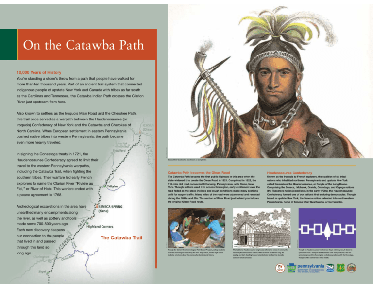
On the Catawba Path 10,000 Years of History You’re standing a stone’s throw from a path that people have walked for more than ten thousand years. Part of an ancient trail system that connected indigenous people of upstate New York and Canada with tribes as far south as the Carolinas and Tennessee, the Catawba Indian Path crosses the Clarion River just upstream from here. Also known to settlers as the Iroquois Main Road and the Cherokee Path, this trail once served as a warpath between the Haudenosaunee (or Iroquois) Confederacy of New York and the Catawba and Cherokee of North Carolina. When European settlement in eastern Pennsylvania pushed native tribes into western Pennsylvania, the path became Warren Library Association even more heavily traveled. In signing the Conestoga treaty in 1721, the Haudenosaunee Confederacy agreed to limit their Seneca Chief Gyantwahia, also known as Cornplanter. travel to the western Pennsylvania warpaths, including the Catawba Trail, when fighting the southern tribes. Their warfare led early French explorers to name the Clarion River “Rivière au Fiel,” or River of Hate. This warfare ended with a peace agreement in 1768. Catawba Path becomes the Olean Road Haudenosaunee Confederacy The Catawba Path became the first public highway in this area when the state widened it to create the Olean Road in 1821. Completed in 1822, the 110-mile dirt road connected Kittanning, Pennsylvania, with Olean, New York. Though settlers used it to access this region, early excitement over the road faded as the steep inclines and rough conditions made many sections unfit for wagon traffic. Many miles of the road were abandoned and rerouted during the 1840s and 50s. The section of River Road just behind you follows the original Olean Road route. Known as the Iroquois to French explorers, the coalition of six tribal nations who inhabited northwest Pennsylvania and upstate New York called themselves the Haudenosaunee, or People of the Long House. Comprising the Seneca, Mohawk, Oneida, Onondaga, and Cayuga nations (the Tuscarora nation joined later, in the early 1700s), the Haudenosaunee Confederacy formed one of our nation’s first enduring democracies. Though based in upstate New York, the Seneca nation extended into northwestern Pennsylvania, home of Seneca Chief Gyantwahia, or Cornplanter. Archeological excavations in the area have unearthed many encampments along the river, as well as pottery and tools made some 700-800 years ago. Each new discovery deepens long ago. Wikimedia Commons through this land so The Catawba Trail Wilbur F. Gordy that lived in and passed Eric S. Patton our connection to the people Through the Clarion River Archeological Field School Program, college students The traditional Haudenosaunee long house reflects the sense of community Though the Haudenosaunee Confederacy flag is relatively new, it draws its excavate archeological sites along the river. They, in turn, mentor high school valued by Haudenosaunee nations. Often as much as 200 feet long, the symbolism from a wampum belt that dates back many centuries. The five students, who learn about the area’s cultural and natural history. sapling-and-bark dwelling housed extended clan families that shared a symbols represent the five original confederacy nations, with the Onondaga, common female ancestor. “keepers of the central fire,” in the middle. pennsylvania WILDS
