Palmyra - UNOSAT
advertisement
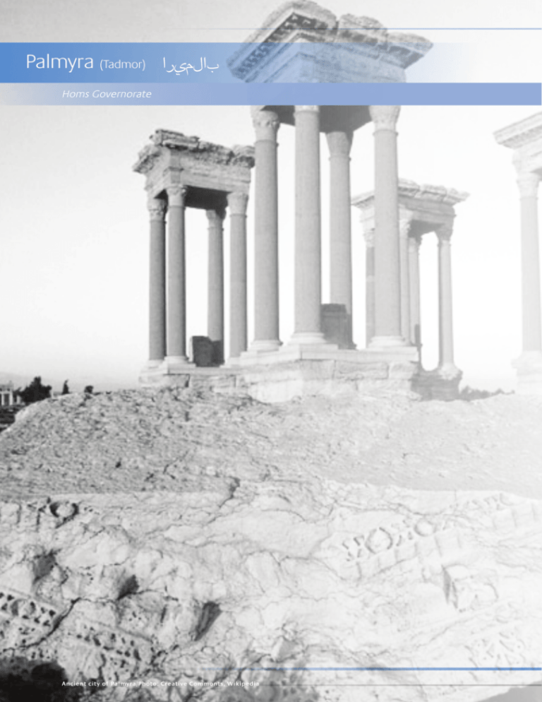
Palmyra (Tadmor) بالميرا Homs Governorate Ancient city of Palmyra/Photo: Creative Commonts, Wikipedia Satellite-based Damage Asessment to Historial Sites in Syria SOUTHWEST ACROPOLIS VALLEY OF TOMBS SMOOTHING OR EXCAVATING OF SOILS IN AREA AS OF 14 NOV 2013 CITY ROMAN WALL BREACHED AS OF 14 NOV 2013 AIN EFQA SPRING NORTHWEST NECROPOLIS EXCAVATED AS OF 1 SEPTEMBER 2012 MULTIPLE BERMS CONSTRUCTED ALL THROUGHOUT THE NORTHERN AND SOUTHERN NECROPOLIS CAMP OF DIOLETIAN NEW ROAD OF APPROX.2.4 KM LONG CONSTRUCTED AS OF 14 NOV 2013 COLONNADED STREET CITY WALL (SOUTHERN SECTION) COLLAPSED COLUMN AS OF 13 NOV 2013 TEMPLE OF BAAL-SHAMIN MONUMENTAL ARCH NORTHERN NECROPOLIS HOTEL ZENOBLA TEMPLE OF BEL CITY WALL (NORTHERN SECTION) RIGHT TO SECTION OF COLUMN ROW MISSING AS OF 14 NOV 2013 SOUTHEAST ACROPOLIS RIGHT HAND COLUMN OF COLUMN ROW MISSING AS OF 8 MARCH 2014 FIGURE 71. Overview of Palmyra and locations where damage has ocurred and is visible. Site Description This area covers the World Heritage Property of Palmyra (inscribed in 1980 and added to the UNESCO List of World Heritage in Danger in 2013. Built on an oasis in the desert, Palmyra contains the monumental ruins of a great city that was one of the most important cultural centres of the ancient world. From the first to the second century, the art and architecture of Palmyra, standing at the crossroads of several civilizations, married Graeco-Roman techniques with local traditions and Persian influences: PALMYRA “The splendour of the ruins of Palmyra, rising out of the Syrian desert northeast of Damascus is testament to the unique aesthetic achievement of a wealthy caravan oasis intermittently under the rule of Rome[…] The [streets and buildings] form an outstanding illustration of architecture and urban layout at the peak of Rome’s expansion in and engagement with the East. The great temple of Ba’al is considered one of the most important religious buildings of the 1st century AD in the East and of unique design.”(i) Palmyra Damage Level (Number of Heritage Locations) 3 0 DESTROYED SEVERE DAMAGE 7 MODERATE DAMAGE 5 POSSIBLE DAMAGE 113 Satellite-based Damage Asessment to Historial Sites in Syria Status Overview A selection of 42 features and areas across the site were examined in the satellite imagery. Of these, 10 are damaged or possibly damaged. In general, examination of the satellite imagery demonstrates only moderate structural damage resulting from the conflict; much of the damage reported from shelling and gunfire(ii) is largely cosmetic (shrapnel and fire damage) and thus not visible. However, stone robbing has caused extensive damage in the Camp of Diocletian, particularly to the Roman barracks. A new dirt road, which in total is more than 3 km long, runs from the citadel across the archaeological area, specifically through the necropolises, but also damaging a section of the Roman walls on the site. It is edged by large earth embankments, in some places constructed from the archaeological soil of the site. Numerous other embankments have also been created using heavy machinery, particularly around the periphery (see figure 71). This is presumably for the tanks and heavy artillery reported at the site(iii) and seen elsewhere in Syria, such as at Apamea, also discussed in this report.(iv) Looting damage was difficult to identify in some areas as some of the tombs are towers with second story entrances. However, new tracks to the tombs could be identified in one area which showed no military activity. A small number of looting holes were visible over the site and, in one area, a substantial amount of earth moving was visible. At least three tombs that had been visibly sealed to protect them were reopened. However, due to the structure type of the tombs and the earth moving for military purposes, the full extent of looting on the site could not be assessed. Despite reports of looting(v) to several areas of the main site within the walls, no damage was visible on a review of imagery. Several areas were excavated between the October 2009 image and the September 2012 image. These include an area south of the exedra and the Temple of Nabu as well as several funerary temples on the walls. These excavations are thought to date from the legitimate 2009 - 10 excavation season.(vi) Only one fully excavated structure may be illegal, as it is located in a heavily disturbed area—the southwest necropolis—and may postdate the last excavation season of the foreign team excavating the site. However, the clarity of the excavated feature, compared to the other disturbed areas, makes this uncertain. NOTE This report provides a detailed analysis of significant changes to the cultural heritage of this site resulting from the ongoing conflict in Syria. Satellite imagery acquired on 10 October 2009, 01 September 2012, 14 November 2013, 08 March 2014 and 26 October 2014 were used for this report. 114 26 October, 2014 Satellite-based Damage Asessment to Historial Sites in Syria OLD RACE TRACK RUIN HAS BEEN EXCAVATED / APPROX. 55m. IN LENGTH OF THE SOUTHERN MOUND SECTION HAS BEEN REMOVED FOR VEHICLE PLACEMENT P311 P317 CLEARED RUINS AS OF 23 FEB 2014 P319 P318 MILITARY BERMS HAVE BEEN PLACED ALL THROUGHOUT THE NORTH AND NORTHWEST NECROPOLIS P337 CLEARED RUINS AS OF 14 NOV 2013 P336 P211 P210 NEW ROAD APPROX. 2.4 km LONG CONSTRUCTURED AS OF 14 NOV 2013 P212 P347 P209 P208 P207 P349 P206 RUINS APPEAR TO HAVE BEEN ADDITIONALLY EXCAVATED BETWEEN 2009 AND 2012. BERM HAS BEEN PLACED ALONG THE SOUTHWESTERN SIDES OF THE RUIN ADDITION SOIL REMOVAL IN AREA AS OF SEMPTEMBER 2014 BERMS CONSTRUCTED AS OF 14 NOV 2013 FIGURE 72. Northwest Necropolis. NEW ROAD Severe Damage The new road is clearly visible on the imagery. It was built between 01 September 2012 and 14 November 2013 and remains in use as of 26 October 2014 (see figure 72). Coming directly down from where the original road to the citadel branches to the communications/radio mast, the new road cuts through the northwest and northern necropolises to the tarmac road on the eastern edge of the modern town of Tadmur. This new road is approximately 2.4 km long. A secondary section, 579 m long, branches off from the main road in the northwest necropolis. It cuts through it to the rise at the eastern-most point of the walls. Here a small clearing has been excavated against and through the walls; an area of wall approximately 44 m long has also been removed (see figures 72 and 73). Soil from the surrounding areas, including the archaeological areas, has been piled up all along the road to provide a walled embankment.(vii) This embankment also disturbs the line of the Hellenistic wall running to the Bel Hammon Temple. The road is dirt, rather than tarmac, which will cause far less damage as it does not require such deep foundations, and no chemicals were used which would leach into the archaeological soils. However, it still requires the flattening of archaeological features, and the vibrations of heavy traffic will damage the archaeological remains. In addition, the tarmac road to the communications tower has been widened and resurfaced. During the same period, a new dirt road was created along, and partially over, the remains of the mud-brick wall on the far north-eastern side of the site that marked the western end of the necropolis. The original wall runs from tower tomb Q287 on the rise heading east from the Valley of the Tombs across the small valley there. The buried part of this wall, within the valley, is now partially covered by a road, 274 m long and 5 m wide, with a roadblock/barrier at the northern end; it does not reach tomb Q287. NORTHWEST NECROPOLIS Description This necropolis extends along the northern defensive walls from the modern city limits up to the eastern slopes of the Arab castle and Alarwasate mount. It contains all types of Palmyrene tombs, including tower, house, underground (hypogea), cave and individual tombs.(viii) Many of these have been integrated within the defensive wall. Generally speaking, they date from the first to the third centuries AD. 115 Satellite-based Damage Asessment to Historial Sites in Syria 10 October 2009 FIGURE 73. Northwest necropolis. Severe Damage Damage Assessment 116 In addition to the banked road running through this area, which has passed over or through several tombs, the ground of the necropolis has been heavily disturbed. A set of small embankments protecting tanks and buildings/tents were constructed between 2012 and November 2013(ix) over several underground tombs, and incorporated the row of tower tombs to the southeast of the racetrack (tombs P206 - P211(x)). Collectively, the embankments measure 200 m x 150 m. Six more separate placements, banked with earth, were created concurrently on or inside the (modern) racecourse, one incorporating tomb P212, the largest of which is just under 50 m in diameter. Two sets of ruins (most likely funerary temples P317 and P319) south of the hexagonal tomb appear to have been cleared or robbed for stone as their outlines were no longer visible as of 2013. A third outline to the west of these was no longer visible by February 2014. Next to these, an embankment was dug into structure P311 for military vehicles/armaments, which destroyed approximately 65 m of the 100-meter southern wall (see figures 72 and 73). The northern edge of this necropolis is restricted by the road that runs along the southern edge of the modern town of Tadmur; another embankment has also been built along this road. Where the town ends, the embankment runs up the slope to the citadel for approximately 500 m. Tomb P349 appears to have been further excavated on the southern edge of the racecourse between 2009 and 2012. Its outline was visible on the imagery from 2009, however as of 2014 there is clear increased definition of the ruins, suggesting further excavation of the tomb. In addition, a berm has been placed along the south-western sides of the ruin.It is unknown if it was excavated legitimately. Soil heaps are visible over or next to a number of the underground tomb entrances, particularly those near the new road. It is also unknown if these are a result of looting or were placed there to assist the construction work. However, the excavators recorded these tombs as “collapsed in the unspecified past, never excavated,”(xi) so it is more likely the spoil heaps are related to construction work. Part of the large excavation spoil heap outside the city walls at the southern end of the necropolis was removed between 2009 and 2012, perhaps as part of the restoration work conducted by the Palmyra Museum on the wall.(xii) Occasional looting holes are also visible; for example, two holes are visible in Funerary temple P214, just outside the walls by the Camp of Diocletian. The first appears between 2009 and 2012, and the second by 2013—the larger of the two is approximately 3 m in diameter. 8 March, 2014 EXCAVATED AS OF 1 SEPTEMBER 2012 Satellite-based Damage Asessment to Historial Sites in Syria FILLED AS OF 1 SEPTEMBER 2012 BERM CONSTRUCTURED AS OF 14 NOV 2013 EXCAVATED AS OF 1 SEPTEMBER 2012 FILLED AS OF 14 NOV 2013 BARRIER ALTERED (REDUCED) AS OF 13 NOV 2014 PARTIALLY FILLED AS OF 8 MARCH 2014 FILLED AS OF 1 SEPTEMBER 2012 FILLED AS OF 1 SEPTEMBER 2012 BERM CONSTRUCTURED AS OF 14 NOV 2013 FILLED AS OF 1 SEPTEMBER 2012 BERMS CONSTRUCTURED AS OF 14 NOV 2013 FIGURE 74. Tombs that were filled in as of 2012. SOUTHEAST NECROPOLIS Description This necropolis lies south of the main oasis and contains tower tombs and underground tombs which mostly date back to the first through third centuries AD. Damage Assessment Severe Damage A comparison of the imagery from 2009 and 2012 shows the entrances to most of the main underground tombs in this area were filled in, presumably when the Syrian DGAM attempted to bury the entrances to the tombs in some of the cemeteries (including this one) in order to protect them.(xiii) Unfortunately, analysis of the imagery also shows that at least three of those filled in—including the Tomb of Bolha(xiv) and the Tomb of Bariki—were reopened between 2012 and 2013, as small holes become visible in the filling. The Tomb of Artaban was completely filled in during the period between 2012 and 2013 (see figures 74 and 75). However, soil heaps are visible around the tomb in 2012, suggesting it was possibly looted and then recovered more thoroughly later. A fourth tomb, tomb C, was filled in by March 2014 and at that point the holes into the tombs were no longer visible, supporting the hypothesis that the tombs were reburied, again in an attempt to protect them. There is also evidence of earth being moved in this area throughout the period under examination. Funerary temple S103 was excavated in the northeast area of the site at some point between October 2010 and September 2012. Though the clarity of the excavation suggests it is legitimate, given the timing,(xv) illicit excavation cannot be ruled out. As in other areas, an earth barrier was created during 2012 - 2013, between the palm groves across the road leading from the site. An additional barrier was created heading south from the eastern road that borders the necropolis down to the northern edge of the palm groves surrounding the site. It dates back to the same period as the other barriers. Lastly, and also during this period, several embankments, usually associated with tanks or military emplacements, were created to the south of this area— one just to the north of the southern road and three to the south. 117 Satellite-based Damage Asessment to Historial Sites in Syria 10 October 2009 FIGURE 75. Location of tombs, open in 2009, and of later military emplacements. HOTEL ZENOBIA Description The historic hotel was built on the site in the 1920s. Severe Damage Description 118 An imagery comparison between September 2012 and October 2014 shows that sections of the roof in the central areas of the hotel appear to have collapsed. The date of the damage is unknown, but photographs(xvi) from December 2013 indicate significant damage to parts of the hotel. Satellite-based Damage Asessment to Historial Sites in Syria CAMP OF DIOCLETIAN Description The area known as Camp of Diocletian includes a section of the colonnaded road, Roman barracks, the Temple of the Standards (a shrine where military standards were housed), the Temple of Allat and the Damascus Gate in the south wall. These were constructed sometime between 284 – 305 AD by the governor of Syria, Sosianus Hierocles. Damage Assessment A comparison of the imagery from September 2012 to November 2013 reveals that a small number of looting holes appear in the barracks. Additionally, the previously well-defined lines of the low walls that formed the interior of the barracks were no longer visible by March 2014. This may be a sign of the stone robbing reported in this location in the 37th State of Conservation Report, which also reported extensive looting in this area.(xvii) However, though reports of looting have not abated, there is no clear evidence of any other change, such as an increase in the size or number of holes, after 2012. Moderate Damage TEMPLE OF BEL Description Considered one of the most important religious buildings of the first century AD, the temple consists of a central shrine within a large walled, colonnaded courtyard with a monumental gateway. Damage Assessment The most visible damage on the imagery was the collapse of one column and its architrave, which occurred between September 2012 and November 2013. Other reports of damage(xviii)—the collapse of a second column, looting around the edge of the temple, and holes in the walls caused by shelling—could not be substantiated, despite a good view of the southern Temple wall (reported to have a 1-x-2-meter hole in it) on the February 2014 image. There have also been numerous reports of light shrapnel damage and minor impact damage(xix) causing burning to the temple; these are not detectable on the satellite imagery. TEMPLE OF BAAL-SHAMIN, LORD OF HEAVENS Description The earliest parts of this charming restored temple date back to 17 AD. Damage Assessment The southwest columns of the northern colonnaded courtyard contain a set of three standing columns and their architrave in front of the temple. Between 14 November 2013 and 08 March 2014, the right-most column was destroyed or removed. In addition, a section of the architrave between two columns of the eastern wall was destroyed or removed between 01 September 2012 and 14 November 2013. VALLEY OF THE TOMBS (WESTERN NECROPOLIS) Description This necropolis contains a number of impressive early tower tombs, funerary temples and underground tombs dating back to the first to the third centuries AD, some of which are reconstructed. The necropolis extends west for more than a kilometre outside the Palmyrene walls and up into the hills to the northwest. Damage Assessment An embankment 250 m long has been dug approximately half a kilometre along the undulating valley at a low point, cutting off the track along the valley. The embankment connects the eastern edge of the Umm al-Belquis rise with the opposite rise. At least three tombs have been incorporated into the embankment (Q122, Q123 and Q295(xx)) and, though they do not appear to be damaged, the track is no longer passable. This was created at the same time as the roads (between 01 September 2012 and 14 November 2013). 119 Satellite-based Damage Asessment to Historial Sites in Syria Although extensive looting of the tombs has been reported,(xxi) it is internal and therefore not visible. However, a track leading from the road to many of the hypogea was visible on the 14 November 2013 image. While such tracks can form quickly, this one saw enough use to smooth down the embankment it crossed. The track was fainter on the 23 February 2014 image and was gone by 08 March 2014, suggesting that for a brief period (post-tourism) the tombs saw regular visitation. One excavated area just to the north of the track, which may have marked the entrance to a hypogeum, has been filled in and dates back to the same period as the other alterations. Next to it, a very small new excavated area (14 x 6 m) was visible on the 2013 image, but by March 2014 it was mostly filled in again. Moderate Damage Most of the excavated funerary temples have experienced no damage. Four looting holes, all of small circumference (between 1 - 3 m), are visible on the two funerary temples to the west of the new embankment (Q141 and Q142), also dated between 2012 - 2013. At least one was shallow enough to be mostly filled in by March 2014. One looting hole of similar size and date is also visible on the collapsed tomb (Q278) to the west of the Tomb of Atenatan. Excavations have been noted in the Hellenistic settlement in the Valley of the Tombs outside the south Palmyrene wall. A small number of looting holes (about five) are visible on the 2013 imagery; these are not associated with any visible structures. However, at least one structure (approximately 12 m2) was excavated between 10 October 2009 and 01 September 2012 and may have been part of a legitimate archaeological excavation before the conflict began. One hole does appear between 2009 and 2012 in the northeast corner of the structure, southeast of the agora and south of the Temple of Arsu. Two more small looting holes appear on the structure next to it between 2012 and 2013. Also between 2009 - 2012, a section roughly 50 m long and 33 m wide was excavated from the area outside the wall and next to the southeast corner of the agora. SOUTHWEST NECROPOLIS Description This necropolis contains some interesting tower tombs and hypogea,(xxii) primarily dating from the first to the third centuries AD. It is located just to the south of the Bel Hammon temple. Damage Assessment A comparison of the imagery between 2009, 2012 and 2013 demonstrates spoil mounds and other piles of earth that have been disturbed, and in some cases flattened. The marks of heavy earth-moving machinery, similar to those used to make the embankments elsewhere on the site, are visible in a few (less than 10) locations, but no disturbance is more than 10 m wide. This is consistent with evidence created by the protective reburial of sites and subsequent looting using heavy machinery, which was reported in this location.(xxiii) Although some of the reported looting occurred at undiscovered underground tombs, no new holes, suggestive of newly discovered tombs, are visible. AIN EFQA SPRING Description The spring that formed the source of the oasis on which Palmyra was built once emerged into a huge cavern. It dried up in the 1960s, but the site is still marked by some ruins. Damage Assessment A comparison of satellite imagery suggests some damage, possibly an illegal excavation, has occurred at the southern end. A comparison of the imagery between 2009, 2012 and 2013 demonstrates spoil mounds and other piles of earth that have been disturbed, and in some case flattened [at the Southwest Necropolis]. The marks of heavy earth-moving machinery are visible in a few locations. 120 Satellite-based Damage Asessment to Historial Sites in Syria 26 October 2014 10 October 2009 NEW ROAD CONSTRUCTED Possible Damage NEW WALL BREACHED AS OF 14 NOV 2013. REMOVING A SECTION OF WALL OF APPRO. 44m LONG FIGURE 76 and 77. Old city walls and new road leading to 44-meter-wall breach caused by emplacement. QALAAT IBN MAAN (ALT. QALAAT SHIRKUH) Description This reconstructed castle dates back to approximately 1230 AD and sits in a prominent position overlooking the main site of Palmyra, offering spectacular views. Damage Assessment No damage is visible to the citadel of Qalaat ibn Maan, however three small buildings (approximately 11 m long by 6 m wide each) have been built on the road, abutting the Citadel walls. These are next to a roadblock that obstructs the last 100 m of the road to the drawbridge. The roadblock and buildings date to the same period as the new road, between 01 September 2012 and 14 November 2013. CITY WALLS Description The city walls date (at their earliest parts) back to the late-third/early-fourth century BC and are remarkably well preserved, still surrounding three quarters of the city. Damage Assessment With the exception of the small removed area (see figures 76 and 77 – New Road), the walls are remarkably intact. Two of the funerary temples on the north wall were excavated between 2009 and 2012, and two towers appear to have been rebuilt. However, the rebuilding work is the result of legitimate restoration work conducted between 2009 - 2010 by the DGAM.(xxiv) It is probable the excavations are likewise legitimate. 121 Satellite-based Damage Asessment to Historial Sites in Syria Remains of the Camp of Diocletian/Photo: Wikimedia Commons. Theater of Palmyra/Photo: Wikimedia Commons. 122 Satellite-based Damage Asessment to Historial Sites in Syria (i) UNESCO Site of Palmyra World Heritage Inscription [1]. Available at: http://whc.unesco.org/en/list/23 See the following sources for examples. (ii) UNESCO State of Conservation Reports - 37th session [2] and 38th Session [3]. Available at: http://whc.unesco.org/en/ soc/1954 and http://whc.unesco.org/en/soc/2913 (iii) Several examples of sites being used for military emplacements are also given by Casana and Panahipour, 2014 [4] (iv) A report [5] shared by Le patrimoine archéologique Syrien en danger, 24 February 2012, suggested looting to the Camp of Diocletian; the Valley of the tombs and the tombs of the Southwest and Southeast; the Triumphant arc and decumanus at colonnades - the areas of the defensive walls South and North; and the edge of the temple of Bel. These are discussed in the main report where evidence was found. Available at: https://www.facebook.com/Archeologie.syrienne?fref=ts (v) Site excavator Professor Gawlikowski confirmed the funerary temples were restored by the DGAM, pers. comm, 2014. (vi) This photograph [6] provides a view of the size of the embankments, provided by the Facebook group Coordinating the Syrian Revolution in Palmyra, 15 December 2013. Available at: https://fbcdn-sphotos-f-a.akamaihd.net/hphotos-ak-frc3/1484091_5481 86188621830_921702732_n.jpg (vii) Some of these tombs can be seen in this DGAM/Universitas Bergensis photograph [7]. Available at: http://www.hist.uib.no/ antikk/dias/Palmyra/NekroNW/Data/page.htm?0,0 (viii) The tanks, buildings and embankments can be seen in this video [8], shared by the The Association for the Protection of Syrian Archaeology, 10 February 2014. Available at: https://www.youtube.com/watch?v=mKho8yat6Dk&feature=youtu.be (ix) Tombs are identified from the map in Schnädelbach, 2010 [9] (x) Site excavator Professor Gawlikowski, pers. comm, 2014 (xi) Site excavator Professor Gawlikowski, pers. comm, 2014 (xii) UNESCO State of Conservation Report - 37th session [2]. Available at: http://whc.unesco.org/en/soc/1954 (xiii) Tombs are identified from the map in Schnädelbach, 2010 [9] (xiv) Photographs of damage were made available on their Facebook page by the group, Coordinating the Syrian Revolution in Palmyra in December 2013. Unfortunately, these photographs are no longer available online. (xv) A comparison with a DigitalGlobe image on Google Earth, dated September 2010, shows the structure was not excavated at that point. There was no official foreign excavation season in 2011. (xvi) Other reports of looting and damage include a report [10] posted by Le patrimoine archéologique Syrien en danger on their Facebook group wall on 24 February 2012. Photos and a brief report [11] were also released by the DGAM. Numerous other reports are available. Available at: https://www.facebook.com/Archeologie.syrienne?fref=photo and http://dgam.gov.sy/index. php?d=314&id=1070 (xvii) Report [5] on the Facebook page of Le patrimoine archéologique Syrien en danger, 24 February 2012, UNESCO State of Conservation Reports - 37th session [2] and 38th Session [3] as well as a report shared on the Facebook page [12] of the The Association for the Protection of Syrian Archaeology, 23 September 2013 and in a news article in Intifada from March 2014 [13]. Available at: https://www.facebook.com/Archeologie.syrienne?fref=ts, http://whc.unesco.org/en/soc/1954, http://whc.unesco.org/en/ soc/2913, https://www.facebook.com/photo.php?fbid=491363720970744&=a.384545504985900.1073741827.324869057620212&type=1&relevant_count=1&ref=nf, and http://www.intifada-palestine.com/2014/03/palmyrenes-risking-lives-preserve-global-cultural-heritage/ (xviii) Report [5] shared by Le patrimoine archéologique Syrien en danger, 24 February 2012, UNESCO State of Conservation Reports - 37th session [2] and 38th Session [3] as well as a report shared on the Facebook page [12]of the The Association for the Protection of Syrian Archaeology, 23 September 2013 and in a news article in Intifada from March 2014 [13]. Available at: https://www.facebook.com/Archeologie.syrienne?fref=ts, http://whc.unesco.org/en/ soc/1954, http://whc.unesco.org/en/soc/2913, https://www.facebook.com/photo.php?fbid=491363720970744&set =a.384545504985900.1073741827.324869057620212&type=1&relevant_count=1&ref=nf, and http://www.intifada-palestine.com/2014/03/palmyrenes-risking-lives-preserve-global-cultural-heritage/ (xix) Tombs are identified from the map in Schnädelbach, 2010 (xx) In addition to the 37th session [2] and 38th Session [3] State of Conservation reports, the DGAM website [14] has numerous reports of seized funerary reliefs that were taken from the tombs.Available at: http://whc.unesco.org/en/soc/1954, http://whc.unesco.org/en/soc/2913, and http://www.dgam.gov.sy (xxi) Some of these tombs can be seen in this DGAM/Universitas Bergensis photograph [16]. Available at: http://www.hist.uib.no/ antikk/dias/Palmyra/NecropolisSW/Data/page.htm?0,0 (xxii) UNESCO State of Conservation Report - 37th session [2]. Available at: http://whc.unesco.org/en/soc/1954. (xxiii) Site excavator Professor Gawlikowski, pers. comm, 2014 123
