MnDOT Zoning Working Group Slides
advertisement
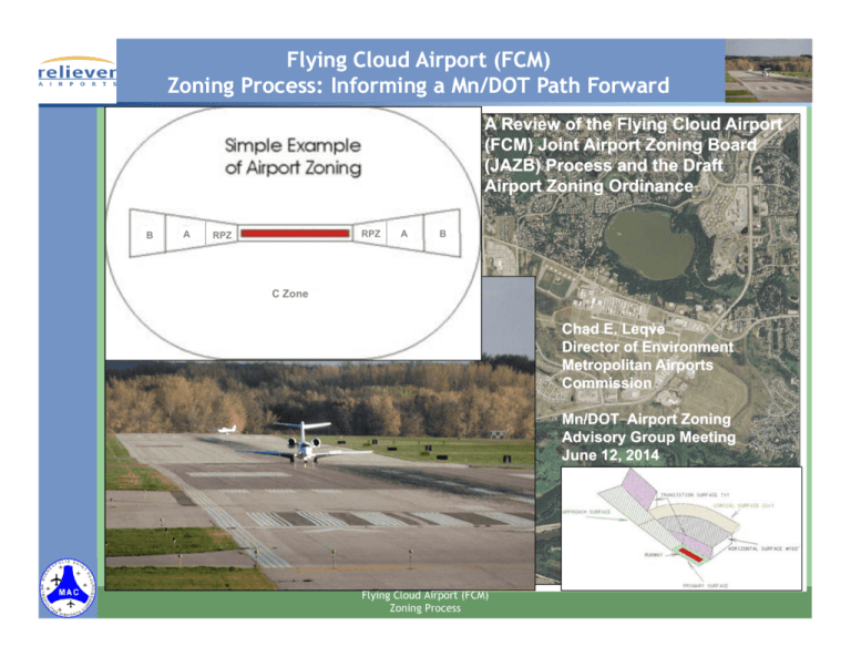
Flying Cloud Airport (FCM) Zoning Process: Informing a Mn/DOT Path Forward A Review of the Flying Cloud Airport (FCM) Joint Airport Zoning Board (JAZB) Process and the Draft Airport Zoning Ordinance B A RPZ RPZ A B C Zone Chad E. Leqve Director of Environment Metropolitan Airports Commission Mn/DOT Airport Zoning Advisory Group Meeting June 12, 2014 Flying Cloud Airport (FCM) Zoning Process Presentation Outline Existing Federal Airspace and Land Use Provisions Why are We Zoning? Goal of the FCM Joint Airport Zoning Board (JAZB) FCM Safety Considerations Economic Impact of Zoning around FCM Proposed Draft FCM Zoning Ordinance Airspace and Land Use Provisions Informing a Mn/DOT Path Forward Flying Cloud Airport (FCM) Zoning Process Runway Safety Zones – Federal Runway Protection Zone (RPZ) Federal Guidance: FAA Advisory Circular 150/5300-13A Runway Protection Zone (RPZ) Dimensions Rwy. 18 Rwy. 36 Rwy. 10L Rwy. 28L Rwy. 28R Rwy. 10R Flying Cloud Airport (FCM) Zoning Process Federal Structure Height Restrictions: FAR Part 77 Primary Surface – aligned (longitudinally) with each runway and extends 200 ft from each runway end with a width of 120 ft to 1,000 ft depending on the runway’s classification. Approach Surface – longitudinally centered with the runway and extends beyond the primary surface at a slope and to a distance based on runway classification. Horizontal Surface – horizontal plane 150 ft above the established airport elevation. Constructed by swinging arcs around the end of the primary surface with a radius of either 5,000 ft or 10,000 ft based on the runway’s classification. Conical Surface – 20:1 surface extending 4,000 ft beyond the horizontal surface. Transitional Surface – constructed to join approach and horizontal or primary and horizontal surfaces. Flying Cloud Airport (FCM) Zoning Process Why Are We Zoning? Minn. Stat. §360.062: Establishes that “airport hazards” endanger lives, property and airport utility and should be prevented with consideration given to avoiding the disruption of existing land uses based on social and financial costs. Minn. Stat. §360.063, subd. 3: In an effort to prevent the creation or establishment of “airport hazards,” the statute states that “the Metropolitan Airports Commission shall request creation of one joint airport zoning board for each airport operated under its authority.” Establishes that “a joint board shall have as members two representatives appointed by the municipality owning or controlling the airport and two from the county or municipality, or in case more than one county or municipality is involved two from each county or municipality, in which the airport hazard is located, and in addition a chair elected by a majority of the members so appointed.” Flying Cloud Airport (FCM) Zoning Process Goal of the FCM JAZB GOAL: Develop FCM Zoning Ordinance for Review and Approval by the Commissioner of Transportation, for Subsequent Adoption by the Board and then by Local Municipalities Major Considerations: MnDOT Model Ordinance – Minnesota Rule 8800.1200 and Minnesota Rule 8800.2400 FCM’s unique characteristics in the context of existing and planned land uses around the airport Maintaining a “reasonable standard of safety” while considering the social and financial costs to the community Minn. Stat. §360.066, subd. 1 is especially instructive when addressing the question of zoning around complex urbanized airports such as FCM Flying Cloud Airport (FCM) Zoning Process Minn. Stat. §360.066, subd. 1 When addressing airport zoning, minimum standards and land uses related to reasonableness, the statute instructs that: “Standards of the commissioner defining airport hazard areas and the categories of uses permitted and airport zoning regulations adopted under sections 360.011 to 360.076, shall be reasonable, and none shall impose a requirement or restriction which is not reasonably necessary to effectuate the purposes of sections 360.011 to 360.076. In determining what minimum airport zoning regulations may be adopted, the commissioner and a local airport zoning authority shall consider, among other things, the character of the flying operations expected to be conducted at the airport, the location of the airport, the nature of the terrain within the airport hazard area, the existing land uses and character of the neighborhood around the airport, the uses to which the property to be zoned are planned and adaptable, and the social and economic costs of restricting land uses versus the benefits derived from a strict application of the standards of the commissioner.” Flying Cloud Airport (FCM) Zoning Process FCM JAZB Safety Study Methodology Included consideration of the character of the flying operations expected to be conducted at the airport, the location of the airport, and the nature of the terrain within the airport hazard area, consistent with Minn. Stat. §360.066, subd. 1 Conducted by HNTB in a manner consistent with the MSP methodology FCM–specific historical accidents and operations data were used in determining the historical accident rate Because of the low number of accidents at FCM over the last 20 years, the Berkeley Study accident location data were used The rate and location data were then applied to the 2025 forecast operations, on a runway-by-runway basis, to establish the safety risk in the FAA’s Runway Protection Zone (RPZ), and State Safety Zones A and B Additional analysis was conducted to determine the probability of aircraft impacting structures on prospective development properties considering pilot control statistics and open space around FCM Flying Cloud Airport (FCM) Zoning Process FCM JAZB Safety Study Findings In all of the present and future planned occupant areas within the State Safety Zones (outside the RPZ) and in Zone A for Runway 10L and Zone B for Runway 28R the accident probabilities are below the FAA standard of one accident in 10 million operations. In the remaining State A Zones (outside the RPZ) and State B Zones at the airport the probability is greater than one accident in 10 million operations. The potential severity of an off-airport aircraft accident is highly dependent upon the nature of the land use at the accident site. Three characteristics are most important: intensity of use; type of use (residential or non-residential); and sensitivity of use. Uses that attract a large assembly of people are the most severe. Uses that are populated 24 hours a day and 365 days a year (e.g., hospitals and nursing homes) are more likely to result in a fatality than uses that are not. While the findings of this study do not establish that strict application of the Mn/DOT Model Zoning Ordinance is required to provide a reasonable standard of safety around FCM, they do support additional consideration be given to land use controls around the airport beyond what might be applied when the accident probability within a State Safety Zone is less than 1 accident in 10 million operations. Further analysis was required Flying Cloud Airport (FCM) Zoning Process Additional Accident Data/Information: Pilot Control One important question when evaluating the degree to which land use should be controlled around FCM is the degree to which pilots can determine the exact impact location of the aircraft. The Berkeley Study found that in 95% of aircraft accidents around General Aviation (GA) airports the pilot had control of the aircraft prior to impact. The Airport Land Use Compatibility Manual, published by the Minnesota Department of Transportation in September 2006, states on page 17 of Appendix 7: “ …In many accidents the pilot has some control of the aircraft and has the ability to avoid some obstacles. If the aircraft is small enough and the population density is low enough, in many cases the pilot can avoid structures, automobiles, etc...” The above facts indicate that the location of distinct open spaces in the proximity of the extended runway centerline beyond the RPZ, large enough to allow a pilot to locate clearly and to contain the extent of the crash site, could be beneficial from a safety perspective. Flying Cloud Airport (FCM) Zoning Process Additional Safety Analysis Findings By virtue of the park agreement, VOR clear area, overlapping of RPZs with state safety zones on other runways, and water areas, when considering the A and B safety zones as one area outside the RPZ on each runway end, maximum contiguous open area acreages in the respective runway safety zones range from 20.93 acres to 65.38 acres. A conservative estimate of the crash site area for the largest design aircraft at FCM (Citation III) is 5,000 square feet; however, over 60% of operations at FCM would result in a crash area of 2,000 square feet or less. On page 17 of Appendix 7 of The Airport Land Use Compatibility Manual published by the Minnesota Department of Transportation in September 2006 it states that “A 2,000 square foot accident site from a general aviation crash will miss humans in many cases.” Flying Cloud Airport (FCM) Zoning Process Additional Safety Analysis Findings (Cont.) Based on the probability calculations for impacting a structure (applying pilot control assumption and accounting for adjacent open spaces provided by virtue of the park agreement, VOR clear area, overlapping of RPZs with state safety zones on other runways, and water areas) the probability of impacting a structure on all of the prospective development properties is well below the FAA collision standard of one in 10 million operations. The RPZ areas, along with providing a minimum of 20 acres of contiguous open space in the remaining State Safety Zones, are more than adequate to ensure adequate clear areas in proximity to the extended runway centerlines around FCM based on the pilot control statistics and crash site characteristics. Flying Cloud Airport (FCM) Zoning Process Flying Cloud Airport (FCM) Zoning Process Economic Considerations Economic Impact: Commercial Value = $150.0 million, Residential Value = $11.7 million, Total Property Taxes = $559,596 Flying Cloud Airport (FCM) Zoning Process Primary Changes from Model Ordinance 1. Safety Zone A – is co-terminus with the Federal Runway Protection Zone (RPZ). 2. Safety Zone B – use restrictions do not include site acre/structure limitations and site area to building plot area ratios and population criteria, allows ponding below an elevation of 865 feet above mean sea level along any Bluff of the Minnesota River, and adds continuous open acreage requirements. 3. Permitted Residential Areas – based on the safety and economic analyses, allow for the improvement, expansion and development of new residential uses in existing and planned residential land use areas in Safety Zone B. These residential uses would be treated as conforming uses in the zoning ordinance. 4. Leveraging the FAA 7460 Review Process – as the initial screening process for the approval of structures in the vicinity of the airport that meet the FAA’s 7460 review criteria, with a separate process for addressing tree heights. Flying Cloud Airport (FCM) Zoning Process Draft Ordinance Safety Zone Restrictions General Restrictions. Subject at all times to the height restrictions, no use shall be made of any land in any of the Safety Zones that creates or causes interference with the operations of radio or electronic facilities on the Airport or with radio or electronic communications between Airport and aircraft, makes it difficult for pilots to distinguish between Airport lights and other lights, results in glare in the eyes of pilots using the Airport, impairs visibility in the vicinity of the Airport, or otherwise endangers the landing, take off, or maneuvering of aircraft. Safety Zone A Restrictions. Subject at all times to the height restrictions, areas designated as Safety Zone A for each end of Runways 10L-28R, 10R-28L, and 18-36 shall contain no Structures or Trees, except Structures related to Airport operations or air navigation as allowed in a Runway Protection Zone by Federal laws and regulations or by FAA advisory circulars shall be permitted. Flying Cloud Airport (FCM) Zoning Process Draft Ordinance Safety Zone Restrictions (Cont.) Safety Zone B Restrictions. Subject at all times to the height restrictions, all land uses shall be permitted in Safety Zone B for each end of Runways 10L-28R, 10R-28L, and 18-36, except for the following uses which shall be specifically prohibited: amphitheaters, campgrounds, churches, fuel storage tank farms and above-ground fuel tanks, gasoline stations, hospitals, nursing homes, residential uses (including low-, medium-, and high-density residential uses), schools, stadiums, theaters, trailer courts, and ponds or other uses that might attract waterfowl or other birds such as putrescible waste disposal operations, wastewater treatment facilities and associated settling ponds, and dredge soil containment areas; provided, however, the prohibition on ponds or other uses that might attract waterfowl or other birds shall not apply to areas below an elevation of eight hundred sixty-five (865) feet above mean sea level along any Bluff of the Minnesota River. In Safety Zone B for each end of Runways 10R-28L, 10L-28R, 36-18, a minimum of 20% of the total Zone B acreage or 20 acres, whichever is greater, shall be maintained as contiguous open space. Flying Cloud Airport (FCM) Zoning Process Draft Ordinance Safety Zone Restrictions (Cont.) Safety Zone C Restrictions. No land use in Safety Zone C shall violate the height restrictions. Flying Cloud Airport (FCM) Zoning Process Draft Ordinance – Permitted Residential Areas In Safety Zone B in Permitted Residential Areas, existing low-, medium-, and highdensity residential uses may be improved and expanded, and new low-, medium- and high-density residential uses may be developed, all subject to the height restrictions. Flying Cloud Airport (FCM) Zoning Process Proposed Safety Zoning Limit • • • • Safety Zone A – is co-terminus with the Federal Runway Protection Zone (RPZ). (Draft Ord. pg. 10) Safety Zone B – use restrictions do not include site acre/structure limitations and site-area-to-building-plotarea ratios and population criteria and allows for ponding below 865 feet MSL. (Draft Ord. pg. 12) Permitted Residential Areas – allows for the improvement, expansion and development of new residential uses in certain areas in Safety Zone B. (Draft Ord. pg. 12) Open Space Requirement – An additional zoning provision in Zone B be developed such that a minimum of 20% of the total Zone B acreage or 20 acres, whichever is greater, is contiguous open space as an added Flying Cloud Airport (FCM) margin of safety. (Draft Ord. pg. 12) Zoning Process Draft Ordinance – Leveraging FAA 7460 Review Process and Tree Heights FAA 7460 Obstruction Evaluation – Any proposed structure with a height in excess of the maximum allowable building height without a permit that has been analyzed by the FAA as part of a 7460 Obstruction Evaluation, and has been determined by the FAA not to be a hazard to air navigation, and not requiring changes to airport or aircraft operations will not require a variance. If a tree is determined to be an airport hazard by the FAA – After proper investigation the Metropolitan Airports Commission’s Executive Director or his designee may issue an order in writing for the property owner to remove the tree, or portion of the tree, such that the hazard is removed. Flying Cloud Airport (FCM) Zoning Process Approach Surface Up to 2 Miles from Airport Boundary 1.5 Miles from Airport boundary Proposed Airspace Zoning Limit Leveraging FAA 7460 Obstruction Evaluation Process (Draft Ord. pg. 17) Separate process for addressing trees Ord. pgs. 9 and 15) Flying Cloud Airport (FCM) (Draft Zoning Process Informing a Mn/DOT Path Forward Minn. Rules 8800.2400 and 8800.1200: Minn. Stat. §360.066, subd. 1, Minn. Rules 8800.2400 subd. 1, and the rigid application of a “minimum standard” Opportunity to leverage FAA 7460 and TERPS review processes and provide a better process for addressing trees at Minn. Rules 8800.2400 subd. 4 Opportunity to leverage FAA 7460 and TERPS review processes at 8800.1200 subd. 1 Minn. Stat. §360.066, subd. 1 and 2 process streamlining – possibly incorporating coordination and approval process with Mn/DOT on the analyses methodologies and processes to be used in addressing the reasonableness question as is provided for in Minn. Stat. §360.066, subd. 1. More discussion and collaboration is needed to determine the specific statutory language, rule changes, and process modifications required Flying Cloud Airport (FCM) Zoning Process

