Word - ITU
advertisement
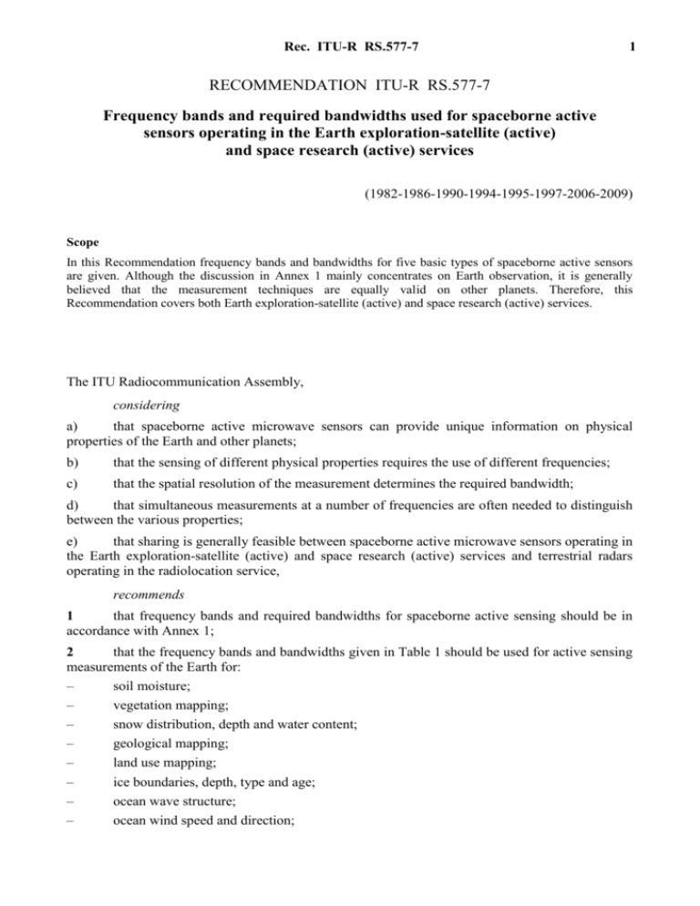
Rec. ITU-R RS.577-7 1 RECOMMENDATION ITU-R RS.577-7 Frequency bands and required bandwidths used for spaceborne active sensors operating in the Earth exploration-satellite (active) and space research (active) services (1982-1986-1990-1994-1995-1997-2006-2009) Scope In this Recommendation frequency bands and bandwidths for five basic types of spaceborne active sensors are given. Although the discussion in Annex 1 mainly concentrates on Earth observation, it is generally believed that the measurement techniques are equally valid on other planets. Therefore, this Recommendation covers both Earth exploration-satellite (active) and space research (active) services. The ITU Radiocommunication Assembly, considering a) that spaceborne active microwave sensors can provide unique information on physical properties of the Earth and other planets; b) that the sensing of different physical properties requires the use of different frequencies; c) that the spatial resolution of the measurement determines the required bandwidth; d) that simultaneous measurements at a number of frequencies are often needed to distinguish between the various properties; e) that sharing is generally feasible between spaceborne active microwave sensors operating in the Earth exploration-satellite (active) and space research (active) services and terrestrial radars operating in the radiolocation service, recommends 1 that frequency bands and required bandwidths for spaceborne active sensing should be in accordance with Annex 1; 2 that the frequency bands and bandwidths given in Table 1 should be used for active sensing measurements of the Earth for: – soil moisture; – vegetation mapping; – snow distribution, depth and water content; – geological mapping; – land use mapping; – ice boundaries, depth, type and age; – ocean wave structure; – ocean wind speed and direction; 2 – – – – – – – – Rec. ITU-R RS.577-7 mapping of ocean circulation (currents and eddies); oil spills; geodetic mapping; rain rates; cloud height and extent; surface pressure; measurement of biomass in tropical forests; etc. TABLE 1 Frequency band as allocated in Article 5 of the Radio Regulations Application bandwidths Scatterometer Altimeter 432-438 MHz 5-500 kHz 3 100-3 300 MHz Cloud profile radar 20-85 MHz 200 MHz 20-200 MHz 5 250-5 570 MHz 5-500 kHz 320 MHz 20-320 MHz 8 550-8 650 MHz 5-500 kHz 100 MHz 20-100 MHz 9 300-9 900 MHz 5-500 kHz 300 MHz 20-600 MHz 13.25-13.75 GHz 5-500 kHz 500 MHz 17.2-17.3 GHz 5-500 kHz (1) 0.6-14 MHz 0.6-14 MHz 24.05-24.25 GHz 35.5-36 GHz Precipitation radar 6 MHz 1 215-1 300 MHz (1) Imager 0.6-14 MHz 5-500 kHz 500 MHz 0.6-14 MHz 78-79 GHz 0.3-10 MHz 94-94.1 GHz 0.3-10 MHz 133.5-134 GHz 0.3-10 MHz 237.9-238 GHz 0.3-10 MHz See the relevant decision of WRC-07. Rec. ITU-R RS.577-7 3 Annex 1 Factors related to determination of frequency bands and required bandwidths used for spaceborne active sensing 1 Introduction Active sensors differ from passive sensors in that they illuminate the object under observation and respond to the reflected energy. There are 5 basic types of active sensors: – scatterometers; – altimeters; – imagers (synthetic aperture radars); – precipitation radars; – cloud profile radars. Radar scatterometers are useful for determining the roughness of large objects. When operating at frequencies higher than 300 MHz, the scatterometer measures the amount of backscatter from the surface roughness in broad categories ranging from smooth to very rough. At frequencies around 200 MHz, reflectivity depends upon the dielectric constant of the object; at lower frequencies, reflectivity depends primarily upon electrical conductivity. These lower frequencies can be used to penetrate the surface of the Earth to detect sub-surface structures. Radar altimetry has yielded three possible operation concepts for practical systems. One of these techniques is based upon the use of a very narrow beamwidth (2 mrad) and a very short transmitted pulse (2 ns). Timing of the round-trip delay of the transmitted pulse leading edge is used to provide altitude information. A technique that is similar to the short pulse system is the pulse compression technique. A short impulse pulse generates a longer frequency modulated pulse and the return, which has a wide bandwidth, is compressed back to a short pulse which is then leading edge detected. The third technique requires moderate antenna size and spacecraft stabilization, with radar return from the nadir point obtained by a time-gating technique. In this system, altitude information is extracted by measuring the centroid of the early portion of the radar waveform rather than the leading edge of a very short pulse. Radar imaging systems are employed to produce high resolution images required by users in such fields as geology, oceanography and agriculture. To achieve reasonable resolution from space, synthetic aperture focused radars will be employed for many applications as they have resolutions independent of range. In the area of meteorology scanning Doppler radars may also be employed. Knowledge of the global rainfall and cloud distributions is required to understand and predict global climate change. Microwave sensors have a clear advantage over visible/infrared sensors in that they have the capability to penetrate the cloud cover, thereby providing direct information of rain and cloud volume. Active sensors are especially important because they are the only instruments which provide vertical rain and cloud structures, and therefore are essential to study large-scale atmospheric circulation and the radiation budget. Moreover, the active sensors can provide quantitative rain and cloud information independent of the microwave emission properties of background surfaces. 4 Rec. ITU-R RS.577-7 Active remote sensing in the microwave region offers several advantages over visible region sensors and passive microwave sensors. Besides being uniquely sensitive to several land/ocean/atmosphere variables (e.g. plant moisture and cloud height), active sensing can, for instance, penetrate the surface and vegetation, operate on an all-weather, day/night basis, attain high spatial resolution (synthetic aperture radar (SAR)) enhance features by changing the illumination angle, and operate over broad spectral ranges independently of emissions from narrow-band phenomena. Active sensors illuminate the object under observation and respond to reflected energy. In order to gather information concerning the Earth’s surface from space, the transmitted signal must traverse the atmosphere twice. As a result the electromagnetic absorption and scattering properties of the atmosphere play an important role in determining the spectral regions suitable for active remote sensors. Severe atmospheric attenuation is confined to the shorter wavelengths, and for this reason, active sensors usually operate below the 60 GHz oxygen absorption region and also avoid the spectral region near the 22 GHz water vapour line. Electromagnetic scattering by precipitation and clouds can present a more serious problem than atmospheric absorption. Echoes from water droplets increase with droplet diameter and decrease with increasing wavelength. Thus, at longer wavelengths clouds give little echo, but precipitation can give somewhat stronger echoes because of the larger particle diameters of the rain drops. Several aspects of active sensor research, particularly as it relates to the choice of frequencies for measuring Earth-oriented variables from a space platform, are presented below. It should be noted in determining optimal frequencies that, due to the broad frequency response range of various phenomena of interest, there is often a need for simultaneous measurements at several frequencies so that contributions of the radar return from different sources can be separated. The radar return from any surface is a function of radar frequency, surface roughness, surface dielectric properties, angle of incidence and aspect, and sub-surface microstructure. In each of the applications listed, the energy reflected back to a radar sensor is strongly affected by at least one backscattering mechanism related to the measured phenomenon. In general, these are: oceanic roughness (used in the study of ocean structure and winds over sea surfaces); O2 absorption (used in determining surface pressure over oceans); and surface roughness and dielectric constant variations (used in studies of ice, snow and land parameters). 2 Active sensing of ocean and ocean winds Oceanic active sensor studies are dominated by wave structure determination, sea-surface wind measurements and ocean current investigations. Generally the reflected microwave energy is due to ocean roughness: specifically, the radar return is a function of diffraction effects from both large gravity waves and small capillary, surface-tension ripples riding on large-scale waves, and foam. The amount of reflected radiation due to each of these effects observed by an active sensor depends on the sea state and the particular active measurement technique. Work at several frequencies within the 3-30 GHz range has shown that the effects of large gravity waves dominate at near-normal incidence and those of capillary waves at incidence angles greater than 20. Thus to sense sea roughness (a function of the very breeze-dependent ripples) and the size and direction of long-lived gravity waves (coarse sea structure), a two-way component concept is used. In the study of ocean surface winds (important in weather prediction models), the underlying principle is that ocean roughness is a gauge by which wind variables can be inferred, since the small roughness elements which convey the transfer of momentum from the wind to the sea are in at least near equilibrium with the wind. Rec. ITU-R RS.577-7 5 Using variable frequencies, polarizations and incidence angles, investigators can infer details of ocean surface wind, significant wave height and mean square wave slopes, an accomplishment beyond the capabilities of passive sensing. Experiments have shown that good wind speed sensitivity is obtained at frequencies near 14 GHz and that there is a reduced sensitivity to wind speed at 1.3 GHz. SARs have shown promise in coarse ocean structure measurements (average significant wave height). One design employs four frequency bands in the 1-10 GHz range and three polarizations with wide-swath and multiple-incidence angle capabilities. Ocean oil slicks suppress short-wavelength ocean waves and therefore the slick area can be discriminated from the surrounding clean surface by microwave imaging radars. Altimeters have been used successfully from a number of satellites over the world’s oceans. For oceanographic studies, an altimeter system having an overall range measurement precision better than 2 cm is required. To achieve 2 cm precision will require removal of the range errors due to ionospheric electron content which cause errors as great as 22 cm at 13.5 GHz. A two-frequency altimeter system can eliminate the range uncertainty due to the ionosphere. A two-frequency altimeter system can also provide accurate measurements of continuous swaths of the ionospheric electron content, measurements which are not available today over large regions of the Earth’s oceans. A region of the spectrum, separated by more than an octave from the 13.25-13.75 GHz band, would be a suitable choice for the second frequency. The second frequency could be selected around 5 GHz, with the main frequency remaining near 14 GHz. It is thought that in the longer term, higher frequencies around 35 GHz will also be used. It can thus be seen that several frequencies have proven useful for the remote active sensing of ocean-wave structure. Due to high wind speed dynamic range and the relative absence of atmospheric effects, wind speed measurement technology has converged on the 10-15 GHz region. 3 Active sensing of ice-covered surfaces Investigations indicate that the following types of ice variables are amenable in varying degrees to active microwave sensing: ice-type (young, old, etc.), surface roughness, concentration, floe size and number, water openings, drift, surface topology, pressure characteristics, thickness and changes in nature and in distribution of types. Based on these studies, a frequency between 3-30 GHz appears to be the best for determining sea-ice types. A radar frequency in the range 0.3-3 GHz is useful in resolving ambiguities resulting from measurements of thin ice, especially when utilized in conjunction with radars between 3-30 GHz. Higher frequencies are also under consideration. The most important spaceborne active microwave sensors for sea-ice application are the SAR, radar altimeter and radar scatterometer. Satellite research on sea-ice has been primarily carried out by SAR at 1.3 GHz. Airborne synthetic aperture radar imagery (1.3 and 9.6 GHz) has shown that in some cases, including sea-ice mapping, the higher frequency channel is preferable. Although the interpretability of sea-ice imagery does improve with higher frequencies, there is no question of the usefulness of the product at 1.3 GHz. Altimeters have been used to map sea-ice parameters and the height of the Greenland ice-cap. Currently, remote sensing of the Earth from space is generally limited to a thin superficial layer, while many issues related to climate, Earth resources or risk monitoring require information over greater depths. Radars operating at frequencies near 435 MHz offer, under certain circumstances, the possibility of imaging through ice layers down to the bed(rock), which could be over 4 km depth. To model global ice sheet dynamics and mass balance (accumulation of snow and losses 6 Rec. ITU-R RS.577-7 through melt and iceberg calving) over longer periods (100 to a few 100 000 years), it is essential to have a complete coverage of the Antarctic ice sheet with observations of homogeneous quality, which can be best accomplished using a spaceborne platform employing such as a nadir ice sounder. 4 Meteorological and climatological observations The knowledge gained in ground-based and airborne measurement of rainfall, storm features and pressure fields in weather prediction models has also been extended to spaceborne systems. The techniques are based upon changes in clear atmosphere refractive index due to rain-related features or differential reflectivities of multi-frequency echoes. Studies carried out with orthogonally polarized radars and multiple, narrow-beam coverage at several frequencies between 2 and 37.5 GHz have been able to measure precipitation rate, intensity, spatial distribution, drop size and surface pressure over oceans and wind movements within storms. There are several factors constraining frequency choices. A combination of bands must be chosen to match minimum sensitivity and spatial resolution, yet not be swamped by ground echo at needed viewing angles. Only downward-looking scanning pencil beams (as opposed to azimuthal or cross-track fan beams) have the capacity to infer rainfall intensity from altimeter estimates of the freezing layer. Single and multi-frequency approaches to the measurement of rain attenuation as well as radar reflectivities have the capability for quantitative retrieval of vertical precipitation profiles from satellites. A frequency near 94 GHz is preferred and used for spaceborne cloud profile radars based upon the following factors: minimum detectable cloud reflectivity, propagation and scattering, resolution, antenna beam interference, previous work and technology. The reflectivity of marine stratus clouds, which are very important to the determination of the Earth’s radiation budget, may be as low as –30 dBZ, a level 70 dB below the reflectivity of rain (10 mm/h). The objective of a spaceborne cloud profiling mission is to measure the reflectivity profile for all clouds within the field of view having a reflectivity as low as –30 dBZ. A frequency near 94 GHz is needed to measure this reflectivity level while also meeting along track resolution objectives. A large amount of experimental work in the form of ground-based and airborne radar systems development and data collection has been done near 94 GHz. Along with this hardware development has been computational work aimed at studying the behaviour of non-Rayleigh scatterers near 94 GHz. 5 Active sensing of vegetation cover and soil moisture Interest in active sensing of soil moisture arose due to the limited spatial resolution of passive sensors. The amount of reflected radar power from the soil depends on soil roughness and dielectric constant, vegetation cover and incidence of the transmitted microwave beam. Early laboratory studies showed that soil moisture affects reflectivity of the soil due to changes in soil dielectric constant. Incidence angles less than 45 can help distinguish roughness returns from moisture returns. Research, which utilized 4.7, 5.9 and 13.3 GHz, indicates that a satellite scatterometer system operated at 4.7 GHz with 5 to 17 incidence angles could adequately distinguish soil moisture returns from those of vegetation cover and roughness. However, additional frequencies are needed when vegetation cover is a factor or when sub-soil measurements are required. On the other hand, vegetation cover has been studied as an objective, particularly in crop identification experiments, where soil returns become an obscuring factor. Both imagers and scatterometers have been used with the reflected power from vegetation being related to vegetation roughness, moisture and dielectric constant, and viewing angle. Results of these investigations indicate that satellites can be useful in active sensor identification of crops and forests, of land use patterns (range, forest, etc.) and of watershed parameters. Multi-spectral, multi-polarization, multi-temporal schemes of observation at high incidence angles (to minimize soil returns) have Rec. ITU-R RS.577-7 7 yielded promising results in research at 1.3, 5.9, 9.0, 9.4, 13, 16, and 35 GHz. Crop classification can be improved by taking growing periods into account, by employing several frequencies and by repeating measurements over several weeks. Because of the increased penetration into dense vegetation near 400 MHz and increased scattering information, near 400 MHz airborne radars have been used in tropical areas, where vegetation tends to be densest, to aid measuring woody biomass in the tropical forests. These radars have been applied to not only analysing deforestation and reforestation, but also to measure above-ground woody biomass. In several sites of boreal and temperate forests, near 400 MHz horizontalhorizontal, horizontal-vertical and vertical-vertical polarization data produced estimates of total above-ground dry woody biomass within 12% to 27% of the actual biomass, depending on forest complexity. In tropical forests, near 400 MHz radar can assist in estimating their forest biomass and provide results unachievable by any other means, even though biomass levels largely exceed 20 kg/m2. Surface penetration near 400 MHz is deeper than for 1 250 MHz by a factor of 8 to 10, and is thus most favourable for Earth penetration studies. It may be possible, using near 400 MHz imaging radars, to document geologic history and climate change within the world’s larger deserts using maps of buried fluvial systems and their surrounding topography and to model regional-scale tectonics in semi-arid regions of the world using maps of surface and buried geologic structures, such as faults, fractures, synclines, and anticlines. 6 Bandwidth requirements for active sensing Bandwidth requirements for active sensors vary with the type of sensor, i.e. SAR, real aperture radar, scatterometer, altimeter or rain and cloud radar. In all cases, the bandwidth is determined by the required range resolution and is equal to: B 1 c 2R (1) where: B: bandwidth (Hz) : pulse duration (equivalent to the inverse of the pulse compression bandwidth) (s) speed of light (m/s) c: R : range resolution along the radar beam (m). It is noted that the range resolution on the surface (or cross-track resolution) of side-looking radars is given by R/cos d, where d is the depression angle from satellite, or equivalently, arrival angle at the Earth. For instance, a bandwidth of 100 MHz gives a value of 1.5 m for R , the range resolution along the radar beam, and at a depression angle of 60, this range resolution on the surface R/cos d is 3 m. For a bandwidth of 500 MHz for finer resolution, this gives a value of 0.3 m for R , and at a depression angle of 60, this range resolution on the surface is 0.6 m. In the case of rain and cloud radars where a large number of independent samples should be obtained in a short dwell time at each scan position, the frequency agility technique may be employed. In this case, the total bandwidth of the radar will require B Nf or more (Nf is the number of frequency channels in the frequency agility system), considering the frequency separation to keep necessary isolation between the radar receiver channels. 8 Rec. ITU-R RS.577-7 In conclusion, a bandwidth of 100 MHz would be compatible with a large majority of applications envisaged by scientists for spaceborne active microwave sensors except altimeters and fine resolution synthetic aperture radars, for which larger bandwidths are required. 7 Summary of frequency bands and necessary bandwidths for active sensing Although active microwave sensing technology is advancing rapidly and much still needs to be learned, a set of frequency bands can be defined which satisfy measurement requirements and provide for multi-frequency measurements needed to separate signal contributions from different sources. Sharing considerations dictate that specific frequency bands for active sensors should be in bands shared with the radiolocation service. Thus, frequency bands for active spaceborne sensor measurements fall near 435 MHz and near 1, 3, 5, 10, 14, 17, 24, 35, 78, 94, 133 and 238 GHz. A bandwidth of 100 MHz is appropriate for most applications using active sensor instruments other than fine resolution synthetic aperture radars and altimeters. Altimeter measurements may need up to 500 MHz bandwidth to satisfy accuracy requirements, but, at present, this requirement can be accommodated only in the bands allocated near 14 and 35 GHz for active sensing. A second frequency band, with 500 MHz bandwidth would achieve 2 cm precision for the application of altimeters to oceanography. Another frequency band which would be useful for achieving this precision is, for instance, around 5 GHz. For a synthetic aperture radar bandwidth of 500 MHz for finer resolution, at a depression angle of 60, this range resolution on the surface is submeter at 0.6 m. A minimum bandwidth of 6 MHz near 435 MHz is sufficient for applications using SAR for measurements of soil moisture and biomass and for documentation of geologic history and climate change by measuring the extent and thickness of the global ice sheets and the subsurface mapping of arid and semi-arid regions.
