Total Field Project Cost (Years 1-4): $3171361
advertisement
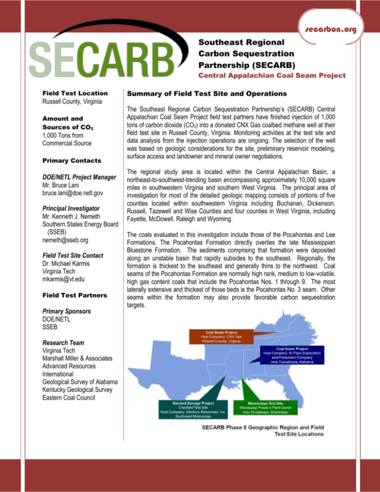
secarbon.org Southeast Regional Carbon Sequestration Partnership (SECARB) Central Appalachian Coal Seam Project Field Test Location Russell County, Virginia Amount and Sources of CO2 1,000 Tons from Commercial Source Primary Contacts DOE/NETL Project Manager Mr. Bruce Lani bruce.lani@doe.netl.gov Principal Investigator Mr. Kenneth J. Nemeth Southern States Energy Board (SSEB) nemeth@sseb.org Field Test Site Contact Dr. Michael Karmis Virginia Tech mkarmis@vt.edu Field Test Partners Primary Sponsors DOE/NETL SSEB Research Team Virginia Tech Marshall Miller & Associates Advanced Resources International Geological Survey of Alabama Kentucky Geological Survey Eastern Coal Council Summary of Field Test Site and Operations The Southeast Regional Carbon Sequestration Partnership’s (SECARB) Central Appalachian Coal Seam Project field test partners have finished injection of 1,000 tons of carbon dioxide (CO2) into a donated CNX Gas coalbed methane well at their field test site in Russell County, Virginia. Monitoring activities at the test site and data analysis from the injection operations are ongoing. The selection of the well was based on geologic considerations for the site, preliminary reservoir modeling, surface access and landowner and mineral owner negotiations. The regional study area is located within the Central Appalachian Basin, a northeast-to-southwest-trending basin encompassing approximately 10,000 square miles in southwestern Virginia and southern West Virginia. The principal area of investigation for most of the detailed geologic mapping consists of portions of five counties located within southwestern Virginia including Buchanan, Dickenson, Russell, Tazewell and Wise Counties and four counties in West Virginia, including Fayette, McDowell, Raleigh and Wyoming. The coals evaluated in this investigation include those of the Pocahontas and Lee Formations. The Pocahontas Formation directly overlies the late Mississippian Bluestone Formation. The sediments comprising that formation were deposited along an unstable basin that rapidly subsides to the southeast. Regionally, the formation is thickest to the southeast and generally thins to the northwest. Coal seams of the Pocahontas Formation are normally high rank, medium to low-volatile, high gas content coals that include the Pocahontas Nos. 1 through 9. The most laterally extensive and thickest of those beds is the Pocahontas No. 3 seam. Other seams within the formation may also provide favorable carbon sequestration targets. Industrial Partners Alpha Natural Resources AMVEST Buckhorn Coal CNX Gas CONSOL Energy Denbury Dominion Energy Eastman Chemical Equitable GeoMet McJunkin Appalachian Natural Resource Partners Norfolk Southern Penn Virginia Piney Land Pocahontas Land Praxair DEPTH 1000 GR The sediments comprising the Lee Formation unconformably overlie Pocahontas Formation strata within the study area. Overall, the thickness of the formation decreases from southeast to northwest reflecting the progradation of the deltas from a southeastern source area across the basin to the northwest. The major seams recognized for the Lee Formation include the Upper Seaboard, Greasy Creek, Middle and Lower Seaboard, Upper and Middle Horsepen, C-Seam, War Creek and Lower Horsepen coals. The Lee Formation coals are typically medium to lowvolatile bituminous in rank within the study area. The Lee and Pocahontas Formation coals are favorable reservoirs for carbon sequestration due to their thickness, depth, rank and permeability characteristics. For the field validation test, an existing coalbed methane (CBM) well was converted for CO2 injection. The surface of the proposed site is mountainous terrain at 2,000’ above sea level that was previously strip-mined. Access to the site will be on coal strip roads and the off-set monitor well sites will be on a stable strip bench and an existing well location. This will allow for minimal land disturbance. The targeted coal seams are in the Pocahontas and Lee formations and include the Pocahontas Nos. 3 - 9 coal seams. The formation depth is approximately 2,200 feet to bottom of formation. The targeted coal seams range from 1,400-2,250 feet deep. The regional dip of the targeted coal seam at the proposed site dips 1.4 feet per 1,000 feet from West to East and 1.2 feet per 1,000 feet from South to North. The thickness of the twenty targeted seams range from 0.5 – 2..2 for a total thickness of 26.4 feet of coals completed for CBM production at the well site . The gas contents of these coals range from 113 – 438 standard cubic feet per ton on a dry, mineral matter free basis. The average temperature of the bottom coal seam across the area is 74 degrees Fahrenheit. The permeability ranges from 5-20 millidarcies in the producing coal seams throughout the area. The porosity is approximately one percent in the producing coal seams. Salinity values range from 40,000 – 130,000 parts per million. DENSITY 1100 1200 1300 1400 1500 1600 ** * 1700 LEE FORMATION INJECTION TEST NET COAL: 8.2 FEET * 1800 LEE FORMATION POCAHONTAS FORMATION 1900 LEGEND COAL SANDSTONE 2000 SHALE The targeted coal seams are commonly interbedded with carbonaceous shale. These geophysically identified shale layers above the coal seams are known seals that will contain the CO2 injected into the target coal seams. A structure map was generated that includes thrust faults, transverse faults, anticlines and synclines. The potential leakage points could include these fault systems and networks, joint systems or existing borehole penetrations related to CBM or natural gas production. The modeled CO2 plume based on the injection plan will not reach these potential leakage points. INJECTION ZONE * PERFORATED ZONE 2100 * * 2200 * POCAHONTAS FORMATION INJECTION TEST NET COAL: 6.4 FEET * 2300 Figure 1. Field Validation Test Site Injection Zones 2 The principal construction requirements under this program included the drilling of one core hole and one monitor well and the installation of monitoring apparatus. Two wells were drilled around the injection well, one at 135 feet and another at 285 feet from the injection well. Cores from the coals were removed for analysis and the core hole was converted into a monitor well. Isolation packers and monitoring equipment were installed to observe reservoir pressure and gas composition during injection of CO2. The injection operation included the injection of 1,000 tons of CO2 into the stacked coal seams over a one month period. Injectivity was higher than anticipated with an average of more than 40-tons injected per day. Results show that the CO2 plume extended to both monitor wells, and gas samples at all off-set wells showed the presence of the injected tracer. Southeast Regional Carbon Sequestration Partnership, Phase II Central Appalachian Coal Seam Project The formation is very well characterized based on core hole data and immense amounts of geophysical data throughout the area. The following two figures illustrate a geologic stratigraphic column (Figure 1) showing the target formation and potential seals of the proposed field validation test site and the location of the test site (Figure 2). Figure 2. Field Validation Test Site Research Objectives The objectives under this field validation test are to assess and to verify the sequestration capacity and performance of mature CBM reservoirs in the Central Appalachian Basin through injection-falloff and production testing, as well as the implementation of subsurface monitoring programs. These tests will demonstrate the potential geologic sequestration into Appalachian coals as a safe and permanent method to mitigate greenhouse gas emissions. The objectives of the project are directly related to the following tasks: expanded geologic characterization, pilot site selection, reservoir modeling, core hole drilling and evaluation, pilot preparation and risk analysis, pilot testing and injection operations, data interpretation and assessment, and public outreach and technology transfer. 3 Southeast Regional Carbon Sequestration Partnership, Phase II Central Appalachian Coal Seam Project Summary of Modeling and Monitoring, Verification and Accounting Efforts Reservoir modeling activities are lead by a team from Advanced Resources International using their COMET3 reservoir simulator, the industry-leading choice for desorption-influenced reservoirs. Reservoir modeling is an important component in understanding the mechanisms involved in carbon sequestration within coal seams. Four types of reservoir modeling efforts will be necessary during the course of the project. These will be: (1) review of the selected primary injection sites within the Central Appalachian Basin; (2) rigorous history matching and assessment of the preferred CO2 injection sites, including numerous sensitivity runs, prior to CO 2- sequestration demonstration; (3) midcourse reservoir modeling to assess the performance of the project against expectations, enabling mid-course corrections to be made; and, (4) post-project history matching and performance prediction of the CO2- sequestration pilots and their implications to CO2 storage in the basin. The post-project history matching is currently underway. The monitoring and verification program focused on both surface and deep well monitoring and includes water composition, soil analysis, subsurface pressure and well log analysis. After the two wells were drilled at each test site, they were converted into deep monitor wells. Packers were installed to isolate coal zones and reservoir pressure and gas composition (CO2 and CH4) was monitored. Pressure response and gas composition will be mapped using the data from the observation wells, and reservoir models will be refined on the basis of the data. The following table summarizes the surface MMV activities ongoing at the site, including work being conducted by DOE’s National Energy Technology Laboratory. Table 1. Surface Measurement MMV Methods/Parameters SURFACE AND NEAR SURFACE MONITORING Monitoring Phase Measurement Method/Parameter Research group* Pre-injection Injection Post-injection Soil Gas Composition DOE/NETL Soil CO2 Flux VCCER Soil CH4 Flux VCCER Soil Moisture And Temperature VCCER Geo-Microbiology Ambient CO2 Concentrations VCCER Ambient CH4 Concentrations VCCER Meteorological Data VCCER Water Quality VCCER DOE/NETL Introduced Tracers VCCER Carbon Isotopes DOE/NETL Vegetative Stress VCCER * DOE/NETL - US Department of Energy/National Energy Technology Laboratory VCCER - Virginia Center for Coal and Energy Research / Virginia Tech 4 Southeast Regional Carbon Sequestration Partnership, Phase II Central Appalachian Coal Seam Project Accomplishments to Date 1. A detailed regional assessment of the Central Appalachian Basin potential carbon sequestration capacity and enhanced CBM recovery has been completed. 2. A comprehensive suite of production maps for the active CBM wells in the Central Appalachian Basin has been performed and finalized. 3. Preliminary reservoir modeling on field validation test site has been completed. 4. Site selection of the field validation test site has been completed. 5. MMV activities ongoing at the site starting in March 2008. 6. Groundbreaking at the site in August 2008 that includes drilling and coring monitoring wells for geological characterization. 7. Injection commenced in January 2009 and successfully injected 1,000 tons of CO2 into the coal-bearing formations. 8. Monitoring activities have verified the CO2 has remained in the coal seams, but gas analysis has shown that the injected tracer is present in the off-set producing CBM wells. 9. A technology transfer and outreach program has been initiated that includes a website, publications and numerous technical and non-technical presentations at conferences and workshops. Target Sink Storage Opportunities and Benefits to the Region The most favorable areas delineated for the proposed Central Appalachian sequestration field test are located within the coalbed methane production region in Buchanan, Dickenson, Russell, Tazewell and Wise Counties, Virginia, and in Fayette, McDowell, Raleigh and Wyoming Counties, West Virginia. Economic production in the Central Appalachian region began in 1988 with the development of the Nora CBM field by Equitable Production Company, located primarily in Dickenson County, Virginia. CONSOL Energy later commenced drilling CBM wells in the prolific Oakwood Field located in Buchanan County, Virginia, in 1990. Since that time, over 4,000 CBM wells have been drilled and completed through year-end 2005 in the Central Appalachian Basin. The prospective coal seams are known to be high rank (low to medium volatile bituminous), have high gas contents and occur at favorable depths for storage. CBM development in 5 Southeast Regional Carbon Sequestration Partnership, Phase II Central Appalachian Coal Seam Project the area has provided extensive geological, engineering and production data, which will be made available for reservoir modeling. The CBM productivity of the province indicates that coal permeabilities should be acceptable for carbon dioxide injection. The sequestration capacity assessments for the Central Appalachian basin indicate 1,341 Million tons (MMt) of carbon dioxide storage capacity, with 398 MMt deemed technically feasible for sequestration projects. The corresponding enhanced CBM recovery potential of these coals is 0.79 – 2.49 trillion cubic feet (TCF) of gas production. Sources of CO2 in the area are large coal-fired power plants that maybe able to supply CO2 for sequestration projects. If the technology proves successful, the possibility exists for large economic development gains in the form of enhanced CBM production and carbon sequestration industries for the region. Cost Field Project Key Dates Total Field Project Cost (Years 1-4): DOE Share: $2,524,470 Non-DOE Share: $646,891 $3,171,361 80% 20% Baseline Completed: Site Selection Completed: Drilling Operations Began: Installed Monitoring Equipment: Injection Operations Began: Site Closure: Post-injection Monitoring Completed: 01/2007 10/2007 08/2008 12/2008 01/2009 10/2009 1 12/2010 Field Test Schedule and Milestones (Gantt Chart): The field test schedule for SECARB’s Central Appalachian Coal Seam Project can be seen in the following diagram and Gantt Chart. Tasks Year 1 Year 2 Year 3 Year 4 Q1 Q2 Q3 Q4 Q1 Q2 Q3 Q4 Q1 Q2 Q3 Q4 Q1 Q2 Q3 Q4 2.1 Project Definition 2.2 Design 2.3 Implementation 2.4 Operations 2.5 Closeout/Reporting Tasks Completed Tasks to be Completed This material is based upon work supported by the U.S. Department of Energy National Energy Technology Laboratory under DE-FC26-04NT42590. 6 Southeast Regional Carbon Sequestration Partnership, Phase II Central Appalachian Coal Seam Project

