Latin America: Physical Geography
advertisement
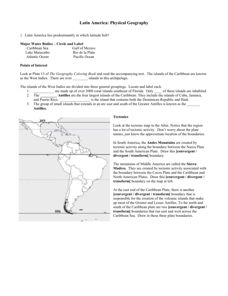
Latin America: Physical Geography 1. Latin America lies predominantly in which latitude belt? Major Water Bodies – Circle and Label Caribbean Sea Gulf of Mexico Lake Maracaibo Rio de la Plata Atlantic Ocean Pacific Ocean Points of Interest Look at Plate 13 of The Geography Coloring Book and read the accompanying text. The islands of the Caribbean are known as the West Indies. There are over ________ islands in this archipelago. The islands of the West Indies are divided into three general groupings. Locate and label each. 1. ___________ are made up of over 2000 coral islands southeast of Florida. Only ____ of these islands are inhabited. 2. The _________ Antilles are the four largest islands of the Caribbean. They include the islands of Cuba, Jamaica, and Puerto Rico. ________________ is the island that contains both the Dominican Republic and Haiti. 3. The group of small islands that extends in an arc east and south of the Greater Antilles is known as the _______ Antilles. Tectonics Look at the tectonic map in the Atlas. Notice that the region has a lot of tectonic activity. Don’t worry about the plate names; just know the approximate location of the boundaries. In South America, the Andes Mountains are created by tectonic activity along the boundary between the Nazca Plate and the South American Plate. Draw this [convergent / divergent / transform] boundary. The mountains of Middle America are called the Sierra Madres. They are created by tectonic activity associated with the boundary between the Cocos Plate and the Caribbean and North American Plates. Draw this [convergent / divergent / transform] boundary on the map at left. At the east end of the Caribbean Plate, there is another [convergent / divergent / transform] boundary that is responsible for the creation of the volcanic islands that make up most of the Greater and Lesser Antilles. To the north and south of the Caribbean plate are two [convergent / divergent / transform] boundaries that run east and west across the Caribbean Sea. Draw in these three plate boundaries. Landforms Middle America is dominated by _________ landforms. This includes most of the islands of the West Indies. Exceptions include the Yucatan Peninsula, the western two-thirds of Cuba, and the Bahamas. The landform of all of these areas is ________________ One of the global phenomena that led Alfred Lord Wegener to the theory of plate tectonics was the fact the east coast of South America looks like it would fit right into the west coast of Africa. That’s because the two used to be part of the same supercontinent. As in Africa, the dominant landform of most of eastern South America is shield. Just as in Africa, these shield areas form _________ topography. In South America, there are two distinct shield areas. These are separated by the ____________ River, the largest river by volume in the world North of the Amazon, these higher plateaus are called the Guiana Highlands. The plateau area south of the Amazon is the Brazilian Highlands. Mark these two areas on the map. There are also outcroppings of shield in southern Argentina. All shield areas are dominated by ancient [igneous / metamorphic / sedimentary] rock. As in Africa, the soils associated with these plateau areas are generally [fertile / infertile]. Shield areas correspond to the number _________ on the map at above. The shield areas have important deposits of [fuel / non-fuel] minerals. Brazil, which contains most of the shield landforms, is a major mining country. Brazil mines about 20% of the world’s iron ore and manganese. It is also a major exporter of semi-precious gemstones – like those sold by the pound at tourist stores. Latin America has much [more /less] sedimentary cover than Africa. The largest areas lie in South America and are associated with the Amazon River Valley and areas just east of the Andes Mountains. Look at the fuel mineral map on pages 58-59 of the Goodes World Atlas. Notice that the largest arrow comes from an area called Maracaibo. Venezuela controls about 5% of the world’s total petroleum reserves. Most of these are concentrated in Lake Maracaibo. This is the second largest petroleum reserve (the Persian Gulf is the largest). Petroleum wealth gives Venezuela (and its political leaders) an enormous amount of clout. It is likely that there are petroleum deposits associated with the Amazon Basin, but exploration of this area has just begun. The rivers of Latin America are more navigable than those of Africa. Why? The major river of Latin America and the biggest river in the world is the _______________________. Circle and label it on your map above. The Rio de la Plata is an estuary like the Chesapeake Bay. It is located between the countries of _________________ and ________________. Circle and label the Rio de la Plata on the map. The Rio Grande forms the eastern border between the United States and Mexico. Circle and label it on the map. CLIMATES High and Low Pressure [Low / high] pressure is dominant over the Equator. [Low / high] pressure belts (20-30° north and south latitude) fall over and the north Caribbean in the north and over Chile, Argentina and Paraguay in the south. Tropical rainforests correspond to the letter ___ on the map at left. In South America, tropical rainforests are found in the Amazon Basin, a coastal strip on the northwest extending from Ecuador through Colombia, and the southeast coast of Brazil. Tropical rainforest is also found on the east coast of Central America, south of the Yucatan Peninsula. Tropical savanna areas correspond to the letter ___ on the map at left. The Guiana and Amazon Highlands have tropical savanna climates. In Middle America, tropical savanna climates are found on most of the islands, as well as the west coast south of the Tropic of Cancer. Moving poleward from the tropical savanna areas are steppes and desserts. Steppes correspond to the letter _____ on the map and deserts correspond the letter _____. The largest area of desert and steppes is found in Northern Mexico, beginning around the Tropic of Cancer. The Atacama Desert of South America is one of the driest places in the world. There are places in the Atacama Desert where it has not rained in recorded history. It is located in coastal areas from southern Peru to Northern Chile. Locate and label the Atacama Desert on the map at left. Why is the Atacama Desert so dry? Notice that southern Argentina is dominated by desert and steppe climates because the deserts switch sides as you move from the low to the middle latitudes. Why? The “cone” of South America is located in the middle latitudes. Argentina, Chile and Uruguay are entirely in the middlelatitude belt. On the west side, Chile has two mid-latitude climates. Central Chile, which lies closer to the low latitudes, has _____________ climates (letter ___ on the map) while southern Chile has _______________ climates (letter ____ on the map). So, Chile is quite similar to California with respect to both climate and landform. What agricultural crops do you expect to find in Chile? Why are Chilean soft fruit exports so important to the United States? On the east side, the ______________________ climate is dominant from about the Tropic of Capricorn south into northern Argentina. This corresponds to the letter ____ on the map above. This region is known as the Pampas. It is very similar climatically to the southern part of the United States. Like the southeast of the U.S., the Pampas region should have trees as the natural vegetation, but frequent fires have caused the dominant natural vegetation to be tall grass. It is likely that most of the fires were man made. The Pampas is a major area of livestock ranching, with sheep and cattle the most important exports. Mountain climates correspond to the letter ____ on the map above. They are found in the Andes Mountains. Label the Andes on the climate map above. They are also found in the interior of Central America, from the Tropic of Cancer to the south. Compared to Africa, the mountains in Latin America are much [higher / lower]. Why? Just as in Africa, mountains attract higher population densities in Latin America. Why? Mountains are so important in Latin America that the different altitudinal zones have distinct names. Know the following altitude zones and the dominant crops associated with each zone: tierra caliente, tierra templada, and tierra fria. The most densely populated of the altitudinal zones is the tierra _________________. Why?
