kandiyohi county mining and reclamation site plan form
advertisement
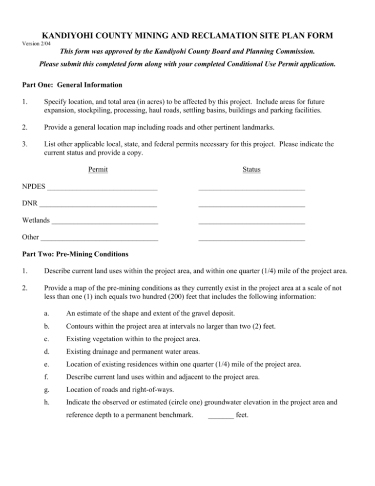
KANDIYOHI COUNTY MINING AND RECLAMATION SITE PLAN FORM Version 2/04 This form was approved by the Kandiyohi County Board and Planning Commission. Please submit this completed form along with your completed Conditional Use Permit application. Part One: General Information 1. Specify location, and total area (in acres) to be affected by this project. Include areas for future expansion, stockpiling, processing, haul roads, settling basins, buildings and parking facilities. 2. Provide a general location map including roads and other pertinent landmarks. 3. List other applicable local, state, and federal permits necessary for this project. Please indicate the current status and provide a copy. Permit Status NPDES ______________________________ _____________________________ DNR ________________________________ _____________________________ Wetlands _____________________________ _____________________________ Other ________________________________ _____________________________ Part Two: Pre-Mining Conditions 1. Describe current land uses within the project area, and within one quarter (1/4) mile of the project area. 2. Provide a map of the pre-mining conditions as they currently exist in the project area at a scale of not less than one (1) inch equals two hundred (200) feet that includes the following information: a. An estimate of the shape and extent of the gravel deposit. b. Contours within the project area at intervals no larger than two (2) feet. c. Existing vegetation within to the project area. d. Existing drainage and permanent water areas. e. Location of existing residences within one quarter (1/4) mile of the project area. f. Describe current land uses within and adjacent to the project area. g. Location of roads and right-of-ways. h. Indicate the observed or estimated (circle one) groundwater elevation in the project area and reference depth to a permanent benchmark. _______ feet. Part Three: Mitigating Impacts 1. Describe measures that will be taken to screen the operation from view, landscaping, and security fencing, if applicable. 2. Describe measures that will be taken to control soil erosion, sedimentation, runoff, dust and noise. If no measures will be used, explain why none are needed. Part Four: Description of Mining Activities and Proposed Mining Methods 1. Briefly describe the products that will be mined from the project area and how they will be mined (i.e., equipment used). 2. Estimate the volume of material in cubic yards to be mined in the period covered by this permit. 3. Estimate the maximum depth of excavation in the period covered by this permit. 4. Describe any recycling of materials that will occur at the site. 5. Describe staging of mining activities. 6. List the commencement and completion date (provide month, day, year) of mining activities and the calendar months, days of the week and hours of the day in which mining activities are expected to occur. Commencement Date: ___________________________ Completion Date: ___________________ Calendar Months: _______________________________ Days of the Week: __________________ Hours of the Day: _______________________________ 7. Describe the processing methods that will be used at the site. 8. Describe the water needed for gravel washing activities, the source of the water, and how the wash water will be disposed. Part Five: Proposed Reclamation This section shall be consistent (at a minimum) with the mining and extraction reclamation provisions set forth in the Kandiyohi County Zoning Ordinance. 1. Describe the type of fill that will be used and depth of restored topsoil. 2. Describe progressive reclamation activities that will occur over the life of the operation, if applicable. 3. Describe proposed reclamation including final slopes, high wall reduction, benching, terracing and other structural slope stabilization measures and when they will take place. 4. Describe anticipated topography, water features and future land use of the site. 5. Describe the methods proposed for the disposal or reclamation of excess materials. 6. Describe or attach a copy of a seeding, planting or re-vegetation plan that includes types, densities, and methods of tree plantings, seed bed preparation, seed mixtures, seeding rates, mulching and other techniques needed to accomplish and establish site stabilization. 7. Provide a reclamation plan map at a scale of no less than one (1) inch equals one hundred (100) feet that includes; the final grade of the site with elevation and contour lines at two (2) foot intervals. 8. The applicant shall provide any other information and exhibits as required by the Zoning Administrator, Planning Commission or County Board necessary to make findings, recommendations and dispositions on the application in order to help protect the public’s health, safety and general welfare. To the best of my knowledge, I certify that the information provided on the application and accompanying documents is true and accurate. Applicants Signature: _____________________________________Date: ______________________________ ** All of the information requested in this form must be submitted along with a completed Conditional Use Permit Application and applicable fees before the County can consider approval.**
