An Expedition to the Seafloor
advertisement
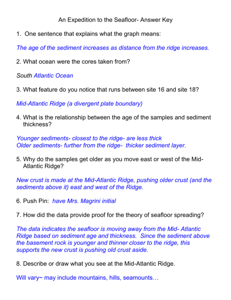
An Expedition to the Seafloor- Answer Key 1. One sentence that explains what the graph means: The age of the sediment increases as distance from the ridge increases. 2. What ocean were the cores taken from? South Atlantic Ocean 3. What feature do you notice that runs between site 16 and site 18? Mid-Atlantic Ridge (a divergent plate boundary) 4. What is the relationship between the age of the samples and sediment thickness? Younger sediments- closest to the ridge- are less thick Older sediments- further from the ridge- thicker sediment layer. 5. Why do the samples get older as you move east or west of the MidAtlantic Ridge? New crust is made at the Mid-Atlantic Ridge, pushing older crust (and the sediments above it) east and west of the Ridge. 6. Push Pin: have Mrs. Magrini initial 7. How did the data provide proof for the theory of seafloor spreading? The data indicates the seafloor is moving away from the Mid- Atlantic Ridge based on sediment age and thickness. Since the sediment above the basement rock is younger and thinner closer to the ridge, this supports the new crust is pushing old crust aside. 8. Describe or draw what you see at the Mid-Atlantic Ridge. Will vary~ may include mountains, hills, seamounts… 9. Describe the end points of the Mid-Atlantic Ridge, including nearest land masses to the northern and southern end points. Going north, the Mid-Atlantic Ridge appears to go through Iceland and over the Arctic Circle ending near Russia. To the south it ends at Antarctica. 10. What different data or more data would you collect to support the seafloor spreading hypothesis? Explain how these data would be useful. (answers will vary) Samples all along the ridge (more north and south of their sites) Samples at other divergent plate boundaries 11. If the Atlantic Ocean is getting larger, what must be happening to the Pacific Ocean on the other side of the world? What type of plate boundary is mostly found near Indonesia and what does this mean? The Pacific must be getting smaller. Indonesia is surrounded by convergent plate boundaries which means the plates are moving toward each other resulting in Subduction of oceanic crust. Calculate the rate of Seafloor spreading Site # 21 20 19 14 15 16 18 17 Rate of Seafloor Spreading (km/m.y.) 1686 km/ 76 m.y. = 22.2 km/m.y. 1303 km/ 67 m.y. = 19.4 km/ m.y. 1010 km/ 49 m.y. = 20.6 km/ m.y. 745 km/ 40 m.y. = 18.6 km/ m.y. 422 km/ 24 m.y. = 17.6 km/ m.y. 221 km/ 11 m.y. = 20.1 km/ m.y. 506 km/ 26 m.y. = 19.5 km/ m.y. 718 km/ 33 m.y. = 21.8 km/ m.y. Convert spreading rates into centimeters per year. (Multiply by 100,000 cm/ 1,000,000 yr) **Or simply move your decimal point one place to the left and round your answer to the nearest tenth! Site # 21 20 19 14 15 16 18 17 Rate of Seafloor Spreading (km/m.y.) 22.2 km/m.y. = 2.2 cm/yr 19.4 km/ m.y. = 1.9 cm/yr 20.6 km/ m.y.= 2.1 cm/yr 18.6 km/ m.y.= 1.9 cm/yr 17.6 km/ m.y.= 1.8 cm/yr 20.1 km/ m.y.= 2.0 cm/yr 19.5 km/ m.y.= 2.0 cm/yr 21.8 km/ m.y.= 2.2 cm/ yr Average rate of Seafloor spreading at the Mid-Atlantic Ridge (according to the data collected by the Glomar Challenger at the 7 sites): = 2.0 cm/ yr
