Telscombe Conservation Area Appraisal
advertisement

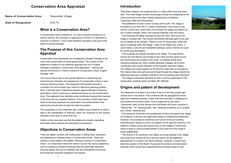
Conservation Area Appraisal Name of Conservation Area : Date of Designation Telscombe Village : 10.8.73 What is a Conservation Area? A Conservation Area is defined as “an area of special architectural or historic interest, the character or appearance of which it is desirable to preserve or enhance.” Such areas therefore represent a key part of the district’s cultural heritage. The Purpose of this Conservation Area Appraisal Conservation Area Appraisals are considered by English Heritage to be vital to the conservation of these special areas. The content of this statement is based on the preferred approach set out in English Heritage’s publication Conservation Area Appraisals – Defining the Special Architecture or Historic Interest of Conservation Areas, English Heritage 1997. The Council has a duty to pay special attention to preserving and enhancing the character and appearance of Conservation Areas in exercising its planning powers. This statement will therefore provide a consistent and sound basis upon which to determine planning applications. It will also help in defending appeals against refusals of planning applications, which could have a detrimental impact on the Conservation Area. This statement also identifies what contributes towards the character of the area and any negative features. This provides a useful base upon which to develop proposals for preservation and enhancement if the opportunity should arise through the planning system. The preparation of the statement also enables local residents to participate in the identification of features, which are important to the special character of the area in which they live. Visitors to the area also may find this statement provides interesting information about special and interesting local features. Objectives in Conservation Areas There are tighter controls over cutting back or felling trees, demolition and alterations or building works in Conservation Areas. These are outlined in more detail in the leaflet “Planning Controls in Conservation Areas”. In Conservation Areas the District Council has various objectives such as seeking to preserve buildings that are historically important, securing design and use of materials that are sympathetic to the area and protecting important vegetation and spaces. Introduction Telscombe village is set unobtrusively in a valley within stunning downland. The small village remains surprisingly remote and isolated given its close proximity to the urban coastal development at Saltdean, Telscombe Cliffs and Peacehaven. The settlement is linear in form running north-south. The village is accessed by car from the C7 Lewes to Newhaven road along a long, narrow country lane, which then runs through the village and peters out into a public footpath, which runs towards Saltdean over the Downs. The buildings are tightly arranged around the road, which gives the village a compact feel. The houses themselves although tight to the road do not appear at all cramped. There is a mix of house types, sizes and uses of buildings within the village. There is the village hall, a farm, a youth hostel, a church and residential buildings, some of which are used for tourist accommodation. Fine buildings are spread throughout the village. The large Manor House and Old Rectory are located to the north and the parish church and Stud House are located to the south. In between these more imposing buildings are many modest attractive cottages, all of which contribute to the overall character of this beautiful downland village. The village unit is tied together by the fine flint walls that run throughout. The mature trees that surround and thread through the village identify the settlement and are in marked contrast to the surrounding open downland. The village is extremely attractive all year round but particularly in the spring when roadside banks are filled with daffodils. Origins and pattern of development The settlement is located in the midst of some of the best quality agricultural land in the district. This combined with its geographical advantages and sheltered situation meant that there has been a settlement in this location since Saxon times. This is supported by the name ‘Telscombe’ itself, as this derives from the British and Saxon variants of Titelscombe – ‘tit’ meaning earth, ‘tieb’ meaning something cut or shaped and ‘combe’ meaning vale. The presence of the farm and proliferation of barns throughout the village are evidence of the key role agriculture played in shaping the settlement. However, the prevalence of barrows and tumuli on the surrounding Downland bear witness to man’s occupation of this area for centuries. The network of paths across the Downs focus on the village of Telscombe, which is likely to have provided shelter on the route from the coast to inland settlements. The church of St Laurence is the oldest surviving building in the village and would have formed its focus and the reason for the additional development of a rectory and other buildings. However, it would have been the erection of the Manor House and its ancillary and associated buildings which would have represented the principle phase of new 2 3 building in the settlement. A rectory, several worker’s cottages and a small classroom followed later when a sufficient population existed in the village. There was a later phase of building centred on Stud Farm in the late 1800s when Ambrose Gorham (trainer of the 1902 Grand National winner ‘Shannon Lass’) became the local squire. With the exception of Stud Farm, Ambrose Gorham forbade any significant new development to take place, instead concentrating on consolidating the village’s facilities, bringing mains water to the village in 1909, electricity in 1930 and building the Village Hall in 1924. Upon his death in 1933 he bequeathed all his land to Brighton Corporation on trust stating that the rural nature of the village must be preserved. Archaeological Interest Telscombe is located on the site of a Saxon Medieval settlement, and consequently the entire hamlet is included within the County Council’s designated ‘Archaeologically Sensitive Area’ (ASA). There is a barrow within this area and many historical artefacts have been found, such as a beaker, a Middle Bronze Age overhanging rimmed urn, loom weights and pot shards from the eleventh or twelfth centuries. The possible remains of a Saxo-Norman hut and Medieval shrunken village are also located within the designation area. Furthermore, to the south of the settlement lies Telscombe Tye cross dyke which is a Scheduled Ancient Monument, and therefore subject to special protection. The Old Rectory The Old Rectory also dates from circa 1840 and is an imposing building constructed in a Tudor Gothic style. The two storey building is set back from the road behind a walled yard, and has three gables with scalloped bargeboards which face the road. The Grade II Listed dwelling is faced with stucco and has a tiled roof. Manor Cottage On the opposite side of the road is Manor Cottage and its outbuildings which are outlying to the Manor House itself. The most notable of these buildings is an eighteenth century, Grade II Listed barn which is located in the garden area, but runs parallel to the road. This is faced with flints with red brick dressings and quoins under a half-hipped slate roof. Oak Cottage Next to the Old Rectory is a small seventeenth century timber framed dwelling known as Oak Cottage. This Grade II Listed building has been refaced with flints with red brick dressings and quoins, and comprises two storeys and an attic with a gabled dormer. Much of the cottage is hidden under ivy and other vegetation. Telscombe Village Club Due to the long history of a settlement in this location, there is a concentration of Listed Buildings within the Conservation Area. Many of the buildings in the village of Telscombe were erected in the seventeenth and eighteenth centuries, with several later examples from the early nineteenth century. There has been no significant development since that time, hence the village is largely unspoilt, and retains much of its original historic character and appearance. The Village Club, although not listed, actively contributes to the character of the Conservation Area. It is located on the eastern side of the road and is a large building faced with unknapped flints and stone dressings (including dripstones). The hall was built in 1924 in a style sympathetic to the older buildings around it, and has a tiled roof and leaded light windows. The Club was given to the villagers by Ambrose Gorham, in order to provide entertainment for the stable lads and girls to stop them going into neighbouring villages and giving racing tips to outsiders. The Club was in operation until the early 1980’s, when it was closed by the Trust of Gorham’s Gift. The Town Council and villagers worked hard to get it returned to the village, and although it is now run as a village hall, for historical reasons the name ‘Telscombe Village Club’ has been retained. Manor House The Old School House When entering the village from the north, one of the first buildings seen is the imposing Manor House on the left side of the road and its ancillary buildings on the east side. This Grade II Listed eighteenth century building has some older work inside. The building comprises two storeys with an attic and was extended in the twentieth century, most notably via the addition of a prominent round tower faced with flints. The building has a clay tiled roof and is faced with a variety of materials, including stucco on the north elevation, flint on the southern end, and stone detailing and dressings (for instance around the windows) though much of the walls are hidden under ivy. The village of Telscombe once included a school, which was accommodated in a small cottage on the western side of the road. This is now known as The Old school House, which dates from circa 1840 and comprises one storey and an attic with dormers. This property is faced with stucco and has a clay tiled roof. Next to this is a nineteenth century barn faced with flints, red bricks and weatherboarding which is now used as a domestic garage. Both the cottage and the barn are Grade II Listed buildings. Buildings 4 Box Tree Cottage To the north of the smaller barn is a Grade II Listed property known as Box Tree Cottage. This property fronts the road and is of timber-framed construction, dating from the seventeenth century. The building was 5 restored and refaced in the nineteenth century with flints and brick, some now rendered and with a brick stringcourse. The cottage is of twostorey construction and has a clay tiled roof incorporating a ridge feature and intricately detailed barge boards. Stud House and Farm Stud House and its adjoining quarters and stables form one of the largest buildings in the Conservation Area. Stud House was at one time called the Manor House and the Grade II Listed property is engraved with the date 1787 and the initials “E.S.S.”, although it has been altered since. The house itself is of two storey construction with an attic, and is faced with flints and has red brick dressings and quoins and a tiled roof. Many of the buildings at Stud Farm were built under the supervision of Ambrose Gorham, a highly successful racehorse owner and bookmaker who moved to Stud Farm in 1893 and invested much in the village, and became the local squire. The main house has been joined to the neighbouring building to form a continuous link through to the late eighteenth century stables (also Listed). The linking to the three storey flint, brick and tile stables forms a large L-shaped building, which encloses a courtyard to the north. To the north west of Stud House and the stables are a pair of Grade II Listed barns. These are at right angles to one another, and both date from the same period as the stables. The barns are faced with flints with red brick dressings and quoins. Both barns have been altered over time as their roles and uses have changed and the many blocked or reinstated openings chart their evolving nature. The larger, westernmost barn has a cement fibre-sheet roof, however the non-traditional material has weathered and mellowed and does not significantly detract from the character of the barn. This large barn is prominent in views of the village from the south-west. The smaller barn is located close to the small green at the junction of the road and the bridleway and helps to enclose this important space. Next to the barn stands an original type K6 cast iron telephone box, designed by Sir Giles Gilbert Scott in 1935. This is now a listed structure in its own right. The Parish Church of St Laurence The oldest building in the village is The Parish Church of St Laurence. This Grade I Listed building is of Norman origin with additions dating from the twelfth century although the aisle and the chapel were rebuilt in the nineteenth century. Records show that the church was gifted with ten hydes of land by Elred, brother of Edmund, to the new monastery of Winchester called Hyde. The church is faced with flint and stone dressings and has a clay tiled roof and pyramidal tower. The windows include two early English lancets in the chancel which were likely to have been used for the ringing of the sanctus bell in the thirteenth century. The font is made from hard green sandstone, known locally as Eastbourne rock, and is believed to also date from the thirteenth century St Laurence’s church is positioned on a raised bank at the junction of a bridleway and the road, which forms an important space in the village and gives the church a prominent position. Bank Cottages To the south of St Laurence’s church are Bank Cottages, a pair of flint, brick and tile Grade II Listed cottages which have been converted into a Youth Hostel. The cottages form an attractive group, but are screened from the road by a thick tree belt. White Cottage The southernmost building in the Conservation Area is White Cottage. This Grade II Listed cottage dates from circa 1840. The simple two-storey cottage is faced with Roman cement and has a slate roof. The property has been extended to the rear, and a notable feature of the original building are the dripstones over the casement windows. These prominent stone features are common to several buildings in the village built around 1840, such as the Manor House, The Old Rectory and Old School Cottage. Important Spaces The Conservation Area is essentially linear in nature, with a number of relatively small open spaces along the route of the road through the settlement, which add to the character of the area as a whole. Some of these open areas are particularly notable and give the Conservation Area its loose, rural character. The village club is set in a well-contained area of lawn with good tree cover which provides a pleasant, quiet space just off the road. On the opposite side of the road is another open area of land to the side and rear of the garage associated with Oak Cottage. This piece of grass has less tree cover and is more amenable to informal recreation uses, and forms a break in built development along the road. Where the road meets with the bridlepath it forms a slight dog-leg, and is therefore at it’s widest at this point. There is also a small green with a park bench and telephone box, and this area forms the main amenity space on the route of the road through the village. There is a raised garden to the south of the green, which also adds to the open nature of this part of the Conservation Area. The graveyard around the Parish Church of St Laurence is an open area of informal space which slopes down towards the road. There are several mature trees in the churchyard and a flint wall runs through the yard. This would have marked the original extent of the graveyard, however it now extends into a parcel of farm land which is demarcated by a post and rail fence. 8 9 4 7 To the south of Stud House and White Cottage is an approximately square paddock. This sloping field is next to the road and is important in views from the southwest when approaching the village from this direction. The paddock serves as a transition between the surrounding countryside and the farm complex and is also important in forming the setting for the listed farm buildings. Building Materials Due to the location of the settlement in chalk Downland, one of the most common building materials used in the settlement is flint, which is found in surrounding fields. This has in some places been stuccoed (such as at the Manor House), or incorporated with stone dressings (such as in the Church of St. Laurence and the Village Hall), but most commonly the flint is used in conjunction with brick dressings and quoins (Stud House, the barns and stables, Bank Cottages etc.). There were several properties built around 1840, and these generally have a simpler appearance due to the use of painted stucco and tile or slate roofs (White Cottage, Old School Cottage and Old Rectory). These properties also featured the distinctive dripstones around the windows, which were later echoed in the construction of the Village Club. The majority of roofs in the Conservation Area use clay tiles. Natural elements There are a number of important tree and hedge belts, and when approaching the village from the north or south, the combined effect of these is the appearance of a wooded hollow with the occasional roof or building visible amongst the greenery. Along the northernmost boundary of the Conservation Area there is a tree belt which helps to reduce the visual impact of the row of modern houses on the surrounding landscape. To the south of the modern houses there is thick tree cover on either side of the road which overhangs the lane, and forms a rural gateway to the village. There are also tree belts or isolated trees along most of the length of the road through the village. There is thick tree cover along the western boundary of the Conservation Area, which contains and screens the spread of the farm buildings. Along the eastern edge of the Conservation Area there is a concentration of hedges and trees along the bridleway which leads to Telscombe Cliffs. The surfaced road peters to a track at the southern end of the village and is bounded on the northwestern side by regularly spaced trees and on the southeastern side by a raised bank with rich tree and undergrowth cover. This results in a tree-lined and rural approach to the village from this direction. These banks also attract visitors to witness the swathes of wild daffodils which emerge every Spring. 10 Relationship Between Conservation Area and Surroundings From the lane into the settlement from the south there are long views up the valley, and from the northern approach there are excellent views westwards over the rolling countryside. It is because the land is rising at the periphery of the village that these views are possible, as the settlement’s tree-covered location in a hollow allows for few long, landscape vistas from within the village itself. Potential Enhancements The Conservation Area does not contain a great number of features which actively detract from its overall character. Several more recent developments, such as the modern farm buildings at Stud Farm or the houses at Hillview, are either set back from the road and well-screened or are of an appearance that, whilst not actively contributing to the character of the Conservation Area, do not detract from it. Adjacent to St Laurence’s Church, the bridleway runs east to west, and beyond this is a property known as Duck Cottage. This Grade II Listed building was originally known as Duck Barn as it was used for agricultural purposes, but has been converted to domestic use. As is often the case with the conversion of such buildings, in order to provide sufficient light to the upper floor the sweeping slate roof has been peppered with various, unsympathetic rooflights. There is vegetation screening along the borders of the property, however its location at the junction of the bridlepath and the main road through the village mean that this inappropriate alteration of a listed building is visible in the surroundings and detracts from them. Where opportunities for enhancement or screening of these features arise through the planning process, these will be taken in order to improve the overall character and appearance of the Conservation Area. Similarly, the informal paving that lines the road through the settlement contributes to the Conservation Area. However, the northernmost 90 metres of kerbstones around Hillview are concrete, and at such a time as the Highways Authority is in a position to undertake such works, the replacement with more appropriate materials will be encouraged in order to enhance the overall character of Telscombe Conservation Area. 11 Planning Policies The Adopted East Sussex and Brighton & Hove Structure Plan [1991] contains broad policies which require the impact of proposed development on Conservation Areas and Listed Buildings to be given due consideration. This plan can be viewed at County Hall, St Anne’s Crescent, Lewes. Switchboard number: (01273) 481000. Website : www.eastsussexcc.gov.uk These policies are reflected in more specific detail in the Adopted Lewes District Local Plan [2003]. Chapter Eight of the plan specifically covers ‘The Historic Environment’ and these planning policies clearly outline the criteria that will be applied to development in, or affecting, a conservation area and the approval or refusal of any planning or conservation area application will be determined against them. Anyone thinking of applying for consent within a conservation area is therefore strongly advised to consider these policies first. The Local Plan can be viewed at the offices at the below address or on the website at : www.lewes.gov.uk/coun/planning/index.html Pre-application advice can also be obtained, free of charge, from Development Control Officers or the Conservation Officer. Further Information For further information on this leaflet, please contact: Policy and Projects Team Department of Planning and Environmental Services Lewes District Council Southover House Southover Road Lewes BN7 1 DW (01273) 471600 This is one of a series of leaflets about the 35 Conservation Areas in the Lewes District. A full list can be obtained by contacting the above officers, or by visiting the Councils web site (www.lewes.gov.uk), or from Lewes Tourist Information Centre (TIC) High Street, Lewes and Seaford Tourist Information Centre (TIC) Clinton Place, Seaford. Visitors can find out about walks and facilities in the area from Lewes and Seaford TIC’s. Lindsay Frost Director of Planning & Environmental Services May 2004 12


