Monitored Priority Catchment and Environmental
advertisement
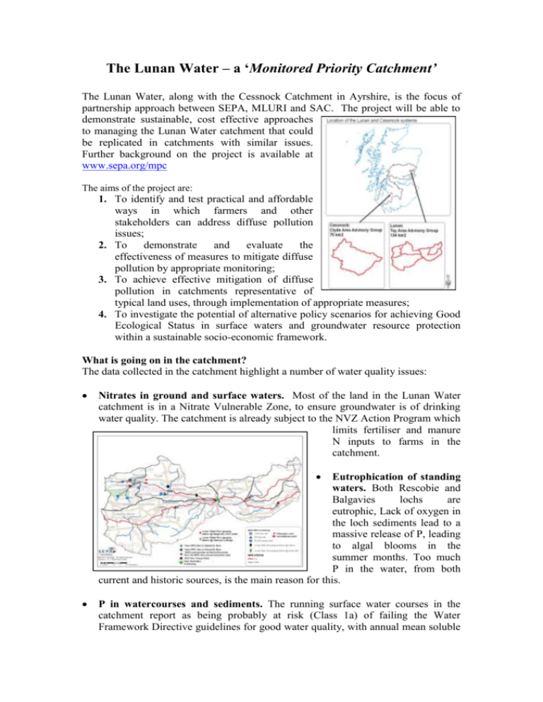
The Lunan Water – a ‘Monitored Priority Catchment’ The Lunan Water, along with the Cessnock Catchment in Ayrshire, is the focus of partnership approach between SEPA, MLURI and SAC. The project will be able to demonstrate sustainable, cost effective approaches to managing the Lunan Water catchment that could be replicated in catchments with similar issues. Further background on the project is available at www.sepa.org/mpc The aims of the project are: 1. To identify and test practical and affordable ways in which farmers and other stakeholders can address diffuse pollution issues; 2. To demonstrate and evaluate the effectiveness of measures to mitigate diffuse pollution by appropriate monitoring; 3. To achieve effective mitigation of diffuse pollution in catchments representative of typical land uses, through implementation of appropriate measures; 4. To investigate the potential of alternative policy scenarios for achieving Good Ecological Status in surface waters and groundwater resource protection within a sustainable socio-economic framework. What is going on in the catchment? The data collected in the catchment highlight a number of water quality issues: Nitrates in ground and surface waters. Most of the land in the Lunan Water catchment is in a Nitrate Vulnerable Zone, to ensure groundwater is of drinking water quality. The catchment is already subject to the NVZ Action Program which limits fertiliser and manure N inputs to farms in the catchment. Eutrophication of standing waters. Both Rescobie and Balgavies lochs are eutrophic, Lack of oxygen in the loch sediments lead to a massive release of P, leading to algal blooms in the summer months. Too much P in the water, from both current and historic sources, is the main reason for this. P in watercourses and sediments. The running surface water courses in the catchment report as being probably at risk (Class 1a) of failing the Water Framework Directive guidelines for good water quality, with annual mean soluble P concentration and possibly pesticides being the principal risk factors. These data have been supported by both SEPA’s Pressures and Impacts report and SNIFFER’s Screening Tool. Sediment transfer into the water is also having an impact on the number and type of invertebrates found in burns around the catchment. Sources of Phosphorus. The diagram shows estimates of sources for the P values that have been established through the monitoring. The results show that it isn’t just agricultural sediment losses that are causing a problem, P in septic tank and STW effluent is also causing an issue. Effluent from these sources is in a form that is easier for plants and algae to take up therefore could be a greater source of pollution. The work to date has shown that addressing these point sources is probably of equal importance as dealing with sources from agriculture. Fishery downgrading. The main water course of the Lunan has shown significant downgrading with respect to salmon catches (table 2). The reasons for this are not fully clear, but it is likely that the canalised morphology, and consequent lack of suitable spawning grounds in the watercourses below the Lochs, is important. Monitoring in more detail - What monitoring is being carried out as part of the project? The upper part of the catchment is the focus for more detailed work, which consists of long term monitoring, looking at 4 subcatchments (plus a Soils and current sampling sites subcatchment in the South Esk for comparison). Measurements include hydrology, water chemistry, turbidity and ecology. These subcatchments, along with sampling points and soils, are shown in Figure 5b. The use of continuous turbidity measurement at these sites, to provide an index of ecological stress, pollutant loads and efficacy of mitigation, is being piloted in the project. Investigation of groundwater response time to mitigation of inputs is being carried out by study of isotopic and other tracer signatures in borehole and stream samples. Sampling sites not yet consented shown as open squares Taking a cooperative approach – who is doing what? The most important participants in this project are the farmers and householders in the catchment; information for farmers is focused around the Environmental Focus Farm (EFF), Mains of Balgavies, who with the support of SAC, hold regular meetings to update farmers on the progress of the project work and if this can help them in their day to day running of the farm business. As far as possible, the intention is that mitigation measures should be identified and developed on the initiative of farmers and other stakeholders in light of the monitoring and scientific data collected in the catchment. One of the ideas to come out of this process already is the more precise use of lime, to ensure good N uptake. There are plans for similar groups to focus on fisheries and septic tanks. How can this work be applied to other catchments? Working in partnership will help to develop models for other catchments. This will include conceptual and process based source apportionment of pollutants, spatial approaches to identification of cost:effective and cost:beneficial measures and analysis of scenarios and alternative policies. The project also gives a long term focus for assessment of improvements to water chemistry as inputs are identified and reduced and information from a range of surveys and observations is collated. The partners in this project are keen to support the trial of low or no cost measures that could help farmers reduce diffuse pollution risk, this in turn will help Scotland achieve targets under the European Water Framework Directive and reaching the objective of Good Ecological Status for all Scottish Waters by 2015. Characterisation of the catchment is an ongoing process, and a working document is available (website) which summarises what is known about the hydrology, land use, biogeochemistry and ecology of the catchments. Further information For more information and to follow the progress of the project, please consult the project website at www.sepa.org.uk/mpc or email diffuse.pollution@sepa.org.uk Main characteristics, diffuse pollution issues and potential mitigation approaches in the Lunan Water catchment Main Characteristics Issues What could help Two eutrophic lochs, one of which is a popular coarse fishery (Rescobie), and one is a SWT reserve (Balgavies) Decline in macrophytes and algal booms. The Lochs are enriched with N and P; loch sediments are also contributing P. Estimated reduction in P loading to Rescobie of 1,400 kg P will be needed to achieve good status Much of area is underlain by groundwater bodies in old Red Sandstone Lunan Water drains the Lochs. Vinny Water and Gighty Water feed into Lunan Water at Letham and Friockheim and Boysack respectively. Catchment area: 134 km2 Intensive arable farming (79% cereals, 12% potatoes) across most of the catchment Groundwater is not achieving drinking water standards for nitrate (11.4 mg/ L NO3-N) Trout and salmon catch in main stem of Lunan River is depleted Significant morphological alteration has taken place Compliance with GAEC and GBRs on farms will help to minimise nutrient losses. Better septic tank maintenance and novel technologies could be used. Straw bales placed in Rescobie may help to reduce algal growth. Full compliance with NVZ regulations could assist this. Rainfall = 771 mm Most rain occurs in autumn when soils are vulnerable to erosion Sloping fields are prone to soil erosion Maximum elevation = 251m, most of topography is undulating hills. Mainly freely draining brown earth and podsol soils Significant numbers (ca 800) of houses not on main sewerage Four public STWs (Craichie, Letham, Friocckheim, Inverkeilor) Landfill Abstraction Quarrying Increase opportunities for spawning by enhancing streambed coarse sediment content. Reintroduction of natural meanders and backwaters Diffuse pollution by sediment runoff and drainage to groundwater. Water abstraction also an issue. These soils are vulnerable to both erosion of sediments and leaching of soluble pollutants This contributes to soluble P, N and BOD inputs to Lochs and streams These are all down stream of Lochs, but contribute to soluble P, N and BOD inputs to Lochs and streams (Give % contribution) 18 ha closed site at Lochhead 19 ha active site at Restenneth 22 licensed abstractions Quarry near Friockheim generates sediment and dust Environmental audits to be offered to all farmers in the catchment Nutrient budgeting and improved liming practice could also reduce risks Ponds,wetlands and riparian buffer strips Spring cropping could limit soil exposure to autumn rain Avoid row crops on steep fields Nutrient budgeting, improved liming practice and precision farming will help N use efficiency Septic tank focus group to highlight issues and gather information Upgrading to tertiary treatment Not thought to be significant polluters Polytunnels require large water inputs Retention bunds and regular wetting of hardstanding surfaces

