Coastal and Continental Temperature Ranges
advertisement
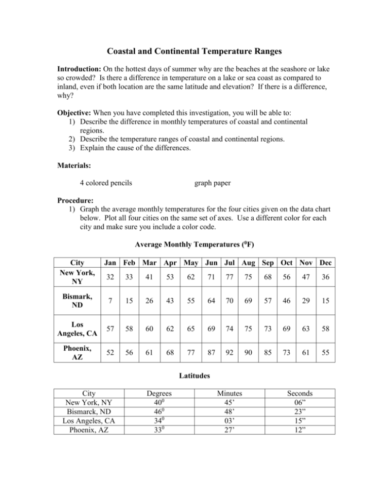
Coastal and Continental Temperature Ranges Introduction: On the hottest days of summer why are the beaches at the seashore or lake so crowded? Is there a difference in temperature on a lake or sea coast as compared to inland, even if both location are the same latitude and elevation? If there is a difference, why? Objective: When you have completed this investigation, you will be able to: 1) Describe the difference in monthly temperatures of coastal and continental regions. 2) Describe the temperature ranges of coastal and continental regions. 3) Explain the cause of the differences. Materials: 4 colored pencils graph paper Procedure: 1) Graph the average monthly temperatures for the four cities given on the data chart below. Plot all four cities on the same set of axes. Use a different color for each city and make sure you include a color code. Average Monthly Temperatures (0F) City New York, NY Jan Feb Mar Apr May Jun Jul Aug Sep Oct Nov Dec 32 33 41 53 62 71 77 75 68 56 47 36 Bismark, ND 7 15 26 43 55 64 70 69 57 46 29 15 Los Angeles, CA 57 58 60 62 65 69 74 75 73 69 63 58 Phoenix, AZ 52 56 61 68 77 87 92 90 85 73 61 55 Latitudes City New York, NY Bismarck, ND Los Angeles, CA Phoenix, AZ Degrees 400 460 340 330 Minutes 45’ 48’ 03’ 27’ Seconds 06” 23” 15” 12”
