Waterbodies are described as been lotic (flowing, moving) or lentic
advertisement
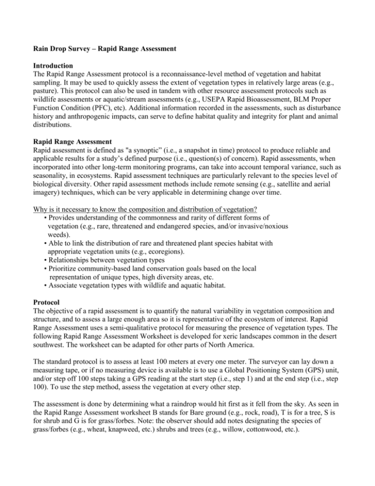
Rain Drop Survey – Rapid Range Assessment Introduction The Rapid Range Assessment protocol is a reconnaissance-level method of vegetation and habitat sampling. It may be used to quickly assess the extent of vegetation types in relatively large areas (e.g., pasture). This protocol can also be used in tandem with other resource assessment protocols such as wildlife assessments or aquatic/stream assessments (e.g., USEPA Rapid Bioassessment, BLM Proper Function Condition (PFC), etc). Additional information recorded in the assessments, such as disturbance history and anthropogenic impacts, can serve to define habitat quality and integrity for plant and animal distributions. Rapid Range Assessment Rapid assessment is defined as "a synoptic” (i.e., a snapshot in time) protocol to produce reliable and applicable results for a study’s defined purpose (i.e., question(s) of concern). Rapid assessments, when incorporated into other long-term monitoring programs, can take into account temporal variance, such as seasonality, in ecosystems. Rapid assessment techniques are particularly relevant to the species level of biological diversity. Other rapid assessment methods include remote sensing (e.g., satellite and aerial imagery) techniques, which can be very applicable in determining change over time. Why is it necessary to know the composition and distribution of vegetation? • Provides understanding of the commonness and rarity of different forms of vegetation (e.g., rare, threatened and endangered species, and/or invasive/noxious weeds). • Able to link the distribution of rare and threatened plant species habitat with appropriate vegetation units (e.g., ecoregions). • Relationships between vegetation types • Prioritize community-based land conservation goals based on the local representation of unique types, high diversity areas, etc. • Associate vegetation types with wildlife and aquatic habitat. Protocol The objective of a rapid assessment is to quantify the natural variability in vegetation composition and structure, and to assess a large enough area so it is representative of the ecosystem of interest. Rapid Range Assessment uses a semi-qualitative protocol for measuring the presence of vegetation types. The following Rapid Range Assessment Worksheet is developed for xeric landscapes common in the desert southwest. The worksheet can be adapted for other parts of North America. The standard protocol is to assess at least 100 meters at every one meter. The surveyor can lay down a measuring tape, or if no measuring device is available is to use a Global Positioning System (GPS) unit, and/or step off 100 steps taking a GPS reading at the start step (i.e., step 1) and at the end step (i.e., step 100). To use the step method, assess the vegetation at every other step. The assessment is done by determining what a raindrop would hit first as it fell from the sky. As seen in the Rapid Range Assessment worksheet B stands for Bare ground (e.g., rock, road), T is for a tree, S is for shrub and G is for grass/forbes. Note: the observer should add notes designating the species of grass/forbes (e.g., wheat, knapweed, etc.) shrubs and trees (e.g., willow, cottonwood, etc.). Rapid Range Assessment Worksheet 1 B T S G 26 B T S G 51 B T S G 76 B T S G 2 B T S G 27 B T S G 52 B T S G 77 B T S G 3 B T S G 28 B T S G 53 B T S G 78 B T S G 4 B T S G 29 B T S G 54 B T S G 79 B T S G 5 B T S G 30 B T S G 55 B T S G 80 B T S G 6 B T S G 31 B T S G 56 B T S G 81 B T S G 7 B T S G 32 B T S G 57 B T S G 82 B T S G 8 B T S G 33 B T S G 58 B T S G 83 B T S G 9 B T S G 34 B T S G 59 B T S G 84 B T S G 10 B T S G 35 B T S G 60 B T S G 85 B T S G 11 B T S G 36 B T S G 61 B T S G 86 B T S G 12 B T S G 37 B T S G 62 B T S G 87 B T S G 13 B T S G 38 B T S G 63 B T S G 88 B T S G 14 B T S G 39 B T S G 64 B T S G 89 B T S G 15 B T S G 40 B T S G 65 B T S G 90 B T S G 16 B T S G 41 B T S G 66 B T S G 91 B T S G 17 B T S G 42 B T S G 67 B T S G 92 B T S G 18 B T S G 43 B T S G 68 B T S G 93 B T S G 19 B T S G 44 B T S G 69 B T S G 94 B T S G 20 B T S G 45 B T S G 70 B T S G 95 B T S G 21 B T S G 46 B T S G 71 B T S G 96 B T S G 22 B T S G 47 B T S G 72 B T S G 97 B T S G 23 B T S G 48 B T S G 73 B T S G 98 B T S G 24 B T S G 49 B T S G 74 B T S G 99 B T S G 25 B T S G 50 B T S G 75 B T S G 100 B – Bare ground (e.g., rock, road) S – Shrub B T S G T – Tree G – Grass (e.g., wheat, knapweed) For more information, contact Bob Hall, US EPA Reg. 9, hall.robertk@epa.gov, phone 415-947-4123

