Biodiversity report
advertisement
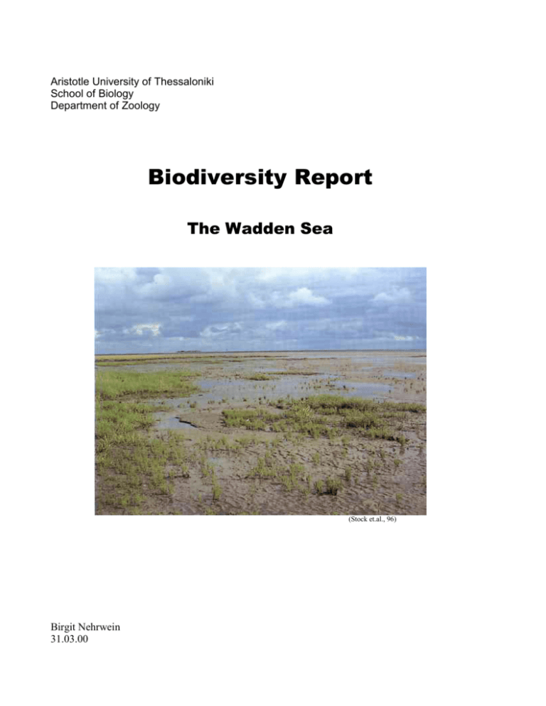
Aristotle University of Thessaloniki School of Biology Department of Zoology Biodiversity Report The Wadden Sea (Stock et.al., 96) Birgit Nehrwein 31.03.00 Index I. II. III. IV. IV.I IV.II IV.II.I IV.II.II IV.III V. V.I VI. VII. VIII. VIII.I IX. X. XI. Introduction Geographical Distribution Conditions for Creating a Wadden Sea Saltmarshes Ecological Distribution and Structure Ecosystems Lower Saltmarshes Higher Saltmarshes Inhabitants Mud and Sandy Flats Inhabitants Seal Colonies Fishes State of Protection The National Parks Threats Conclusion References 3 3 4 4 4 5 5 6 6 6 7 7 8 8 8 10 12 12 I. Introduction 2 The Wadden Sea is a worldwide unique biotope and forms together with the higher region of the Alpes the last big natural landscape of Central Europe. It is determined by its huge eulittoral zone, which can stretch up to 20 km and forms a vast and fascinating biotope. There are not many species that can bare the stress of being emerged and submerged again, but those that can, live there in high numbers. Lots of birds take advantage of this, as well as many young fish that feed in the Wadden Sea. But not only animals are in need of the Wadden Sea. Every year thousands of people visit the region in order to find some recreation. Although a lot of the area belongs to a National Park, military and industrial use, as well as mass tourism threaten to destroy the area. The aim of this report is to introduce this unique ecosystem, to show the threats and to talk about the possibilities to protect it. II. Geographical Distribution "Between the northwestern part of the Netherlands (Den Helder) and the southwestern part of Denmark (Jutland, Skallingen ) the Wadden Sea area extends. To the seaside the Wadden Sea is delimited by the 10m depth zone or by a chain of isles (Westfrisian Islands from Texel to Rottumeroog, Eastfrisian Islands from Borkum to Mellum-Scharhoern- Neuwerk, the German Northfrisian Islands from Nordstrand to Sylt and the Danish islands Romo, Mano and Fano). On the sheltered landside coast of 24 Wadden Sea islands, of 9 small marsh islands (Halligen) and of 5 higher sandplates we also find some salt marsh areas. The Wadden Sea Area (Stock et.al., 96) The Wadden Sea has an area of 730,000 ha, two thirds of which belong to the eulittoral zone with 3 two emergence and two submergence phases each day. Nearly one third belongs to the sublittoral zone, which is normally always covered with water. Of the Wadden Sea's 730,000 ha only appr. 10% are mud flats mostly in the eulittoral zone, and 2.7% are saltmarshes (= supralittoral zone). Consequently the saltmarsh is the less frequent ecosystem in the Wadden Sea." (B. Heydemann,1981) III. Conditions for Creating a Wadden Sea - there must be a gradual slope of the sea bottom; the North Sea covers the continental shelf, which means that there isn't a big slope - the landscape behind the sea must be flat as well, so that rivers can bring only fine sediment - there must be big rivers, that bring enough fine material for the building of the Wadden Sea; in Germany those rivers are Elbe, Weser, Jade, Ems and in the Netherlands Rhine and Maas - Islands, sandbanks and small marsh islands protect the area against the open sea, otherwise new sediment would be carried away immediately - the tide must be more than 1.50m so that there is enough current for bringing the material in and distributing it in a big area - the area must be within the temperate zone; in the tropics mangrove forests grow under such conditions (Stock et.al., 1996) IV. Saltmarshes IV.I. Ecological Distribution and Structure "The normal inclination of saltmarshes is in average 1: 1000 til 1: 500. Normally saltmarshes exist between MHWL1 to 1.30m. In a vertical distribution of 1.50m there are 5 different saltmarsh-zones : 1) Lower Puccinellietum maritimae 2) Higher Puccinellietum maritimae 3) Lower Festucetum rubrum littorale 4) Higher Festucetum rubrum littorale 5) Transition zone to freshwater-grass-ecotones. (Leontodon- autumnalis-zone)2 These ecological zones are created by the decrease of the salinity of soil-water: from 30%S to 1%S, by the increase in the variability of salinity (seasonal change and weather dependent change) and by the number of inundation (150- 400 in the lower Puccinellietum, decreasing to 310 in the transition- zone to freshwater meadows). 1Mean 2Stock High Water line et.al. distinguish three different zones: 1. Salicornia ssp., 2. Puccinellietum m., 3. Festucetum r. 4 Saltmarshes... have a world wide distribution. But the above mentioned 5 ecosystem complexes from which the saltmarshes develop are not to be found anywhere else in the world." (B.Heydemann, 1981) IV.II Ecosystems IV.II.I Lower Saltmarshes a) Halophytic pioneer ecosystem - from 40 cm below MHWL to the MHW-line - amphibiotic ecosystem within daily tidal range - dominant species are Salicornia stricta and (or) Spartina anglica, they are vascular plants that prepare sedimentation for the supralittoral saltmarshes Salicornia spp. (Janke/ Kremer, 90) b) Halo- nitrophilous tidal drift zone - Suaeda maritimae and Atriplex hastata are the dominant plant species - vegetation normally only found on small plots or narrow bands - this zone hosts very diverse animal communities, but is disturbed by intensive grazing in many regions c) Aster tripolium- pioneer- ecosystem - exists on clayey soil, which is rich in organic matter - zone is particularly rich in phytophagous insects - the Aster- complex is not resistent to grazing, that's why it is now very rare in Germany d) Low pioneer- grassland and dwarf shrub vegetation - communities dominated by Puccinellia maritima, Limonium vulgare and Halimione portulacoides (B. Heydemann, 1981) 5 Limonium vulgare (Janke/ Kremer, 90) IV.II.II Higher Saltmarshes The higher saltmarshes are inhabited by different plant associations like Festucetum rubrum littorale, Limonietum vulgare,... and they appear , when the area has been rised up by sedimentation to 30- 40cm above MHWL. In most cases the higher saltmarsh is a grassland- ecosystem. If it is grazed grasses like Festuca or Agrostis dominate. Otherwise a vegetation of 20- 50 cm in height succeeds (Artemisia maritima,...). (B. Heydemann, 1981) IV.III Inhabitants 100 species of primary producers (45 vascular plants, 55 frequent algae) can be found in the saltmarshes. The fauna of the supralittoral is dominated by arthropods - 90% of the macrofauna (appr. 650 species) and 15% of the microfauna (appr. 350 species) belongs to them. 90-93% of the macrofauna- arthropods are insects the rest can be distinguished into Araneae, Acari, Diploda and Crustacea. There are 500 species of the detritophagous group, from which 400 species are Diptera. One can also find 410 phytophagous and 535 zoophagous species, of which the last can be divided into three different trophic levels (2.,3.,4. range). Of the 100 bird species that can be found feeding in the saltmarshes, 25 are breeding there and 75 are migratory. " In autumn 3 million birds live from the nutritive ressource of the Wadden Sea area, particularly from the ressources in the mud flats and the saltmarshes. Besides, the higher saltmarshes are extremely important as resting places for the bird population. The specialisation of the fauna is very high. Nearly 500 species only exist in saltmarsh ecosystems- these are "endemic species". All ecosystems of the saltmarshes are unique in funal composition and cannot exist outside the Wadden Sea- they are "endemic ecosystems"." (B.Heydemann, 1981) V. Mud and Sandy Flats Mud flats are built up where the turbulence of the sea is low and the gradient of the underlying soil slight, because only there the deposition of the fine sediments can take place. Therefore one can find mud flats in bays, inlets, behind islands or dune-systems. The accretion over the MHWL leads generally to the development of saltmarshes. In more exposed areas with higher wave action one can find sandy flats. In the Wadden Sea they range from small areas of 1 ha or less to vast stretches of many kilometres. The eulittoral zone consists to 80-90% of sandy flats and only to 10- 20% of mud flats. Sandy flats form a stresfull habitat and large grain sand gives only limited protection against predatory. 6 V.I. Inhabitants "The eulittoral benthos macrofauna mainly belongs to the Crustacea (Cirripedia, Musidacea, Cumacea, Tanaidacea, Isopoda, Amphipoda, Decapoda, in all 40 species), to the polychaetes and oligochaetes (appr. 70 species), to the bivalves (20 species), the gastroinsects (Collembola, Carabidae, Staphalinidae, Hydrophilidae, Hymenoptera parasitica and Diptera), these species, however are not numerous. The microfauna consists of appr. 1100 species, mainly species from the groups of Ciliata, Turbellaria, Nematodes, Rotatoria and Crustacea. No species of the eulittoral fauna is found exclusively in the Wadden Sea, but many species have the ecological centre of their distribution in the Wadden Sea. Many species are especially important as nutritive base for the large populations of coastal birds." (B.Heydemann, 1981) VI. Seal Colonies The biggest part of the European seals live in the Wadden Sea area especially in Schleswig Holstein, because they like shallow water and sandy coasts. Most of the year they stay in the open water of the North sea and hunt for fish, but during summer they come to the sandbanks and beaches. There they give birth and raise the young. Seals at sandbank (Stock et.al., 96) The rest at sandbanks during emergence is very important for the seals, but they escape into the sea as soon as they are disturbed e.g. by boats, tourists,… These escapes weaken the animals as well as poisonous substances that are in the sea. Their weak immune system was probably the reason why almost 2/3 of the population died in 1988 by a kind of pneumonia. Since then the number of seals is increasing again, but they are still threatened by pollution. 7 VII. Fishes During submergence many fishes come into the Wadden Sea area in order to feed. Some species stay there during their whole life circle like Zoarces viviparus and Myoxocephalus scorpius, whereas others like Pleuronectes platessa just stay there while growing up. Zoarces viviparous (Janke/ Kremer, 90) VIII. State of Protection There exist three national parks for the protection of the Wadden Sea in Germany. This is due to the fact, that nature conservation is carried out by the Lands, because Germany is federally organized. Also, all the German part of the Wadden Sea belongs to a biosphere reservate of the Man and Biosphere programme of UNESCO. Although a big part of the Wadden Sea belongs to a national park, which is the highest protection status in Germany, there are still a lot of problems. This is because the economic use of the area is going to be stopped step by step. Because of this the three German national parks do not fit into the international criteria of the IUCN and are not internationally recognized. (Stock et.al, 96) VIII.I The National Parks The three national parks are called Nationalpark Schleswig- Holsteinisches Wattenmeer, Nationalpark Hamburgisches Wattenmeer and Nationalpark Niedersaechsisches Wattenmeer. All the national parks are divided into two to three zones. Zone 1: This zone includes the most sensitive parts of the Wadden Sea. Entering this zone is either forbidden or only allowed on marked pathways. In this zone one can find breeding and resting places for birds, some saltmarshes and seal colonies. Professional fishery is allowed, except in the national park Hamburgisches Wattenmeer. 8 Zone 2: This zone serves as a buffer between zone 1 and the environment. One can enter most of the zone, but it is forbidden to change the character of the Wadden Sea, which means for example restricted access to bird colonies during breeding season. The area can be used in a sensitive way, for example by extensive grazing. Zone 3: Uses are as above plus swimming and cultural uses are added. A Comparison Region N.P. Schl.- Holst. WM N.P. Hamburg. WM N.P. Niedrs. WM Foundation 1.10.1985 1.10.1990 1.1.1986 Area Borders 285000 ha starting 150m in front Of the dike or dune Island and small marsh islands are excluded 11500 ha see map Starts at the dike Zonation Zone 1 (30%), 2 and 3 are not outlined yet Zone 1(90%), Zone 2(10%) Zone 1 (54%) Zone 2 (45%) Zone 3 (1%) Regulations Forbidden to enter Z1 Z2 & Z3 can be used in a sustainable, sensitive way Forbidden to enter Z1, except on marked pathways Forbidden to enter Z1, except on Marked pathways Agricult. Use Sheep grazing on salt marshes and dikes (coastal protection) only in Z2 & Z3 Extensive grazing In Z1 allowed other agric. uses In Z2 allowed Possible, but Reduced on state Land Fishing Z1: Only profesional fishing Z2,3: fishing allowed Z1: Forbidden Z2:Partly allowed Z1: Only prof. Fishing Z2,3: fishing Allowed Hunting Forbidden in Z1 Forbidden Forbidden in Z1 Other Uses Military Use Oil Production (Janke/Kremer, 90) 9 Map of the national parks (Janke/ Kremer, 90) IX. Threats Tourism The Wadden Sea belongs to the most popular holiday regions in Central Europe. About 30 Mio. overnight stays are counted every year, to which one must add the number of tourists that come just for a day visit. Walks in the mud and sandy flats, watersports and tours by boat to seal colonies are very popular and many of the inhabitants earn their money in the tourism business. But mass tourism restricts the habitats for animals and the vegetation gets damaged by people that walk through it. Better protection and educational programmes for tourists and inhabitants must help to find a way for a coexistence between the aims of nature conservation and tourism. Fishing 10 The shrimp and fish stocks of the Wadden Sea are threatened by overfishing. Because nets with small mesh size are used for shrimp fishing, many young fish are also caught and therefore the reptoduction of the population is affected. Machines to sort the catch could avoid this in future. Fishing with trawling nets has irreversibly changed the surface of some areas. Even in zone 1 one cannot find the "reefs" of the tube-building Sabellaria-worms anymore. Embankment and Agricultural use Embankment has a long tradition in the area. In former days there was always a to and fro between gaining land for agriculture and loosing it again to the sea. But today the technique of embankment is almost perfect and even huge bays can be embanked. In doing this valuable habitats are lost and this is even more questionable in times of agricultural overproduction. Grazing of sheep and cattle in the saltmarshes is another problem in the area. On grazed saltmarshes the biodiversity degreases, because many plant species cannot withstand it and with the plants also the specialized fauna gets lost. Shipping The mouth of the Elbe is the most frequented shipping route in the world and Rhein and Weser are also highly frequented. Therefore the risk of an oil catastrophe is high and at present small amounts of oil are leaked into the Wadden Sea every day. One can often find dead birds on the coast, which were killed by ingesting oil, while preening their feathers. Dead birds (Janke/ Kremer, 90) Oil Production Oil production takes place in the Meldorfer Bay. An accident could mean mass damage for the area. Chemicals Dangerous chemicals get into the Wadden Sea with the rivers. In shrimps, fish, birds and seals those substances accumulate in their fat. This weakens their immune system or even leads to death. Military 11 Some parts of the Wadden Sea serve the military as training grounds. The noise of helicopters or missiles disturbs the animals, especially birds and seals, that are often scared from their feeding and resting places. In some cases this results in reduced feeding time and therefore the animals are weakened and more susceptible to illness and ultimately increases their mortality.(Janke/Kremer, 90) X. Conclusion The Wadden Sea is a worldwide unique habitat, but although it is protected by a national park, there are still lots of threats. There are many reasons why it should be better protected. Especially in the saltmarshes one can find many endemic species and the area is of big importance as feeding grounds for migratory birds and fishes. But also men is in need of the area, e.g. for recreation, fishing,… Better educational and management programmes must help to find a solution for the different interests that are connected with this area. XI. References Heydemann, B., "Biological Cosequences of Diking on Saltmarshes and Mud and Sandy Flats" in "Environmental Problems In The Waddensea-Region"; published by Museum of Fisheries and Shipping, Esbjerg, 1981 Janke, K ./ Kremer, B., "Das Watt- Lebensraum, Tiere und Pflanzen", Franckh- Kosmos Verlags GmbH & Co., Stuttgart, 1990 Stock et.al.,"Watt- Lebensraum zwischen Land und Meer", Westholsteinische Verlagsanstalt Boyens & Co., Heide, 2. Aufl. , 1996 12
