Plate Tectonics Notes
advertisement
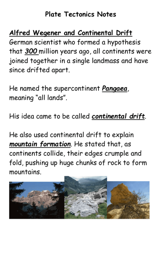
Plate Tectonics Notes Alfred Wegener and Continental Drift German scientist who formed a hypothesis that 300 million years ago, all continents were joined together in a single landmass and have since drifted apart. He named the supercontinent Pangaea, meaning “all lands”. His idea came to be called continental drift. He also used continental drift to explain mountain formation. He stated that, as continents collide, their edges crumple and fold, pushing up huge chunks of rock to form mountains. Wegener’s Evidence for Continental Drift Landforms-mountain ranges in S. Africa and Argentina lined up -European coalfields matched coalfields in N. America Fossils- identical fossils found in places now separated by oceans -Glossopteris, fossil of a fernlike plant, was found in Africa, S. America, Australia, India, and Antarctica but its seeds could not have traveled across distances that now separate the continents. Climate-fossils of tropical plants found on islands with polar climates -evidence of glaciers found on continents with tropical climates Wegener’s idea was rejected because he could not explain the force that pushes and pulls on the continents. Sea-Floor Spreading Harry Hess, an American geologist, studied the mid-ocean ridge, the longest chain of mountains on the ocean floor that extends into all Earth’s oceans and that is mostly completely submerged. In 1960, Hess suggested that, beginning along the mid-ocean ridge, the ocean floors move apart, carrying the continents with them. Molten material rises from a crack in the midocean ridge and spreads out, pushing older rock to the side. As it cools, it forms a strip of solid rock in the center, which is then pushed apart by more molten material. Hess called this process sea-floor spreading. Evidence for Sea-Floor Spreading Molten Material-In the 1960s, scientists studying the central valley of the midocean ridge found rocks that only form when molten material hardens quickly after erupting underwater, showing that there have been repeated eruptions there. (pillow lava) Magnetic Stripes-Rock on the ocean floor contains iron, which is magnetic. When this rock formed from molten material, the iron particles lined up in the direction of the magnetic poles. Earth’s poles have reversed themselves, as shown by rock on the ocean floor that lies in a pattern of magnetized stripes that alternately point north and south. The pattern is identical on both sides of the mid-ocean ridge. Drilling Samples-Scientists dated rocks from both sides of the mid-ocean ridge and found that the farther away from the ridge, the older the rocks were and the youngest rocks were always in the center. Subduction Process by which the ocean floor sinks beneath a deep-ocean trench (underwater canyon at the edge of an oceanic plate) and back into the mantle. The Pacific Ocean is shrinking because it is ringed by many trenches and subduction is taking place faster than new crust is forming. The Atlantic Ocean is expanding because it has few trenches. Plate Tectonics J. Tuzo Wilson observed that the continents have cracks similar to those on the ocean floor. He proposed that the lithosphere is broken into sections called plates, which fit closely together and carry the continents, parts of the ocean floor, or both. He combined what is known about continental drift, sea-floor spreading, and the plates into a single theory called plate tectonics, which states that pieces of the Earth’s lithosphere are in constant, slow motion driven by convection currents in the mantle. Plate Boundaries Lines where the edges of the plates meet. Transform boundary-where two plates slip past each other in opposite directions and crust is neither created nor destroyed. -Earthquakes occur here. Divergent boundary-where two plates move apart (diverge) -most occur on the mid-ocean ridge resulting in sea-floor spreading and new crust -on land they form a deep valley called a rift valley Convergent boundary-where two plates come together (converge) -results in a collision -if two oceanic plates collide, subduction results -if oceanic and continental plates collide, the oceanic plate subducts and volcanoes may form on the continent -if two continental plates collide, neither subducts and the crust is pushed up, forming mountains A. Oceanic Crust(Basalt) B. Oceanic Crust(Basalt) C. Continental Crust(Granite) X. Mid-Ocean Ridge Y. Trench Z. Subduction Zone Changes to Earth’s Surface Plate movements produce stress in rock, a force that causes it to change shape or break and move. This results in deformation, a change in a rock’s shape or volume. Types of Deformation Shearing-pushes each mass of rock in opposite directions Tension-pulls on a rock, making it thinner in the middle Compression-squeezes rock, making it thicker in the middle Faults and Fault Movements Faults-breaks in the crust that form along plate boundaries. Strike-Slip Fault-caused by shearing -rocks on either side slip past each other with little up or down motion -results in a transform boundary Normal Fault-caused by tension force -fault is at an angle so one block of rock lies above the fault (hanging wall) and the other lies below (footwall) -results in a divergent boundary Reverse Fault-caused by compression force -has the same structure as a normal fault but the hanging wall slides over the footwall -results in a convergent boundary Mountain Building Folded Mountains-form when two continental plates collide, causing layers of rock near the edges of plates to compress and fold, ex: Appalachian Mts. Fault-Block Mountains-form when blocks of crust slide along normal faults, ex: Teton Mts. Land Subsidence Occurs when land surface sinks as a result of geologic processes or human activities. Can be caused by plate movement along divergent boundaries or by uplift of areas of crust. Volcanoes A weak spot in the crust where molten rock (magma) comes to the surface. Most occur along divergent boundaries like the mid-ocean ridge or rift valleys or at convergent boundaries where two oceanic plates collide (forming island arcs like Japan and the Caribbean) or where oceanic and continental plates collide (forming volcanic mountain ranges like the Andes). Hot spot volcanoes form in the middle of plates where the mantle melts through the crust, ex: Hawaiian Islands.
