App 5-A Mitigation Impl Table2
advertisement
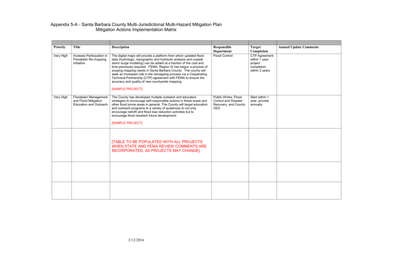
Appendix 5-A - Santa Barbara County Multi-Jurisdictional Multi-Hazard Mitigation Plan Mitigation Actions Implementation Matrix Priority Title Description Responsible Department Target Completion Very High Increase Participation in Floodplain Re-mapping Initiative The digital maps will provide a platform from which updated flood data (hydrologic, topographic and hydraulic analysis and coastal storm surge modeling) can be added at a fraction of the cost and time previously required. FEMA, Region IX has begun a process of scoping mapping needs in Santa Barbara County. The county will seek an increased role in the remapping process via a Cooperating Technical Partnership (CTP) agreement with FEMA to ensure the accuracy and quality of new countywide mapping. Flood Control CTP Agreement within 1 year, project completion within 2 years Public Works, Flood Control and Disaster Recovery, and County OES Start within 1 year, provide annually [SAMPLE PROJECT] Very High Floodplain Management and Flood Mitigation Education and Outreach The County has developed multiple outreach and education strategies to encourage self-responsible actions in these areas and other flood prone areas in general. The County will target education and outreach programs to a variety of audiences to not only encourage retrofit and flood loss reduction activities but to encourage flood resistant future development. [SAMPLE PROJECT] [TABLE TO BE POPULATED WITH ALL PROJECTS WHEN STATE AND FEMA REVIEW COMMENTS ARE INCORPORATED, AS PROJECTS MAY CHANGE] 2/12/2016 Annual Update Comments


