Adriatic_E2M3A_Mar05..
advertisement
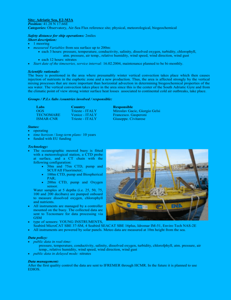
Site: Adriatic Sea, E2-M3A Position: 41.28 N 17.66E Categories: Observatory, Air-Sea Flux reference site; physical, meteorological, biogeochemical Safety distance for ship operations: 2miles Short description: 1 mooring measured Variables from sea surface up to 200m: each 3 hours: pressure, temperature, conductivity, salinity, dissolved oxygen, turbidity, chlorophyll, atm. pressure, air temp., relative humidity, wind speed, wind direction, wind gust each 12 hours: nitrates Start date of the timeseries, service interval: 16.02.2004, maintenance planned to be bi-monthly. Scientific rationale: The buoy is positioned in the area where presumably winter vertical convection takes place which then causes injection of nutrients in the euphotic zone and a new production. Thus, the area is affected strongly by the vertical mixing processes that are more important than horizontal advection in determining biogeochemical properties of the sea water. The vertical convection takes place in the area since this is the center of the South Adriatic Gyre and from the climatic point of view strong winter surface heat losses associated to continental cold air outbreaks, take place. Groups / P.I.s /labs /countries involved / responsible: Labs OGS TECNOMARE ISMAR-CNR Country Trieste - ITALY Venice - ITALY Trieste - ITALY Responsible Miroslav Gacic, Giorgio Gelsi Francesco. Gasperoni Giuseppe. Civitarese Status: operating time horizon / long-term plans: 10 years funded with EU funding Technology: The oceanographic moored buoy is fitted with a meteorological station, a CTD probe at surface, and a CT chain with the following configuration: 50m and 75m CTD, pump and SCUFAII Fluorimeter; 100m CTD, pump and Biospherical PAR; 200m CTD, pump and Oxygen sensor. Water samples at 5 depths (i.e. 25, 50, 75, 100 and 200 decibars) are pumped onboard to measure dissolved oxygen, chlorophyll and nutrients. All instruments are managed by a controller mounted on the buoy. The collected data are sent to Tecnomare for data processing via GSM type of sensors: YOUNG INSTRUMENTS, Seabird MicroCAT SBE 37-SM, 4 Seabird SEACAT SBE 16plus, Idromar IM-51, Enviro Tech NAS-2E All instruments are powered by solar panels. Meteo data are measured at 10m height from the sea. Data policy: public data in real-time: pressure, temperature, conductivity, salinity, dissolved oxygen, turbidity, chlorofphyll, atm. pressure, air temp., relative humidity, wind speed, wind direction, wind gust public data in delayed mode: nitrates Data management: After the first quality control the data are sent to IFREMER through HCMR. In the future it is planned to use EDIOS. Societal value / Users / customers: Users of the data could be the Adriatic scientific community and in addition meteorological surface data could be used by the meteorological community. Also, wind data from the South Adriatic mooring site will be used for the prediction model of the high tides in the Venice lagoon. Role in the integrated global observing system: The obtained time-series could be used for studies of the long-term changes of the response of the Adriatic Sea to local climatic forcing and the volume of the dense water formed as a function of the winter heat losses. The amount of the dense water formed then determines the water exchange between the Adriatic and Eastern Mediterranean. It has to be stressed that the Adriatic Bottom Water as formed in the Southern Adriatic represents the main component of the Eastern Mediterranean Deep Water. Contact Person: Dr. Vanessa Cardin (vcardin@ogs.trieste.it), Dr. Giorgio Gelsi (ggelsi@ogs.trieste.it) Links / Web-sites: for Project information : http://www.poseidon.ncmr.gr/M3A/ for data access : http://doga.ogs.trieste.it/boma_mfstep or http://www.ifremer.fr/mfstep compiled by: Vanessa Cardin and Kostas Nittis, March 2005
![locandina dottorandi [modalità compatibilità]](http://s2.studylib.net/store/data/005259821_1-9e349e4e3bf89f1cc48d1fe5ca196528-300x300.png)
