Full Size - Saint
advertisement
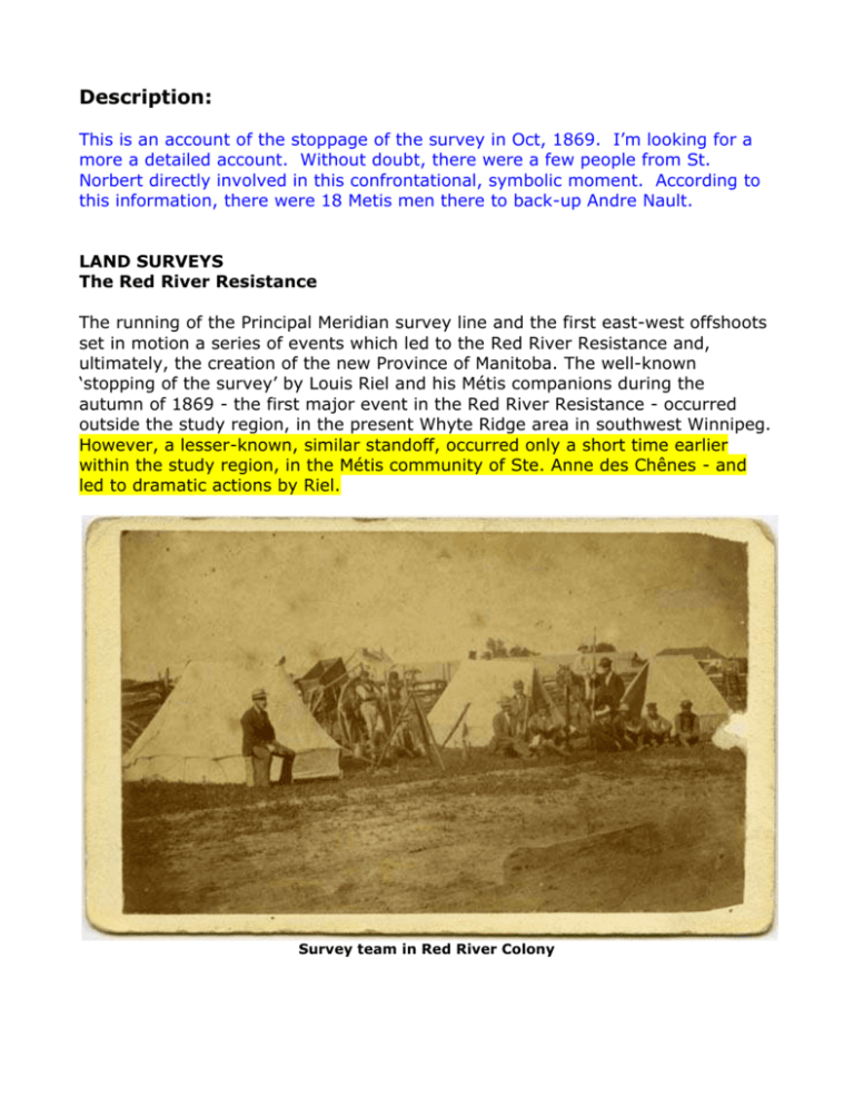
Description: This is an account of the stoppage of the survey in Oct, 1869. I’m looking for a more a detailed account. Without doubt, there were a few people from St. Norbert directly involved in this confrontational, symbolic moment. According to this information, there were 18 Metis men there to back-up Andre Nault. LAND SURVEYS The Red River Resistance The running of the Principal Meridian survey line and the first east-west offshoots set in motion a series of events which led to the Red River Resistance and, ultimately, the creation of the new Province of Manitoba. The well-known ‘stopping of the survey’ by Louis Riel and his Métis companions during the autumn of 1869 - the first major event in the Red River Resistance - occurred outside the study region, in the present Whyte Ridge area in southwest Winnipeg. However, a lesser-known, similar standoff, occurred only a short time earlier within the study region, in the Métis community of Ste. Anne des Chênes - and led to dramatic actions by Riel. Survey team in Red River Colony Local history records that while laying down base lines in Ste. Anne des Chênes, the surveyors and their largely White/Anglo-Saxon/Protestant work crews falsely informed the Métis residents of the area that they were to be dispossessed of their land. They also underpaid the Métis workers for their labours and overcharged for goods sold to them, and generally taunted and ill-treated the Métis residents of the area, leading ultimately to a little-known first confrontation, and ‘stopping of the survey’. The Red River Settlement at this time was essentially without a local government, with the Hudson’s Bay Company in the process of giving up its authority and the Canadian government representatives not yet present in the region. The deteriorating situation made the Métis believe they had no choice but to try to safeguard their lands and traditions by rising up and establishing a legal, provisional government. With these events unfolding, the Dominion Survey was abruptly curtailed. It did not start up again until 1871 after the passage of the Manitoba Act and the creation of a Manitoba provincial government, with its guarantees of French language and Métis land rights. The Principal Meridian and the Start of the Dominion Survey The map below, dated February 12, 1870, shows the surveys completed by Lt. Col. J.S. Dennis and his survey crews in 1869, before Rupert's Land was transferred to Canada. Among several noteworthy elements portrayed are: The north-south Winnipeg or Principal Meridian base line; the 64 section-sized townships; the existing Parish Settlements along the Red and Assiniboine rivers; and most interesting, the "Point where Webb's Party was stopped" by Louis Riel and his men, in the St. Vital Parish. August: John S. Dennis arrived at the Red River State to survey the North West Territories. The Métis farmers are alarmed by this foreign government invasion. October 11: The sale of so called Rupert's land is not complete when the National Committee, chaired by John Bruce, ordered Louis Riel (1844-1885) and eighteen unarmed Métis to confront Mr. Webb; the surveyor. He worked for the bumbling John Stoughton Dennis (1820-1885), friend of William McDougall (1822-1905). McDougall had ordered the survey to suit emigrants from Central Canada, not the local community. The encounter took place behind the farm of Andre Nault (18291924) on the White Horse Plains, Red River and stopped them from continuing their work by standing on the survey chains. It is noteworthy that Nault was not a Métis. The whole country is in an uproar over the deliberate attempt by Canada to again cut up their land for sale without their permission. October 19: The National Committee of the Métis is formed at St. Norbert, Manitoba, with John Bruce as President and Louis Riel (1844-1885) as Secretary. This is effectively the Provisional Government for the People. http://manitobia.ca/content/en/maps/SJD/SJD_1870.xml Feb 12, 1870 The Survey Resumes When surveying resumed in 1871, the smaller sized townships and sections were used, because they would allow for more homesteads on the same amount of land, and thus were better for business. A proposal to have fewer road allowances, which would have similar advantages, was considered but rejected, as was the use of the long-lot quarter sections. This final, last minute decision, to retain the square quarter-section over the long-lot quarter, had immense future implications in terms of dispersed farmstead locations, the pattern and cost for the construction of roadways, and the provision of utilities and services. The cultural landscape of all of western Canada would have been radically different, had the long-lot quarter section been adopted. Development patterns would have been linear and ‘fishbone’, rather than dispersed and ‘checkerboard’. So, starting from the Principal Meridian once again, the Dominion surveyors laid down the now familiar 36-section township, with 99-foot road allowances around each section, westward right across the Canadian prairies, with only a few exceptions and variations. French River-lot Settlements In addition to the areas surveyed under the parish survey system along the Red River, the Crow Wing Study Region also possesses six unusual, and smaller, river-lot ‘settlements’, established for and settled by French-speaking settlers from Québec, and expatriots from New England, where such land holdings were common and preferred. During the 1870s and 1880s the Roman Catholic Diocese of St. Boniface was very active in promoting French settlement in Manitoba, particularly southeastern Manitoba, and was able to arrange for the creation of a series of ‘satellite’ or ‘outer’ river-lot parishes at several locations along the Seine and Rat rivers. These special survey settlements included the Ste. Anne des Chênes Settlement; Lorette; Rat River Settlement; St. Malo Settlement; Ile des Chênes Settlement, and Grande Pointe Settlement. The lots were roughly two miles deep and fronted along a section of a riverbank. The Ile des Chênes (Oak Island) settlement is quite unusual in that the section of river channel used as the base line for the lots is only 5 km (3 miles) long, and exists as the Oak River on only a few maps. It is otherwise an un-defined watercourse and contains flowing water only during times of high water or unusually wet years. The Grande Pointe Settlement is also noteworthy for a simple, but critical error that caused the lots to overlap those of the outer two miles of the St. Norbert Parish, resulting in an administrative nightmare, and several highly unusual lot configurations. In all of the outer parish river-lot settlements, the combination of the long-lot parcels, running perpendicular to the local watercourses, and meandering trails, running roughly parallel to the riverbanks in these communities, gives these settlements an unusual and characteristic linear look about them.
