wsi_4893_rpt - Ministry of Environment
advertisement
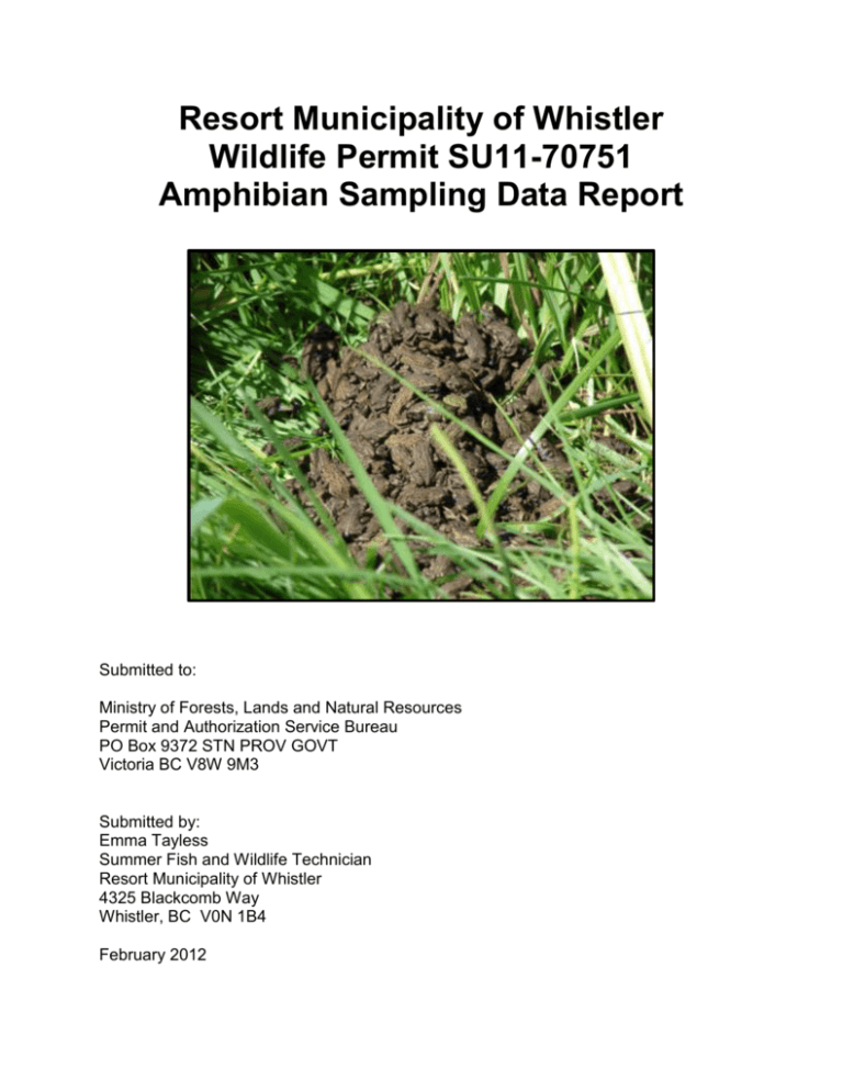
Resort Municipality of Whistler Wildlife Permit SU11-70751 Amphibian Sampling Data Report Submitted to: Ministry of Forests, Lands and Natural Resources Permit and Authorization Service Bureau PO Box 9372 STN PROV GOVT Victoria BC V8W 9M3 Submitted by: Emma Tayless Summer Fish and Wildlife Technician Resort Municipality of Whistler 4325 Blackcomb Way Whistler, BC V0N 1B4 February 2012 Resort Municipality of Whistler Wildlife Permit SU11-70751 Amphibian Sampling Data Report Summary This report summarizes data collected for amphibian presence surveys in selected waterways located throughout the Resort Municipality of Whistler (RMOW). As well as information collected for Western Toad Management purposes at Lost Lake Municipal Park. The surveys were conducted through visual observation and dip netting through the summer of 2011. Amphibian species observed in 2011 in surveyed Whistler waterways and their conservation listings are tabled below. English Name Scientific Name Taricha granulose Roughskin newts Salamanders species Northern Pacific Tree Pseudacris regilla Frogs Anaxyrus boreas Western Toads Species Code A-TAGR A-AM A-PSRE BC Conservation Listing Yellow Yellow Yellow A-ANBO Blue ii Resort Municipality of Whistler Wildlife Permit SU11-70751 Amphibian Sampling Data Report Table of Contents Summary ..........................................................................................................................ii 1.0 Introduction............................................................................................................ 1 1.1 Objectives .............................................................................................................. 1 1.2 Study Area ............................................................................................................. 1 2.0 Methods................................................................................................................. 3 3.0 Results and Discussion ......................................................................................... 4 3.1 Cal-Check constructed wetland ponds .................................................................. 4 3.2 Cheakamus Crossing SP2 Pond ........................................................................... 5 3.3 Cheakamus Crossing SP4N Pond ......................................................................... 5 3.4 Cheakamus Crossing RP1 Pond ........................................................................... 6 3.5 Lost Lake Western Toad Population ...................................................................... 6 4.0 Recommendations ................................................................................................ 7 5.0 References ............................................................................................................ 8 iii Resort Municipality of Whistler Wildlife Permit SU11-70751 Amphibian Sampling Data Report 1.0 Introduction In the summer of 2012, the Resort Municipality of Whistler (RMOW) conducted reconnaissance level amphibian surveys for amphibian presence in selected waterways throughout Whistler. These report summaries the survey data collected under Wildlife Permit SU11-70751 for the summer of 2011. The surveys were conducted by RMOW summer fish and wildlife technicians. The goal of the reconnaissance level surveys were to document amphibian use of constructed wetland ponds and stormwater ponds as well as document the timing and life stage of the 2011 Western Toad population at Lost Lake Municipal Park. This information can be used to track amphibian species use of specific waterways over time, as well as to determine what waterways amphibians are using and apply best management practices for amphibians to these areas. 1.1 Objectives The objective of the 2011 amphibian presence surveys were to document amphibian species use of stormwater and constructed wetland ponds. The objectives of the 2012 Western Toad Surveys at Lost Lake Municipal Park were to: estimate population numbers at various life stages; and divert juveniles away from high mortality trampling areas. 1.2 Study Area The surveys were conducted within the boundaries of the RMOW. The three main study areas were the Cal-Check parking lot restoration site, Cheakamus Crossing (previously the Whistler Athletes Village) and Lost Lake Municipal Park. Map 1 shows the general survey area locations. 1 Resort Municipality of Whistler Wildlife Permit SU11-70751 Amphibian Sampling Data Report Map 1. General amphibian study area locations in Whistler for 2011 amphibian surveys are outlined in red and the RMOW boundary in grey. Base map source RMOW 2012. The Cal-Check constructed wetland ponds (UTM 10U 491790 5545270) were built in 2010 as part of efforts by the Ministry of Highways to restore amphibian habitat in the sea to sky region, after it had been heavily impacted by the re-alignment of Highway 99 and parking lot construction by the Vancouver Organizing Committee (VANOC) for the 2010 Olympics Games. The ponds were designed to be ephemeral (to dry up for part of the year) and like small water bodies in natural ecosystems, some years will be more productive than others. The ponds are numbered 1 through 5, from Pond 1 at the south end of the site (lowest elevation) to Pond 5 at the north of the site (highest elevation). Fully wetted the ponds have an approximate surface are of 50 m2 to 120 m2 and a maximum depth of 20cm to 100 cm. The Cheakamus Crossing neighborhood (previously the Whistler Athletes Village) had three ponds surveyed in this area. 1. SP2 Pond (UTM 10U 497010 5547315) is centrally located in the Cheakamus Crossing neighborhood. Historically this was a naturally wetted area that was converted to a stormwater pond during neighborhood development by Whistler 2020 and post-construction it was converted into a constructed 2 Resort Municipality of Whistler Wildlife Permit SU11-70751 Amphibian Sampling Data Report wetland/stormwater retention area. Fully wetted the pond has an approximate surface are of 1750 m2 and a maximum depth of 3 m. 2. SP4N Pond (UTM 10U 496767 5547560) is an unintentional shallow pond just north of SP4 that is seasonally wetted by surface water and snow melt. Fully wetted the pond has an approximate surface area of 100 m 2 and a maximum depth of 40 cm. 3. RP1 Pond (UTM 10U 496625 5547952) is a constructed wetland pond located in a previously disturbed landfill area. The pond in approximately 180 m2 and a maximum depth of 1 m. It is seasonally wetted, usually drying up by August. Lost Lake (UTM 10U 504530 5552690) (watershed code: 119-467100-97600-171000930) has a surface area of 16.73 ha, maximum depth of 23 m, mean depth of 8 m and is located at 685 m in elevation. The one inlet channel is a side channel to Blackcomb Creek and enters at the south-west end of the lake near the one lake outlet. Terrestrial habitat around the lake is composed of mature second growth forest in the Coastal Western Hemlock biogeoclimatic zone. The Valley Trail system circumnavigates the lake and provides a connector trails to the village that are hard packed and/or paved. The park also features an extensive network of single track mountain biking / hiking trails that weave throughout the park. The park is surrounded by a golf course and residential development from the south and west. A road provides vehicle access to the parking lot and main beach area of the park and to the golf course maintenance area. 2.0 Methods Waterways were assessed for amphibian presence by a shore based visual surveys and live capture (dip netting). Shore based visual surveys consisted of walking around the edge of the pond with polarized sunglasses. Species presence and estimated numbers were noted. Live capture consisted of dip netting amphibians from shore and transferring them to a wetted bucket., then released at the site of capture after identification. Standard Operating Procedures: Hygiene Protocols for Amphibian field Fieldwork (MOE 2008) were followed to reduce the risk of disease transmission between sites and included: rinsing gear and equipment of any mud, algae, plants or invertebrates; bleaching of gear/equipment for a minimum of 15 minutes; rinsing of bleached gear/equipment; and sun drying of gear/equipment. 3 Resort Municipality of Whistler Wildlife Permit SU11-70751 Amphibian Sampling Data Report 3.0 Results and Discussion 3.1 Cal-Check constructed wetland ponds Cal-Check pond monitoring in 2011 consisted of random visits to the ponds throughout June and July to document water retention rates and amphibian use of the ponds. A distinction was not made between northwestern salamanders, long-toed salamanders and rough skinned newt hatchlings or larvae, as they can be similar in appearance. Although based on habitat type and some appearance characteristics, it is likely the salamanders present in the ponds are long-toed salamanders. In 2011 newt/salamander hatchlings/larvae and western toad tadpoles were observed in the ponds. Due to the ponds 1 to 3 drying by late June/early August, no tadpoles or larvae survived to metamorphose stage. Pond 4 did not retain any water and was dry all summer. Pond 5 stay remained wetted beyond late July and it is unknown if the newt/salamander larvae survived to metamorphose stage. Table 1 summaries amphibian observation and pond dry by dates. Table 1. Cal-Check Constructed wetland ponds summary of water retention and amphibian observations. Water body Date Pond 1 Pond 1 Pond 1 Pond 1 23-Jun-11 6-Jul-11 13-Jul-11 19-Jul-11 Est. Wetted Surface Area (m2) Est. Max Water Depth (cm) <1 dry dry dry NS Amphibian Species Observed 450 western toad tadpoles 11 salamander hatchlings Pond 2 23-Jun-11 60 NS Pond 2 Pond 2 Pond 2 6-Jul-11 13-Jul-11 19-Jul-11 35 10 dry NS 7 (avg. 2) 500 Western toad tadpoles 10 Salamander larvae 1 Adult Rough skin newt 500 western toad tadpoles (back legs) 10 salamander larvae 500 western toad tadpoles (dead) Pond 3 Pond 3 Pond 3 Pond 3 23-Jun-11 6-Jul-11 13-Jul-11 19-Jul-11 80 70 56 dry NS NS NS 1 salamander larvae 3 salamander larvae Pond 4 All summer dry Metamorphoses Achieved? No - No Unlikely 4 Resort Municipality of Whistler Wildlife Permit SU11-70751 Amphibian Sampling Data Report Pond 5 23-Jun-11 Pond 5 6-Jul-11 Pond 5 13-Jul-11 Pond 5 19-Jul-11 NS = not sampled 15 10 4.5 12 NS NS 7 20 1 salamander larvae 4 salamander larvae 5 salamander larvae Unknown This was the first year the ponds where functioning for an amphibian breeding season since construction. As the ponds development and there is an increase in aquatic vegetation growth and development of the pond bottom, they may retain water for longer periods of time. Or they made need some redesign. The summer of 2011 was hot and dry and the ponds only received a little recharge through rainfall. 3.2 Cheakamus Crossing SP2 Pond The Cheakamus Crossing SP2 pond was surveyed once for amphibians on June 30, 2011. Newt/salamander larvae were observed in the pond. Table 2 summarizes amphibian observations. Table 2. SP 2 Pond, Cheakamus Crossing Constructed Stormwater retention/wetland pond amphibian observations. Water body Date Amphibian Species Observed Number captured SP 2 June 30, 2011 Newt/salamander hatchlings 2 Previous to pond construction, western toad tadpoles were observed using the naturally wetted area. Since post pond construction and the development of roads, trails and building around the pond, no western toads have being observed in the area. 3.3 Cheakamus Crossing SP4N Pond Western toad tadpoles and pacific tree frog tadpoles were observed in the SP4 N Pond. The pond was dry by late August. It appeared the western toad tadpoles did not survive long enough to metamorphose, it is unknown if the tree frog tadpoles metamorphosed. Table 3 summaries the amphibian observations for the pond. Table 3. SP 4N Pond, Cheakamus Crossing stormwater pond amphibian observations. Water body Date Amphibian Species Observed Number observed* SP 4N June 8, 2011 Western toad tadpoles 15 SP 4N June 30, 2011 Western toad tadpoles 10 SP 4N June 30, 2011 Northern pacific tree frog 5 * Due to very dark water, visibility for observing amphibians was poor. Amphibian use of this pond in past years is unknown. 5 Resort Municipality of Whistler Wildlife Permit SU11-70751 Amphibian Sampling Data Report 3.4 Cheakamus Crossing RP1 Pond Northern pacific tree frog tadpoles were observed in the pond in July. By August 14 th the pond was dry and two juvenile salamanders were found under woody debris in the pond. Table 4 summaries amphibian observations. Table 4. RP 1 Constructed wetland pond, Cheakamus Crossing, amphibian observations. Water body Date Amphibian Species Observed Number observed RP 1 June 8, 2011 Northern pacific tree frog tadpoles 10 Amphibian use of this pond in 2009, the year the wetland construction was completed is unknown. 3.5 Lost Lake Western Toad Population The western toad population at Lost Lake varies from year to year as does the time it takes for the tadpoles to develop and become land based. Adult breeding was not observed in 2011. Tadpoles were observed grouping at the southern wetland/beach area May 31st with peak numbers estimated at 15,000. Juvenile toads started emerging form the lake on August 21st and moved back and forth from the wetland grasses to the lake. The toads started migrating to the forest September 13th, with stragglers still heading to the forest September 30th. ACO wildlife fencing was used to guide migrating juvenile toads from the wetland to the riparian area of Blackcomb Creek, away from the main beach, lawns and park access trail. The juvenile toads still had to cross one trail and a park access road (for the ones that choice to travel south-east). A mortality event of juvenile toads was noted on August 26 and September 3. On August 26 approximately 1,500 dead juvenile toads were found and on September 3 approximately 1000 juvenile toads were found dead. The toads were stuck together in various piles throughout the wetland grasses. It appears the dead toads had piled on top of one another and the toads at the bottom of the pile had overheated and stuck together creating a sticky mass that alive toads in the middle and top layer began to stick to as well. The dead piles of toads were removed from the wetland grasses. After the first incident the toad piles in the wetland area were lightly sprayed with water in the afternoon to break up the piles and let the toads at the bottom move out as well as to help keep the toads moist. 2011 produced the largest toad migration in the last five years that records have been kept. This is a large change from 2010 which only saw 1 juvenile toad develop from a tadpole grouping of 5,000-7,000 individuals (it is thought there was a mass tadpole die off in the lake). 6 Resort Municipality of Whistler Wildlife Permit SU11-70751 Amphibian Sampling Data Report 4.0 Recommendations Follow up recommendations to this reconnaissance level amphibian survey data include: reconnaissance level monitoring of stormweater and constructed wetland ponds in 2012 to see if there is any change in species that use the ponds; and applying adaptive management techniques to the western toad population at Lost Lake, including but not limited to improved signage, alteration of diversion fence to follow natural migration route and construction of a trail underpasses. 7 Resort Municipality of Whistler Wildlife Permit SU11-70751 Amphibian Sampling Data Report 5.0 References Ministry of Environment (MOE). 2008. Standard Operating Procedures: Hygiene Protocols for Amphibian Field Work. Ecosystems Branch. Ministry of Water, Land and Air Protection (MWLAP). 2004. Best Management Practices for Amphibians and Reptiles in Urban and Rural Environments in British Columbia. Resort Municipality of Whistler (RMOW). 2012. RMOW External GIS. Accessed February 1, 2012. Web address: http://maps.whistler.ca/WhistlerMap/Default.aspx 8
